


- News
- E-mail list
- Signup for our newsletter
- Stentec news
- News
- Developers Blog
- WinGPS
- WinGPS series
- WinGPS versions
- WinGPS specifications
- For Windows
- WinGPS Lite
- WinGPS Navigator
- WinGPS Pro
- WinGPS Voyager
- For Android
- WinGPS Marine
- WinGPS Marine Plus
- WinGPS Smartwear
- For iOS
- Apps for iOS
- WinGPS Marine
- WinGPS Marine Plus
- DKW 1800 series
- Vaarkaart Friese Meren
- Service and upgrades
- Service Subscriptions
- WinGPS Yacht Navigator
- WinGPS trackpilot
- Charts
- Chart overview
- DKW Inland waters
- DKW The Netherlands
- DKW Friese meren
- DKW Amsterdam
- DKW Biesbosch
- DKW Belgium
- DKW Northern France
- DKW Southern France
- DKW Northeast Germany
- DKW Northwest Germany
- DKW Southwest Germany
- DKW Rhine and Moselle
- DKW Danube 1-West
- DKW Danube 2-Central
- DKW Danube 3-East
- DKW Coastal waters
- DKW 1800 series
- DKW 1600+
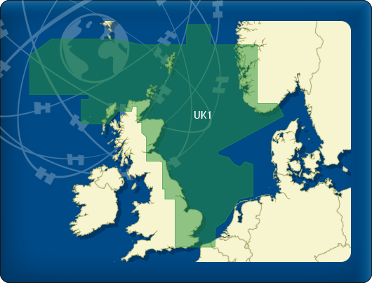
- DKW UK1 English & Scottish Eastcoast
- DKW German Bight
- DKW German Baltic coast
- DKW Imray series
- DKW Delius Klasing series
- NV-Verlag series
- Exclusive for Android
- Subscription - DKW the Netherlands
- Chart apps
- Other
- Hardware
- Simulators
- Shop
- Downloads
- Support
- Downloads
- Help pages
- Documentation
- System Requirements
- Availability GRIB files
- Frequently asked questions - FAQ
- WinGPS 5
- WinGPS Marine (Android)
- WinGPS Marine (iOS)
- Installation help
- WinGPS 5 (Windows)
- WinGPS Marine (Android)
- Tips
- Offline installation DKW charts (Windows)
- Installation ENC charts (Windows)
- Connecting SD card (Android)
- NV Verlag charts
- Offline NOAA Charts
- Download TeamViewer
- Contact
- Contactform - Helpdesk
- Callback Service
- Commercial Shipping

|
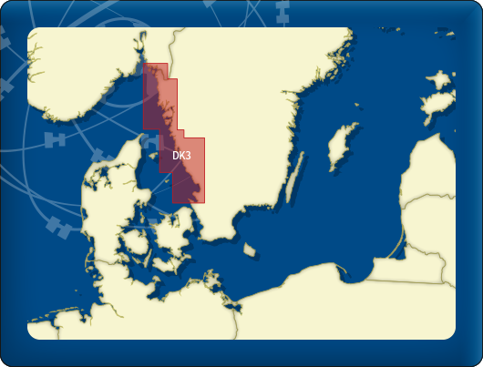
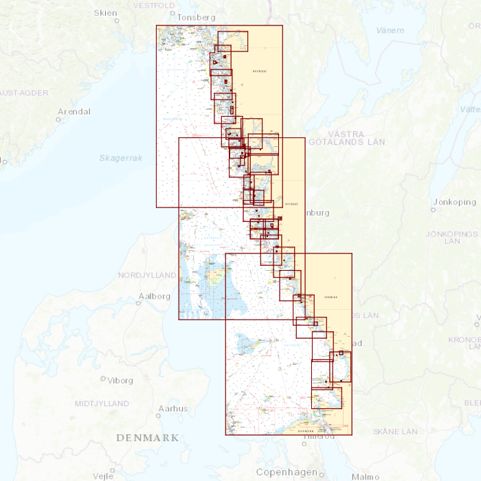
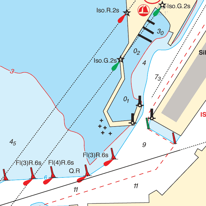
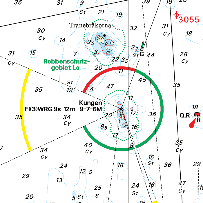
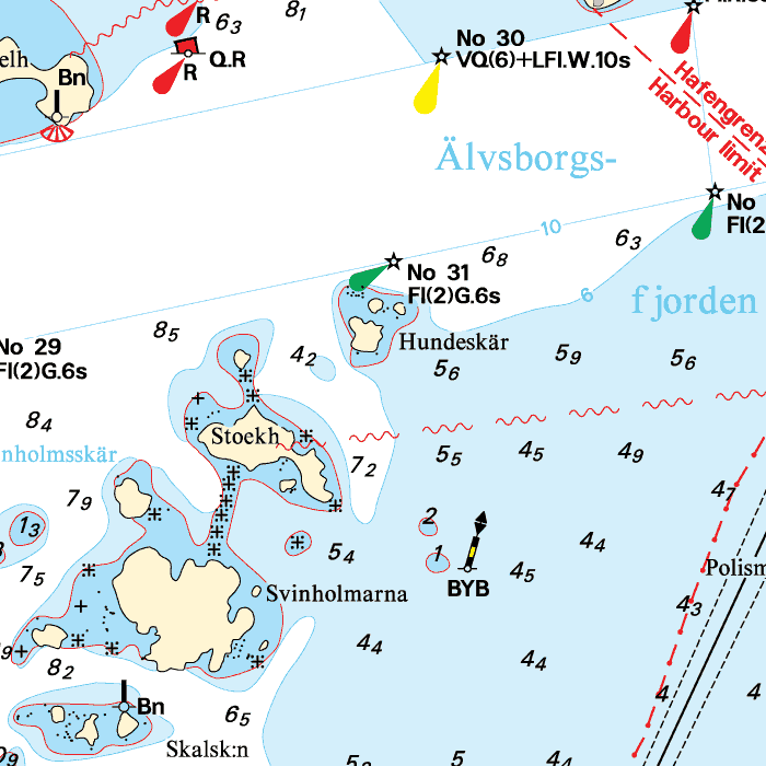
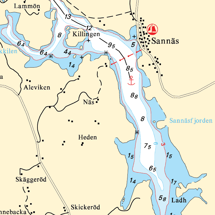
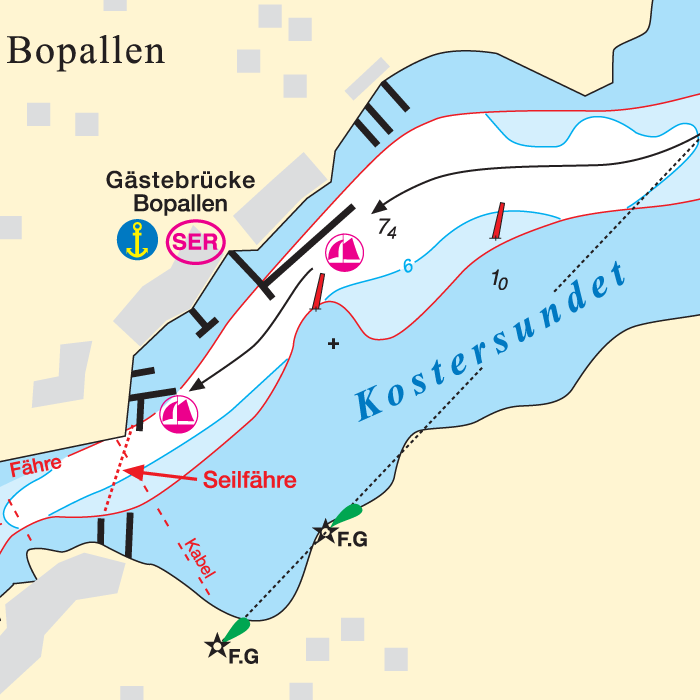
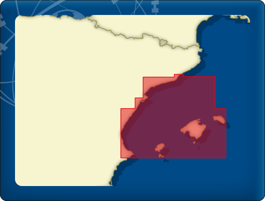
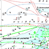
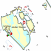
DKW DK3: Swedish Westcoast
Since 2014, Stentec Software has been publishing the well-known Delius Klasing charts digitally. These are based on the paper charts of Delius Klasing and have a nice, clear chart image.
Now, 10 years later in 2024, our cooperation has been strengthened and the digital versions of Delius Klasing's paper charts can be downloaded exclusively via Stentec.
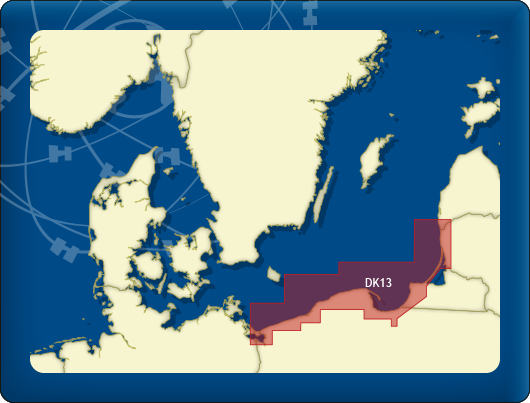
Covering area
From the Skälderviken along the Swedish coast to the North up until Halden (just past the Norse border). Including all cities and island in between along the coast, with a.o. Göteborg.
Depth image
The depths are shown in clear colors; deep waters are white and shallow waters are color coded. This is comparable to the DKW 1800 series.
Chart image
The DKW Delius Klasing series are comprised of raster charts. Because of this, the charts are an exact copy of the paper versions and you will see pixels when zoomed in to the maximum amount. The advantage of this is that all information, for example buoyage or shallows, are projected on the exact coordinates. When using vector charts a misleading image can show up when zooming in.
All products in the DKW Delius Klasing series
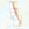
Click on an image for more information about the chart set.
|
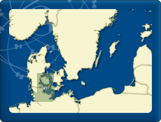
DKW DK1 |
DKW DK2 |
DKW DK3 |
|
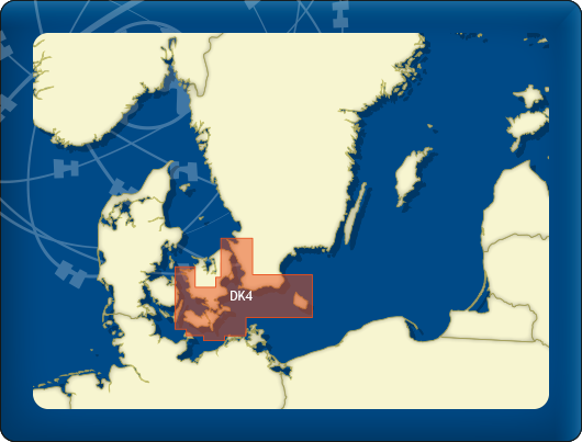
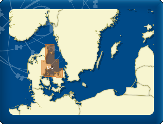
DKW DK4 |
DKW DK5 |
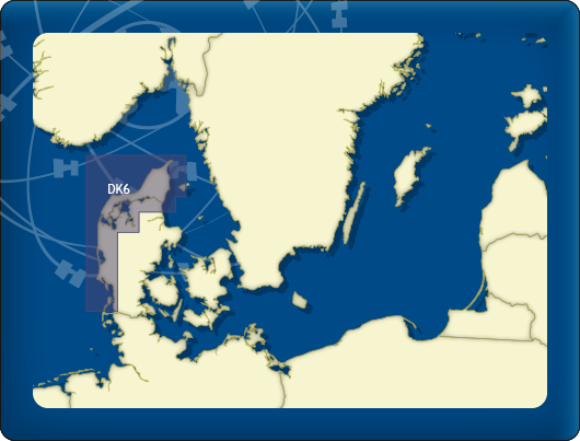
DKW DK6 |
|
DKW DK7 |
DKW DK8 |
DKW DK9 |
|
DKW DK10 |
DKW DK11 |
DKW DK12 |
|
DKW DK13 |
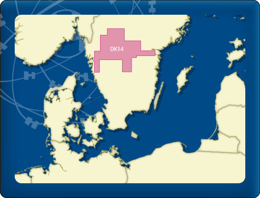
DKW DK14 |

|
|
|
System Requirements: This chart can be used in the free WinGPS Lite for Windows and can also be installed on the WinGPS Marine apps for Android and iOS. For accurate route planning with rotating chart and AIS you will need at least WinGPS Pro or the paid version of WinGPS Marine. Click here for more information about the WinGPS series. |
|
|

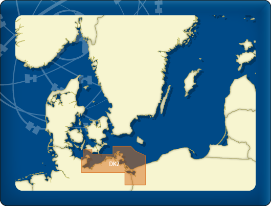
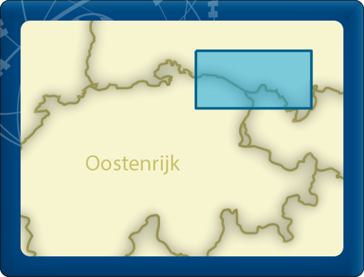
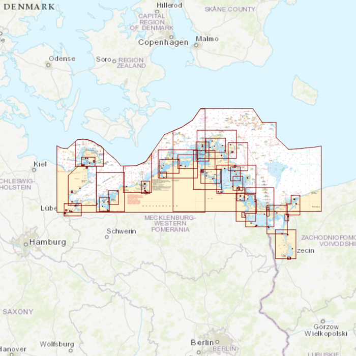
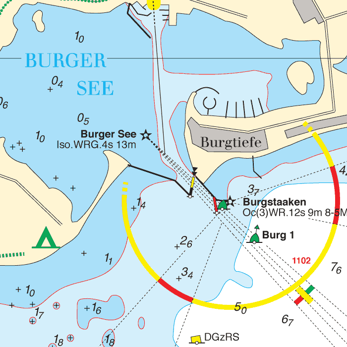
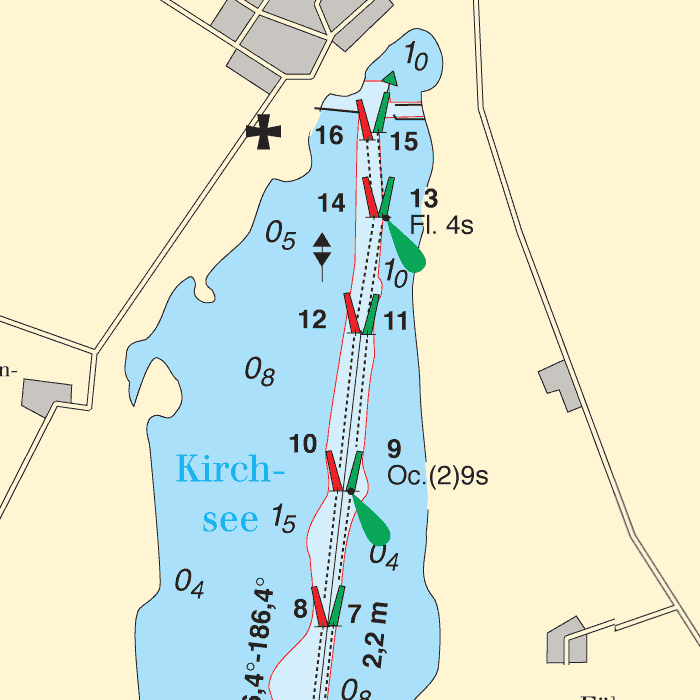
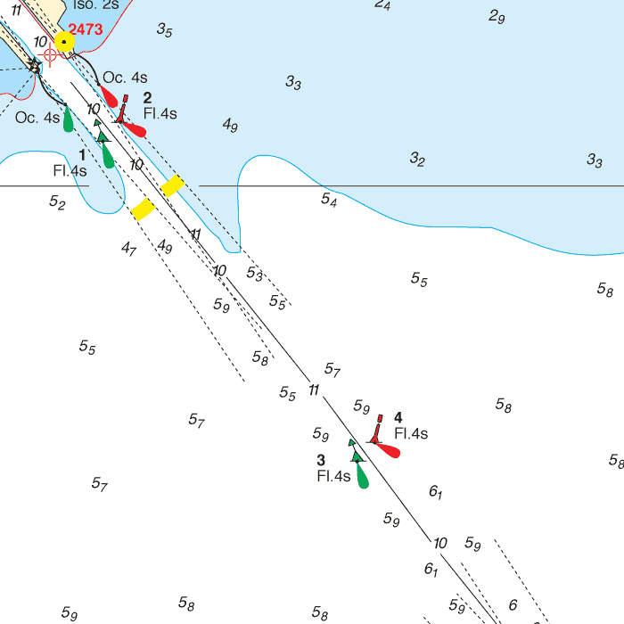
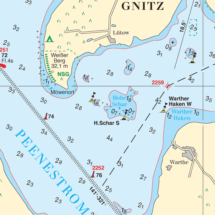
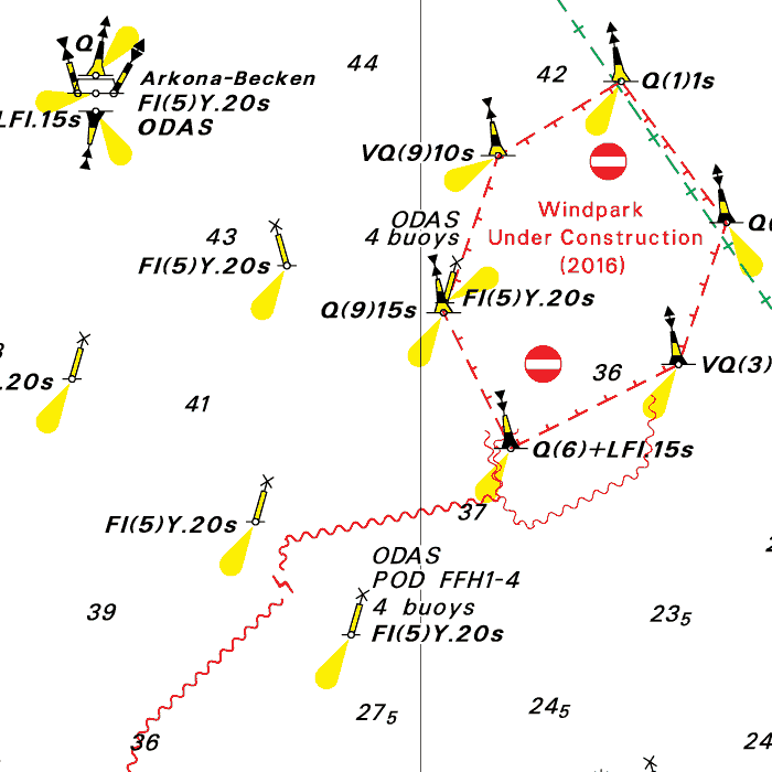
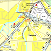
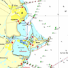
DKW DK2: Mecklenburg-Vorpommern
Since 2014, Stentec Software has been publishing the well-known Delius Klasing charts digitally. These are based on the paper charts of Delius Klasing and have a nice, clear chart image.
Now, 10 years later in 2024, our cooperation has been strengthened and the digital versions of Delius Klasing's paper charts can be downloaded exclusively via Stentec.
Covering area
From Fehmarn island past the German coast to Lübeck, Roskock, Stralsund, Greifswald, Świnoujście up until Stettin/Szczecin and Dziwnów (just past the Polish border).
Depth image
The depths are shown in clear colors; deep waters are white and shallow waters are color coded. This is comparable to the DKW 1800 series.
Chart image
The DKW Delius Klasing series are comprised of raster charts. Because of this, the charts are an exact copy of the paper versions and you will see pixels when zoomed in to the maximum amount. The advantage of this is that all information, for example buoyage or shallows, are projected on the exact coordinates. When using vector charts a misleading image can show up when zooming in.
All products in the DKW Delius Klasing series
Click on an image for more information about the chart set.
|
DKW DK1 |
DKW DK2 |
DKW DK3 |
|
DKW DK4 |
DKW DK5 |
DKW DK6 |
|
DKW DK7 |
DKW DK8 |
DKW DK9 |
|
DKW DK10 |
DKW DK11 |
DKW DK12 |
|
DKW DK13 |
DKW DK14 |
|
|
|
System Requirements: This chart can be used in the free WinGPS Lite for Windows and can also be installed on the WinGPS Marine apps for Android and iOS. For accurate route planning with rotating chart and AIS you will need at least WinGPS Pro or the paid version of WinGPS Marine. Click here for more information about the WinGPS series. |
|
|
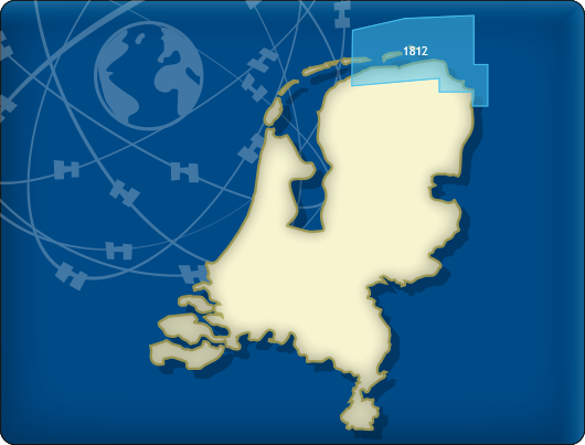
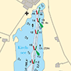
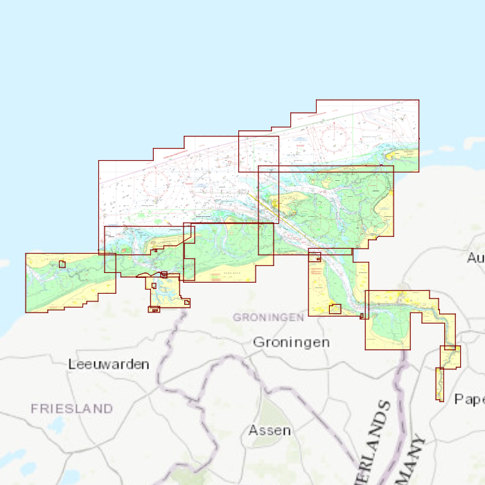
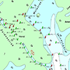
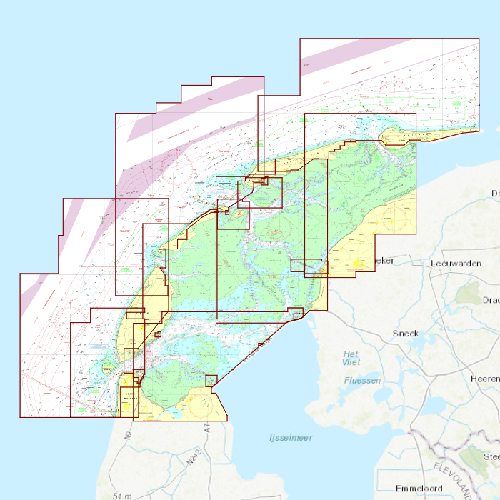
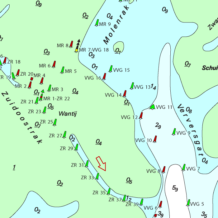
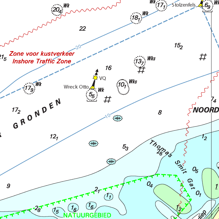
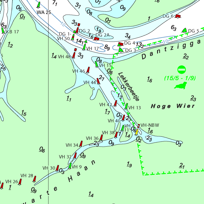
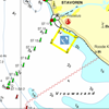
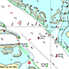
DKW 1812 Wadden Sea east
Since 1999 Stentec Software produces the digital versions of the Dutch hydroraphical charts. Thanks to the weekly BaZ Update Service you will always have the latest, most up-to-date charts.
At a time like this, where there is no certainty about the releases of the paper 1800 chart series by the Dutch Hydrographic Services, this is a unique product. With the free weekly update service and the ability to use the charts on Windows devices as well as on Android devices, an up-to-date chart of these busy and unpredictable waters is always at hand. As soon as a new paper version of a chart set is released, users can download these directly in digital form. If desired, the charts can also be printed for personal use.
The Waddensea charts DKW 1811 and DKW 1812 are supplied with monthly updated depth marks from Rijkswaterstaat. Great when sailing on the tidal waters of the Wadden Sea.
Covering area
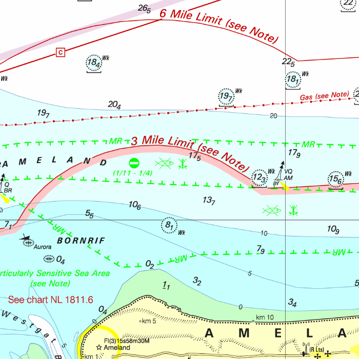
The DKW 1812 Wadden Sea east covers east-Ameland up until Juist, including the Lauwersmeer, the Dollard and adjourning North Sea.
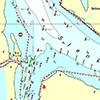

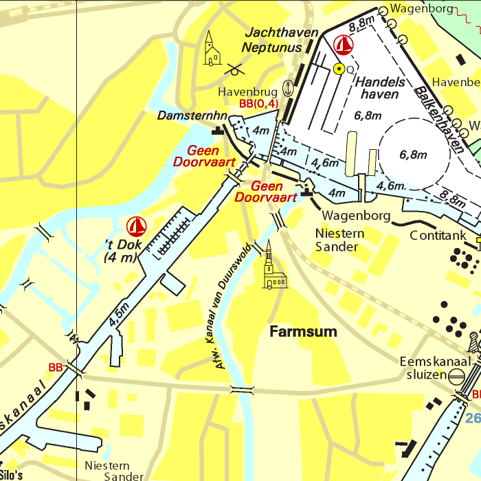
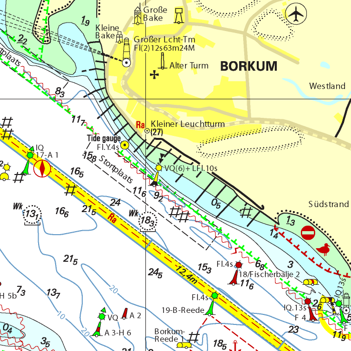
Depth image
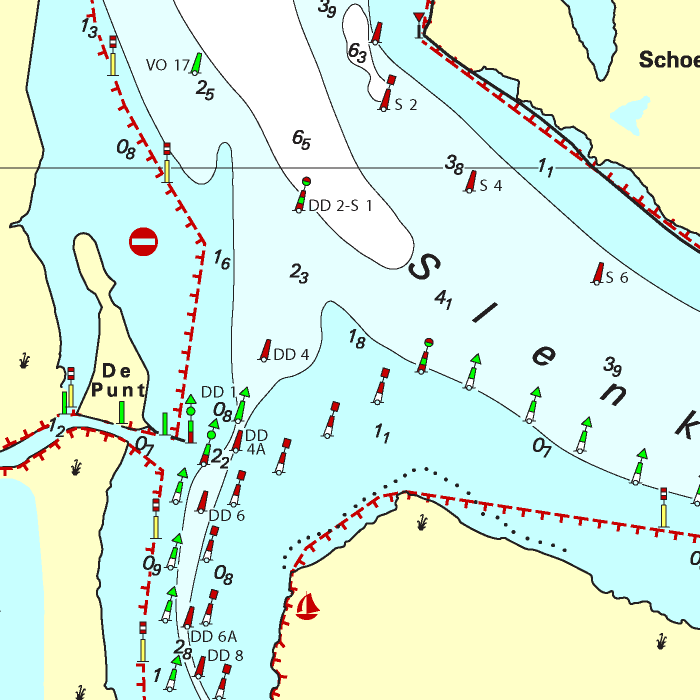
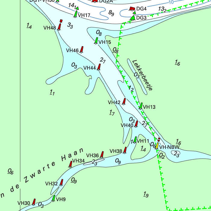
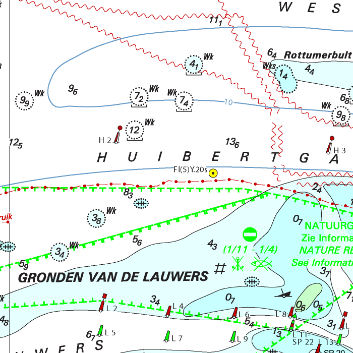
The DKW 1800 series contains a clear depth image and is the same as the well known paper version of the 1800 charts. Deep water is white and shallows are shown in different colors.
Stentec publishes the DKW 1800 series annually. The data is provided by the Dutch hydrographic service and the free weekly updates are based on the 'BaZ - Berichten aan Zeevarenden' (NtM - Notices to Mariners). User remarks are also screened and added to the charts which makes these chart sets the most up-to-date chart for the Dutch coastal waters.
Chart image
The DKW 1800 series are comprised of raster charts. Because of this, the charts are an exact copy of the paper versions and you will see pixels when zoomed in to the maximum amount. The advantage of this is that all information, for example buoyage or shallows, are projected on the exact coordinates. When using vector charts a misleading image can show up when zooming in.
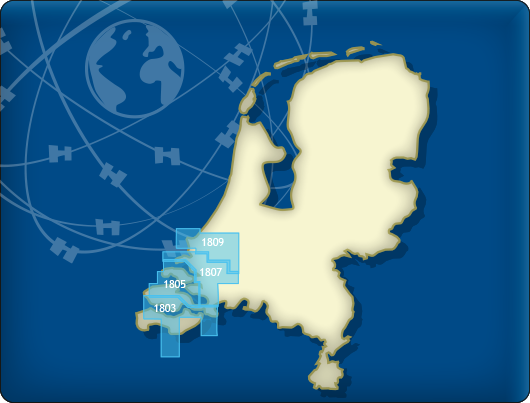
All products in the DKW 1800 series
Click on an image for more information.
|
DKW 1800 Complete |
DKW 1800 North |
DKW 1800 South |
|
DKW 1801: |
DKW 1803: |
DKW 1805: |
|
DKW 1807: |
DKW 1809: |
DKW 1810: |
|
DKW 1811: |
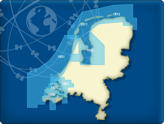
DKW 1812: |


|
|
|
System Requirements: This chart can be used in the free WinGPS Lite for Windows and can also be installed on the WinGPS Marine apps for Android and iOS. For accurate route planning with rotating chart and AIS you will need at least WinGPS Pro or the paid version of WinGPS Marine. Click here for more information about the WinGPS series. |
|
|

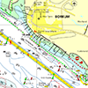
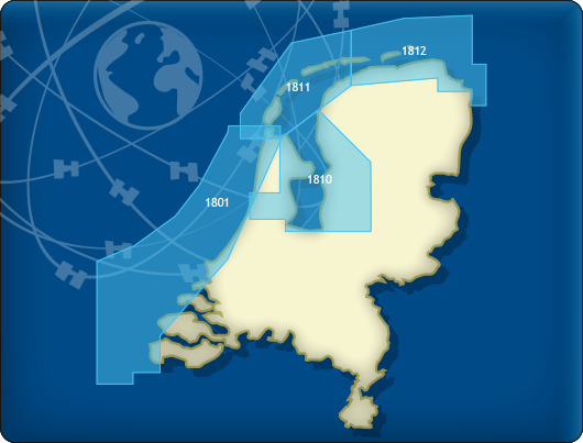
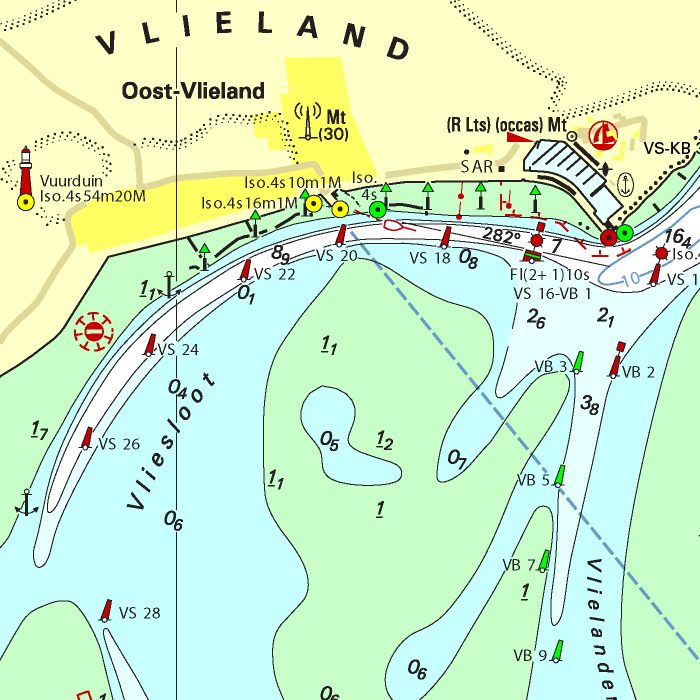
DKW 1811 Wadden Sea west
Since 1999 Stentec Software produces the digital versions of the Dutch hydroraphical charts. Thanks to the weekly BaZ Update Service you will always have the latest, most up-to-date charts.
At a time like this, where there is no certainty about the releases of the paper 1800 chart series by the Dutch Hydrographic Services, this is a unique product. With the free weekly update service and the ability to use the charts on Windows devices as well as on Android devices, an up-to-date chart of these busy and unpredictable waters is always at hand. As soon as a new paper version of a chart set is released, users can download these directly in digital form. If desired, the charts can also be printed for personal use.
The Waddensea charts DKW 1811 and DKW 1812 are supplied with monthly updated depth marks from Rijkswaterstaat. Great when sailing on the tidal waters of the Wadden Sea.
Covering area
The DKW 1811 Wadden Sea west covers Den Helder up until west-Ameland, including adjourning North Sea.

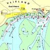
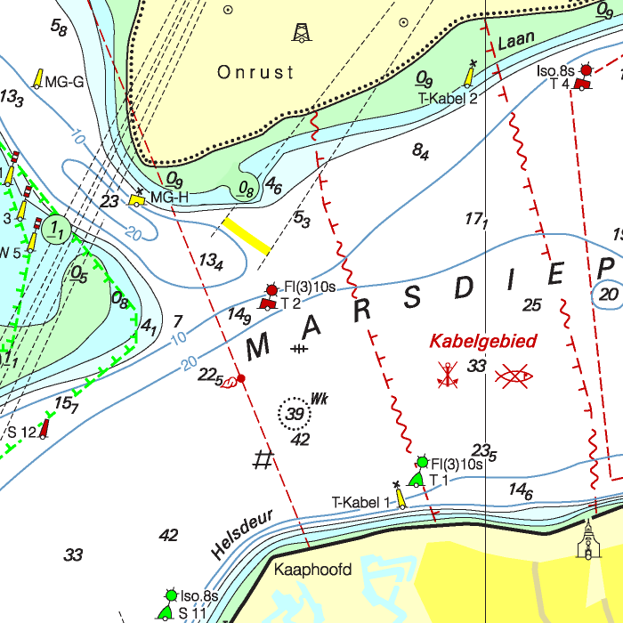
Depth image
The DKW 1800 series contains a clear depth image and is the same as the well known paper version of the 1800 charts. Deep water is white and shallows are shown in different colors.
Stentec publishes the DKW 1800 series annually. The data is provided by the Dutch hydrographic service and the free weekly updates are based on the 'BaZ - Berichten aan Zeevarenden' (NtM - Notices to Mariners). User remarks are also screened and added to the charts which makes these chart sets the most up-to-date chart for the Dutch coastal waters.
Chart image
The DKW 1800 series are comprised of raster charts. Because of this, the charts are an exact copy of the paper versions and you will see pixels when zoomed in to the maximum amount. The advantage of this is that all information, for example buoyage or shallows, are projected on the exact coordinates. When using vector charts a misleading image can show up when zooming in.
All products in the DKW 1800 series
Click on an image for more information.
|
DKW 1800 Complete |
DKW 1800 North |
DKW 1800 South |
|
DKW 1801: |
DKW 1803: |
DKW 1805: |
|
DKW 1807: |
DKW 1809: |
DKW 1810: |
|
DKW 1811: |
DKW 1812: |
|
|
|
System Requirements: This chart can be used in the free WinGPS Lite for Windows and can also be installed on the WinGPS Marine apps for Android and iOS. For accurate route planning with rotating chart and AIS you will need at least WinGPS Pro or the paid version of WinGPS Marine. Click here for more information about the WinGPS series. |
|
|

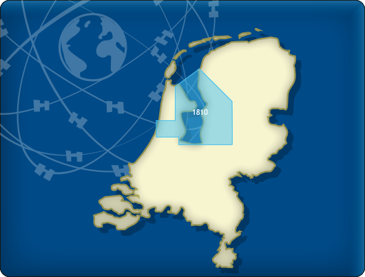
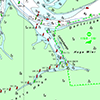
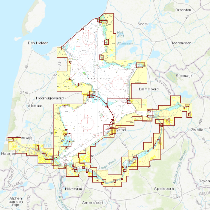
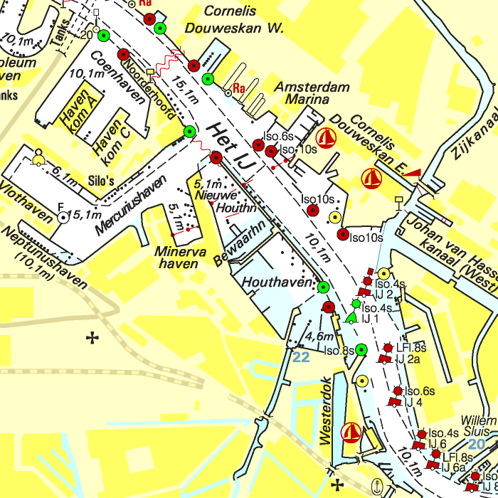
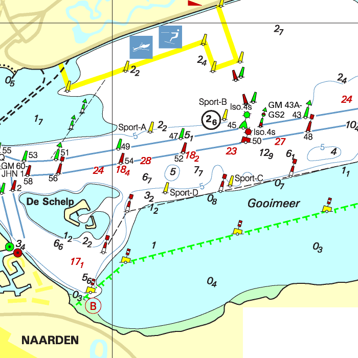
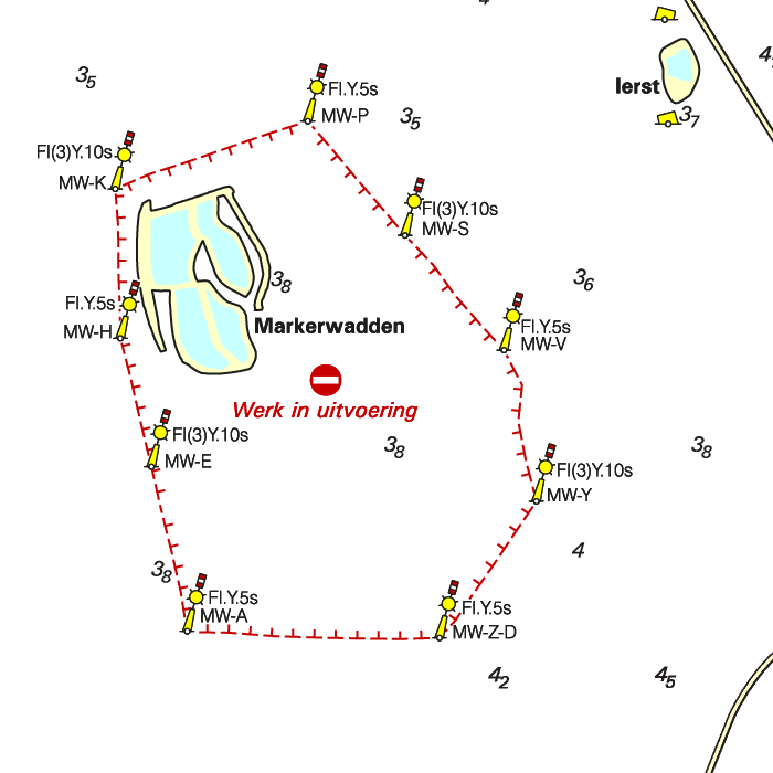
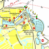
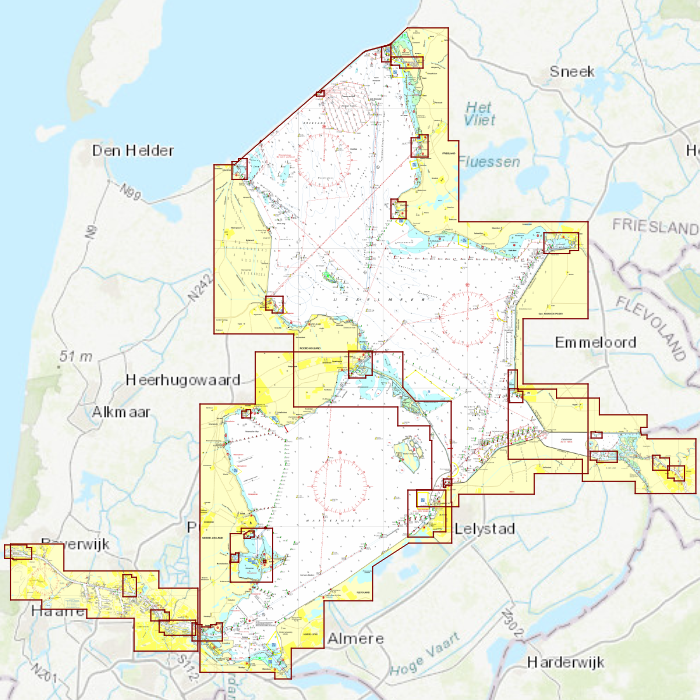
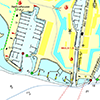
DKW 1810 IJsselmeer
Since 1999 Stentec Software produces the digital versions of the Dutch hydroraphical charts. Thanks to the weekly BaZ Update Service you will always have the latest, most up-to-date charts.
At a time like this, where there is no certainty about the releases of the paper 1800 chart series by the Dutch Hydrographic Services, this is a unique product. With the free weekly update service and the ability to use the charts on Windows devices as well as on Android devices, an up-to-date chart of these busy and unpredictable waters is always at hand. As soon as a new paper version of a chart set is released, users can download these directly in digital form. If desired, the charts can also be printed for personal use.
Covering area
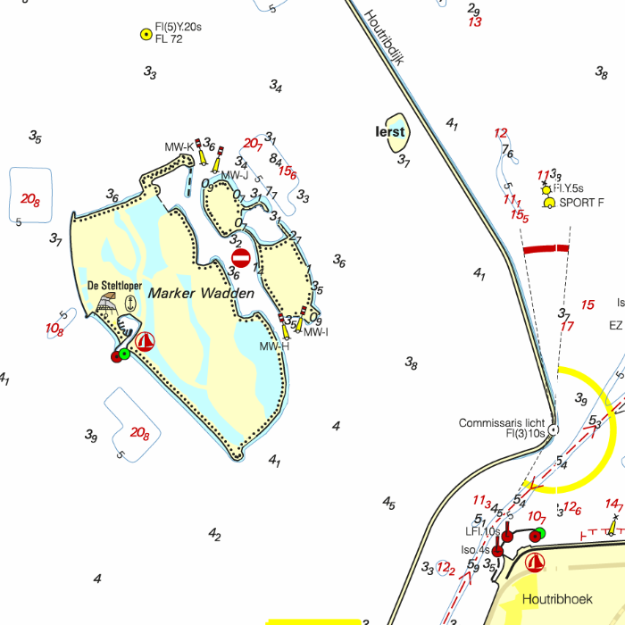
The DKW 1810 IJsselmeer covers the IJsselmeer, Markermeer, Randmeren and Noordzeekanaal, including the Markerwadden.

Depth image
The DKW 1800 series contains a clear depth image and is the same as the well known paper version of the 1800 charts. Deep water is white and shallows are shown in different colors.
Stentec publishes the DKW 1800 series annually. The data is provided by the Dutch hydrographic service and the free weekly updates are based on the 'BaZ - Berichten aan Zeevarenden' (NtM - Notices to Mariners). User remarks are also screened and added to the charts which makes these chart sets the most up-to-date chart for the Dutch coastal waters.
Chart image
The DKW 1800 series are comprised of raster charts. Because of this, the charts are an exact copy of the paper versions and you will see pixels when zoomed in to the maximum amount. The advantage of this is that all information, for example buoyage or shallows, are projected on the exact coordinates. When using vector charts a misleading image can show up when zooming in.
All products in the DKW 1800 series
Click on an image for more information.
|
DKW 1800 Complete |
DKW 1800 North |
DKW 1800 South |
|
DKW 1801: |
DKW 1803: |
DKW 1805: |
|
DKW 1807: |
DKW 1809: |
DKW 1810: |
|
DKW 1811: |
DKW 1812: |
|
|
|
System Requirements: This chart can be used in the free WinGPS Lite for Windows and can also be installed on the WinGPS Marine apps for Android and iOS. For accurate route planning with rotating chart and AIS you will need at least WinGPS Pro or the paid version of WinGPS Marine. Click here for more information about the WinGPS series. |
|
|
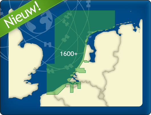
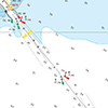
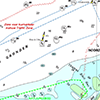
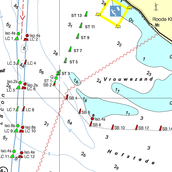
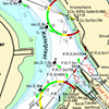
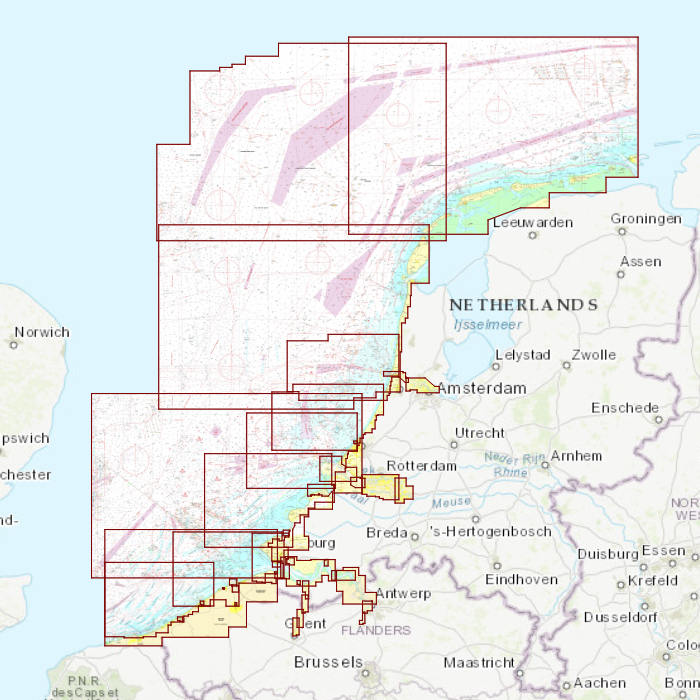
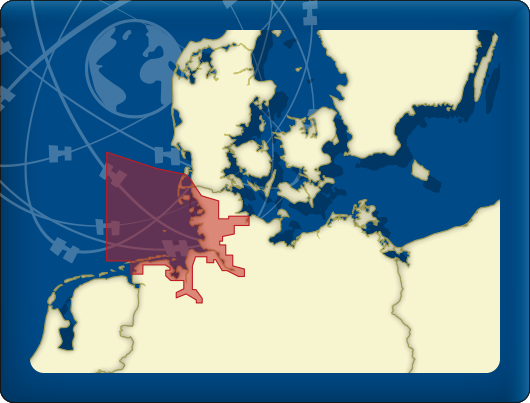
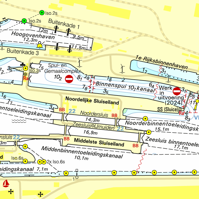
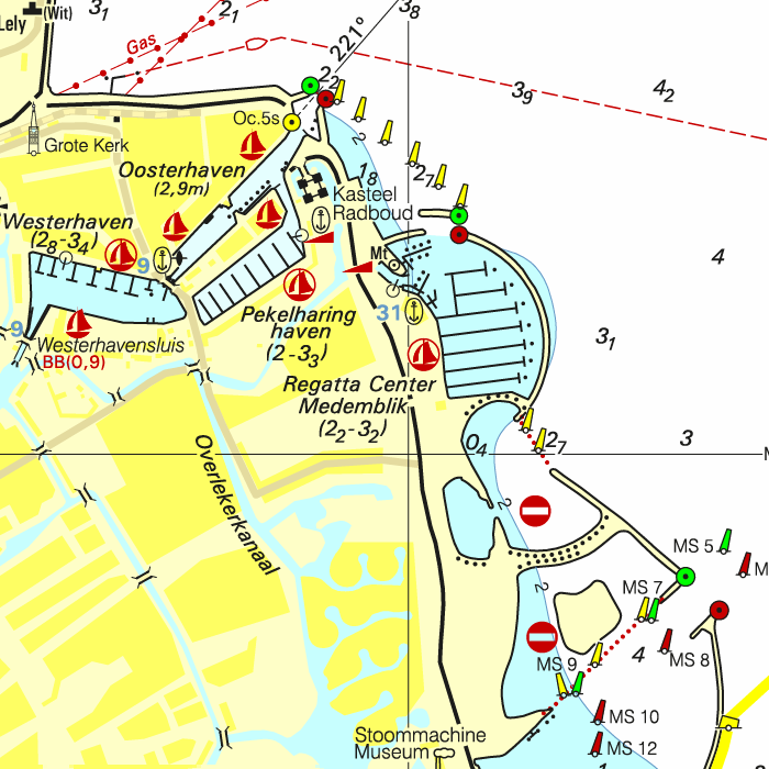
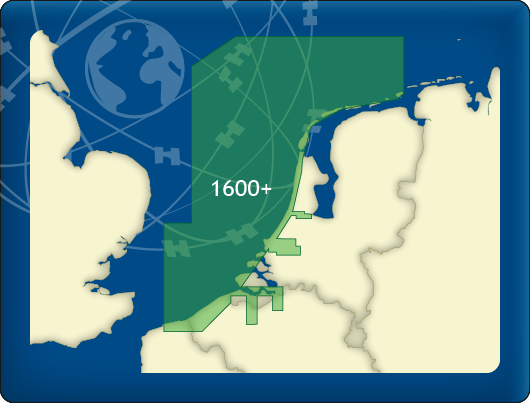
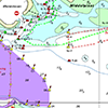
DKW 1600+
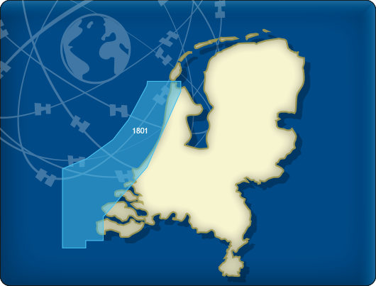
North Sea Coast Netherlands
With our new DKW 1600+, you can navigate the Dutch and Belgian coasts with a clear, up-to-date digital chart, including the trusted weekly BaZ updates automatically installed in WinGPS.
The chart is based on the Hydrographic Chart 1600 and supplemented with additional chart sheets. This gives you a single, clear overview of the most important sailing areas along the coast and in the North Sea.
NEW:
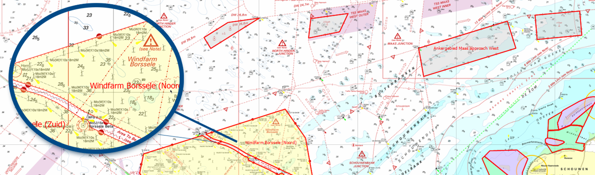
This new digital chart offers extra-wide North Sea coverage and smart alarm zones for enhanced safety near wind farms and other locations.
Coverage Area
The DKW 1600+ covers:
- the North Sea coast of the Netherlands and Belgium
From Rottumerplaat to Dunkirk. In some areas, up to 85 miles from the coast. This includes the numerous wind farms and traffic separation schemes. - the Rijnmond area
This includes the Maasvlakte up to Capelle aan den IJssel, Lekkerkerk, Sliedrecht, 's Gravendeel up to Oud Beijerland. - the Westerschelde up to Antwerp and Ghent..
The DKW 1600+ is the ideal replacement for the well-known 1801 North Sea Coast, 1803 Western Scheldt, and 1809 Rijnmond areas, which are no longer published by the Hydrographic Service. It is ideal for combining with the DKW 1800 Complete series. This creates a beautiful set of up-to-date charts for Dutch coastal waters.
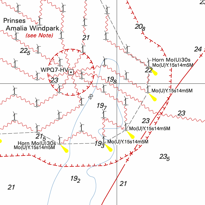
Extra safety: preset alarm zones
Pre-set alarm zones have been added to the DKW 1600+ for use in WinGPS 6.
With the alarm zone function in WinGPS 6, zones can be marked on the map where you are not allowed to enter or where you need to be extra alert. For the DKW 1600+, we have prepared a number of these zones for you, including in:
- wind farms
- test and training areas
- nature reserves
- anchorage areas
When you activate the alarm zones in WinGPS 6, you will receive a warning as soon as your current position approaches or crosses such a zone. This provides you with immediate clarity regarding risk areas, especially in places where there is often uncertainty in practice about what is and is not permitted.
Important: The alarm zones can only be used in WinGPS 6 Pro, Voyager, or Inland from 2026 or later. They are intended as an additional navigation aid. As a skipper, you always remain responsible for consulting official publications and complying with laws and regulations.
|
|
Key Features DKW 1600+
- Based on Hydrographic Chart 1600
Clear, well-organized chart display, just like you're used to from the paper 1600, available digitally in WinGPS. - Extensive North Sea Coverage
The DKW 1600+ covers much further North Sea than you're used to with traditional coastal charts. Ideal for coastal voyages, crossing between North Sea ports, and planning routes along the Dutch and Belgian coasts. - Includes Weekly Notices to Mariners (NtM) Updates
The chart is updated weekly with the latest Notices to Mariners (NtM). These updates are automatically installed via WinGPS, ensuring your charts are always up-to-date. - A Practical Replacement for Discontinued 1800 Charts
Because several 1800 charts are no longer published by the Hydrographic Service, many users were looking for a suitable alternative. The DKW 1600+ offers a practical successor for these sailing areas, with comparable coverage, BaZ updates, and a familiar chart view in your WinGPS navigation system. - Includes innovative alarm zones
Preset alarm zones for wind farms, among others, for easily planning safe routes and which warn you in WinGPS 6 as soon as you approach a risk area. - Seamless integration with WinGPS 6 for Windows
Use with WinGPS 6 Pro, Voyager, and Inland (2026 & newer). Plan routes, connect AIS and GPS, and start sailing.
|
|
Discount with a Premium Subscription:
Do you have a Premium Subscription? Then you'll receive a €20 discount on our new DKW 1600+ North Sea Coast Netherlands.
Connecting DKW charts
Click the image for more information.
|
DKW 1800 Complete |
DKW 1800 North |
DKW 1805: |
|
DKW 1807: |
DKW 1811: |
DKW 1812: |
|
DKW 1820: |
DKW Vaarkaart |
DKW UK1 |

|
DKW German |
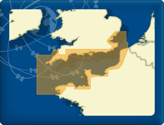
DKW ID20 |
|
|
|
System Requirements: This chart can be used in WinGPS 6 for Windows and can also be installed on the WinGPS Marine apps for Android and iOS. For accurate route planning with rotating chart and AIS you will need at least WinGPS Pro or the paid version of WinGPS Marine. Click here for more information about the WinGPS series. |
|
|

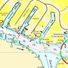
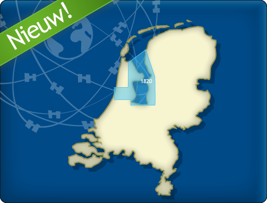
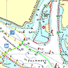
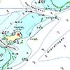
DKW 1820 IJsselmeer
A precise digital chart with the familiar DKW chart layout: clear overview, accurate depth information and ideal for both recreational and professional navigation.
Automatic weekly NtM updates
With this chart, you always sail with the most up-to-date information. The DKW 1820 automatically receives the latest Notices to Mariners (NtM) each week via WinGPS. Updates are processed immediately, ensuring you have current depths, buoyage and waterway changes without any extra effort.
Covering area
The DKW 1810 IJsselmeer covers the IJsselmeer, Markermeer, Ketelmeer and Noordzeekanaal, including the Markerwadden.

Depth image
The DKW 1800 series contains a clear depth image and is the same as the well known paper version of the 1800 charts. Deep water is white and shallows are shown in different colors.
Stentec publishes the DKW 1800 series annually. The data is provided by the Dutch hydrographic service and the free weekly updates are based on the 'BaZ - Berichten aan Zeevarenden' (NtM - Notices to Mariners). User remarks are also screened and added to the charts which makes these chart sets the most up-to-date chart for the Dutch coastal waters.
Chart image
The DKW 1800 series are comprised of raster charts. Because of this, the charts are an exact copy of the paper versions and you will see pixels when zoomed in to the maximum amount. The advantage of this is that all information, for example buoyage or shallows, are projected on the exact coordinates. When using vector charts a misleading image can show up when zooming in.
Connecting DKW charts
Click the image for more information.
|
DKW 1800 Complete |
DKW 1800 North |
DKW 1805: |
|
DKW 1807: |
DKW 1811: |
DKW 1812: |
|
DKW 1600+ |
DKW Vaarkaart |
DKW UK1 |

|
|
|
System Requirements: This chart can be used in WinGPS 6 for Windows and can also be installed on the WinGPS Marine apps for Android and iOS. For accurate route planning with rotating chart and AIS you will need at least WinGPS Pro or the paid version of WinGPS Marine. Click here for more information about the WinGPS series. |
No longer available |

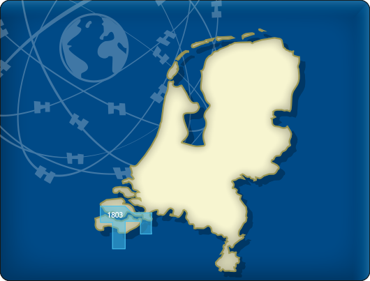
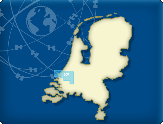
DKW 1809 Nieuwe Waterweg
The DKW 1809 is no longer published by the Hydrographic Service. As alternatives for this area, we offer:
DKW 1600+ North Sea Coast Netherlands
DKW The Netherlands
Below you will find these and other chart products.
Alternative and connecting DKW charts
Click on an image for more information.
|
DKW 1800 Complete |
DKW 1805: |
DKW 1807: |
|
DKW 1600+: |
DKW The Netherlands |
DKW UK1 |
|
|

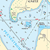
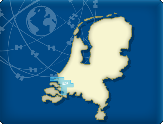
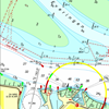
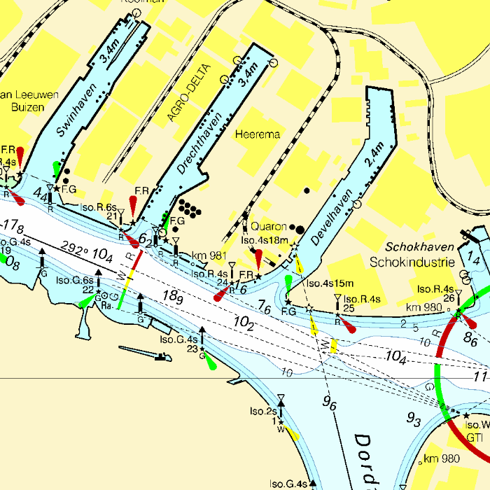
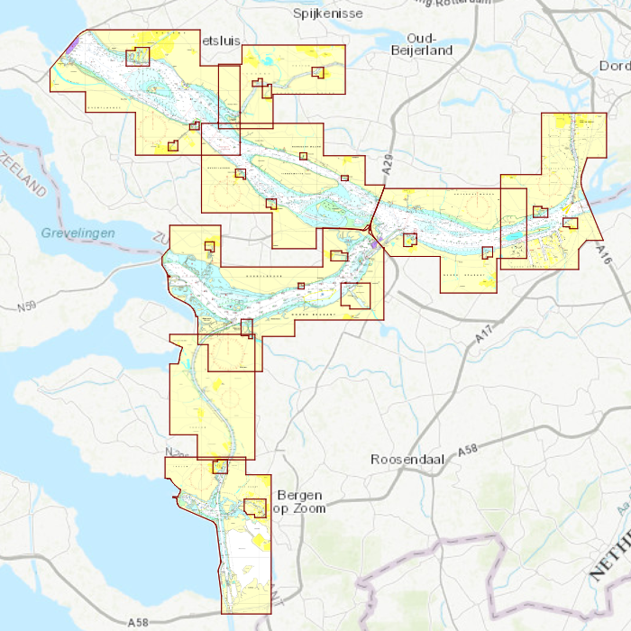
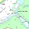
DKW 1807 Haringvliet & Hollandsch Diep
The DKW 1807 offers a clear and familiar DKW chart layout for the Haringvliet and Hollands Diep. With precise depth information, a clean visual presentation and reliable data, this chart is ideal for both recreational and professional navigation in these busy waterways.
Automatic weekly NtM updates
With automatic weekly Notices to Mariners (NtM), your chart remains continuously up to date. Through WinGPS, changes in buoyage, depths and fairways are processed directly, ensuring you always navigate with the most current data — without any extra effort.
Covering area
The DKW 1807 covers the Haringvliet, Hollandsch Diep, Volkerak and Zoommeer.
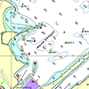
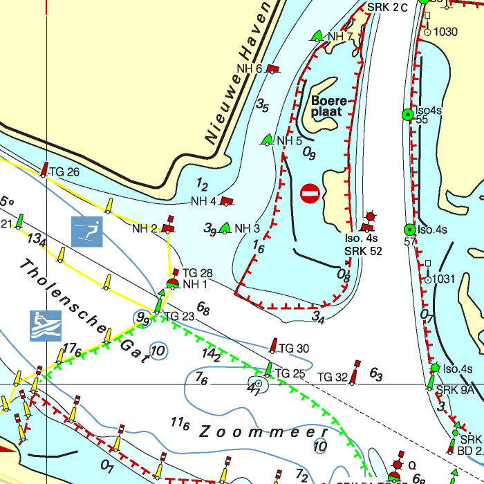
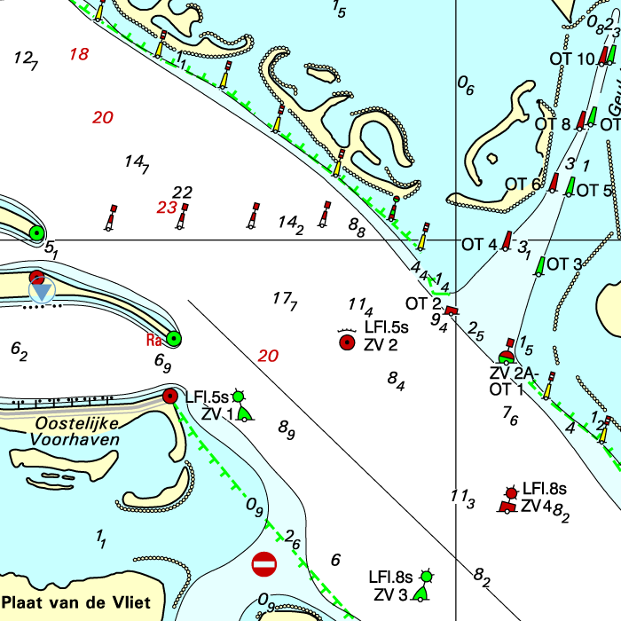
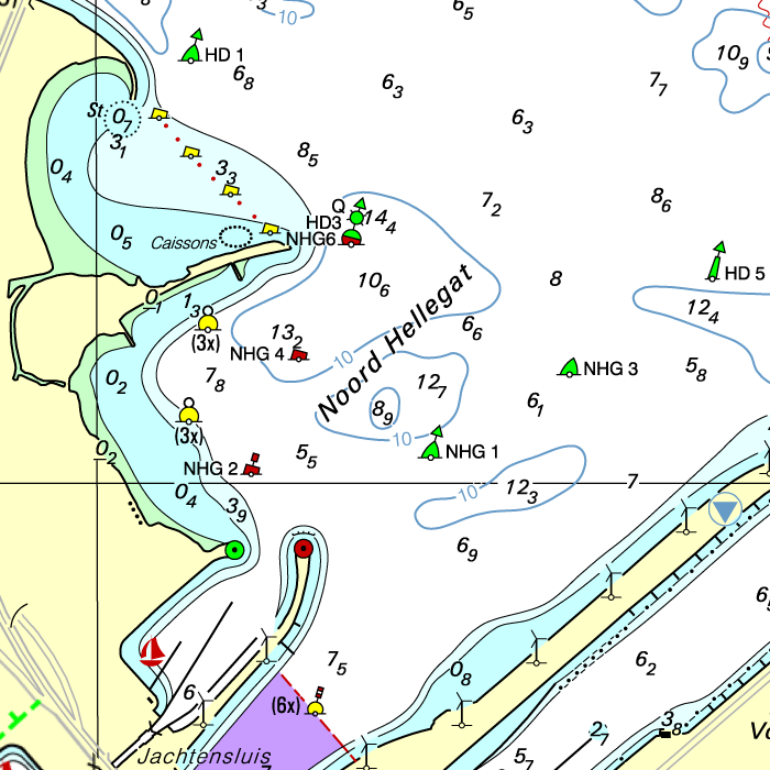
Depth image
The DKW 1800 series contains a clear depth image and is the same as the well known paper version of the 1800 charts. Deep water is white and shallows are shown in different colors.
Stentec publishes the DKW 1800 series annually. The data is provided by the Dutch hydrographic service and the free weekly updates are based on the 'BaZ - Berichten aan Zeevarenden' (NtM - Notices to Mariners). User remarks are also screened and added to the charts which makes these chart sets the most up-to-date chart for the Dutch coastal waters.
Chart image
The DKW 1800 series are comprised of raster charts. Because of this, the charts are an exact copy of the paper versions and you will see pixels when zoomed in to the maximum amount. The advantage of this is that all information, for example buoyage or shallows, are projected on the exact coordinates. When using vector charts a misleading image can show up when zooming in.
Connecting DKW charts
Click on an image for more information.
|
DKW 1800 Complete |
DKW 1805: |
DKW 1600+: |
|
DKW 1811: |
DKW 1812: |
DKW 1820: |
|
DKW The Netherlands |
DKW ID20 The Channel |
DKW UK1 |
|
|
|
System Requirements: This chart can be used in WinGPS for Windows and can also be installed on the WinGPS Marine apps for Android and iOS. For accurate route planning with rotating chart and AIS you will need at least WinGPS Pro or the paid version of WinGPS Marine. Click here for more information about the WinGPS series. |
|
|

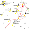
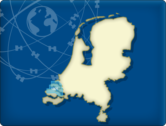
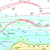
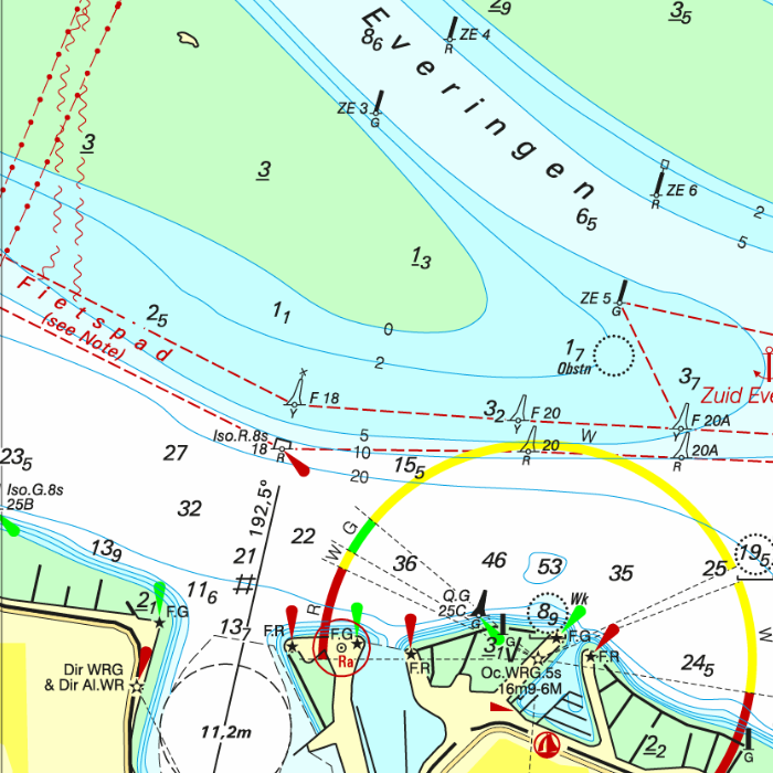
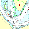
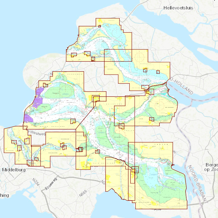
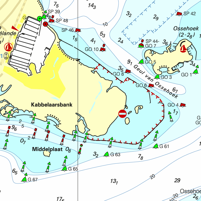
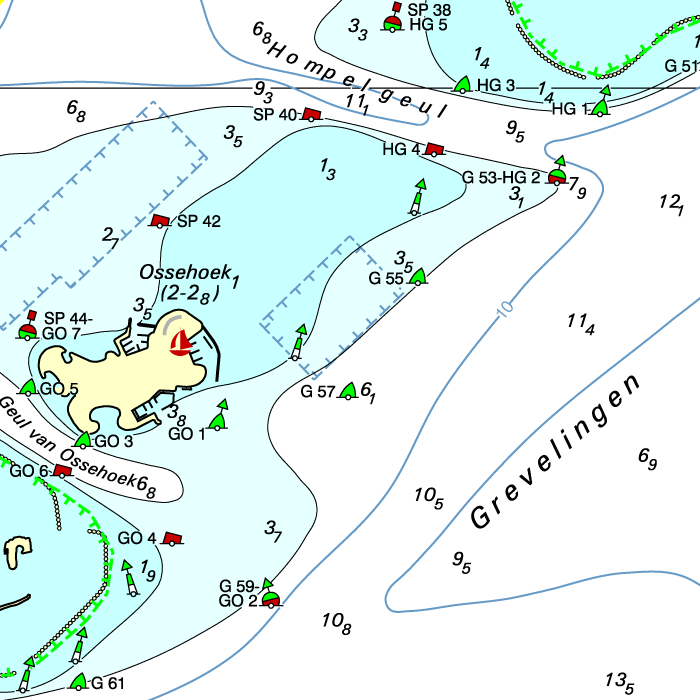
DKW 1805 Oosterschelde
The digital chart for Oosterschelde, Grevelingen and Veerse Meer
With the DKW 1805 you can navigate the Oosterschelde, Veerse Meer and Grevelingen with confidence. The familiar DKW chart style offers instant clarity, clear depth information and accurate data for both recreational and professional navigation in these popular sailing areas.
Automatic weekly NtM updates
Thanks to the automatic weekly Notices to Mariners (NtM) updates, your chart is always up to date. All changes in buoyage, depths and fairways are processed directly into the DKW 1805 via WinGPS, ensuring you always have the most current information at hand, without any extra effort.
Covering area
The DKW 1805 covers the Grevelingen, the Veerse Meer and the Oosterschelde.
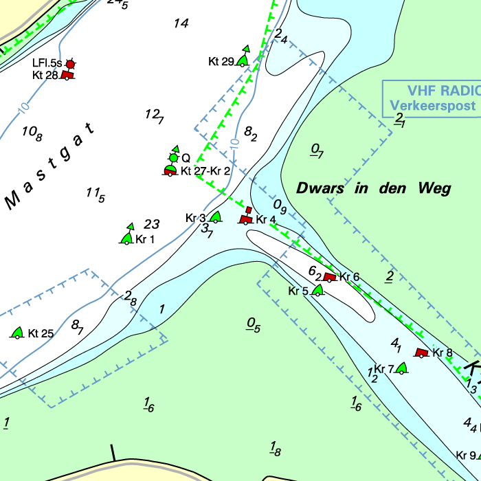
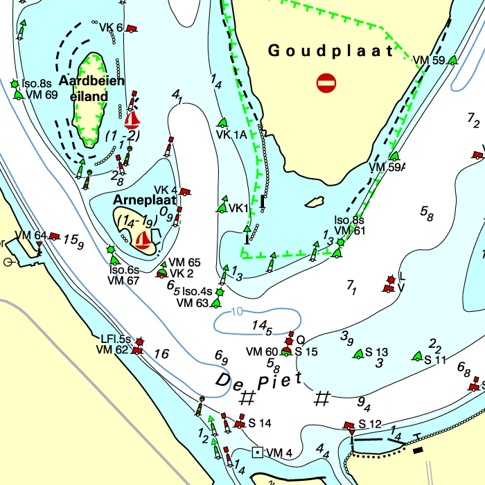
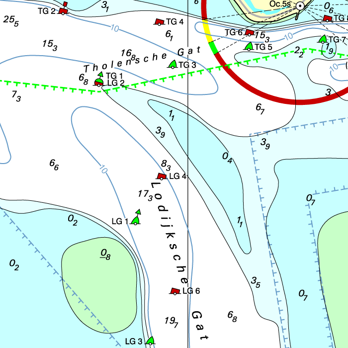
Depth image
The DKW 1800 series contains a clear depth image and is the same as the well known paper version of the 1800 charts. Deep water is white and shallows are shown in different colors.
Stentec publishes the DKW 1800 series annually. The data is provided by the Dutch hydrographic service and the free weekly updates are based on the 'BaZ - Berichten aan Zeevarenden' (NtM - Notices to Mariners). User remarks are also screened and added to the charts which makes these chart sets the most up-to-date chart for the Dutch coastal waters.
Chart image
The DKW 1800 series are comprised of raster charts. Because of this, the charts are an exact copy of the paper versions and you will see pixels when zoomed in to the maximum amount. The advantage of this is that all information, for example buoyage or shallows, are projected on the exact coordinates. When using vector charts a misleading image can show up when zooming in.
Connecting DKW charts
Click on an image for more information.
|
DKW 1800 Complete |
DKW 1807: |
DKW 1600+: |
|
DKW 1811: |
DKW 1812: |
DKW 1820: |
|
DKW 1800 North |
DKW The Netherlands |
DKW ID20 The Channel |

|
DKW UK1 |
DKW German Bight |
|
|
|
System Requirements: This chart can be used in WinGPS for Windows and can also be installed on the WinGPS Marine apps for Android and iOS. For accurate route planning with rotating chart and AIS you will need at least WinGPS Pro or the paid version of WinGPS Marine. Click here for more information about the WinGPS series. |
Do you have any questions?
Call us on +31 515 443515, fill in the contact form or make an appointment at our store in Heeg.
Click here for our opening hours.


News
 The boating season is in full swing, and the water is calling! Whether you’re planning a relaxing weekend getaway or a major trip on Europe’s inland...
 The new charts for the Wadden Sea, DKW 1811 and DKW 1812, and DKW 1805 (Oosterschelde, Veerse Meer, and Grevelingenmeer) are now available! The quarterly...
 Are you familiar with our WinGPS Marine Plus for Android? This popular navigation app is now available as an affordable subscription and can be paired with an...
| WinGPS Navigator |
|
• Easy to use route planner |

| WinGPS Marine |
|
A navigation app for use aboard your ship. An upgradable navigation solution for all sailors, from beginner to professional. |

Stentec Navigation is specialised in digital navigation for water sporters and commercial shipping.
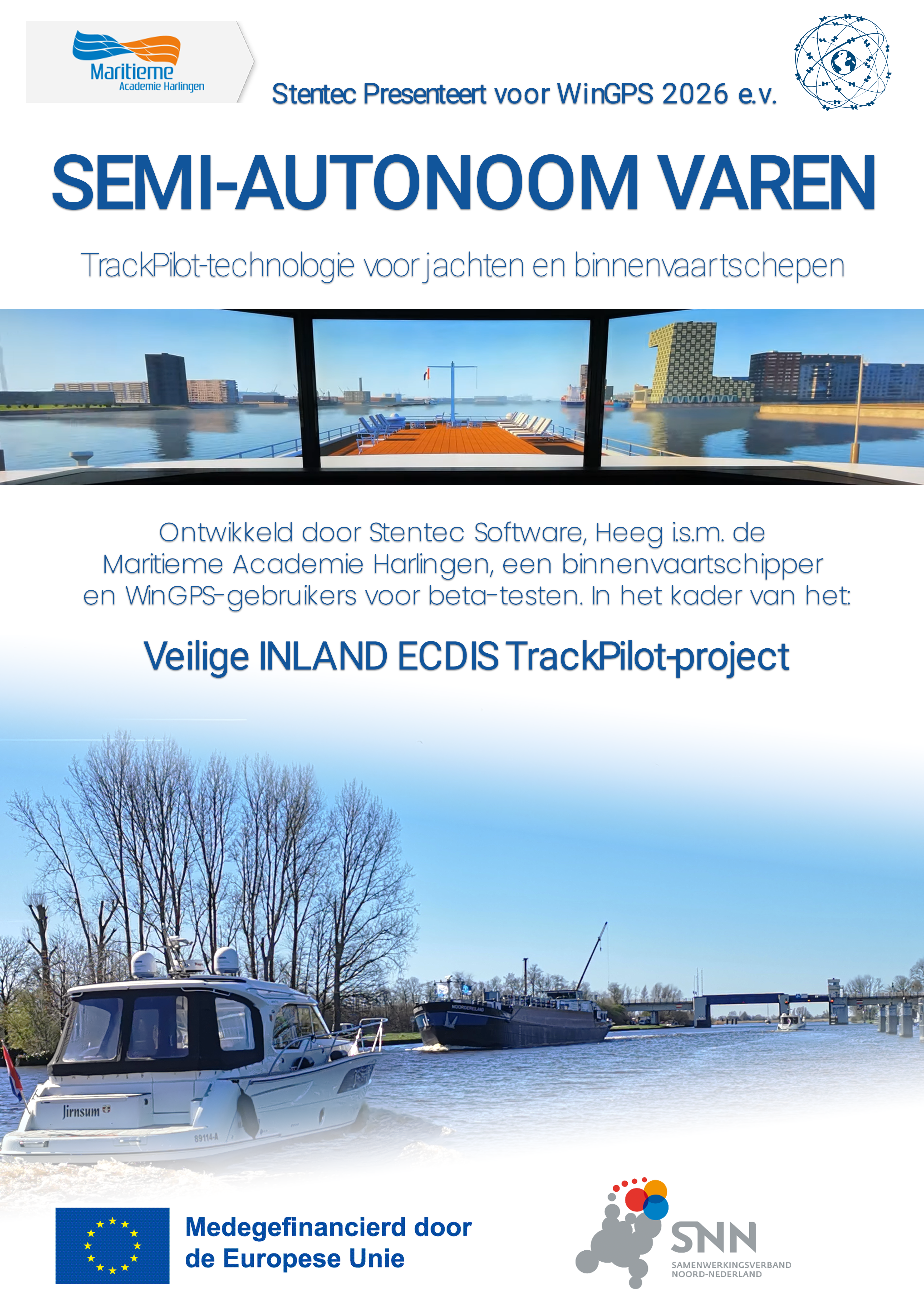
Trackpilot-project : 2025-2028

Harinxmastrjitte 29
8621 BJ HEEG
The Netherlands
T +31 (0) 515 443515

Copyright © Stentec Software. All rights reserved.
By using this website you acknowledge that you agree with our user agreement.