


- News
- E-mail list
- Signup for our newsletter
- Stentec news
- News
- Developers Blog
- WinGPS
- WinGPS series
- WinGPS versions
- WinGPS specifications
- For Windows
- WinGPS Lite
- WinGPS Navigator
- WinGPS Pro
- WinGPS Voyager
- For Android
- WinGPS Marine
- WinGPS Marine Plus
- WinGPS Smartwear
- For iOS
- Apps for iOS
- WinGPS Marine
- WinGPS Marine Plus
- DKW 1800 series
- Vaarkaart Friese Meren
- Service and upgrades
- Service Subscriptions
- WinGPS Yacht Navigator
- WinGPS trackpilot
- Charts
- Chart overview
- DKW Inland waters
- DKW The Netherlands
- DKW Friese meren
- DKW Amsterdam
- DKW Biesbosch
- DKW Belgium
- DKW Northern France
- DKW Southern France
- DKW Northeast Germany
- DKW Northwest Germany
- DKW Southwest Germany
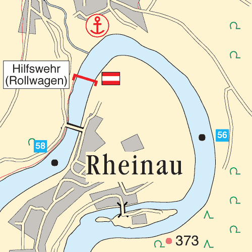
- DKW Rhine and Moselle
- DKW Danube 1-West
- DKW Danube 2-Central
- DKW Danube 3-East
- DKW Coastal waters
- DKW 1800 series
- DKW 1600+
- DKW UK1 English & Scottish Eastcoast
- DKW German Bight
- DKW German Baltic coast
- DKW Imray series
- DKW Delius Klasing series
- NV-Verlag series
- Exclusive for Android
- Subscription - DKW the Netherlands
- Chart apps
- Other
- Hardware
- Simulators
- Shop
- Downloads
- Support
- Downloads
- Help pages
- Documentation
- System Requirements
- Availability GRIB files
- Frequently asked questions - FAQ
- WinGPS 5
- WinGPS Marine (Android)
- WinGPS Marine (iOS)
- Installation help
- WinGPS 5 (Windows)
- WinGPS Marine (Android)
- Tips
- Offline installation DKW charts (Windows)
- Installation ENC charts (Windows)
- Connecting SD card (Android)
- NV Verlag charts
- Offline NOAA Charts
- Download TeamViewer
- Contact
- Contactform - Helpdesk
- Callback Service
- Commercial Shipping

|
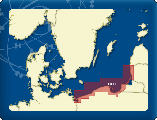
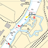
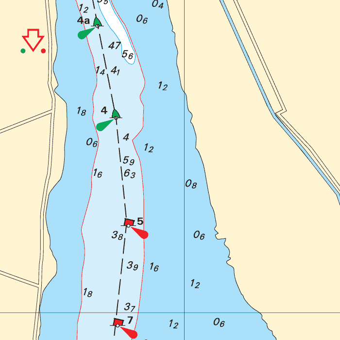
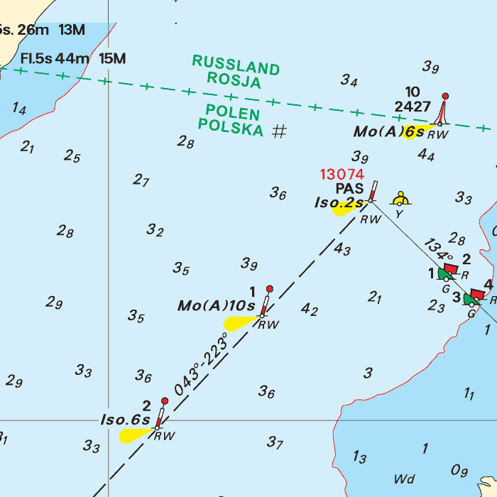
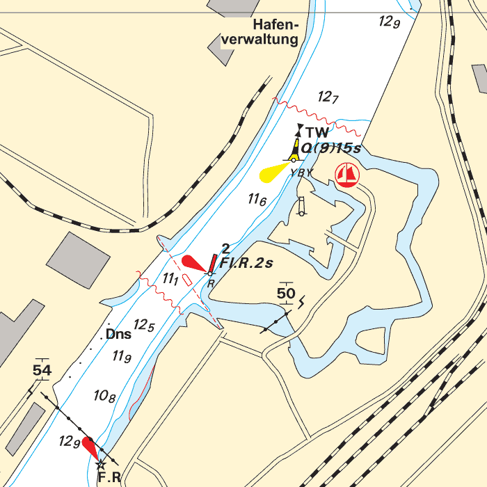
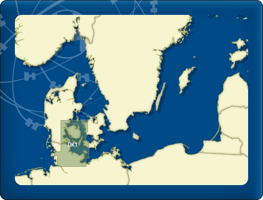
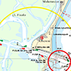
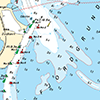
DKW DK13: Poland & Lithuania
Since 2014, Stentec Software has been publishing the well-known Delius Klasing charts digitally. These are based on the paper charts of Delius Klasing and have a nice, clear chart image.
Now, 10 years later in 2024, our cooperation has been strengthened and the digital versions of Delius Klasing's paper charts can be downloaded exclusively via Stentec.
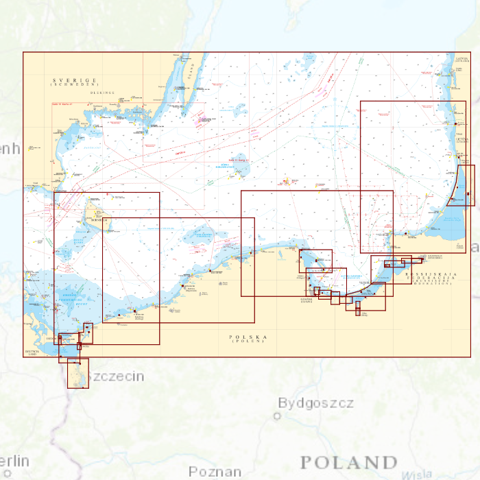
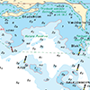
Covering area
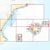
Covering the eastcoast of Poland and Lithuania from Stettin/Szczecin past lake Dąbie, the Stettiner Haff, Świnoujście, Gdańsk, Kaliningrad with a crossing chart up until the Latvian border. With an additional chart for the northern (Lithuanian) part of the Kuršių marios.

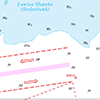
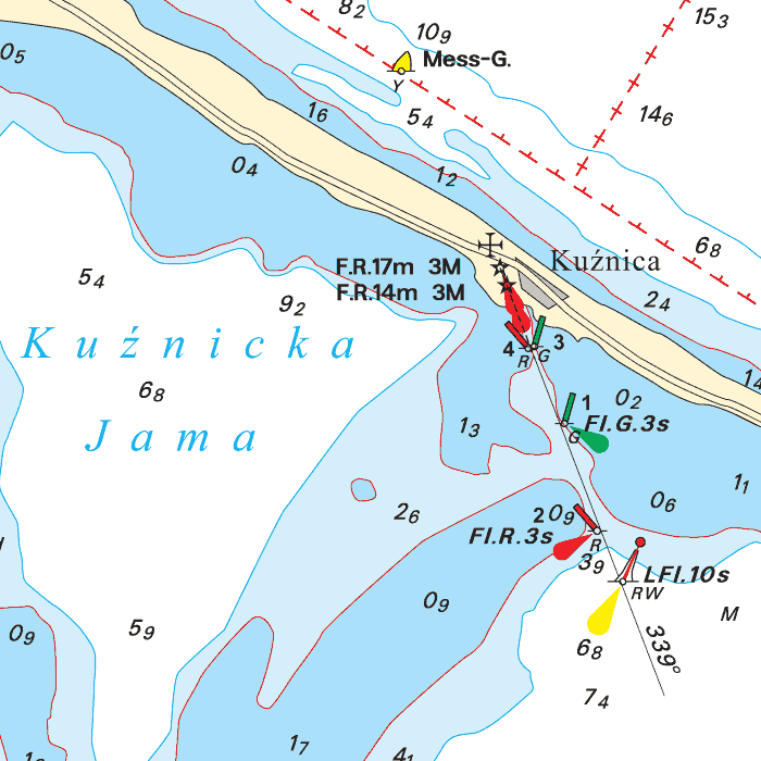

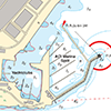
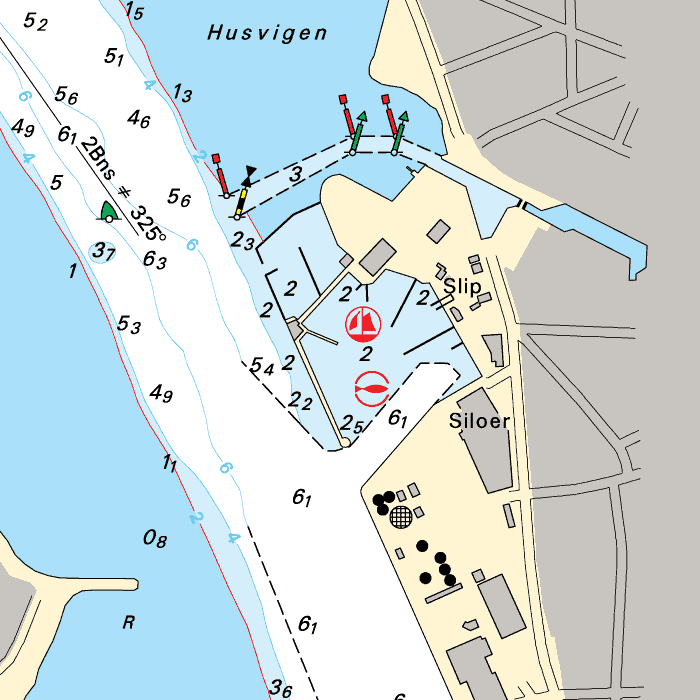
Depth image
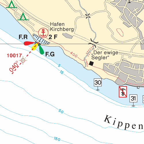
The depths are shown in clear colors; deep waters are white and shallow waters are color coded. This is comparable to the DKW 1800 series.
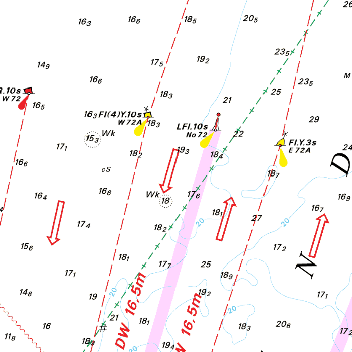
Chart image
The DKW Delius Klasing series are comprised of raster charts. Because of this, the charts are an exact copy of the paper versions and you will see pixels when zoomed in to the maximum amount. The advantage of this is that all information, for example buoyage or shallows, are projected on the exact coordinates. When using vector charts a misleading image can show up when zooming in.
All products in the DKW Delius Klasing series
Click on an image for more information about the chart set.
|
DKW DK1 |
DKW DK2 |
DKW DK3 |
|
DKW DK4 |
DKW DK5 |
DKW DK6 |
|
DKW DK7 |
DKW DK8 |
DKW DK9 |
|
DKW DK10 |
DKW DK11 |
DKW DK12 |
|
DKW DK13 |
DKW DK14 |

|
|
|
System Requirements: This chart can be used in the free WinGPS Lite for Windows and can also be installed on the WinGPS Marine apps for Android and iOS. For accurate route planning with rotating chart and AIS you will need at least WinGPS Pro or the paid version of WinGPS Marine. Click here for more information about the WinGPS series. |
|
|

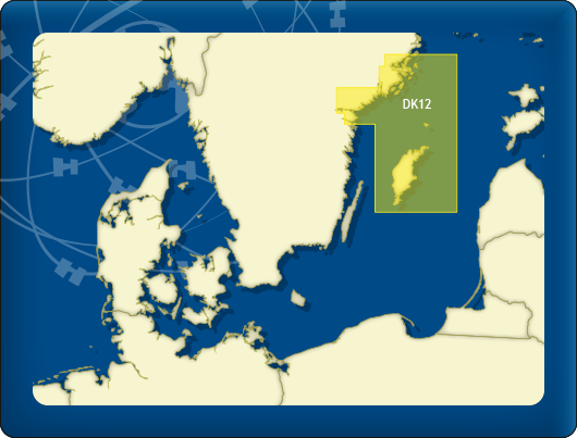
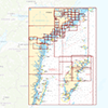
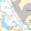
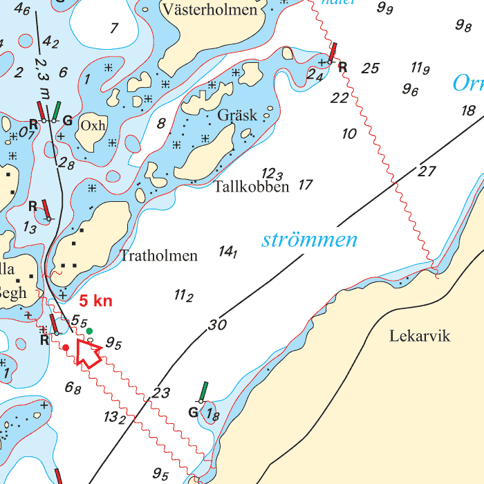
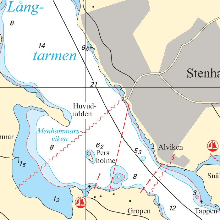
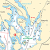
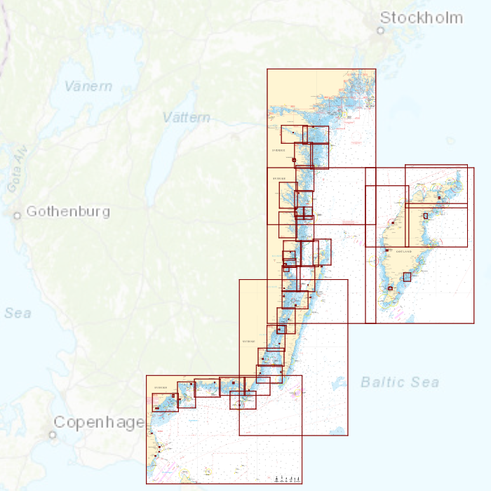
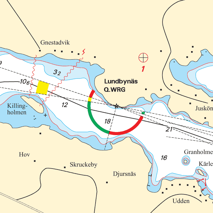
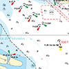
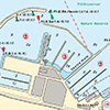
DKW DK12: Swedish Eastcoast 2
Since 2014, Stentec Software has been publishing the well-known Delius Klasing charts digitally. These are based on the paper charts of Delius Klasing and have a nice, clear chart image.
Now, 10 years later in 2024, our cooperation has been strengthened and the digital versions of Delius Klasing's paper charts can be downloaded exclusively via Stentec.
Covering area
Covering the northern part of the Swedish Eastcoast from Mem on the Göta channel past Norrköping, Stockholm up until th Kanholms Fjärden. Including all islands such as Vindö, Värmdön, Ingarö, Sandö, Ornö, Muskö, Utö and a crossing chart to Gotland island.

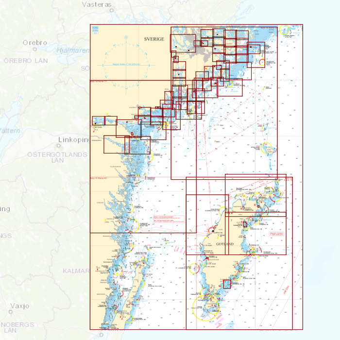

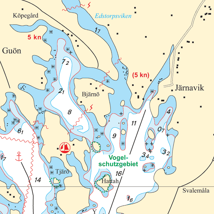
Depth image
The depths are shown in clear colors; deep waters are white and shallow waters are color coded. This is comparable to the DKW 1800 series.
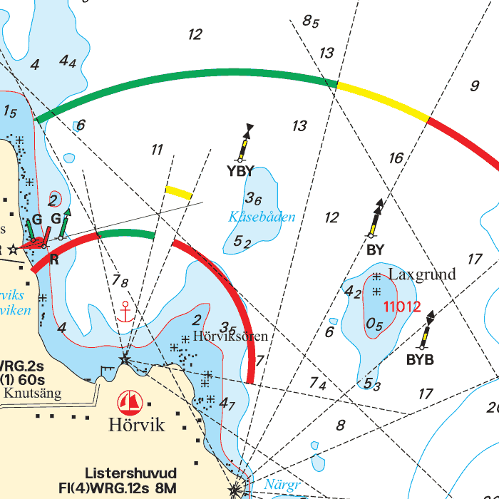
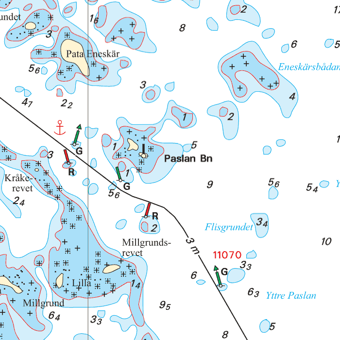
Chart image
The DKW Delius Klasing series are comprised of raster charts. Because of this, the charts are an exact copy of the paper versions and you will see pixels when zoomed in to the maximum amount. The advantage of this is that all information, for example buoyage or shallows, are projected on the exact coordinates. When using vector charts a misleading image can show up when zooming in.
All products in the DKW Delius Klasing series
Click on an image for more information about the chart set.
|
DKW DK1 |
DKW DK2 |
DKW DK3 |
|
DKW DK4 |
DKW DK5 |
DKW DK6 |
|
DKW DK7 |
DKW DK8 |
DKW DK9 |
|
DKW DK10 |
DKW DK11 |
DKW DK12 |
|
DKW DK13 |
DKW DK14 |
|
|
|
System Requirements: This chart can be used in the free WinGPS Lite for Windows and can also be installed on the WinGPS Marine apps for Android and iOS. For accurate route planning with rotating chart and AIS you will need at least WinGPS Pro or the paid version of WinGPS Marine. Click here for more information about the WinGPS series. |
|
|

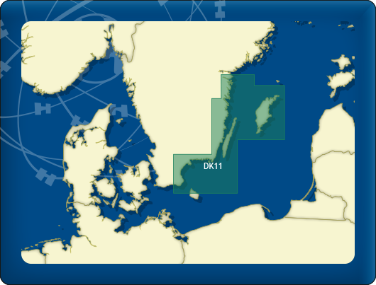
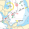
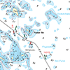
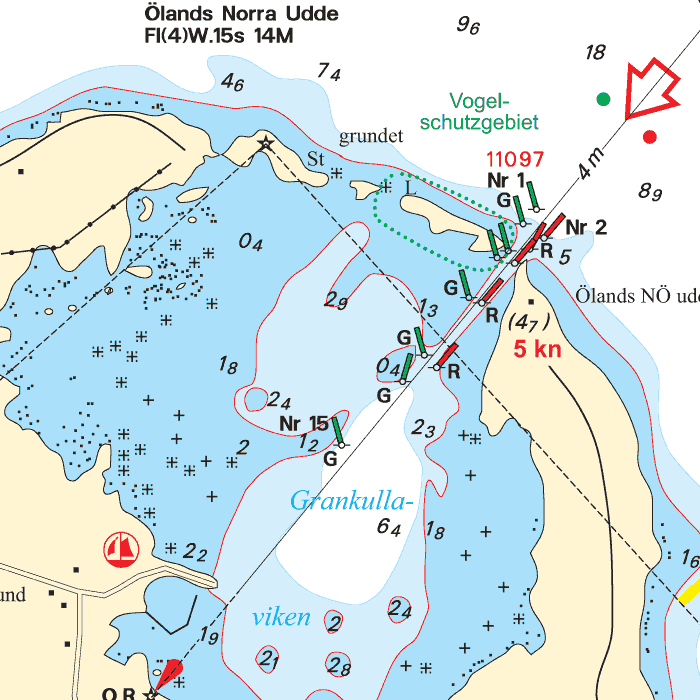
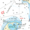
DKW DK11: Swedish Eastcoast 1
Since 2014, Stentec Software has been publishing the well-known Delius Klasing charts digitally. These are based on the paper charts of Delius Klasing and have a nice, clear chart image.
Now, 10 years later in 2024, our cooperation has been strengthened and the digital versions of Delius Klasing's paper charts can be downloaded exclusively via Stentec.
Covering area
Covering the southern part of the Swedish Eastcoast. From Åhus past Karlskrona, Kalmar, Figeholm, Västervik, Valdemarsvik up until Arkö. Including part of the Götakanal up until Mem, and the islands Öland and Gotland.
Depth image
The depths are shown in clear colors; deep waters are white and shallow waters are color coded. This is comparable to the DKW 1800 series.
Chart image
The DKW Delius Klasing series are comprised of raster charts. Because of this, the charts are an exact copy of the paper versions and you will see pixels when zoomed in to the maximum amount. The advantage of this is that all information, for example buoyage or shallows, are projected on the exact coordinates. When using vector charts a misleading image can show up when zooming in.
All products in the DKW Delius Klasing series
Click on an image for more information about the chart set.
|
DKW DK1 |
DKW DK2 |
DKW DK3 |
|
DKW DK4 |
DKW DK5 |
DKW DK6 |
|
DKW DK7 |
DKW DK8 |
DKW DK9 |
|
DKW DK10 |
DKW DK11 |
DKW DK12 |
|
DKW DK13 |
DKW DK14 |
|
|
|
System Requirements: This chart can be used in the free WinGPS Lite for Windows and can also be installed on the WinGPS Marine apps for Android and iOS. For accurate route planning with rotating chart and AIS you will need at least WinGPS Pro or the paid version of WinGPS Marine. Click here for more information about the WinGPS series. |
|
|

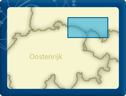
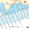
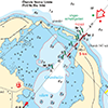
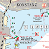
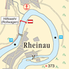
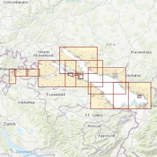
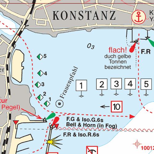
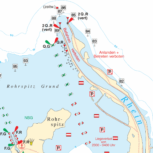
DKW DK10: Bodensee
Since 2014, Stentec Software has been publishing the well-known Delius Klasing charts digitally. These are based on the paper charts of Delius Klasing and have a nice, clear chart image.
Now, 10 years later in 2024, our cooperation has been strengthened and the digital versions of Delius Klasing's paper charts can be downloaded exclusively via Stentec.
Covering area
Covering the entire Bodenmeer borders at Germany, Switzerland and Austria. From Neuhausen am Rheinfall, past Radolfzell, Reichenau, Konstanz, Ludwigshafen, Friedrichshafen, Romanshorn up until Lindau and Bregenz.
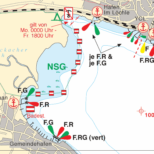
Depth image
The depths are shown in clear colors; deep waters are white and shallow waters are color coded. This is comparable to the DKW 1800 series.
Chart image
The DKW Delius Klasing series are comprised of raster charts. Because of this, the charts are an exact copy of the paper versions and you will see pixels when zoomed in to the maximum amount. The advantage of this is that all information, for example buoyage or shallows, are projected on the exact coordinates. When using vector charts a misleading image can show up when zooming in.
All products in the DKW Delius Klasing series
Click on an image for more information about the chart set.
|
DKW DK1 |
DKW DK2 |
DKW DK3 |
|
DKW DK4 |
DKW DK5 |
DKW DK6 |
|
DKW DK7 |
DKW DK8 |
DKW DK9 |
|
DKW DK10 |
DKW DK11 |
DKW DK12 |
|
DKW DK13 |
DKW DK14 |
|
|
|
System Requirements: This chart can be used in the free WinGPS Lite for Windows and can also be installed on the WinGPS Marine apps for Android and iOS. For accurate route planning with rotating chart and AIS you will need at least WinGPS Pro or the paid version of WinGPS Marine. Click here for more information about the WinGPS series. |
|
|

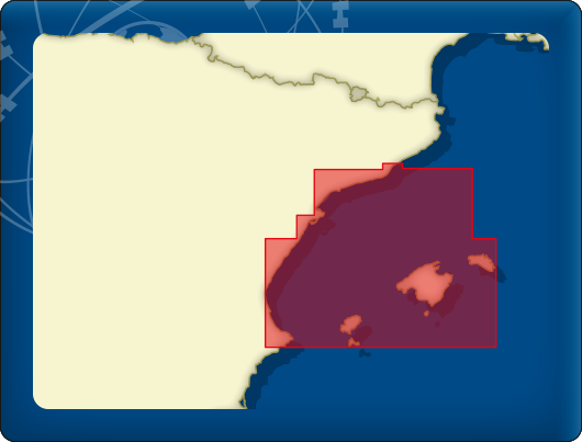
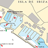
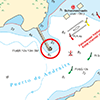
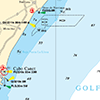
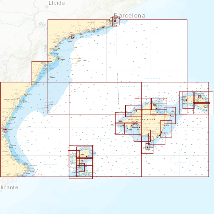
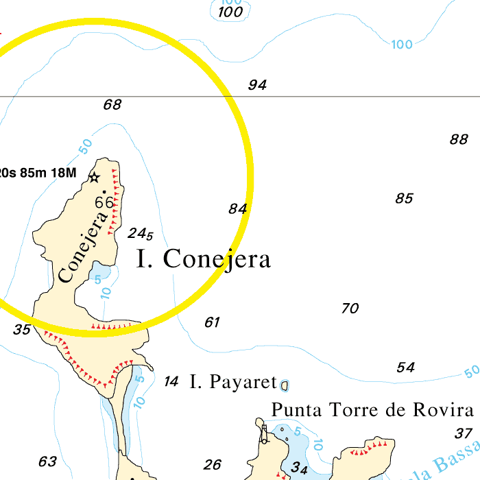
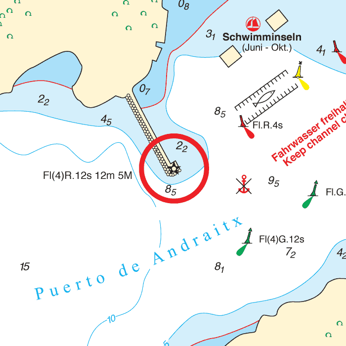
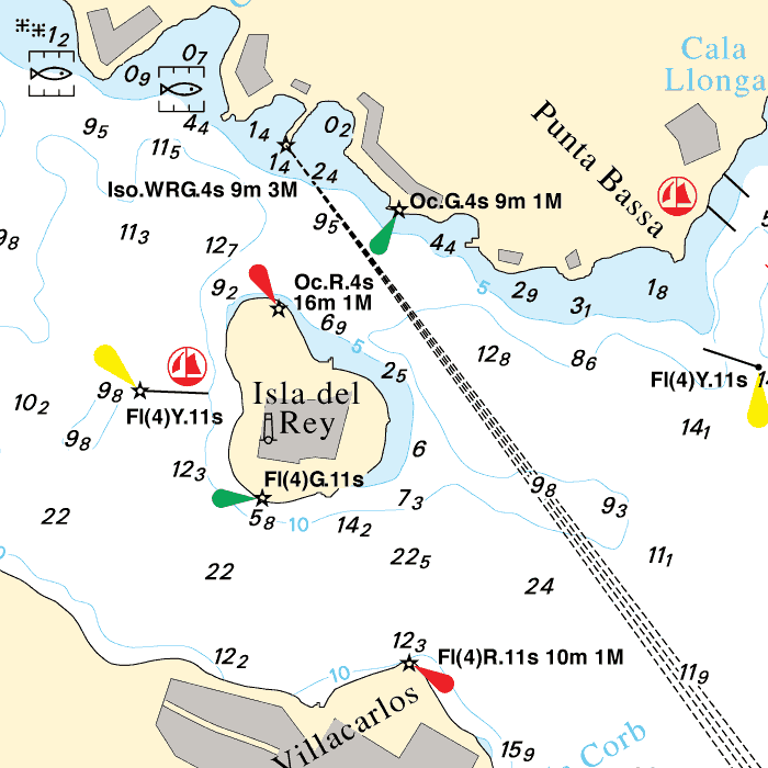
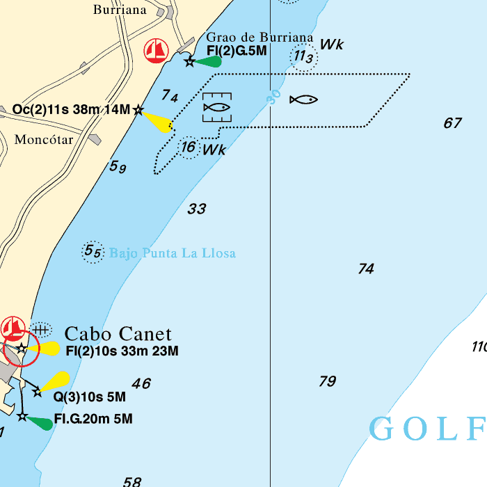
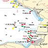
DKW DK9: Balearic Islands
Since 2014, Stentec Software has been publishing the well-known Delius Klasing charts digitally. These are based on the paper charts of Delius Klasing and have a nice, clear chart image.
Now, 10 years later in 2024, our cooperation has been strengthened and the digital versions of Delius Klasing's paper charts can be downloaded exclusively via Stentec.
Covering area
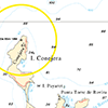
Covering the Balearic islands: Mallorca, Ibiza, Menorca and Formentera. Including crossings to the Spaninsh coast from Barcelona up until Cabo de la Nao.


Depth image
The depths are shown in clear colors; deep waters are white and shallow waters are color coded. This is comparable to the DKW 1800 series.
Chart image
The DKW Delius Klasing series are comprised of raster charts. Because of this, the charts are an exact copy of the paper versions and you will see pixels when zoomed in to the maximum amount. The advantage of this is that all information, for example buoyage or shallows, are projected on the exact coordinates. When using vector charts a misleading image can show up when zooming in.
All products in the DKW Delius Klasing series
Click on an image for more information about the chart set.
|
DKW DK1 |
DKW DK2 |
DKW DK3 |
|
DKW DK4 |
DKW DK5 |
DKW DK6 |
|
DKW DK7 |
DKW DK8 |
DKW DK9 |
|
DKW DK10 |
DKW DK11 |
DKW DK12 |
|
DKW DK13 |
DKW DK14 |
|
|
|
System Requirements: This chart can be used in the free WinGPS Lite for Windows and can also be installed on the WinGPS Marine apps for Android and iOS. For accurate route planning with rotating chart and AIS you will need at least WinGPS Pro or the paid version of WinGPS Marine. Click here for more information about the WinGPS series. |
|
|

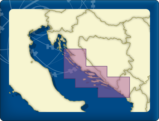
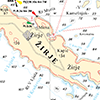
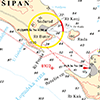
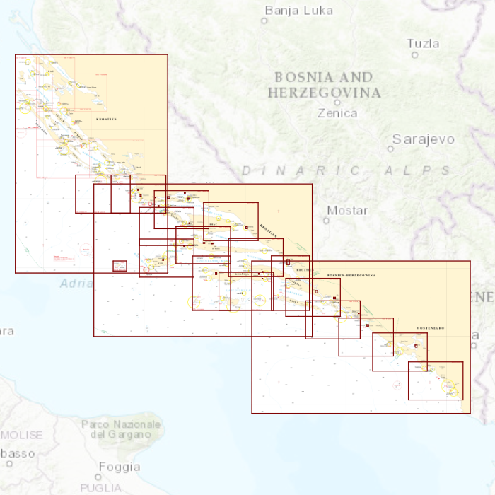
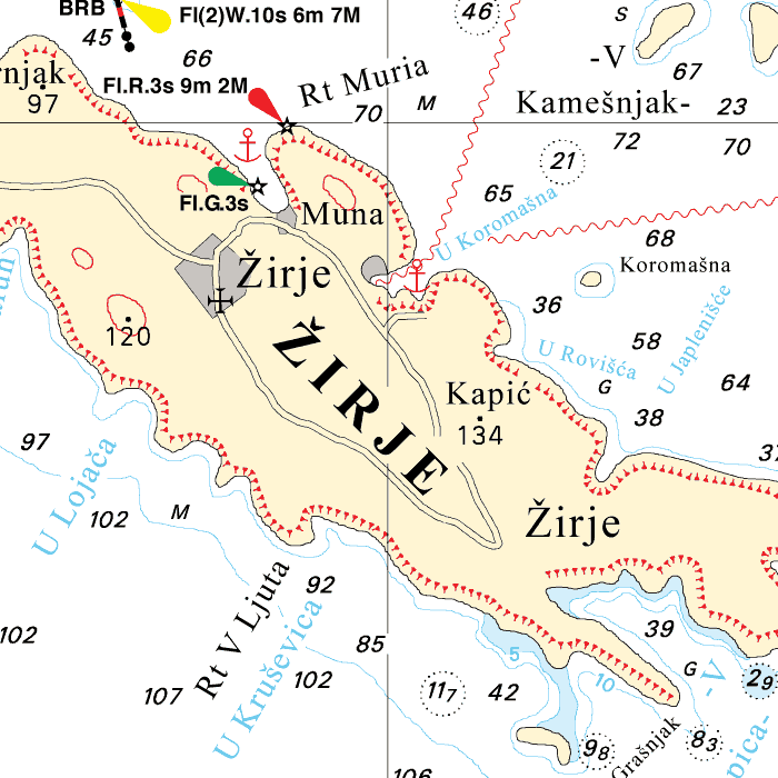
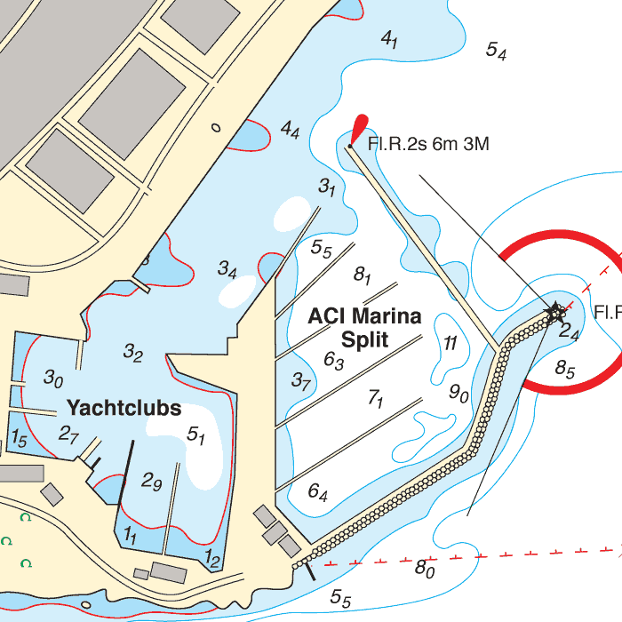
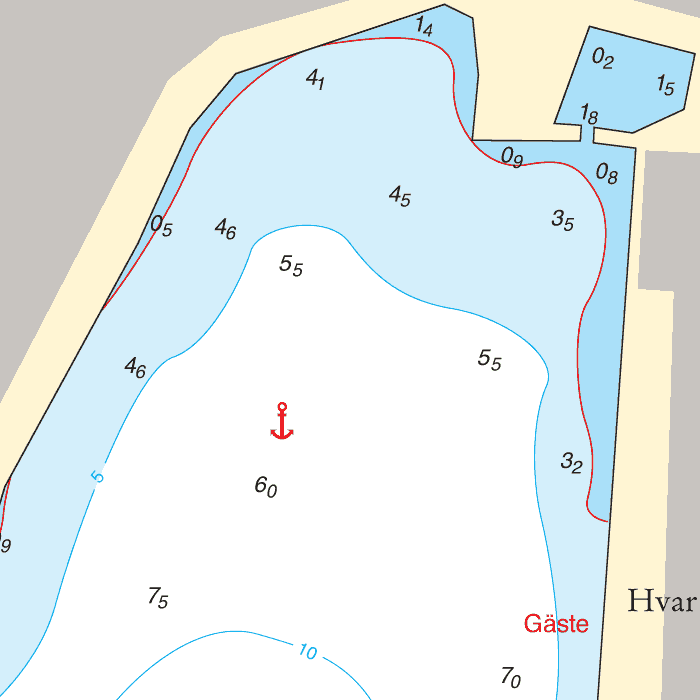
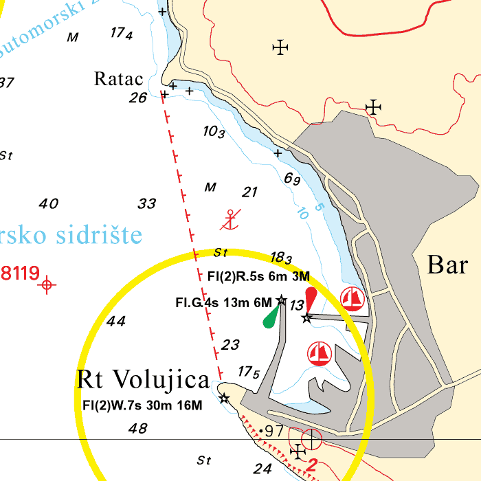
DKW DK8: Žirje - Split - Dubrovnik - Bar
Since 2014, Stentec Software has been publishing the well-known Delius Klasing charts digitally. These are based on the paper charts of Delius Klasing and have a nice, clear chart image.
Now, 10 years later in 2024, our cooperation has been strengthened and the digital versions of Delius Klasing's paper charts can be downloaded exclusively via Stentec.
Covering area
Covering the Southeast Adriatic coast, from Žirje past Split, Dubrovnik up until Bar in Montenegro. Including all Croatian islands such as Šipan, Mljet, Korčula, Hvar, Vis, Brač and Šolta.

Depth image
The depths are shown in clear colors; deep waters are white and shallow waters are color coded. This is comparable to the DKW 1800 series.
Chart image
The DKW Delius Klasing series are comprised of raster charts. Because of this, the charts are an exact copy of the paper versions and you will see pixels when zoomed in to the maximum amount. The advantage of this is that all information, for example buoyage or shallows, are projected on the exact coordinates. When using vector charts a misleading image can show up when zooming in.
All products in the DKW Delius Klasing series
Click on an image for more information about the chart set.
|
DKW DK1 |
DKW DK2 |
DKW DK3 |
|
DKW DK4 |
DKW DK5 |
DKW DK6 |
|
DKW DK7 |
DKW DK8 |
DKW DK9 |
|
DKW DK10 |
DKW DK11 |
DKW DK12 |
|
DKW DK13 |
DKW DK14 |
|
|
|
System Requirements: This chart can be used in the free WinGPS Lite for Windows and can also be installed on the WinGPS Marine apps for Android and iOS. For accurate route planning with rotating chart and AIS you will need at least WinGPS Pro or the paid version of WinGPS Marine. Click here for more information about the WinGPS series. |
|
|

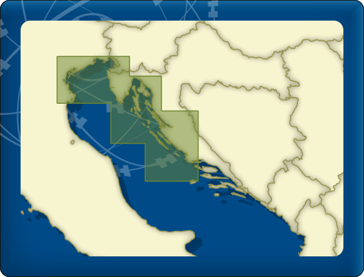
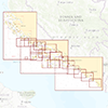
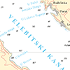
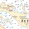
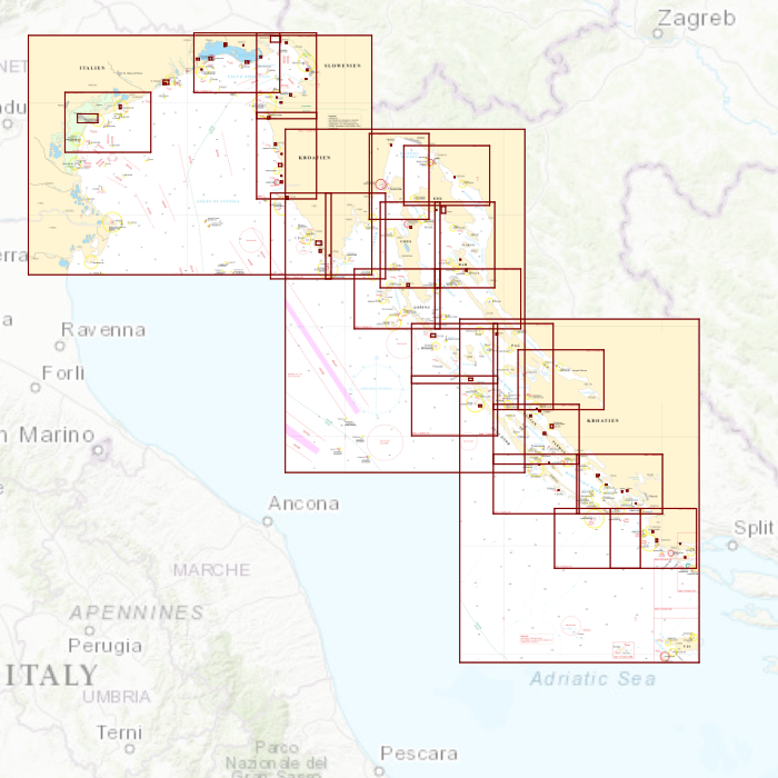
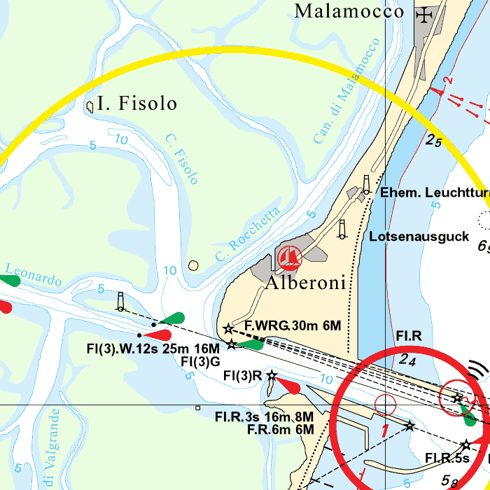
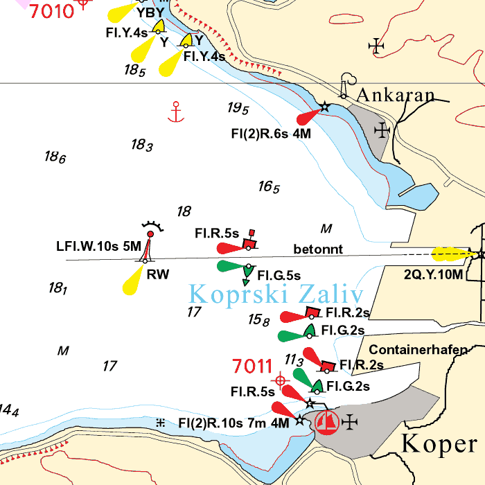
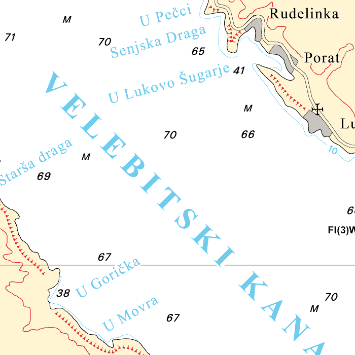
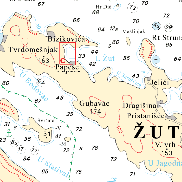
DKW DK7: Venice - Rijeka - Šibenik - Drvenik V.
Since 2014, Stentec Software has been publishing the well-known Delius Klasing charts digitally. These are based on the paper charts of Delius Klasing and have a nice, clear chart image.
Now, 10 years later in 2024, our cooperation has been strengthened and the digital versions of Delius Klasing's paper charts can be downloaded exclusively via Stentec.
Covering area
Covering the Northeast Adriatic coast, from Venice past Triëst, Pula, Rijeka, Zadar and Šibenik. Including all Croatian islands such as Murter, Kornati, Pašman, Ugljan, Pag, Krk, Cres and Rab.
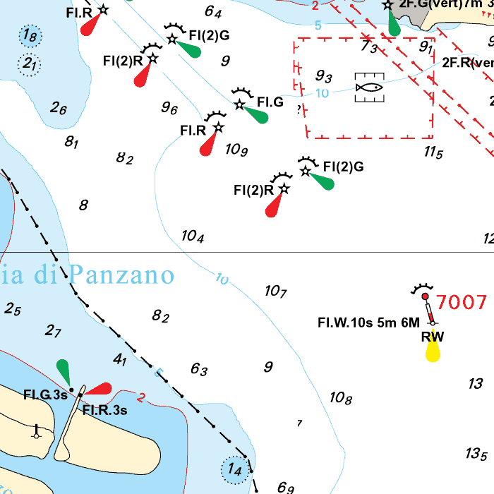
Depth image
The depths are shown in clear colors; deep waters are white and shallow waters are color coded. This is comparable to the DKW 1800 series.
Chart image
The DKW Delius Klasing series are comprised of raster charts. Because of this, the charts are an exact copy of the paper versions and you will see pixels when zoomed in to the maximum amount. The advantage of this is that all information, for example buoyage or shallows, are projected on the exact coordinates. When using vector charts a misleading image can show up when zooming in.
All products in the DKW Delius Klasing series
Click on an image for more information about the chart set.
|
DKW DK1 |
DKW DK2 |
DKW DK3 |
|
DKW DK4 |
DKW DK5 |
DKW DK6 |
|
DKW DK7 |
DKW DK8 |
DKW DK9 |
|
DKW DK10 |
DKW DK11 |
DKW DK12 |
|
DKW DK13 |
DKW DK14 |
|
|
|
System Requirements: This chart can be used in the free WinGPS Lite for Windows and can also be installed on the WinGPS Marine apps for Android and iOS. For accurate route planning with rotating chart and AIS you will need at least WinGPS Pro or the paid version of WinGPS Marine. Click here for more information about the WinGPS series. |
|
|

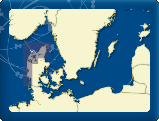
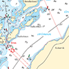
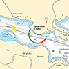
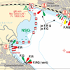
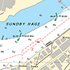
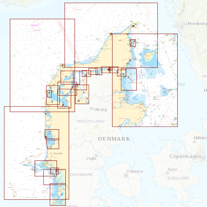
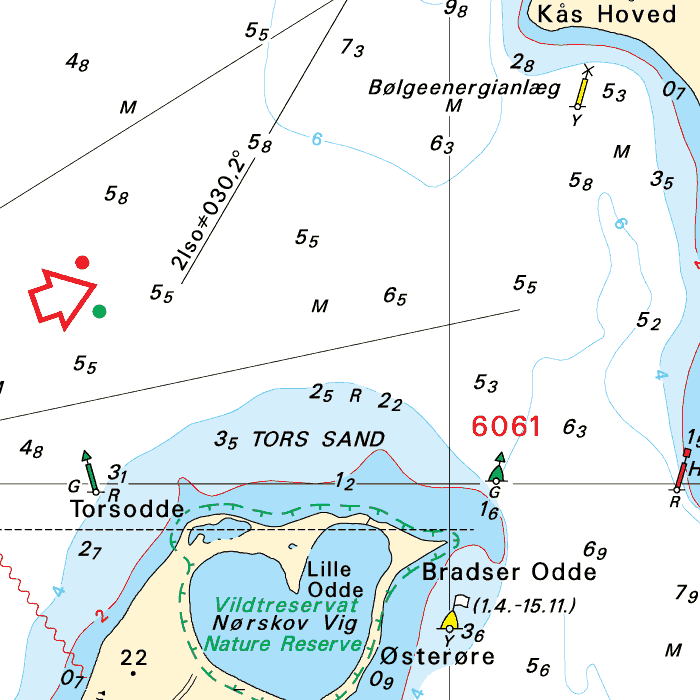
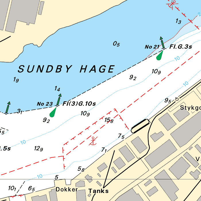
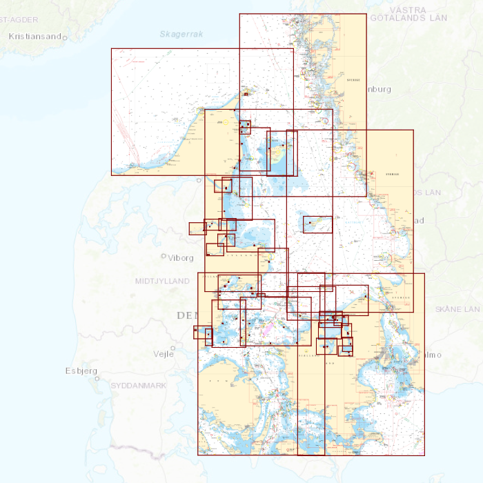
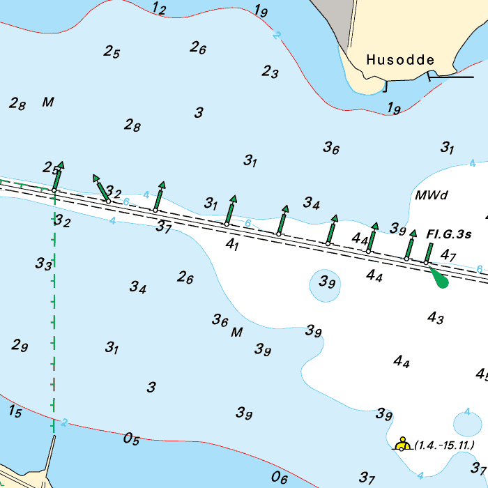
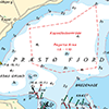
DKW DK6: Limfjord - Skagerrak - Danish Northsea coast
Since 2014, Stentec Software has been publishing the well-known Delius Klasing charts digitally. These are based on the paper charts of Delius Klasing and have a nice, clear chart image.
Now, 10 years later in 2024, our cooperation has been strengthened and the digital versions of Delius Klasing's paper charts can be downloaded exclusively via Stentec.
Covering area
Covering the Danish Northsea coast and the Skagerrak, including the Limfjords.

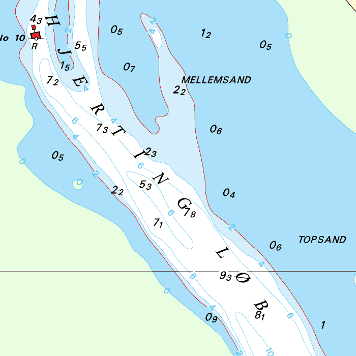
Depth image
The depths are shown in clear colors; deep waters are white and shallow waters are color coded. This is comparable to the DKW 1800 series.
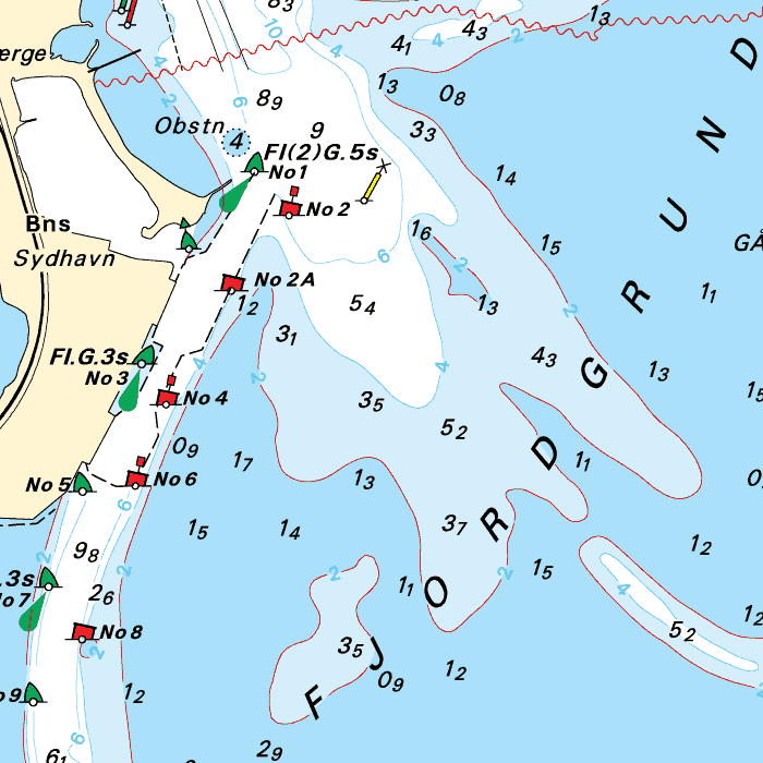
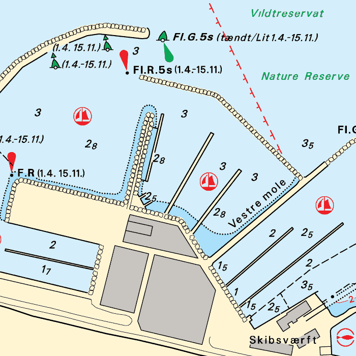
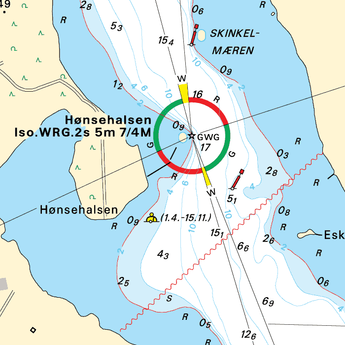
Chart image
The DKW Delius Klasing series are comprised of raster charts. Because of this, the charts are an exact copy of the paper versions and you will see pixels when zoomed in to the maximum amount. The advantage of this is that all information, for example buoyage or shallows, are projected on the exact coordinates. When using vector charts a misleading image can show up when zooming in.
All products in the DKW Delius Klasing series
Click on an image for more information about the chart set.
|
DKW DK1 |
DKW DK2 |
DKW DK3 |
|
DKW DK4 |
DKW DK5 |
DKW DK6 |
|
DKW DK7 |
DKW DK8 |
DKW DK9 |
|
DKW DK10 |
DKW DK11 |
DKW DK12 |
|
DKW DK13 |
DKW DK14 |
|
|
|
System Requirements: This chart can be used in the free WinGPS Lite for Windows and can also be installed on the WinGPS Marine apps for Android and iOS. For accurate route planning with rotating chart and AIS you will need at least WinGPS Pro or the paid version of WinGPS Marine. Click here for more information about the WinGPS series. |
|
|

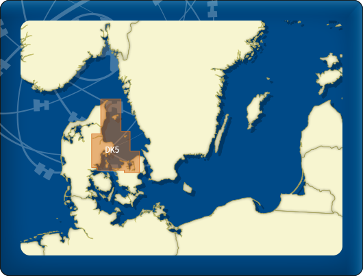
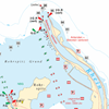
DKW DK5: Kattegat
Since 2014, Stentec Software has been publishing the well-known Delius Klasing charts digitally. These are based on the paper charts of Delius Klasing and have a nice, clear chart image.
Now, 10 years later in 2024, our cooperation has been strengthened and the digital versions of Delius Klasing's paper charts can be downloaded exclusively via Stentec.
Covering area
The whole of the Kattegat is covered, with detailed charts of the Northeastern Denmark coast and the north of Seeland. Including the islands Læsø, Anholt and Samsø.

Depth image
The depths are shown in clear colors; deep waters are white and shallow waters are color coded. This is comparable to the DKW 1800 series.
Chart image
The DKW Delius Klasing series are comprised of raster charts. Because of this, the charts are an exact copy of the paper versions and you will see pixels when zoomed in to the maximum amount. The advantage of this is that all information, for example buoyage or shallows, are projected on the exact coordinates. When using vector charts a misleading image can show up when zooming in.
All products in the DKW Delius Klasing series
Click on an image for more information about the chart set.
|
DKW DK1 |
DKW DK2 |
DKW DK3 |
|
DKW DK4 |
DKW DK5 |
DKW DK6 |
|
DKW DK7 |
DKW DK8 |
DKW DK9 |
|
DKW DK10 |
DKW DK11 |
DKW DK12 |
|
DKW DK13 |
DKW DK14 |
|
|
|
System Requirements: This chart can be used in the free WinGPS Lite for Windows and can also be installed on the WinGPS Marine apps for Android and iOS. For accurate route planning with rotating chart and AIS you will need at least WinGPS Pro or the paid version of WinGPS Marine. Click here for more information about the WinGPS series. |
|
|

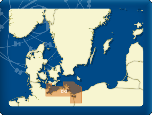
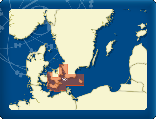
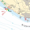
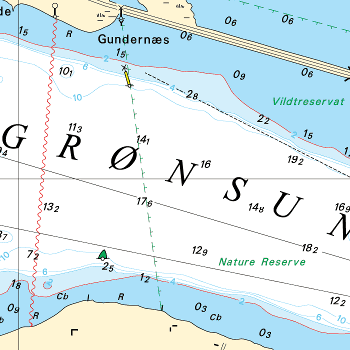
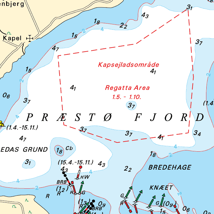
DKW DK4: Great Belt to Bornholm
Since 2014, Stentec Software has been publishing the well-known Delius Klasing charts digitally. These are based on the paper charts of Delius Klasing and have a nice, clear chart image.
Now, 10 years later in 2024, our cooperation has been strengthened and the digital versions of Delius Klasing's paper charts can be downloaded exclusively via Stentec.
Covering area
From Kalundborg on the island Seeland to the south near Lolland, Falster and Møn, back north past Kopenhagen and Malmö (on the Swedish coast) up until Helsingør and Helsingborg. The Swedish southcoast and Bornholm are also included.


Depth image
The depths are shown in clear colors; deep waters are white and shallow waters are color coded. This is comparable to the DKW 1800 series.
Chart image
The DKW Delius Klasing series are comprised of raster charts. Because of this, the charts are an exact copy of the paper versions and you will see pixels when zoomed in to the maximum amount. The advantage of this is that all information, for example buoyage or shallows, are projected on the exact coordinates. When using vector charts a misleading image can show up when zooming in.
All products in the DKW Delius Klasing series
Click on an image for more information about the chart set.
|
DKW DK1 |
DKW DK2 |
DKW DK3 |
|
DKW DK4 |
DKW DK5 |
DKW DK6 |
|
DKW DK7 |
DKW DK8 |
DKW DK9 |
|
DKW DK10 |
DKW DK11 |
DKW DK12 |
|
DKW DK13 |
DKW DK14 |
|
|
|
System Requirements: This chart can be used in the free WinGPS Lite for Windows and can also be installed on the WinGPS Marine apps for Android and iOS. For accurate route planning with rotating chart and AIS you will need at least WinGPS Pro or the paid version of WinGPS Marine. Click here for more information about the WinGPS series. |
Do you have any questions?
Call us on +31 515 443515, fill in the contact form or make an appointment at our store in Heeg.
Click here for our opening hours.


News
 The boating season is in full swing, and the water is calling! Whether you’re planning a relaxing weekend getaway or a major trip on Europe’s inland...
 The new charts for the Wadden Sea, DKW 1811 and DKW 1812, and DKW 1805 (Oosterschelde, Veerse Meer, and Grevelingenmeer) are now available! The quarterly...
 Are you familiar with our WinGPS Marine Plus for Android? This popular navigation app is now available as an affordable subscription and can be paired with an...
| WinGPS Navigator |
|
• Easy to use route planner |

| WinGPS Marine |
|
A navigation app for use aboard your ship. An upgradable navigation solution for all sailors, from beginner to professional. |

Stentec Navigation is specialised in digital navigation for water sporters and commercial shipping.
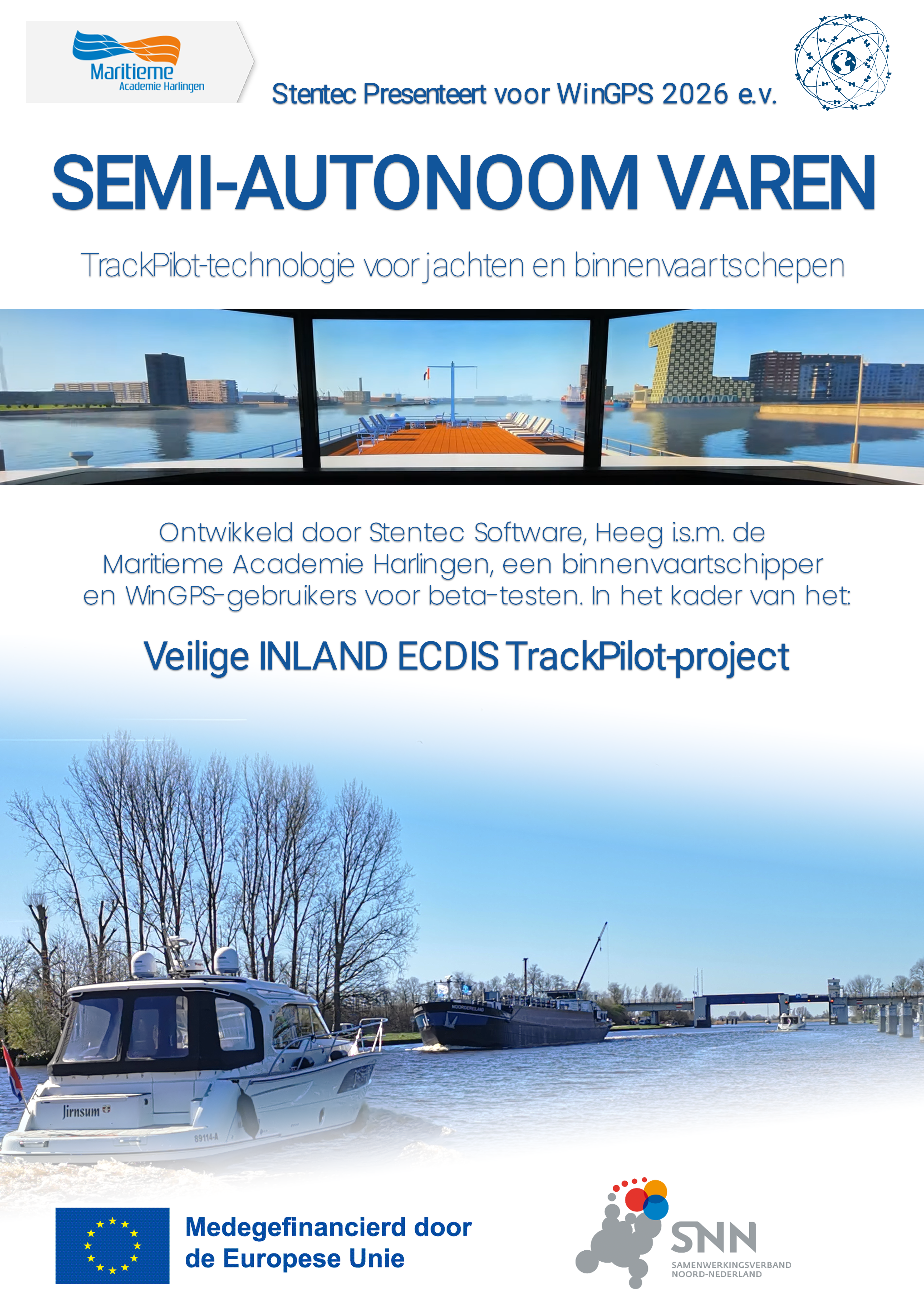
Trackpilot-project : 2025-2028

Harinxmastrjitte 29
8621 BJ HEEG
The Netherlands
T +31 (0) 515 443515

Copyright © Stentec Software. All rights reserved.
By using this website you acknowledge that you agree with our user agreement.