


- News
- E-mail list
- Signup for our newsletter
- Stentec news
- News
- Developers Blog
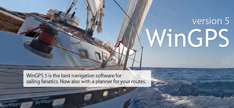
- WinGPS
- WinGPS series
- WinGPS versions
- WinGPS specifications
- For Windows
- WinGPS Lite
- WinGPS Navigator
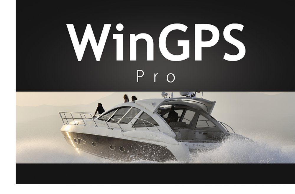
- WinGPS Pro
- WinGPS Voyager
- For Android
- WinGPS Marine
- WinGPS Marine Plus
- WinGPS Smartwear
- For iOS
- Apps for iOS
- WinGPS Marine
- WinGPS Marine Plus
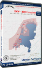
- DKW 1800 series
- Vaarkaart Friese Meren
- Service and upgrades
- Service Subscriptions
- WinGPS Yacht Navigator
- WinGPS trackpilot
- Charts
- Chart overview
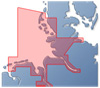
- DKW Inland waters
- DKW The Netherlands
- DKW Friese meren
- DKW Amsterdam
- DKW Biesbosch
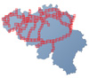
- DKW Belgium
- DKW Northern France
- DKW Southern France
- DKW Northeast Germany
- DKW Northwest Germany
- DKW Southwest Germany
- DKW Rhine and Moselle
- DKW Danube 1-West
- DKW Danube 2-Central
- DKW Danube 3-East
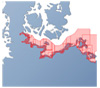
- DKW Coastal waters
- DKW 1800 series
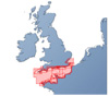
- DKW 1600+
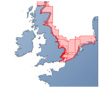
- DKW UK1 English & Scottish Eastcoast
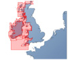
- DKW German Bight
- DKW German Baltic coast
- DKW Imray series
- DKW Delius Klasing series
- NV-Verlag series
- Exclusive for Android
- Subscription - DKW the Netherlands
- Chart apps
- Other
- Hardware
- Simulators
- Shop
- Downloads
- Support
- Downloads
- Help pages
- Documentation
- System Requirements
- Availability GRIB files
- Frequently asked questions - FAQ
- WinGPS 5
- WinGPS Marine (Android)
- WinGPS Marine (iOS)
- Installation help
- WinGPS 5 (Windows)
- WinGPS Marine (Android)
- Tips
- Offline installation DKW charts (Windows)
- Installation ENC charts (Windows)
- Connecting SD card (Android)
- NV Verlag charts
- Offline NOAA Charts
- Download TeamViewer
- Contact
- Contactform - Helpdesk
- Callback Service
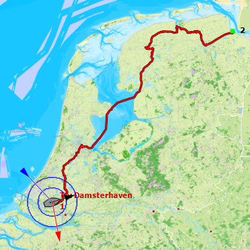
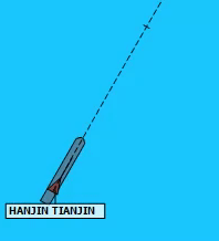
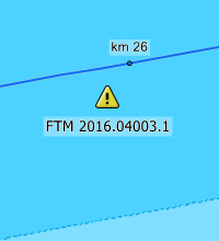
- Commercial Shipping
|
|

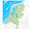
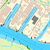
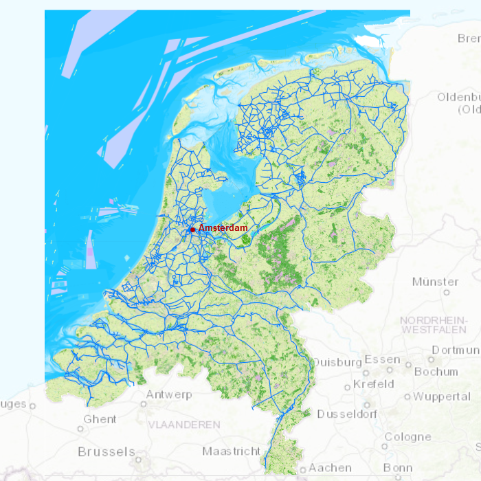
DKW the Netherlands
The DKW The Netherlands is developed for sailors, motorboaters and commercial use. The DKW The Netherlands is the most up-to-date inland water chart, thanks to all available updates throughout the year.
All Dutch inland waters are incorporated: the salty waters of Zeeland, the stirring rivers of Limburg and the small canoe fosses in Friesland. The DKW the Netherlands is great in combination with a paid version of WinGPS. Use the route network for a quick and easy way to plan routes along the Dutch inland waters.
More information regarding this chart set can be found below the detailed images.
Covering area
In this chart set you will find all Dutch inland waterways. 3 extra detailed charts are added for the Friese Meren, the Biesbosch and the waterways in and around Amsterdam.
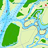

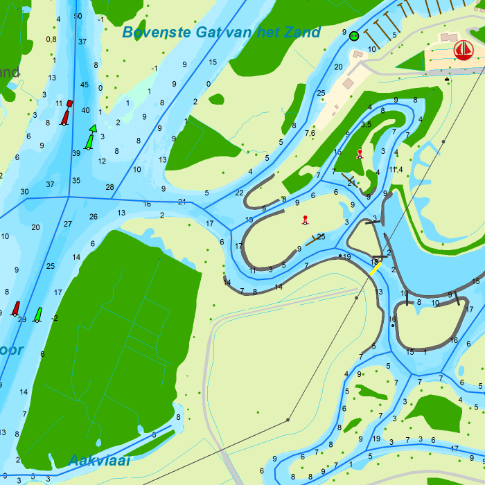
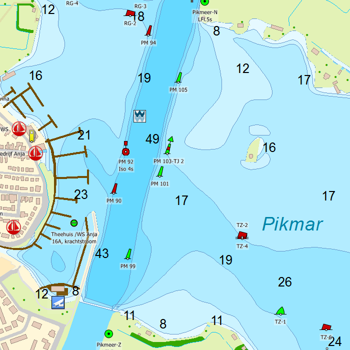
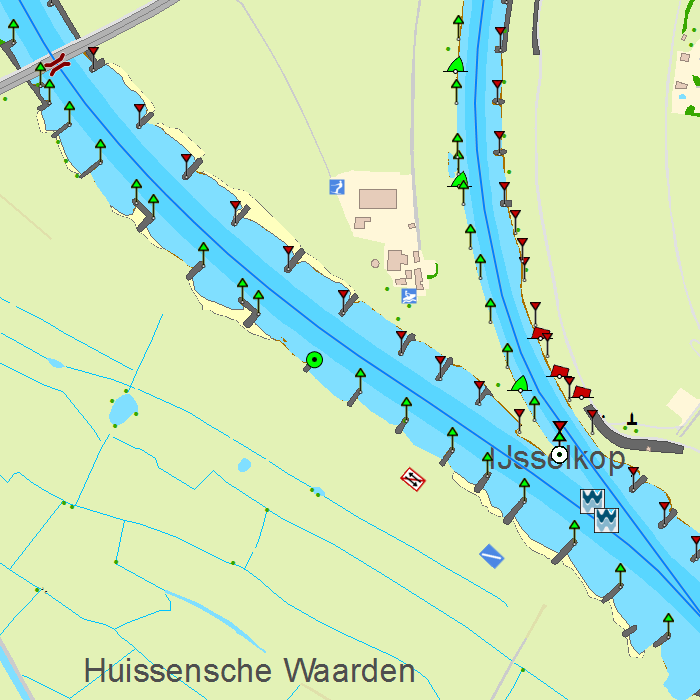


Depth image
This chart set has a unique and clear depth image with distinctly colored depth surfaces on the lakes and depth numbers along the waterways. The chart is published annually by Stentec, based on the Top10NL data from the Kadaster, Inland ENC charts, Rijkswaterstaat and user remarks. The chart has a high level of detail with 2 meter per pixel, making it possible to zoom in up until the jetties at your home port.
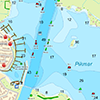
Chart image
Stentecs inland water charts are so-called hybrid charts. The bottom surface is a raster format. This is where a.o. the quays, depths and buildings are shown. All other navigational information is projected on top of this through waypoints. These waypoints remain the same size when zooming in or out. The chart can be fully personalized by adding or removing certain waypoint groups and showing you only the information you select.
The DKW Vaarkaart Nederland contains waypoints, including a.o. buoys, harbours, moorings, Marrekrite moorings, diesel tank stations, watersport campsites, VHF channels, electric chargers ‘Elektrisch Varen’ and ‘Varen Doe Je Samen’ nodes.
Specifically for commercial shipping waterway signs and VIN moorings are added.
|
|

|
System Requirements: This chart can be used in WinGPS for Windows and can also be installed on the WinGPS Marine apps for Android and iOS. For accurate route planning with rotating chart and AIS you will need at least WinGPS Pro or the paid version of WinGPS Marine. Click here for more information about the WinGPS series. |
|
DKW 1800 Complete |
DKW 1600+ |
DKW UK1 |
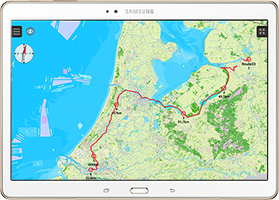
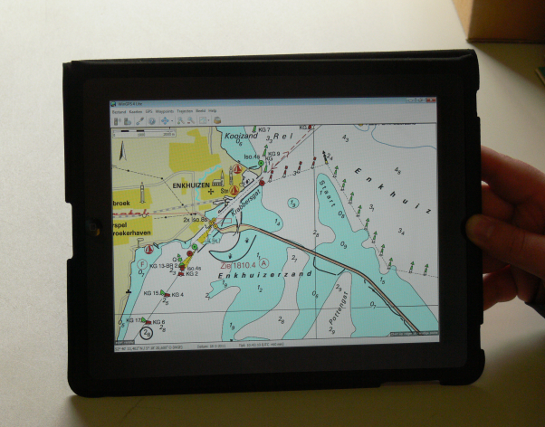 More and more skippers have bought an iPad or Android tablet to use onboard.
It is not possible to install WinGPS on your tablet for now but it can be used as an extra monitor. By using an external program like iDisplay, you can turn your tablet into a navigation device. Zooming and operating WinGPS is done easily with your fingers.
The iPad/tablet does not need to have GPS or 3G, making even the cheapest iPad suitable. Bluetooth needs to be turned off on the iPad.
An advantageous and simple solution, tested by our users, is an iPad connected to a Windows 7 netbook. Connectify turns your netbook into a Wifi hotspot, which allows you to communicate with your tablet onboard.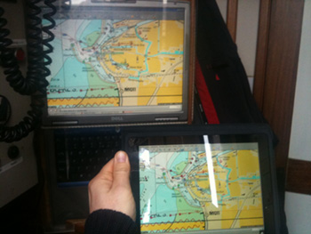 In the figure to the right you see a Navbook which is connected trough a Bluetooth multiplexer to the (Raymarine) system. This also shows AIS targets. The laptop is connected to a Wifi access point so communication can go to and from the iPad. The iPad does not only show our position but the AIS targets and our polar diagram as well.
Below is a video of an iPad onboard. We thank the skipper of Eelske Medde.
Your comments and experiences with tables is apreciated. We would like to share them with other users.
Send an e-mail to helpdesk@stentec.com.
WinGPS Chart apps
In addition to Stentecs digital charts for Windows we also provide chart apps for Android and iOS devices. In these chart apps it is only possible to install and use the individual charts.
WinGPS Marine
These chart apps are based on the technology behind WinGPS Marine. If you want more information on your chart view (such as tidal information or AIS) or if you want multiple charts in the same view you can use WinGPS Marine.
Replacement for paper charts
Stentecs chart apps are designed as a replacement for the paper chart sets. A large tablet or iPad is preferable as it has the largest possible chart view. With a built in GPS receiver the chart will move along with your position on your screen and you will always see your current position, speed and course. Place a navigational waypoint on the chart view and receive a 'course to steer' onscreen.
The app can also be used in Android smartphones or iPhones (for quick position checks) and makes it ideal for use on dinghies, charterers and for passengers.
Water chart license
You can download the chart apps from the Google Play store or Apple App store (see links below). After the chart set has been purchased and connected to your Stentec account they can also be used in our main navigation app, WinGPS Marine for iOS or Android. Or on your Windows system with WinGPS (Lite, Navigator, Pro of Voyager).
DKW Friese Meren
With this chart set you can navigate the popular Friese Meren for Fryslân. This chart set is free of charge and can be downloaded from the Google Play store.
![]()
 Free
Free
DKW 1800 Series
With this chart set you can replace the paper versions of the 1800 series created by the Dutch Hydrographical Service. This app is available per chart set or in combination packages.
![]() From € 24,90
From € 24,90
DKW New Zealand
Navigational app with detailed and actual digital watercharts for New Zealand from the British Admiralty. For motor boaters, sailors and commercial shipping.
![]() Free
Free
DKW Imray
These digital Imray charts are based on the well-known paper charts and have the same color coding. The advantage of these charts is the large covering area per chart set.
![]()
This is an overview of some of our chart apps. These are not all chart apps we have available for your Android device. When you buy a (DKW) water chart in our online shop, you can use this in combination with WinGPS Marine for Android or iOS, or in WinGPS for Windows. Click here for a chart overview.
|
|
WinGPS Lite
WinGPS Lite is the free version of the WinGPS series for your Windows PC or laptop.
You can use WinGPS Lite to introduce yourself to digital onboard navigation. Combine WinGPS Lite with the DKW 1800 series or the DKW the Netherlands chartset and experience the reliability of WinGPS and the extra safety it brings aboard.
Connect a GPS receiver to your laptop and:
- Determine your position
- See your heading
- See your speed
- Monitor your sailed tracks
For Windows and Android WinGPS Lite, the free version of Stentec's navigation software WinGPS, is developed for your Windows PC or Laptop. If you have an Android tablet or smartphone, you can download and install the free version of our Android application WinGPS Marine Lite via Google Play. |
More functionality If you want extra functions that aren't available in WinGPS Lite, you can purchase a full version of WinGPS. With one of these programs you can plot routes, download GRIB files for weather forecast, connect board instruments (such as AIS) and much more! |
Digital water charts
All of Stentec's DKW water charts are available for WinGPS Lite and are easily installed.
|
|
|
System Requirements: |
Charts for WinGPS
Besides your navigation program you will also need digital charts. The WinGPS series support world wide coverage which can easily be installed with DKW Manager.Most charts come with an online update service. Our goal is to deliver the most actual charts to sailors. Safety must come first. Besides the charts we publish, you may also create your own charts with DKW Builder.
Below an overview with charts suitable for WinGPS
DKW Inland charts
Stentec is creating our own inland charts, especially made for digital navigation. Perfect in combination with WinGPS 5 thanks to the route planner and Bridges en Locks database.
Supplier: Stentec Software
Ammount of updates: n/a
Coverage:
Ammount of updates: n/a
Coverage:
- DKW Inland ENC Nord Deutschland More information Online Shop
- DKW Inland ENC Rhein More information Online Shop
- DKW Vaarkaart Fryslan More information Online Shop
- DKW Vaarkaart Nederland Online Shop
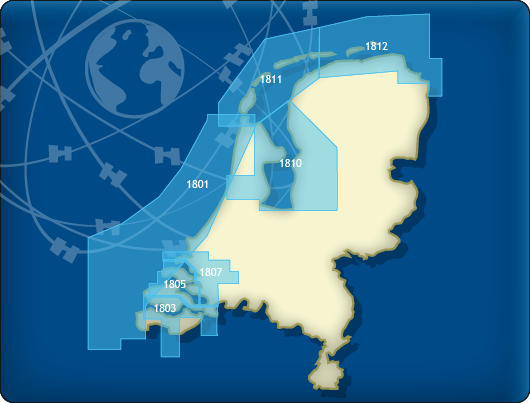
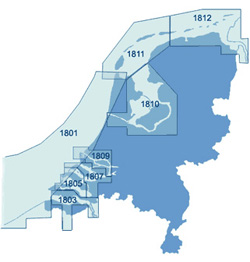
DKW 1800 The Netherlands
Stentec Software publishes the digital version of the Hydrographic charts of The Netherlands since since 1999. Thanks to the weekly online update service you will always have the most recent charts. The charts can be ordered seperately or as a whole.
Supplier: Stentec SoftwareAmmount of updates: Weekly
Coverage:
- DKW 1801 Noordzeekust
- DKW 1803 Westerschelde
- DKW 1805 Oosterschelde
- DKW 1807 Zoommeer
- DKW 1809 Nieuwe Waterweg
- DKW 1810 IJsselmeer
- DKW 1811 Waddenzee West
- DKW 1812 Waddenzee Oost
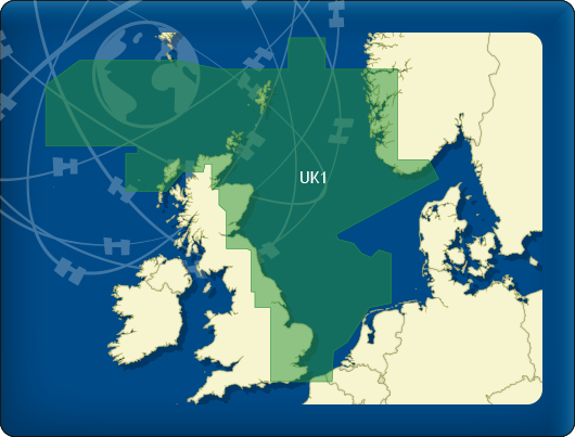
DKW Imray
Stentec Software publishes the renown Imray charts digitally since 2009. These are based on paper charts and also have the famous Imray colors. The great advantage of these charts is that they cover a large area in 1 set.
Supplier: Stentec Software
Ammount of updates: 4 times/year
Coverage:
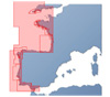
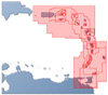
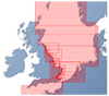
- DKW-ID10 Engelse en Schotse Oostkust
- DKW-ID20 English Channel
- DKW-ID30 Britse Westkust en Ierland
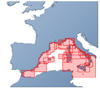
- DKW-ID40 Atlantische kust Frankrijk, Portugal tot Gibraltar
- DKW-ID50 Middellandse Zee West (European Coast)
- DKW-ID60 Middellandse Zee Midden
- DKW-ID70 Oostelijke Middellandse Zee
- DKW-ID100 Eastern Caribbean
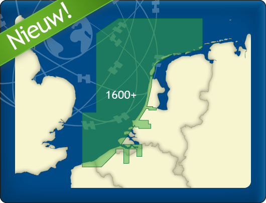
DKW Internationaal
For the most popular areas we also publish our own chart sets. This way you can easily download your charts from our websites. Because we make the charts ourselves, it is easier to update them regularly, keeping them recent and safe.
Supplier: Stentec Software
Ammount of updates: n/a
Coverage:
- DKW Duitse Oostzeekust
- DKW Duitse Bocht
- DKW Engelse Oostkust
NV-Verlag
 NV-Verlag is a publisher of charts which cover the entire world. They also publish the Baltc Sea charts, which are combipacks, paper and digital charts.
Supplier: NV-Verlag, Navicarte, Soltek
Ammount of updates: n/a.
Coverage:
- Africa
- Atlantic
- Internal Waters Europe
- Caribbean and South America
- Florida, Bahamas & Gulf Coast
- Indian Ocean
- Mediterranean
- North Sea
- East Coast U.S.
- Baltic Sea
- Pacific Ocean
- World
{module 62}
This list will give you a good overview of our different versions.
For a complete overview of the features please click here.
| Features of WinGPS 5 | Lite | Navigator | Pro | Voyager | |
| GPS Tracking | |||||
| Map Windows | 1 | 2 | 3 | 3 | |
| Route planner | |||||
| Time Control | |||||
| Weather (Grib) | |||||
| Current & Tide (NL Tides, Rijkswaterstaat) | |||||
| NMEA Instruments like : AIS, Depth meter,Autopilot, etc. | |||||
| Interactive planning of routes with Polar | |||||
| WinGPS | |||||
| Functions specialized for power boats | |||||
| Functions specialized for sailing boats | |||||
| Prices | |||||
| Price Download | Free | € 129,- | € 279,- | € 379,- | |
| Price CD version | Free | € 149,- | € 299,- | € 399,- | |
 Stentec’s New WinGPS 4 Mobile Navigator is specially designed for GPS-navigation with your handheld PC or PDA on board.
- WinGPS 4 Mobile Start-Up sheet
- An english manual will follow
 Buy this product
To the shop
Specs WinGPS 4 Mobile Navigator

- Useful for all charts using WinGPS 4, like DKW 1800, ANWB, Navkom and charts which were reset from DKW1 to DKW2. Also suitable for charts made in DKWBuilder. Also supporting the most common BSB4 charts.
- You will get to see all charts without borders as one big picture on your screen. Ideal for planning routes on multiple charts. No chart names to remember, but only zoom-in and –out. Multiple chart sets to use simulteneously.
- Position and sailed routes to plot, when an NMEA-0183 compatible GPS is connected you can see your course line and position.
- Groundcourse (COG), groundspeed (SOG) and WGS84 coordinates. Chart rotation: Chart Up, North Up, Leg Up (along route line) and Course Up and Automatic center to get as much chart in front of your cursor.
- Plan routes by using waypoints and sail alongside with a XTE indicator. Optional: scale indicator and North arrow Installation, delete and update (only DKW1800) charts by using DKW Manager.
|
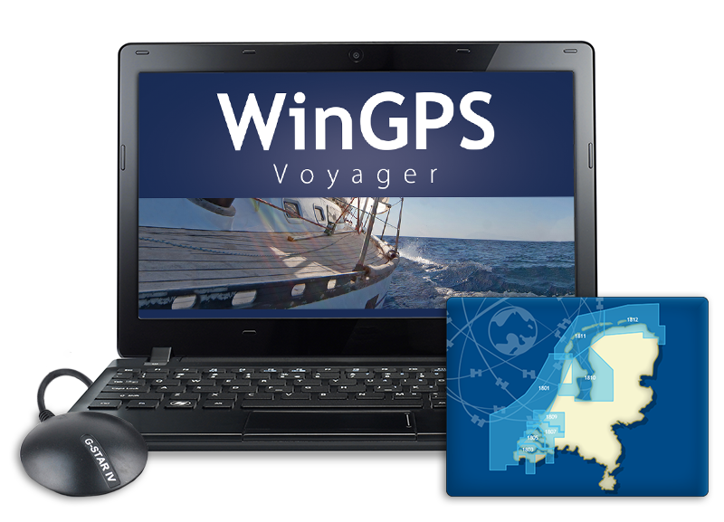
WinGPS Voyager
Stentecs top navigation program helps you plan the optimal route, providing extra security for long journeys and benefits in competitions. Voyager shows the fastest, shortest and cheapest route, both by engine and sail.
|
|
GPS navigation on your laptop WinGPS Voyager is an interactive route planner which you can install on your Windows laptop. Connecting the on-board instruments changes your laptop into a complete navigation center. Connect a second monitor (such as a waterproof touchscreen) to your laptop or install the charts on an Android tablet, so that you can also view and edit the route if the situation has changed from outside as well. |
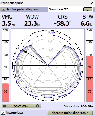
Polar diagram De biggest added value of WinGPS Voyager to Pro is the route optimization thanks to the use of a polar diagram during the planning of the route. In a polar diagram, the speed of a sailing ship is recorded at different wind speeds and courses, and is therefore unique to each ship. In addition to the measurements of your ship, in WinGPS Voyager you can select the polar diagram of the sailing ship from over 3000 included polar diagrams. Is your ship not included? Record your own polar diagram with Voyager and connected wind meter, or adjust an already existing polar diagram to the desired data. While sailing, you can see if you are sailing the optimal course and getting the maximum speed from your ship. WinGPS Voyager contains polar diagrams of over 3000 different types of boats, including: Baltic, Bavaria, Beneteau, Breehorn, Contest, Dehler, Dufour, Elan, Etap, F&F, Feeling, First, Friendship, Gib’Sea, Grand Soleil, Halberg Rassy, Hanse, Hunter, J22-92, Jeanneau, Kolibri, Koopmans, Maxi, Nicholson, Oceanis, Optima, Solana, Sigma, Spirit, Standfort, Sunfast, Sun Odyssey, Swan, Sweden, Trintella, v.d. Stadt, Victoire, Waarschip, Winner en X-yacht. |
|
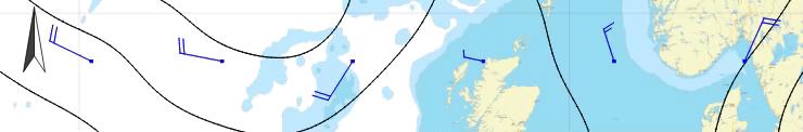
GRIB files Download GRIB files for your weather forecast for the next 7 days as a good preparation for your trip or race. Voyager can help you plan the optimal route, taking into account the wind. Look ahead in time with the time bar to see how the weather will develop.
|
|
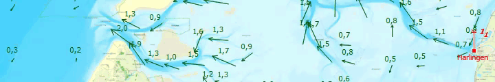
Stream, tides, water heights and waves In some sailing areas, such as the Wadden sea, the water can be very unpredictable. With the annual stream and tidal information from NLtides, which is produced by the Dutch Hydrographic services, it's possible to look forward in time to determine when a crossing can best be planned. A few days before your voyage you can download the detailed stream information, water heights and actual depths from within the 'Kustfijn-model'. This model is based on data from Rijkswaterstaat, including current weather influences such as wind propulsion. If you are planning a trip to the German Bight, Balticsea, Northsea or the English Channel, you can download GRIB files for the current stream data. This data is provided by the BSH, the German Hydrographic services, which gives you predictions for the next 3 days. Some times it is possible to get annoying high waves due to a combination of high wind and stream. understandibly, you would want to avoid these waves in stead of them catching you by surprise. Thanks to the GRIB Files for wave prediction from the NOAA, it is possible to set a maximum wave height which will show you exactly which areas to avoid. Follow this link for an example. All of the data mentioned above can be added to the route plotting, along with the current wind and the polair diagram. For the inland waters NAP measuring stations are added in WinGPS. These stations show the actual water heights for the Dutch inland waters, made available by Rijkswaterstaat. As soon as the shipping notifications have been updated within WinGPS, the NAP measuring stations will also have been updated.
|
|
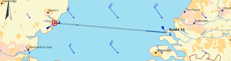
Route optimization After setting up the polar diagram and downloading the latest GRIB files for weather forecast, you can start planning the optimal route. You only need to enter the route points and WinGPS Voyager gives you advice, taking into account the wind, currents and the characteristics of your ship. The arrival time and passing times along the route points are shown immediately, allowing you to instantly see if your route is safe. By dragging the time bar, you will immediately see what will happen on the chart. Ideal for example for the Wadden or the crossing to England.
|
Standing mast route Is the wind too tough to sail the open waters? Then you can quickly and easily plan a route over the 'standing mast route' and immediately see how long the journey takes, considering all bridge and lock information. |
Safe navigation with AIS If you have an AIS device, you can connect this to WinGPS Voyager. This will show the AIS objects on the chart, including name, MMSI number, call sign, measurements, destination, freight and, of course, speed and course of the ship. Indicate your CPA and Voyager will give you a warning when a ship is on collision course. The AIS object will light up, so you can call the ship directly with the call sign and match the course plans. For your own ship, as well as for AIS ships, the predicted track can be displayed on the chart. AIS-XT, or AIS extrapolation technology, will show the AIS traffic over your charts fluently. Convenient for assessing a traffic situation and making a turn. With the time bar, the track can be simulated to see which AIS ships will be crossed. The ships will be shown at scale (as well as your own ship) when zoomed in on them. Ideal for when you are sailing on rivers and are unable to see behind the corner. This way you can see if the AIS object is a small pleasure craft or a large inland commercial vessel. |
|
Your reliable partner onboard and at home A big advantage of WinGPS Voyager is the option to install the program on 2 systems, so that you can plan the route on a big screen at home to prepare your trip. This is especially ideal with longer, more complicated routes, for example crossing the Waddenzee. Look ahead in time with the time bar and decide the best departure time, based on currents, tides and wind: downloading the up to date water levels for the Waddenzee or IJsselmeer, also known as the Kustfijn model, makes planning your route even easier. While sailing, WinGPS Voyager keeps a logbook with data from connected board instruments, your route and any user entries. You can analyze your sailed track in detail later. When at home, you can print or email your tracks and logbooks, or place them on your website. Nice for your family at home or the crew. In combination with WinGPS you can use Stentec’s digital chart, also known as DKW charts. Make sure they are up to date when you start planning the route. Print the route table and possibly the updates charts of important areas on the route. This way you are well prepared for your trip! Note: WinGPS Voyager is prepared for malfunctions in your GPS by sunflowers. As a result of increased solar activity, solar flames will become increasingly frequent, which can cause huge GPS disturbances. WinGPS Voyager is set up for this and will pass on your position safely.
To be sure that WinGPS will work properly on your system, you can install our free WinGPS Lite. When WinGPS Lite is running on your system without any problems, then WinGPS Navigator, Pro and Voyager will also work flawlessly. You can download WinGPS Lite here for free. |
|
WinGPS Pro
If you not just want to plan routes but also want to connect your onboard equipment or sail on tidal waters you can choose WinGPS Pro as your professional navigation software.
|
|

GPS navigation on your laptop WinGPS Pro is an interactive route planner which can be installed on your Windows laptop. By connecting your onboard insstruments you can turn your laptop into a fully functional navigation system. Add a second monitor (for example a water proof touch screen) or install your charts on an Android tablet, making it possible to view the charts outside. |
Multiple day planning with shipping notifications In WinGPS Pro is it possible to plan a route for multiple days along the inland waterways. Check your location on your desired 'stop times' and find a suitable harbour around that position to schedule a stay. Download the shipping notifications to avoid obstructions along your voyage. |
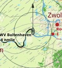
Chart windows and rotating charts It is possible to open multiple chart windows in WinGPS Pro. For example, use one window for a chart up view with rotating charts and a second window with the run-up to the destined harbour. |
|
Safe navigation with AIS When you have an AIS device installed it is possible to connect it with WinGPS Pro. You will see all received AIS objects on your chart including name, MMSI number, call sign, dimensions, destination, cargo and of course the position, speed and course of the ship. Enter your CPA and WinGPS Pro will give off an alarm when you are on a collision course. You will immediately see the AIS object with call sign and can hail them immediately for a course change. It is possible to plot an expected course on the charts for your own ship and the other ships. AIS-XT, or AIS extrapolation technology, makes for a fluent motion of AIS ships on your chart which makes it easy while judging a traffic situation or when making a turn. With the time bar you can see which ships will be overtaken and which will be crossed. When zooming in or out the AIS target will be rescaled along with your own ship. Great when sailing along a river and you are about to go into a curve. You will immediately see which targets are pleasure ships and which are commercial vessels. |
GRIB files
Download GRIB files for the weather forecast of your area for the coming 7 days to prepare yourself for your voyage or regatta. Look ahead of time with the time bar to see how the weather will change.
Currents, tides and water heights
In some areas, such as the Waddenzee, the waters are pretty changeable. With the annual current and tidal data from the NLTides, produced by the Dienst der Hydrografie, it is possible to look ahead of time during the calendar year to plan the best time to make the crossing.
A few days before your departure download the highly detailed current information, water heights and depth data throught the Kustfijn model. This model is based on data from Rijkswaterstaat, including current influences, such as backwater.
If you plan a voyage to the German Bight, Baltic sea, Northsea or English Channel you can download the actual current data through GRIB files. This data is provided by the BSH, the German hydrographic service, with information on the upcoming 2 to 3 days.
All above mentioned data can automatically be used during the planning of your routes. Enter the sea gauge of your ship download the latest water depths and plan your route; WinGPS Pro will automatically show you where you have enough depth under your kell and where you will dry out.
For the inland waterways NAP measuring stations have been added in WinGPS Pro. These stations show the actual water depths for the Dutch inland waterways, made available by Rijkswaterstaat. When you update your shipping notifications the NAP measuring stations will also be updates automatically.
Your reliable partner onboard and at home
A large advantage of WinGPS Pro is the possibility to install it on two Windows systems. Making it possible to plan your voyage at home on a large screen with all peace and comforts. Making your voyage even easier is printing the route overview.
During your voyage WinGPS Pro keeps track of a log of your route in which you can enter additional information. Your sailed tracks can be analyzed afterwards. When back at home you can print your logs and sailed tracks, send them to your crew or friends via e-mail or post them on your website or blog.
Stentecs digital water charts can be used in combination with WinGPS, also know as DKW charts. Make sure these charts are up to date before you start planning your routes and print your route overview and important chart details. This way you are well prepared for your journey!
For your information: WinGPS Pro has been prepared for deviation in your GPS by solar flares. Due to hightened solar activity solar flares will become more frequent which can cause large disruptions in GPS. WinGPS Pro has been adjusted to compensate for these deviations and will show your correct location.
|
Digital water charts
|
|
System Requirements: |
Program release log: |
If you want to check if WinGPS Pro can be run on your system you can install the free version WinGPS Lite. When this version works without any problems WinGPS Navigator, Pro or Voyager will also be able to run on your system. You can download WinGPS Lite through this link.
|
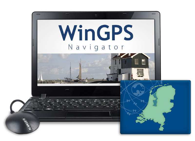
WinGPS Navigator
WinGPS Navigator is a full and affordable basic navigational program for sailors and motorboaters on the inland waterways.
|
|
GPS navigation on your laptop WinGPS Navigator is an interactive route planner which can be installed on your Windows laptop. By connecting your GPS receiver you can turn your laptop into a fully functional navigation system. Add a second monitor (for example a water proof touch screen) or install your charts on an Android tablet, making it possible to view the charts outside. |
|
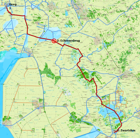
Route planing Easily plan your routes along the extended route network for the Netherlands, Belgium, Germany, France, the Baltic sea and the Danube up until the Black Sea. Enter the dimensions of your ship only once and you are ready to plan your routes. Place a starting point and an end point for your voyage on the route network and the route will appear automatically between the points. Taking into account are the water way dimensions and the operating times for bridges and locks. |
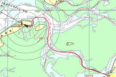
Route network, bridges and locks In the route network in WinGPS Navigator you will see all information regarding maximum allowed depth, width, length and speed. You will also be informed about restrictions regarding commercial and pleasure restrictions on the water ways. All structures are shown on the route network, including bridges & locks, high voltages lines and aqueducts. All structures include the passable dimensions. Bridges and locks also include a picture of the actual structure and all needed information such as chamber length, threshhold depth and the VHF channel. |
Log and sailed tracks During your voyage WinGPS keeps track of your sailed course. This is shown on the chart as a thin red line including date and intermediate times. When you start a log manually, this will automatically be updated. It is possible to add your own information to the log. For example pictures you have taking along your journey or a URL to a local diner you found. Ater returning home you can analyse your logs, tracks and routes, print them out or send them to friends or crew via e-mail. |
GRIB files
Download GRIB files for the weather forecast of your area for the coming 7 days to prepare yourself for your voyage or regatta. Look ahead of time with the time bar to see how the weather will change.
Your reliable partner onboard and at home
A large advantage of WinGPS Navigator is the possibility to install it on two Windows systems. Making it possible to plan your voyage at home on a large screen with all peace and comforts. Making your voyage even easier is printing the route overview.
During your voyage WinGPS Navigator keeps track of a log of your route in which you can enter additional information. Your sailed tracks can be analyzed afterwards. When back at home you can print your logs and sailed tracks, send them to your crew or friends via e-mail or post them on your website or blog.
Stentecs digital water charts can be used in combination with WinGPS, also know as DKW charts. Make sure these charts are up to date before you start planning your routes and print your route overview and important chart details. This way you are well prepared for your journey!
For your information: WinGPS Navigator has been prepared for deviation in your GPS by solar flares. Due to hightened solar activity solar flares will become more frequent which can cause large disruptions in GPS. WinGPS Navigator has been adjusted to compensate for these deviations and will show your correct location.
|
Digital water charts
|
|
System Requirements: |
Program release log: |
If you want to check if WinGPS Voyager can be run on your system you can install the free version WinGPS Lite. When this version works without any problems WinGPS Navigator, Pro or Voyager will also be able to run on your system. You can download WinGPS Lite through this link.
Do you have any questions?
Call us on +31 515 443515, fill in the contact form or make an appointment at our store in Heeg.
Click here for our opening hours.


News
 The boating season is in full swing, and the water is calling! Whether you’re planning a relaxing weekend getaway or a major trip on Europe’s inland...
 The new charts for the Wadden Sea, DKW 1811 and DKW 1812, and DKW 1805 (Oosterschelde, Veerse Meer, and Grevelingenmeer) are now available! The quarterly...
 Are you familiar with our WinGPS Marine Plus for Android? This popular navigation app is now available as an affordable subscription and can be paired with an...
| WinGPS Navigator |
|
• Easy to use route planner |
| WinGPS Marine |
|
A navigation app for use aboard your ship. An upgradable navigation solution for all sailors, from beginner to professional. |

Stentec Navigation is specialised in digital navigation for water sporters and commercial shipping.
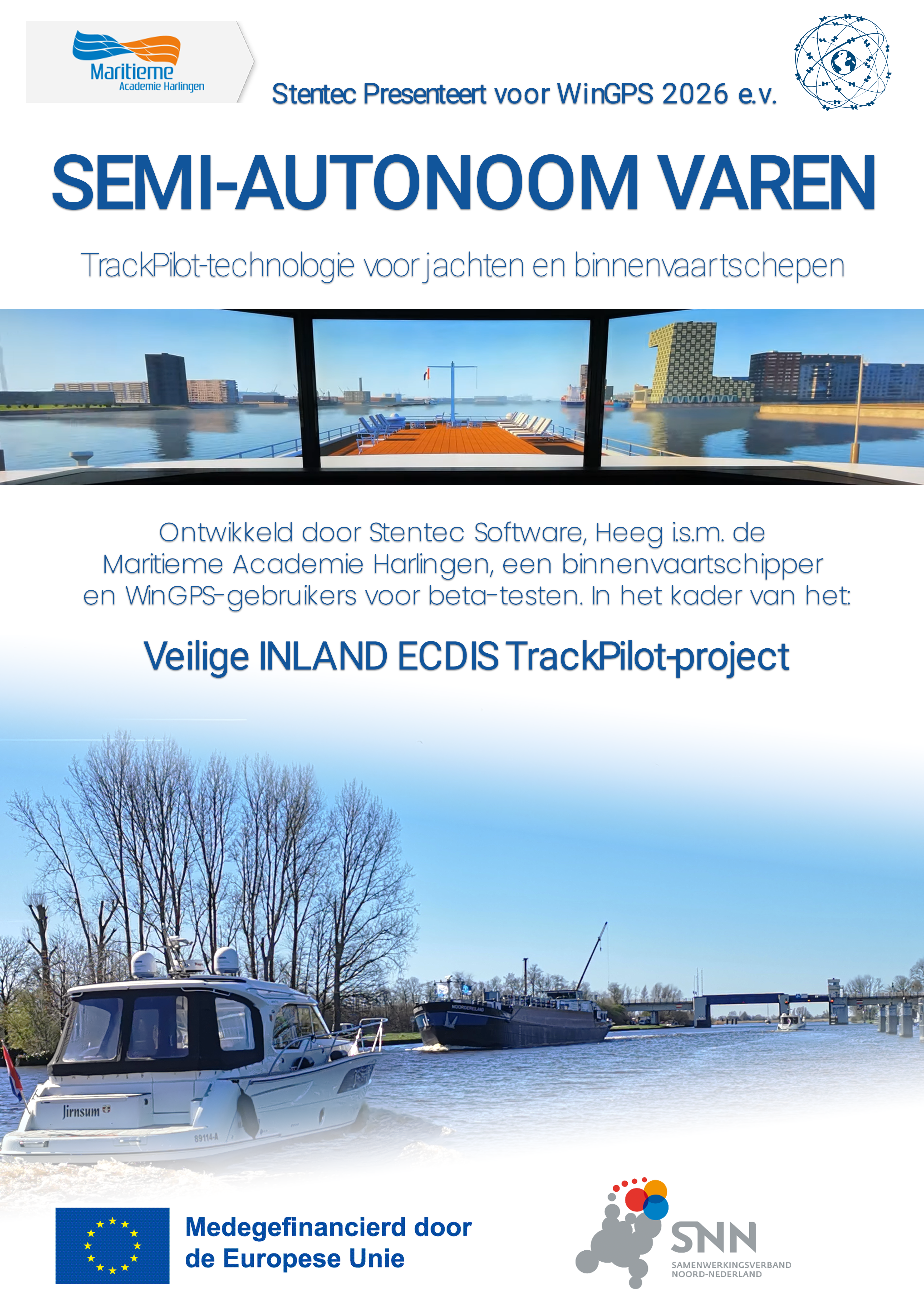
Trackpilot-project : 2025-2028


Harinxmastrjitte 29
8621 BJ HEEG
The Netherlands
T +31 (0) 515 443515

Copyright © Stentec Software. All rights reserved.
By using this website you acknowledge that you agree with our user agreement.