


- News
- E-mail list
- Signup for our newsletter
- Stentec news
- News
- Developers Blog
- WinGPS
- WinGPS series
- WinGPS versions
- WinGPS specifications
- For Windows
- WinGPS Lite
- WinGPS Navigator
- WinGPS Pro
- WinGPS Voyager
- For Android
- WinGPS Marine
- WinGPS Marine Plus
- WinGPS Smartwear
- For iOS
- Apps for iOS
- WinGPS Marine
- WinGPS Marine Plus
- DKW 1800 series
- Vaarkaart Friese Meren
- Service and upgrades
- Service Subscriptions
- WinGPS Yacht Navigator
- WinGPS trackpilot
- Charts
- Chart overview
- DKW Inland waters
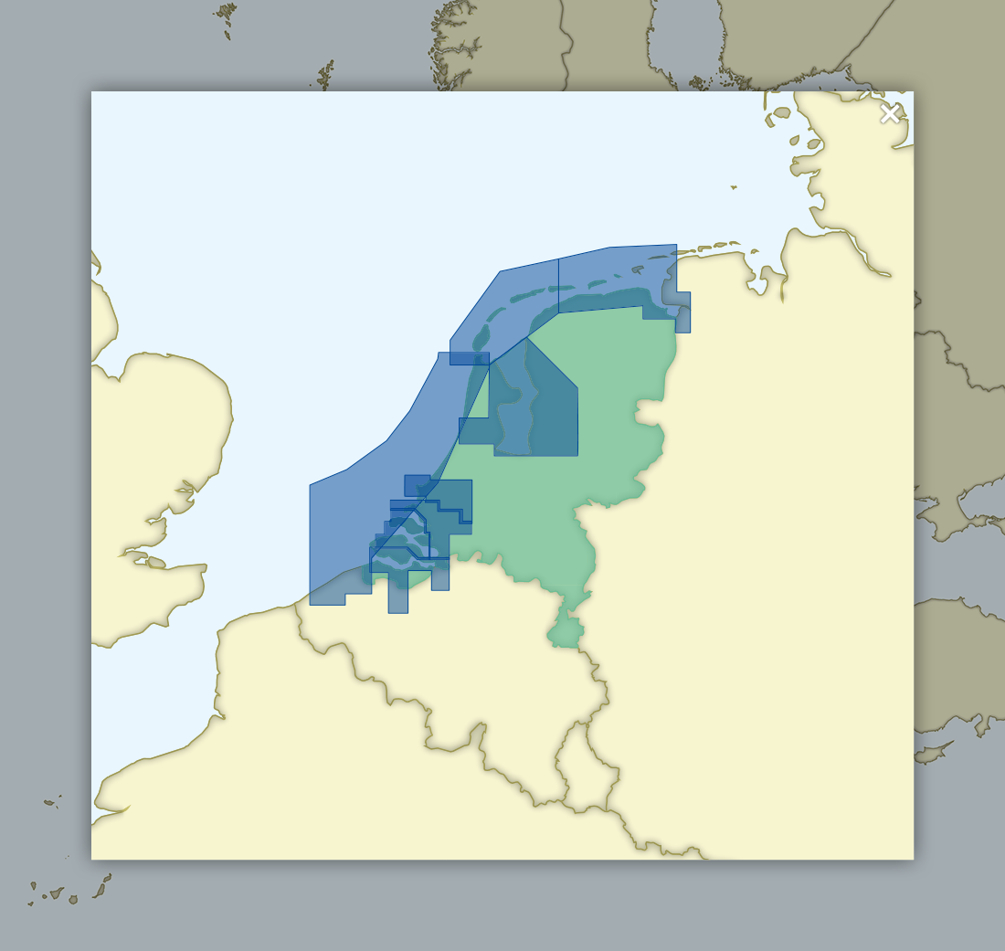
- DKW The Netherlands
- DKW Friese meren
- DKW Amsterdam
- DKW Biesbosch
- DKW Belgium
- DKW Northern France
- DKW Southern France
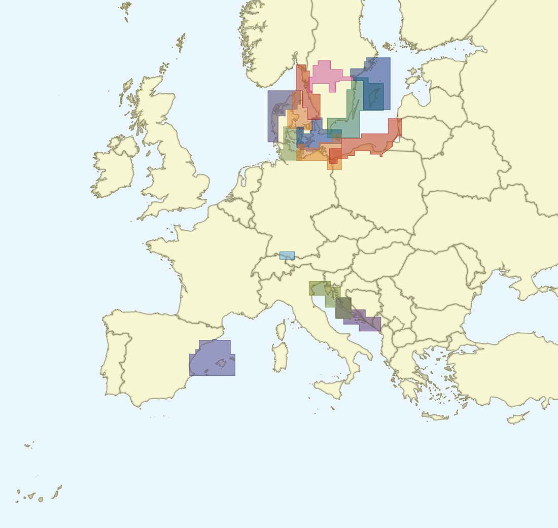
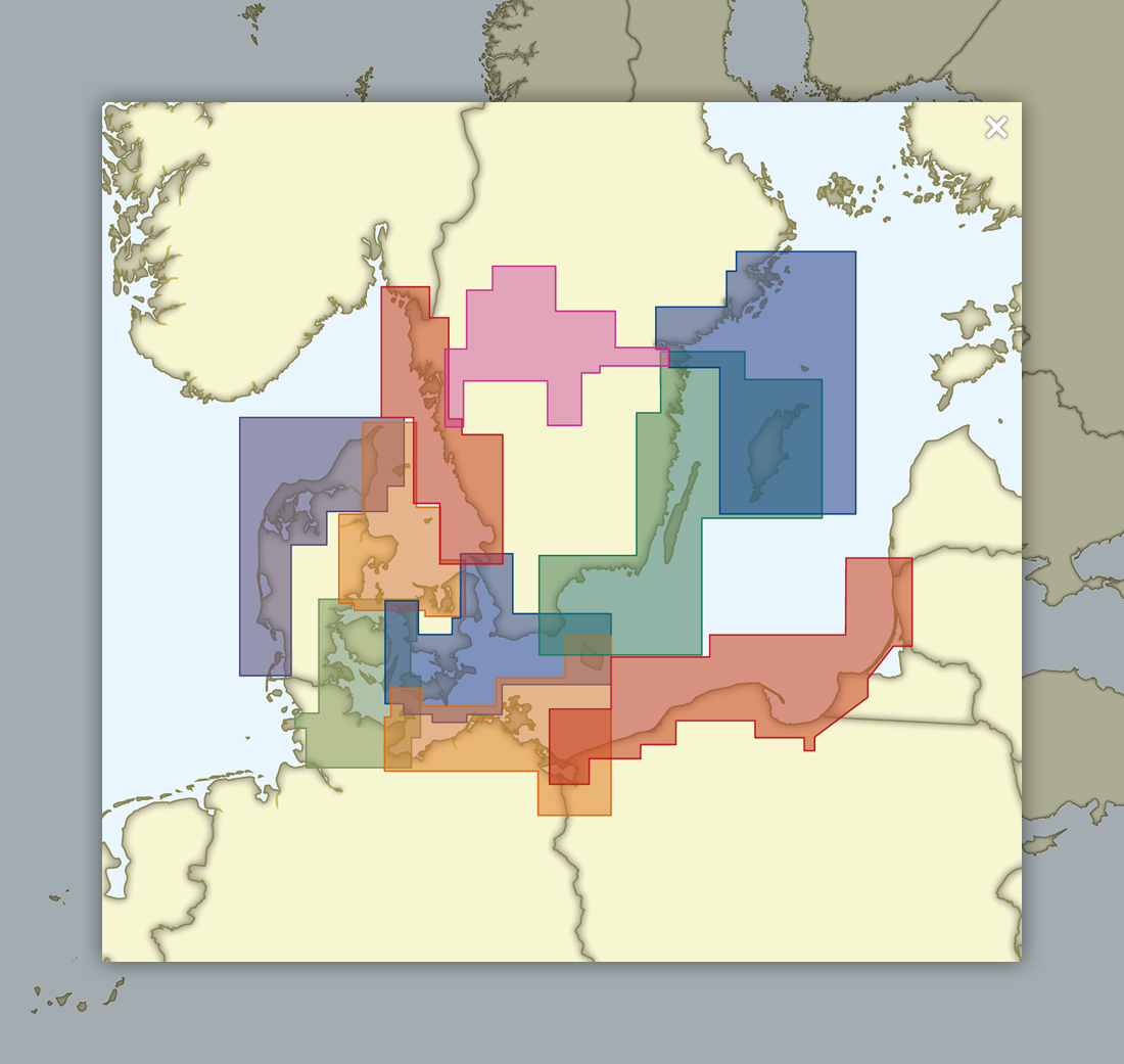
- DKW Northeast Germany
- DKW Northwest Germany
- DKW Southwest Germany
- DKW Rhine and Moselle
- DKW Danube 1-West
- DKW Danube 2-Central
- DKW Danube 3-East
- DKW Coastal waters
- DKW 1800 series
- DKW 1600+
- DKW UK1 English & Scottish Eastcoast
- DKW German Bight
- DKW German Baltic coast
- DKW Imray series
- DKW Delius Klasing series
- NV-Verlag series
- Exclusive for Android
- Subscription - DKW the Netherlands
- Chart apps
- Other
- Hardware
- Simulators
- Shop
- Downloads
- Support
- Downloads
- Help pages
- Documentation
- System Requirements
- Availability GRIB files
- Frequently asked questions - FAQ
- WinGPS 5
- WinGPS Marine (Android)
- WinGPS Marine (iOS)
- Installation help
- WinGPS 5 (Windows)
- WinGPS Marine (Android)
- Tips
- Offline installation DKW charts (Windows)
- Installation ENC charts (Windows)
- Connecting SD card (Android)
- NV Verlag charts
- Offline NOAA Charts
- Download TeamViewer
- Contact
- Contactform - Helpdesk
- Callback Service
- Commercial Shipping
|
|
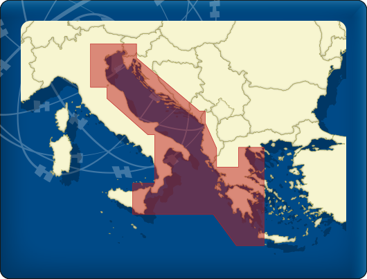
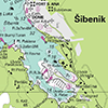
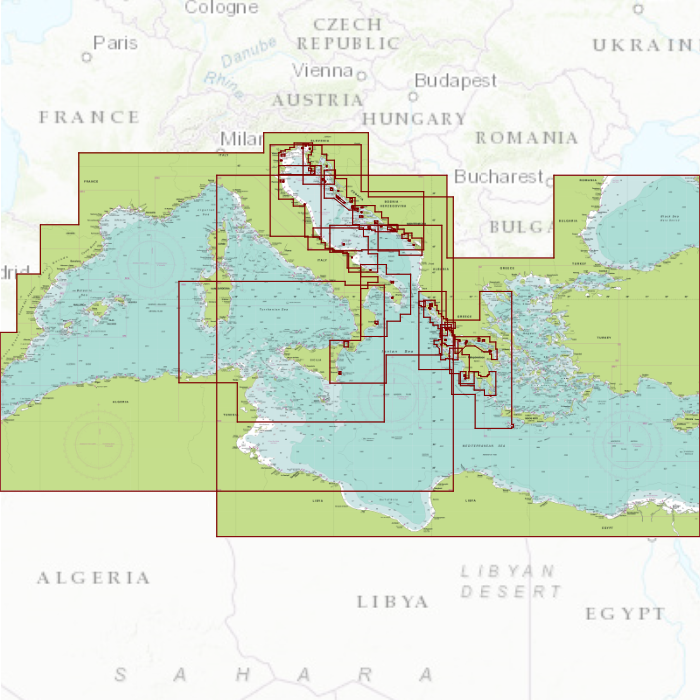
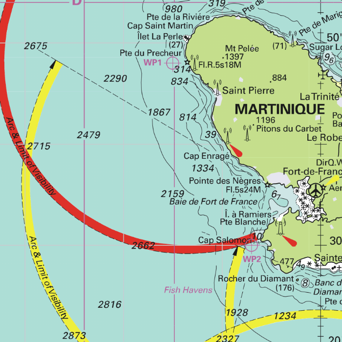
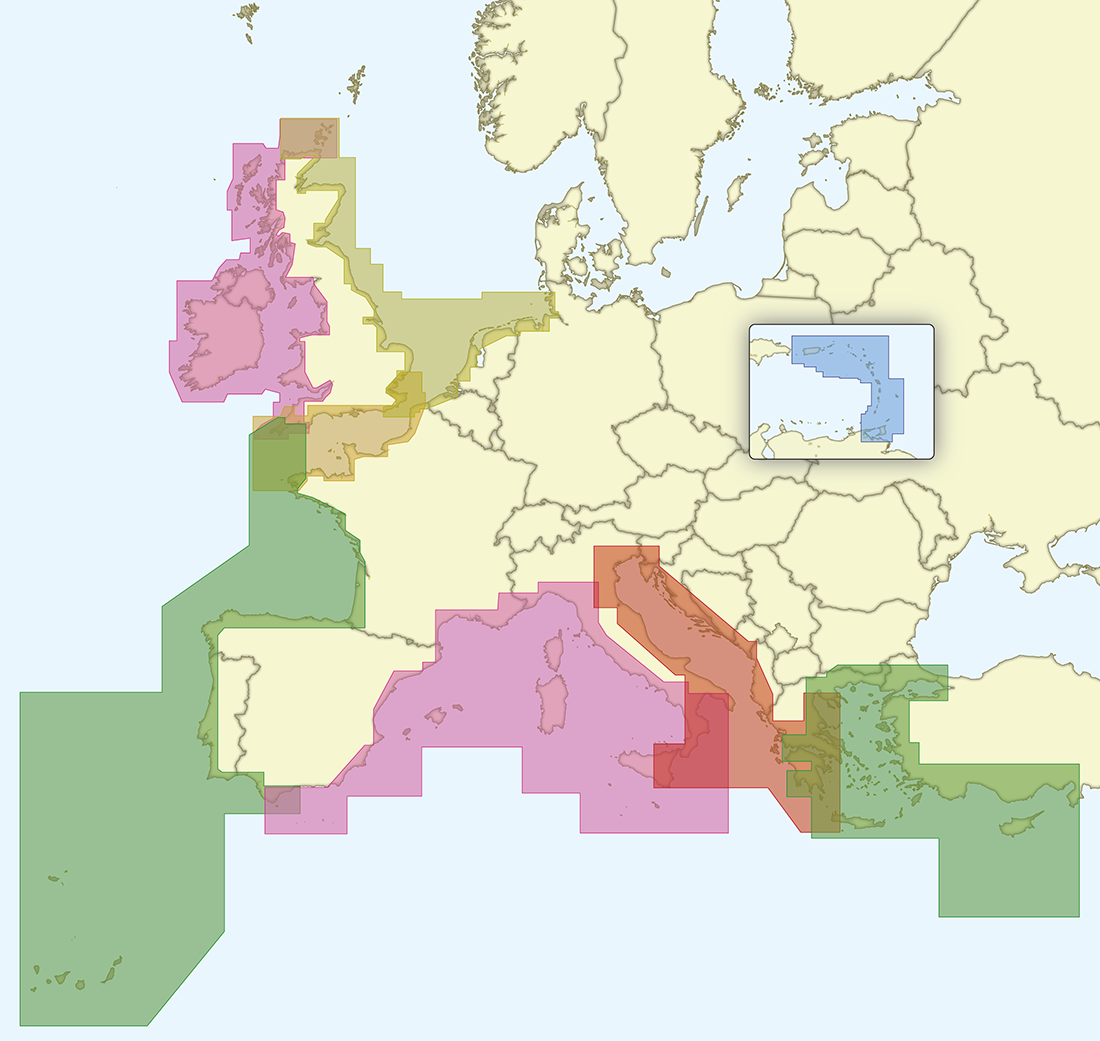
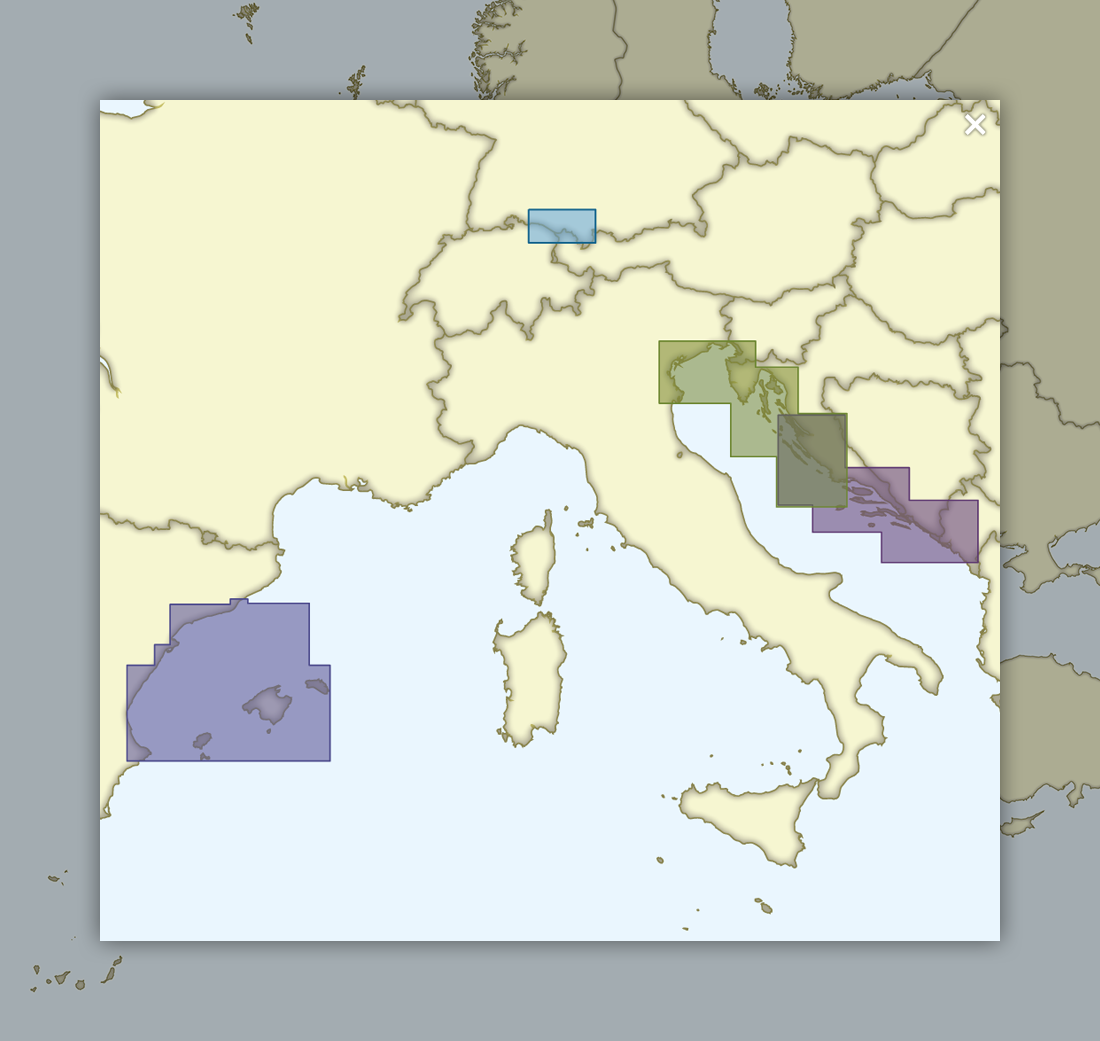
DKW ID60: Mediterranean Central
Since 2009 Stentec Software publishes the famous Imray charts digitally. These are based on the paper charts and feature the same well known Imray colors.
Covering area
The Mediterranean coast on the Adriatic and Ionic Sea: the eastcoast of Italy, the westcoast of Greece and the whole Slovenian and Croatian coast. Use this chart in combination with the Delius Klasing chart sets for Croatia, the DKW DK7 and DK8, for even more detail.
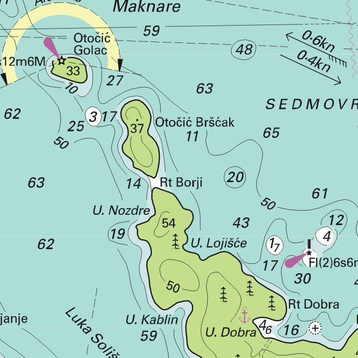
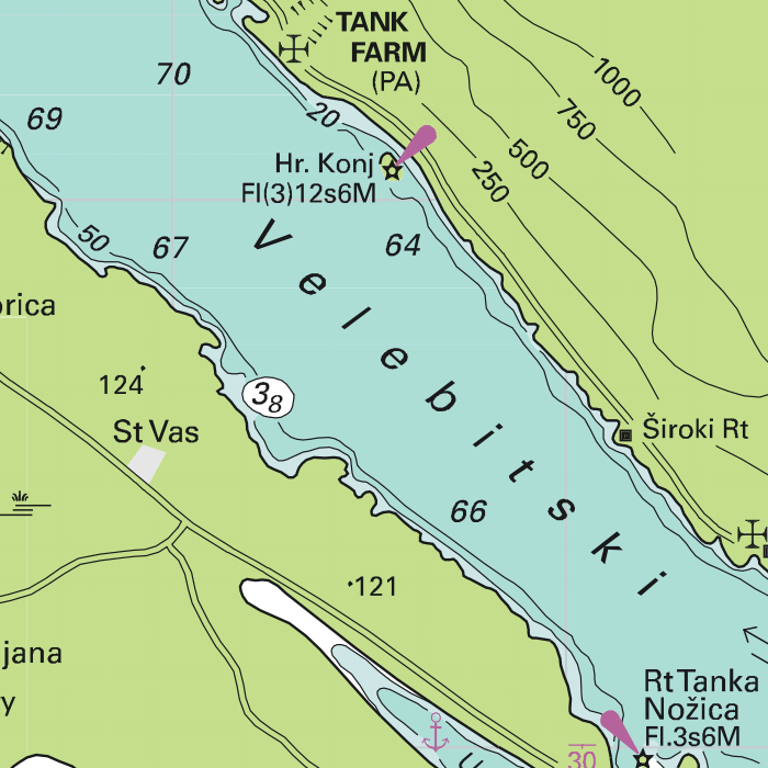
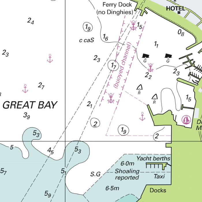
Depth image
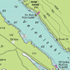
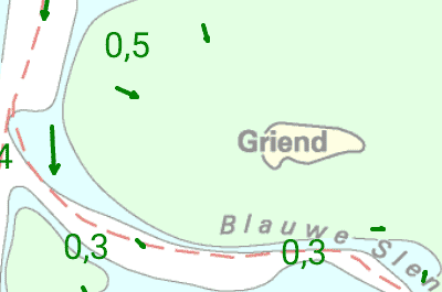
The depths are shown in the recognizable Imray colors: deep waters are blue and shallows are shown in whites. This configuration is the opposite of the DKW 1800, DKW German Bight and DKW English & Scottish Eastcoast.
Stentec publishes the DKW Imray series annually. All data is supplied by Imray. During the edition year 2 free updates are published in April and July, giving you the most up-to-date charts during your voyage.
Chart image
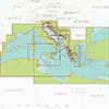
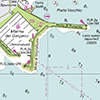
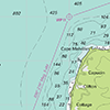
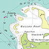
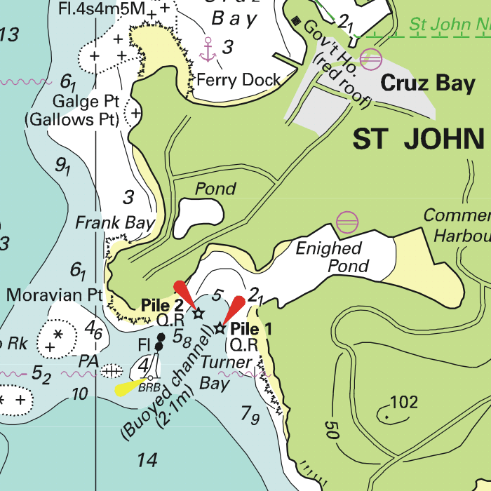
The DKW Imray series are comprised of raster charts. Because of this, the charts are an exact copy of the paper versions and you will see pixels when zoomed in to the maximum amount. The advantage of this is that all information, for example buoyage or shallows, are projected on the exact coordinates. When using vector charts a misleading image can show up when zooming in.
|
|
|
System Requirements: This chart can be used in WinGPS for Windows and can also be installed on the WinGPS Marine apps for Android and iOS. For accurate route planning with rotating chart and AIS you will need at least WinGPS Pro or the paid version of WinGPS Marine. Click here for more information about the WinGPS series. |
|
|
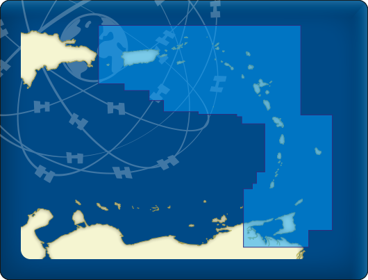
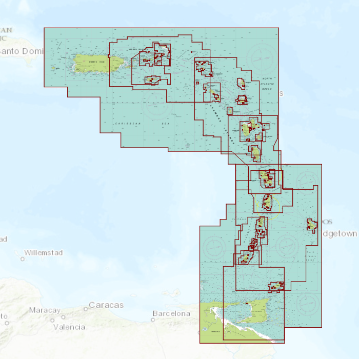
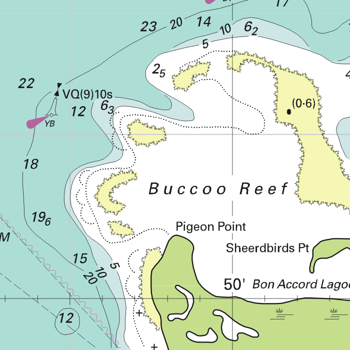
DKW ID100: Caribbean East
Since 2009 Stentec Software publishes the famous Imray charts digitally. These are based on the paper charts and feature the same well known Imray colors.
Covering area
The Caribbean Sea, including the islands:
|
|


Depth image
The depths are shown in the recognizable Imray colors: deep waters are blue and shallows are shown in whites. This configuration is the opposite of the DKW 1800, DKW German Bight and DKW English & Scottish Eastcoast.
Stentec publishes the DKW Imray series annually. All data is supplied by Imray. During the edition year 2 free updates are published in April and July, giving you the most up-to-date charts during your voyage.
Chart image
The DKW Imray series are comprised of raster charts. Because of this, the charts are an exact copy of the paper versions and you will see pixels when zoomed in to the maximum amount. The advantage of this is that all information, for example buoyage or shallows, are projected on the exact coordinates. When using vector charts a misleading image can show up when zooming in.
|
|
|
System Requirements: This chart can be used in WinGPS for Windows and can also be installed on the WinGPS Marine apps for Android and iOS. For accurate route planning with rotating chart and AIS you will need at least WinGPS Pro or the paid version of WinGPS Marine. Click here for more information about the WinGPS series. |
|
|
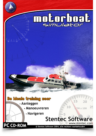
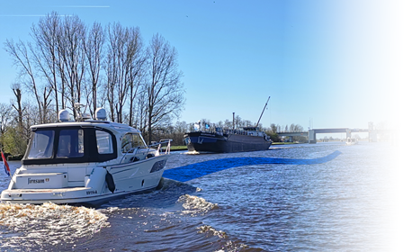
Motorboat Simulator
Learn the most important aspects of sailing on the PC, such as docking, maneuvering and navigating with our very realistic Motorboat Simulator 1.2. The realistic water with variable flow and wind-based waves and the natural occuring wind with gusts and windshifts, are based on the techniques of our popular Sail Simulator 4.
Make use of the various available onboard instruments. Plot a route on the digital map, view your position with the GPS and navigate with your compass to the next waypoint. It is also possible to engage the autopilot and see how the tachometer responds to the waves that the ship encounters.
Fleet
Your fleet consists of several types of ships, each with their own way of handling:
- Single thrusted motor cruiser with bow thruster (32’, 4 tons, 65 hp).
- Classic speed boat with outboard motor (14’, 18 hp).
- Classic Dinghy (25’, 10 hp diesel).
- Tugboat (64,6’, 150 hp diesel).
- No Limit 1500, double thrusted Ocean cruiser (15 m, 18 tons, 2x480 hp).
- KNRM Koning Willem 1 rescue boat (18.8m 28 tons, 2x1000 hp).
Multiplayer
By default the Motorboat Simulator is single player. You will not encounter any other ships while playing. To make the digital sailing even more realistic, it is possible to sail with others. This can be done via the internet or via a local area network (LAN). This allows traffic rules to be tested or you can explore the coast of England together.
Sailing areas
The following areas are included in Motorboat Simulator. It is also possible to make your own areas with the scenery tool, or to import areas made by other users.
- Ile d’Oussant – France
- Bodenmeer – Germany
- Vierwoudstedenmeer – Swiss
- St Martin – Antilles
- Motorboat Simulator instruction area (fictional)
Screenshots
Video
System requirements:
Windows 95, 98, XP, Vista, 7, 8, 10 or 11. Pentium III 350Mhz, 64MB RAM, 175MB HD. DirectX 9 compatible video card.
Scenery designer toolkit
|
|
|
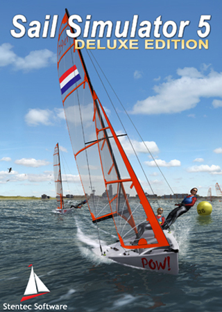
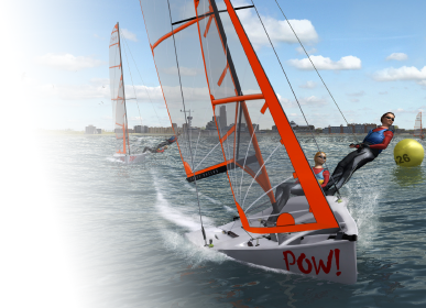
Sail Simulator 5
In 2009 Stentec proudly presented the latest version of the Sail Simulator 5 at HISWA: an extremely realistic sailing experience on your computer. Ideal for learning purposes or getting through the offseason.
Learning how to sail
Make a calm start with an optimist on the Frisian Fluessen and get a feeling of the wind in your sails. Operating the big lap and the helm is a big deal to start with!
Next, choose a more flashy model such as a Laser, Splash or Flash and experience how the ship is slanting or even overturns! No worries, with the press of a button your ship will turn upright again. Make a voyage on the Northsea, set your wind a bit higher and choose a catamaran, 29’er or 49’er. Or, if you are still learning about bigger sea waves, choose a Bavaria 36 or YD 40. You can even plot a course to learn how to navigate or how to sail into a harbour.
If you really got a hang of it you can get everything out of your ship by trimming the sails, controlling the sword and crew and maintaing the correct course and sail setups. The Regatta Valk or the fast Olympic 470 are excellent for this experience as these are no ships for beginners. Even if you don't have full control of these ships you are ready for the online gameplay. Racing against other players from all over the world.
Regattas
Most sailors will know the feeling: sailing alone is about enjoying the wind through your hair and the beautiful sights. But when another ship comes along side it can turn into a race quickly.
You can now sail regattas when on your home computer, with Sail Simulator 5. You will be challenged to get even more out of your ship.
Create a (offline) LAN network and compete with friends and family. Choosing to compete online gives you the opportunity to race against players from all over the world! Your sailing performances are saved on your own personal account and will be visible on the rankings list. The ranking list can be found via the Sail Simulator community.
Regattas are updated regularly and new regattas are added by other Sail Simulator 5 players. Subscribe to these regattas or create your own regatta and others will participate.
Highlights
- Easy and flexible user interface.
- Stable multiplayer server for long distance regattas.
- Realistic aerodynamics with wind shear and twist.
- True to nature wave field and sea wearthiness.
Sailing areas
- Cabrera: Group of island south of Mallorca in the Mediterranean Sea. Protected nature area with sheltered bay on the main Cabrera island (Goat Island).
- Koh Hong: Sailing between tropical islands in Thailand. Clear blue water and steep cliffs. Beware of the rocks on the seabed and sudden wind drops behind the islands.
- Scheveningen, Den Haag: City, beach, pier and harbour are highly detailed for an unsurpassed sailing experience.
- Treasure Island: Fantasy island with buried treasure, made specifically for regattas. Lots of water, wind and little land. Beware of the shallows at the northeast side of the island!
- Fluessen: The home port for Stentec in Friesland. This freshwater area is perfect for youth boat matches. Available in the Add on - 'Boat Set 1'
Screenshots
|
Ships in Sail Simulator 5
|
Ships in the Boat set Add on
|
More information on www.sailsimulator.com
System requirements:
Windows XP, Vista, 7, 8, 10 or 11 with DirectX9 videcard (or higher).
At this moment Sail Simulator is no longer in development. Your remarks and suggestions are highly appreciated and will be put to good use once a new version of Sail Simulator will be developed. You can contact us via helpdesk@stentec.com.
WinGPS Series
Route planner for open- and inland water.
Turn your laptop, onboard PC, tablet and/or smartphone into a complete navigational center with WinGPS. Based on the experience of thousands of WinGPS users and our extensive experience in the nautic world, we can provide a wide array of different navigationsoftware. Plot a route within seconds and download the latest chart updates. WinGPS will lead you past all obstructions along your route.
What do you need?
- WinGPS navigationsoftware.
- Digital water charts. For example, Stentecs DKW water charts.
- Windows laptop or onboard PC, or an Android smartphone or tablet.
- GPS receiver
Why choose WinGPS?
- Determine your position, plot a course and see previously sailed tracks.
- Current predictions for wind, rainfall, temperature, stream and tides.
- Connect your onboard instruments with WinGPS 5 or WinGPS Marine.
- Stentecs DKW water charts are updated regularly and can be installed on both systems with just 1 license.
- English speaking helpdesk.
View the different WinGPS versions in the menu (left), or go directly to the overview of all WinGPS versions via the button below.
|
|
|
|
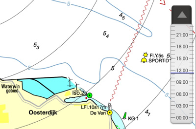
DKW water charts
Safely navigating the waters requires up-to-date water charts. Stentec develops their own digital chats which are based on information from the Dutch hydrographic services, Rijkswaterstaat, Imray and Delius Klasing, which makes it possible to update regularly. Download the latest updates just before you start your voyage to assure yourself of the most up-to-date charts!
The most popular charts are the DKW 1800 series. These charts are updated weekly with the latest BaZ (notices to mariners) information. The DKW German bight is treated to the same weekly update, and the DKW the Netherlands is updated bi-weekly.
In addition to the DKW charts, it is possible to read charts of the S57 and BSB format in WinGPS. These include the IENC for European inland waters and the well-known charts of NV-Verlag and (free) charts of the NOAA for American waters.
Supplied with WinGPS are the online ESRI charts. These charts can only be used when you have a working internet connection and are not suitable for navigation. If you want to make your own charts you can use DKW Builder. With this program you can add scanned paper charts to WinGPS.
WinGPS Specifications
Below you will find the specifications per WinGPS version.
More info about our WinGPS versions, click on the button below.
= Available
= Not Available
= Available soon
W = Only available for Windows
| WinGPS 6 [Windows] |
WinGPS Marine [Android] |
WinGPS Marine [iOS] |
WinGPS 6 Inland [Windows] | WinGPS Yacht Navigator | |||||||
| Basic functions | Lite | Navigator | Pro | Voyager | Lite | Marine | Plus | Lite | Plus | Professional | Delius Klasing-Version |
| GPS position, speed, course, traveled distance | |||||||||||
| Anchor watch, Night view, Logbook | |||||||||||
| Distance measurement / bearing line | |||||||||||
| Waypoints: create, rename and edit | |||||||||||
| Waypoints: group and create your own types | |||||||||||
| Save and view your sailed tracks | |||||||||||
| Play back your sailed tracks | |||||||||||
| Blockages from Shipping notifications | |||||||||||
| Timeline - looking forward in time | |||||||||||
| Tracking mode: Track GPS position on the chart | Chart-up; North-up | Course-up; North-up |
Chart-up; Course-up; Head-up; Leg-up; North-up | Chart-up; Course-up; Head-up; Leg-up; North-up; Polair | Chart-up | Chart-up; Course-up; Kompas modus | Chart-up; Course-up; Kompas modus | Chart-up; Course-up; Head-up; Leg-up; North-up | Chart-up; North-up | ||
| Tracking Mode: Automatic cursor position, provides more chart view for your GPS position | W | ||||||||||
| Routes | |||||||||||
| Route network with waterway information, bridges and locks | |||||||||||
| Set out routes | |||||||||||
| Plan routes in combination with bridges, locks, waterways and ship dimensions | W | ||||||||||
| Route planner in combination with sailing times and operating times | W | ||||||||||
| Route planner in combination with stream and tides | |||||||||||
| Route planner in combination with Stentec Tidal Service | |||||||||||
| Route planner in combination with wind, waves and polair diagram | |||||||||||
| Multi-day route planner | |||||||||||
| Destination button: 'Navigate to..' at the touch of a button. | |||||||||||
| Extensive Bridges & Locks information incl. photo | |||||||||||
| Charts | |||||||||||
| Print chart image | W | ||||||||||
| Offline Charts: DKW2, BSB, NOAA | * | * | * | **** | **** | ||||||
| Upload S57 charts (IENC & ENC) | |||||||||||
| IENC Information mode (mandatory for commercial shipping and large ships in Germany) | |||||||||||
| Offline charts: NV-Digital | W | ||||||||||
| Online chart layer ESRI | |||||||||||
| Weather/Waves | |||||||||||
| Current data from KNMI weather stations | |||||||||||
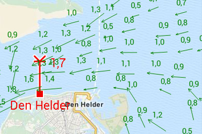
| GRIB files NOAA - worldwide - 0.25 degrees | |||||||||||
| GRIB files Harmonie model - Netherlands - high detail | |||||||||||
| NOAA waves forecast – worldwide | |||||||||||
| Tides/Water Levels | |||||||||||
| Current NAP water level – NL | |||||||||||
| Stream and tides - NL tidal data and BSH | ** | ||||||||||
| Stentec Tidal Service - The Netherlands | *** | ||||||||||
| Equipment | |||||||||||
| GPS receiver | |||||||||||
| AIS | |||||||||||
| Windmeter/Anemometer, depth gauge, log, compass, repeater | |||||||||||
| Autopilot | |||||||||||
| Import and export files | |||||||||||
| Inland AIS | |||||||||||
| Sailing | |||||||||||
| Polar diagram - 4000 supplied | |||||||||||
| Interactive route planning with polar diagram, wind, stream and tides | |||||||||||
| Updates and Support | |||||||||||
| News center with an overview of the latest updates and news | |||||||||||
| Send notifications and error logs including screenshot from WinGPS | W | ||||||||||
| Fully automatic updating of charts, weather, route network, etc. | W | ||||||||||
| Lite | Navigator | Pro | Voyager | Lite | Marine | Plus | Lite | Plus | For commercial shipping & larger pleasure boats |
Delius Klasing version | |
| WinGPS 6 [Windows] |
WinGPS Marine [Android] | WinGPS Marine [iOS] - |
WinGPS 6 Inland [Windows] |
WinGPS Yacht Navigator [Windows-Android-iOS] | |||||||
* DKW Karten from 2014 and newer.
** NL tidal data is free for 1 calendar year, then €19.90 per year.
*** One-off €25,-.
**** DKW2 is, BSB and NOAA are not
q
Connect your onboard GPS
Use a Bluetooth or WIFI connection to connect your tablet or smartphone to the GPS receiver of your ship. This makes tracking your location easier, more accurate, and uses less of your battery. If you don't have a wireless GPS on board you can also use the internal GPS of your tablet or smartphone.
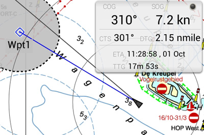
Waypoint navigation
With CTS (course to steer) and DTG (distance to go) you can use this app to navigate to a waypoint. You can create, delete and edit your own waypoints, or use the waypoints that are on the chart database.
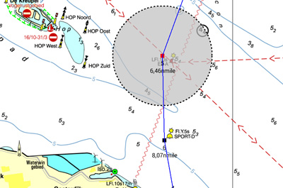
Digital charts
All DKW water charts from edtion 2014 and newer can be used within WinGPS Marine. These charts can be installed on multiple systems with just 1 license, using your stentec account. For example on a laptop, tablet and smartphone. A check for updates of your charts will happen automatically as soon as the app is started, providing you have a working internet connection.
WinGPS Marine uses ESRI charts when you don't have any DKW water charts installed on your system. This is a free of charge chart overlay which can only be used when a working internet connection is available. ESRI charts are not suited for navigation, but can be used for global positioning and initial route plotting.
It is also possible to use the free, digital NOAA charts in WinGPS Marine Lite. These charts are provided by the US government for free on the NOAA website.
System requirements
Check whether your device is suitable for WinGPS via the link below.
|
|
WinGPS Marine Plus
WinGPS Marine Plus is the navigation app that lets you create a full-fledged navigation system on your Android device. Plan routes, download GRIB files, save sailed tracks, and wirelessly connect your GPS, AIS, and onboard instruments. Use the timeline to see weather, water levels, and currents directly on the chart.
WinGPS Marine offers handy digital navigation on board for you and your crew and is the ideal reliable backup.
WinGPS Marine is an excellent complement to WinGPS 6, the more comprehensive navigation program for Windows, and ideal for those who want flexible navigation. The app is perfect for skippers, crew members, and others who want to monitor or plan a route on their own tablet or smartphone.
In addition, WinGPS Marine is a valuable onboard backup should the main navigation system fail. This way, you always have an overview and peace of mind at your fingertips.
With WinGPS Marine for Android, you decide how comprehensively you want to navigate. Start for free with the Lite version, ideal for getting started.
Want more? Then choose WinGPS Marine Plus with a budget-friendly subscription of €39.90 per year..
Route Navigation
With this app you can create routes and edit them while on the move. Longpress the screen to create a single waypoint or multiple to create a route. You can create multiple routes, and give each route and routepoint a unique name.
Track management
You can automatically record the sailed tracks. The tracks will be saved to review or share later. You can give each sailed track a unique name.
Meteo data
You can download Meteo predictions for a selected area. The wind, air pressure and rainfall can be plotted on the chart view using downloadable GRIB information.
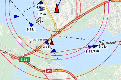
AIS (Automatic Identification System)
Your AIS receiver can communicate with the app using a wireless connection using WIFI or Bluetooth. With AIS you see all surrounding ships plotted on the chart view. You can also bring up the targets in a list, and if you tap a ship's name you can see all the AIS target data. The built-in AIS collision alarm helps you in making important decisions.
Time Bar
By using the time bar you can see the prediction on your track. By sliding it forward you will see the upcoming weather, and tidal information if available.
Follow GPS position
When this function is activated, your GPS position will be centered on your screen and the underlying chart will move under it. Multiple following options are available: 'North up', 'Course up' & 'Compass mode'.
Tidal data
In addition to meteo data you can also download tidal data to use for planning and adjusting your route in this app. You can see the currents, and the depth difference.
Stentec Tidal service
The Stentec Tidal service gives you the most accurate information regarding stream, tidal heights and depths for the Northsea and the Waddensea. This detailed information is based on data from the Dutch Rijkswaterstaat.
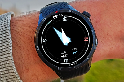
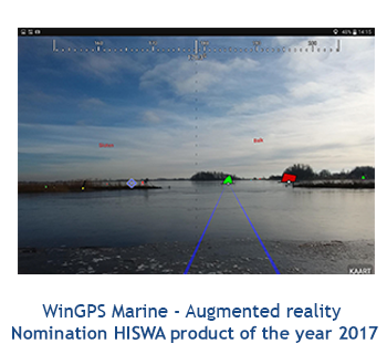
Connect your Android Smartwear Navigation data always at your fingertips, without picking up your phone. The new WinGPS Marine app for Wear OS displays live data from your navigation system directly on your wrist: course, speed, depth, wind data, route info, and more. |
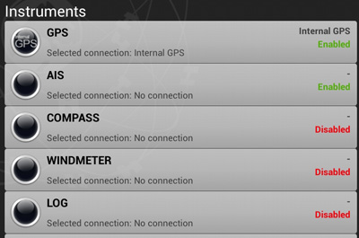
Connect your onboard instruments
Using a wireless connection you can connect your board system and read out your wind meter, compass, log and echosounder. Review all entered and incoming data in the data plotter and instrument monitor to optimize your route for a safe voyage.
System requirements
Check whether your device is suitable for WinGPS via the link below.
Hardware overview
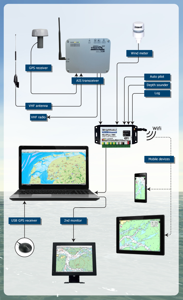
For navigation with WinGPS on board
The diagram below gives you an overview of the options regarding the hardware that you can use on board for navigation with WinGPS. We are happy to help you put together a nice navigation solution that suits your wishes and ship.

Click on the products for more information.
Do you have any questions?
Call us on +31 515 443515, fill in the contact form or make an appointment at our store in Heeg.
Click here for our opening hours.


News
 The boating season is in full swing, and the water is calling! Whether you’re planning a relaxing weekend getaway or a major trip on Europe’s inland...
 The new charts for the Wadden Sea, DKW 1811 and DKW 1812, and DKW 1805 (Oosterschelde, Veerse Meer, and Grevelingenmeer) are now available! The quarterly...
 Are you familiar with our WinGPS Marine Plus for Android? This popular navigation app is now available as an affordable subscription and can be paired with an...
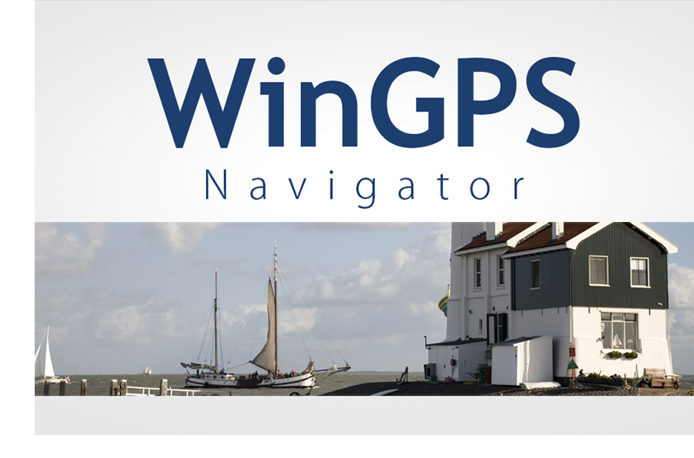
| WinGPS Navigator |
|
• Easy to use route planner |

| WinGPS Marine |
|
A navigation app for use aboard your ship. An upgradable navigation solution for all sailors, from beginner to professional. |

Stentec Navigation is specialised in digital navigation for water sporters and commercial shipping.
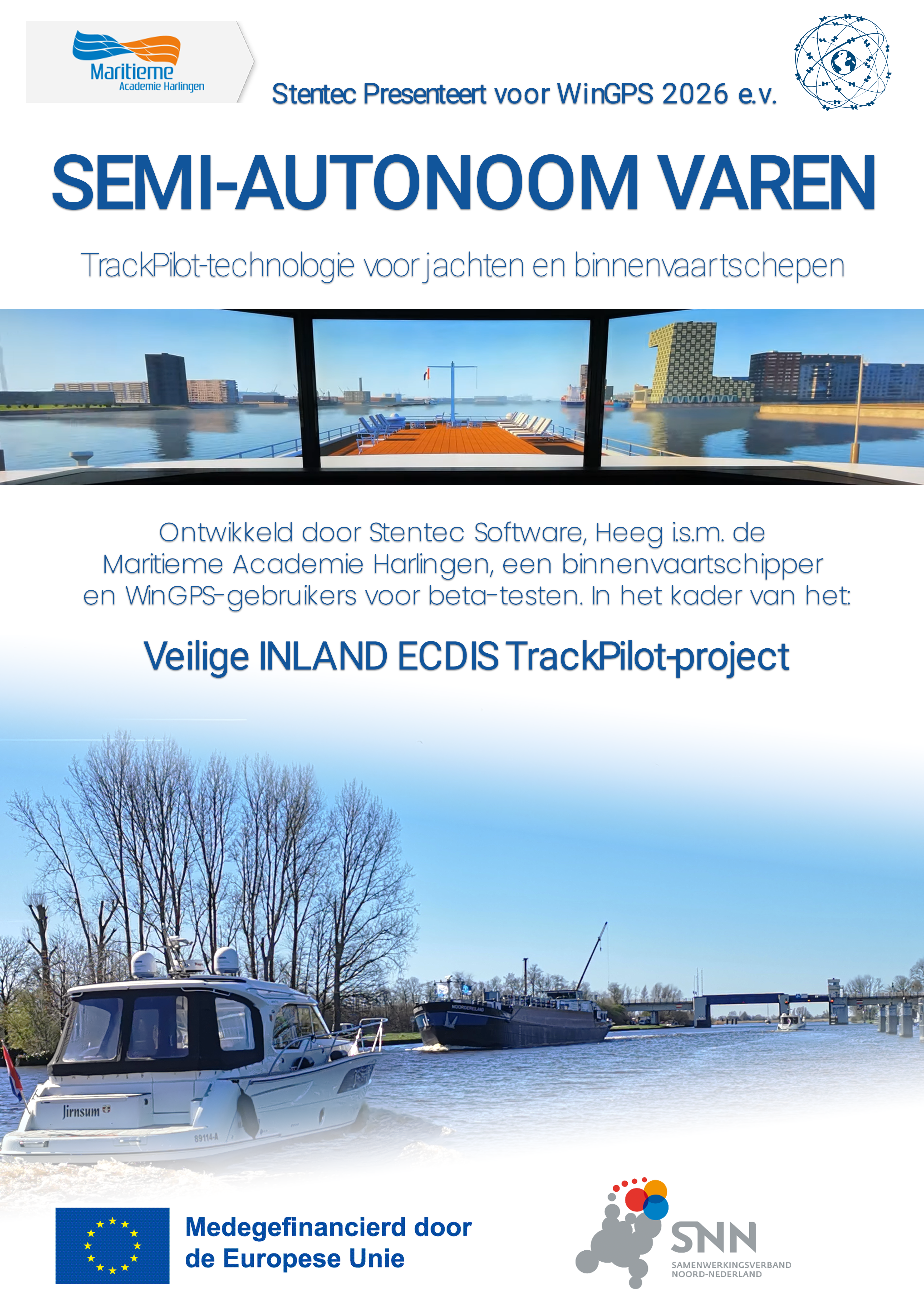
Trackpilot-project : 2025-2028
|
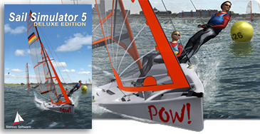
Sail Simulator 5
|
|
|
TrackPilot for WinGPS 6Stentec presents for WinGPS 2026 and later |
|


Harinxmastrjitte 29
8621 BJ HEEG
The Netherlands
T +31 (0) 515 443515

Copyright © Stentec Software. All rights reserved.
By using this website you acknowledge that you agree with our user agreement.