


|
|

WinGPS Marine Plus
WinGPS Marine Plus is the navigation app that lets you create a full-fledged navigation system on your Android device. Plan routes, download GRIB files, save sailed tracks, and wirelessly connect your GPS, AIS, and onboard instruments. Use the timeline to see weather, water levels, and currents directly on the chart.
WinGPS Marine offers handy digital navigation on board for you and your crew and is the ideal reliable backup.
WinGPS Marine is an excellent complement to WinGPS 6, the more comprehensive navigation program for Windows, and ideal for those who want flexible navigation. The app is perfect for skippers, crew members, and others who want to monitor or plan a route on their own tablet or smartphone.
In addition, WinGPS Marine is a valuable onboard backup should the main navigation system fail. This way, you always have an overview and peace of mind at your fingertips.
With WinGPS Marine for Android, you decide how comprehensively you want to navigate. Start for free with the Lite version, ideal for getting started.
Want more? Then choose WinGPS Marine Plus with a budget-friendly subscription of €39.90 per year..
Route Navigation
With this app you can create routes and edit them while on the move. Longpress the screen to create a single waypoint or multiple to create a route. You can create multiple routes, and give each route and routepoint a unique name.
Track management
You can automatically record the sailed tracks. The tracks will be saved to review or share later. You can give each sailed track a unique name.
Meteo data
You can download Meteo predictions for a selected area. The wind, air pressure and rainfall can be plotted on the chart view using downloadable GRIB information.
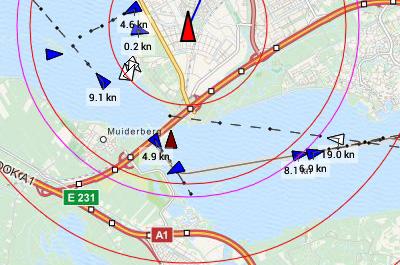
AIS (Automatic Identification System)
Your AIS receiver can communicate with the app using a wireless connection using WIFI or Bluetooth. With AIS you see all surrounding ships plotted on the chart view. You can also bring up the targets in a list, and if you tap a ship's name you can see all the AIS target data. The built-in AIS collision alarm helps you in making important decisions.
Time Bar
By using the time bar you can see the prediction on your track. By sliding it forward you will see the upcoming weather, and tidal information if available.
Follow GPS position
When this function is activated, your GPS position will be centered on your screen and the underlying chart will move under it. Multiple following options are available: 'North up', 'Course up' & 'Compass mode'.
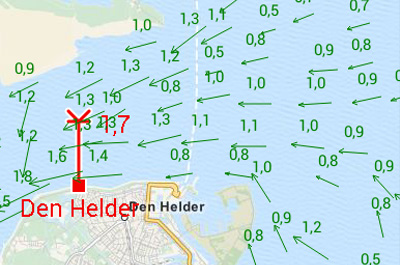
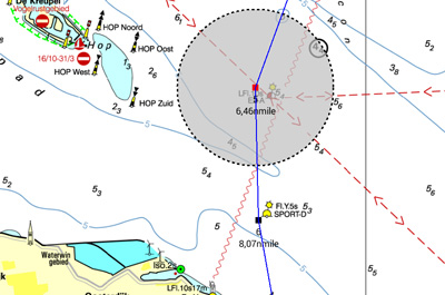
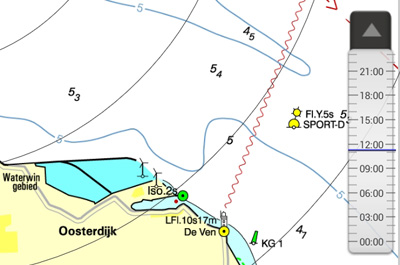
Tidal data
In addition to meteo data you can also download tidal data to use for planning and adjusting your route in this app. You can see the currents, and the depth difference.
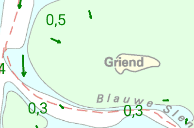
Stentec Tidal service
The Stentec Tidal service gives you the most accurate information regarding stream, tidal heights and depths for the Northsea and the Waddensea. This detailed information is based on data from the Dutch Rijkswaterstaat.
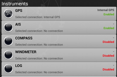
Connect your onboard instruments
Using a wireless connection you can connect your board system and read out your wind meter, compass, log and echosounder. Review all entered and incoming data in the data plotter and instrument monitor to optimize your route for a safe voyage.
System requirements
Check whether your device is suitable for WinGPS via the link below.


