| WinGPS Marine update - Route network |
|
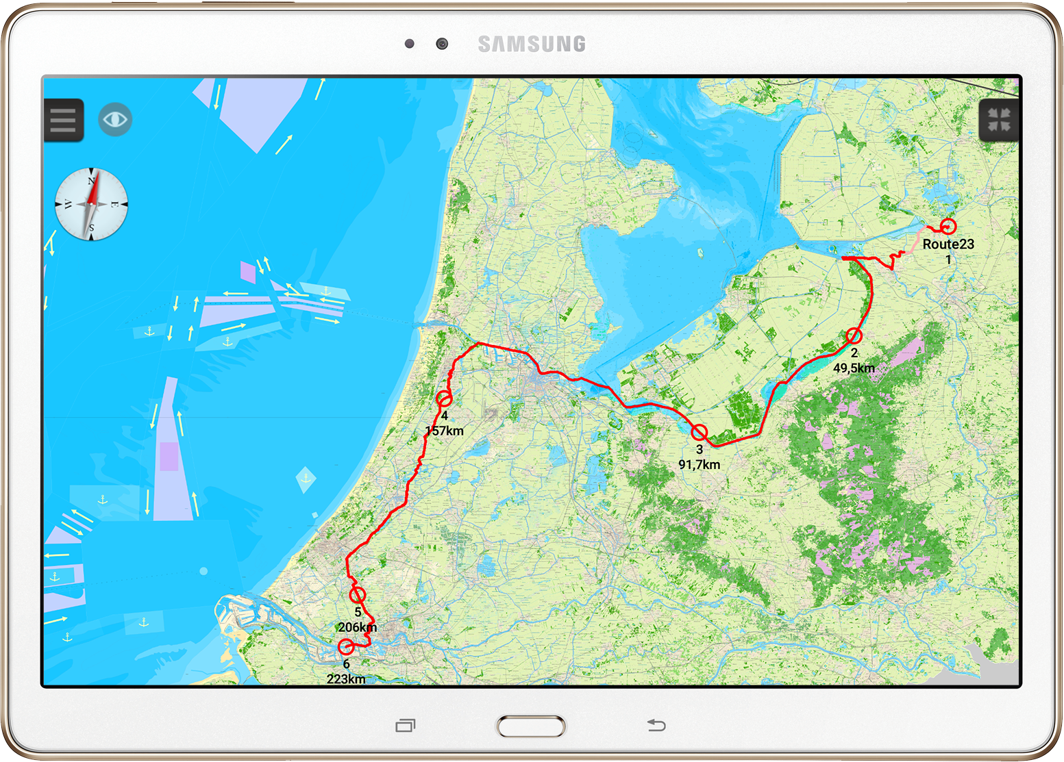
The route network for Western Europe and the Danube have been added to WinGPS Marine, Stentecs navigation app for Android devices. The route network gives you the possibility to make complete routes over the inland waters while only having to place a start and end point. Taken into account are the measurements of your ship, measurements for bridges and lock (height, width) and of course the waterway information (depth, width).
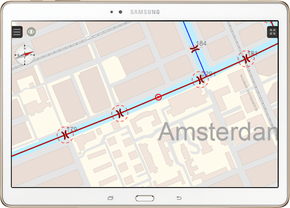
If a bridge or lock can't be passed due to size limitations this will be marked by a dotted circle. If the plotted route runs along a water way which is too shallow that part will be shown in a different color. Both options make it possible to foresee blocks along the route giving you the option to plot your route along another water way.
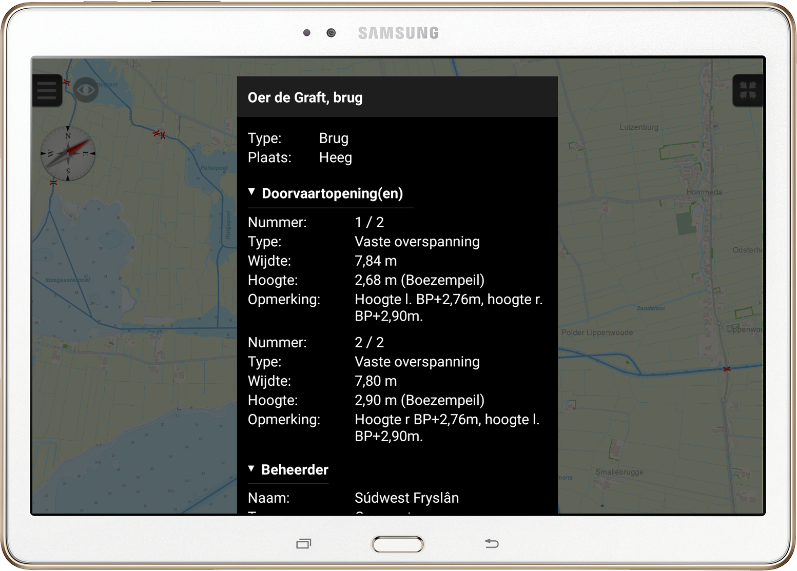
When you double click on a bridge, lock or water way a new window will appear with all known information (See image below). For example, the telephone number for the bridge operator, passage times or number of passage ways. Tips:
Follow this link for a full 'Frequently Asked Questions' list. Please mind: when plotting a route the speed of your ship and bridge/lock operating time are not accounted for within WinGPS Marine. It is advisable to only use the route function for short routes in the nearby future. Ideally while planning a one day trip right before setting sail.
|