


- News
- E-mail list
- Signup for our newsletter
- Stentec news
- News
- Developers Blog
- WinGPS
- WinGPS series
- WinGPS versions
- WinGPS specifications
- For Windows
- WinGPS Lite
- WinGPS Navigator
- WinGPS Pro
- WinGPS Voyager
- For Android
- WinGPS Marine Lite
- WinGPS Marine
- WinGPS Marine Plus
- For iOS
- Apps for iOS
- WinGPS Marine
- WinGPS Marine Plus
- DKW 1800 series
- Vaarkaart Friese Meren
- Service and upgrades
- Service Subscriptions
- WinGPS Service Card
- Charts
- Chart overview
- DKW Inland waters
- DKW The Netherlands
- DKW Friese meren
- DKW Amsterdam
- DKW Biesbosch
- DKW Belgium
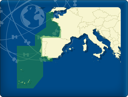
- DKW Northern France
- DKW Southern France
- DKW Northeast Germany
- DKW Northwest Germany
- DKW Southwest Germany
- DKW Rhine and Moselle
- DKW Danube 1-West
- DKW Danube 2-Central
- DKW Danube 3-East
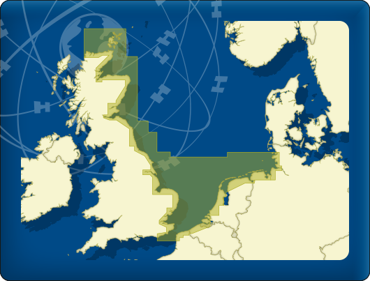
- DKW Coastal waters
- DKW 1800 series
- DKW UK1 English & Scottish Eastcoast
- DKW German Bight
- DKW German Baltic coast
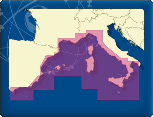
- DKW Imray series
- DKW Delius Klasing series
- NV-Verlag series
- Exclusive for Android
- Subscription - DKW the Netherlands
- Chart apps
- Other
- ADAC Marina Guide
- Hardware
- Simulators
- Shop
- Downloads
- Support
- Downloads
- Help pages
- Documentation
- System Requirements
- Availability GRIB files
- Frequently asked questions - FAQ
- WinGPS 5
- WinGPS Marine (Android)
- WinGPS Marine (iOS)
- Installation help
- WinGPS 5 (Windows)
- WinGPS Marine (Android)
- Tips
- Offline installation DKW charts (Windows)
- Installation ENC charts (Windows)
- Connecting SD card (Android)
- NV Verlag charts
- Offline NOAA Charts
- Download TeamViewer
- Contact
- Contactform - Helpdesk
- Callback Service
- Commercial Shipping
- Details
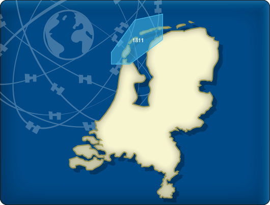
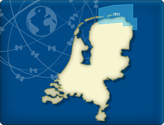
| Update DKW 1811 and 1812 - 2019 |
The 2019 editions of the 1811 Wadden Sea West and 1812 Wadden Sea East were newly published in April by the Hydrographic Service and, of course, were also included directly in the updates of our DKW 1800 series 2019.
Are you already in possession of the 2019 edition of these cards? Then you can download the updates for free in WinGPS.
|


- Details
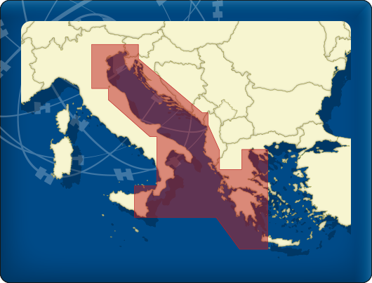
| DKW Imray-series 2019 Update |
| A major update for the DKW Imray charts was released last month. Many changes have been made to the charts of the Channel, the mouth of the Thames, along the Portuguese coast to Gibraltar, large parts of the Mediterranean and around Greece.
What's new?
Are you not yet in possession of the 2019 edition of the Imray charts? Order them now in our online shop, after which you may download and install the charts immediately.
|
- Details

| Is your navigation ready for the new sailing season? |
With the great weather predictions for the upcoming Easter weekend, this is the ideal moment to check if your navigational system is ready for operations and if everything is up-to-date. Updating WinGPS and charts With the 2019 release of WinGPS 5, the DKW1800 series and the popular DKW The Netherlands, the sailing season can now start properly. To prepare yourself properly, we advise you to update your charts and navigational software before you start your trip. This way you will ensure yourself of the most up-to-date navigational data and will leave you without any surprises along the way. You are welcome to visit our store in Heeg. When you bring your laptop or tablet with you, you can check if your system is up-to-date with one of our shop assistants. We recommend you make an appointment beforehand. We can also check and update your system remotely using TeamViewer when you give us a call. GPS receiver Have you tested your GPS receiver yet? After the GPS rollover of early April 2019, it is possible your GPS receiver will no longer function properly. Our usb GPS receivers are a great alternative. They are easy to install and have a high accuracy while sailing. |
- Details

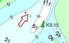
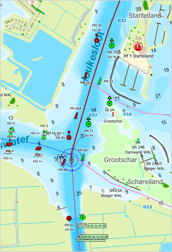
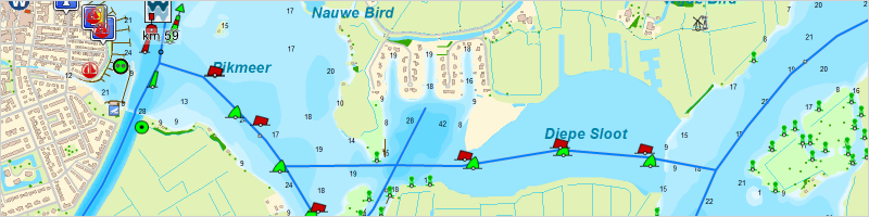
| DKW The Netherlands 2019 available now! |
The new lake between the Wijde Ee and the Pikmeer near Grou. WinGPS 5 of WinGPS Marine All DKW chart sets can be used in both WinGPS 5 for Windows, WinGPS Marine for Android and in the bèta version of WinGPS Marine for iOS. Need help installing? 
The DKW The Netherlands 2019 is available in our online shop, our store in Heeg and through our dealers. When you want help with purchasing or installing the charts, you can contact us via our contact form or visit us in our store. Here we can install the DKW The Netherlands and all of our other charts right away. We advise you to make an appointment beforehand. When you have a good working internet connection, we can even install the charts remotely via Teamviewer. |

- Details
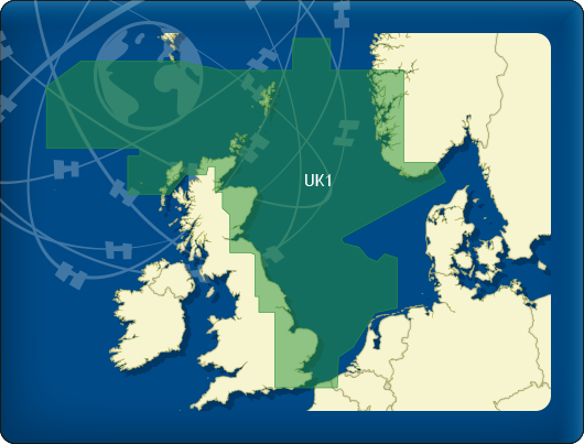
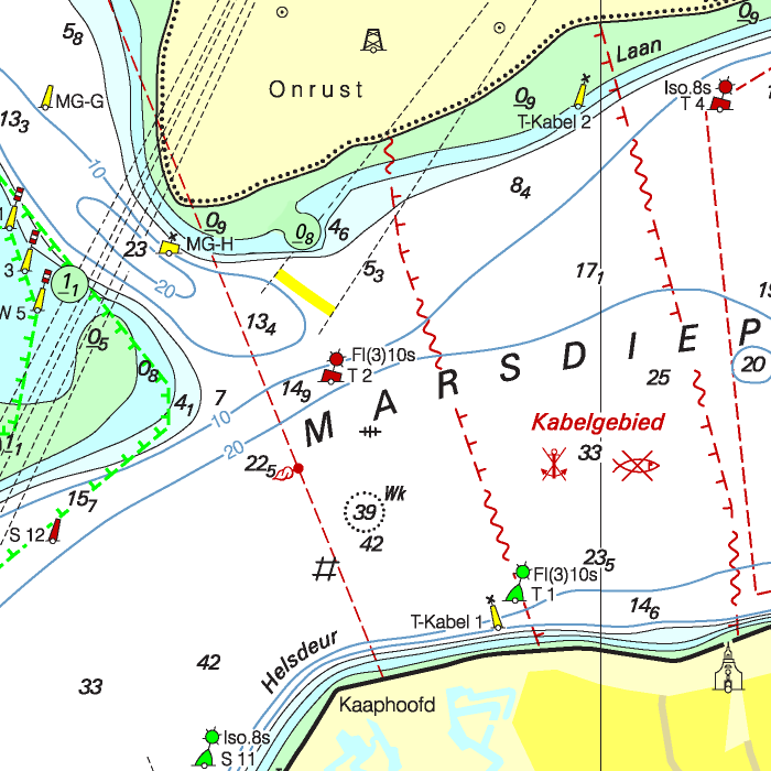
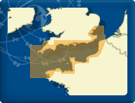
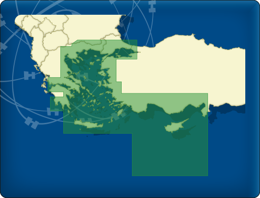
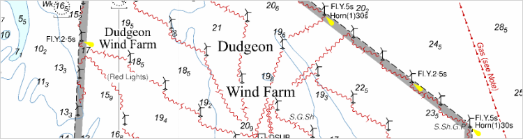
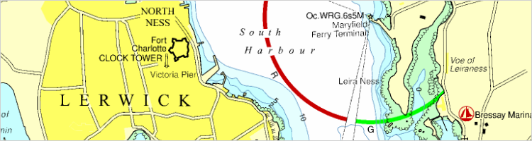
| Large update for chartset UK1 2019 |
|
Gray contour lines have been added aroud windmill farms.
Light sectors have been added near Lerwick. WinGPS 5 or WinGPS Marine The DKW charts are compatible with both WinGPS 5 for Windows and WinGPS Marine for Android (and soon for iOS). If you have both software packages it is possible to load these charts in both programs without having to buy extra licenses. |

News
- 1 year of free WinGPS with new Delius Klasing charts
- Updates & Easter discount!
- DKW The Netherlands 2025-edition now available!
- Old WinGPS 5 Navigator?
- Navigation on board: update, plan routes and set sail!
- WinGPS 6 - 2025 is now available - sooner than expected!
- NEW: BASIC Mode in WinGPS 6
- WinGPS 6 – 2025: faster, more stable, route planner 2.0
- DKW German Bight & Baltic Sea Coast 2025 available!
- New 2025 editions: Southern France & UK1


