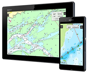
Navigating with Android: the WinGPS Marine series

The last few weeks we informed you about navigation on your laptop. Since a couple of years we also provide the option to navigate on Android tablets and smartphones. We want to tell you more about our Android apps.

Navigation on a tablet or smartphone is very useful when you want to be mobile. There is no place onboard where you can't view or change the current navigational information. Chart updates can easily be downloaded via your mobile network or wifi.

In Google Play, your Android devices' app store, you can find the navigation app WinGPS Marine and several chart apps. In this mailing our attention goes to the WinGPS Marine series.


Free

WinGPS Marine Lite
When you install the app WinGPS Marine on your tablet or smartphone, it will start as the free Lite version. By downloading your charts in the app, you will immediately have the tools for a basic navigation system: see your current location, course and speed and mark certain locations by placing a waypoint on the chart.


€ 49,99

WinGPS Marine
When you're starting to get the hang of navigating on a tablet, you will soon realize you want more features. By upgrading to WinGPS Marine you can get started.

Create routes on open water with multiple route points or place your route points on the waterwaynetwork along the inland waters. WinGPS Marine will take the waterway depths and dimensions of bridges and locks into account.

Just before starting your journey, download the latest GRIB files for the weather forecasts and connect your AIS wirelessly. Now you can see the predicted weather and all AIS objects around you without needing an internet connection.


€ 99,99

WinGPS Marine Plus
Are you planning on sailing tidal waters? Or do you want to connect other onboard equipment besides AIS and GPS in WinGPS Marine? You can upgrade to WinGPS Marine Plus.

The well known NLTides, also called HP-33, is also included within WinGPS Marine Plus. With the time bar you can see the stream and tidal information of the Dutch coastal waters on the chart for the entire year.

Connect your anemometer, depth meter, log and compass to a multiplexer with wifi or bluetooth. Your tablet can receive the NMEA data from your onboard equipment wirelessly and all will be shown in WinGPS Marine Plus.

If you already have a license for WinGPS Marine and want to upgrade, you can purchase an upgrade for only € 49,99.


€ 25
Add on for
WinGPS Marine (Plus)

'Kustfijn' model
With this add on you can download highly detailed information for predicted tides and water heights for North Sea, Wadden Sea, Zeeland and the IJsselmeer. The add on is available for WinGPS Marine and WinGPS Marine Plus.

Rijkswaterstaats' depth model is added to the 'Kustfijn' model with the predicted water heights. Making it possible to check the predicted true depths. Enter the depth of your ship and you can see a red line which marks waters that are too shallow to pass. Great in combination with the NLTides while planning a crossing along dry falling areas.


Available for all
WinGPS Marine versions

Android smartwatch app
If you really want to have all navigational information available at all times you can use an Android smartwatch.

You can connect an Android smartwatch with WinGPS Marine on your tablet or smartphone and the smartwatch shows you your current speed and position and also the course to steer and distance to the next waypoint.

By pointing towards a buoy you can add a red course line on your chart in WinGPS Marine. This compass pointer option is activated when you scroll to the rightmost screen in the smartwatch app.

Ideal for regatta sailing!


For more information and images please visit www.wingpsmarine.com.