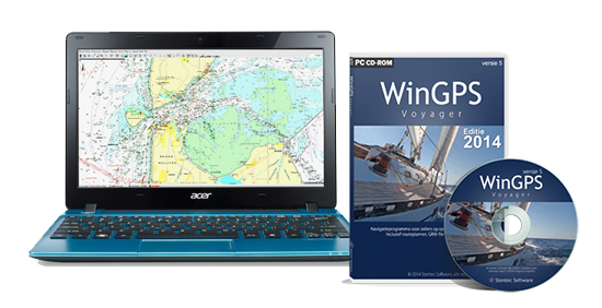
 Stentec will release a new version of WinGPS 5 in January 2015. In this 2015 edition of WinGPS 5 you'll find the most important releases in the January release and the Summer update. In this article we will provide you with all the cool new functions we are plannning to put into this edition.
The WinGPS 5 series 2015 is just like in the preceding years, great for route planning and navigation on board. For use on a laptop, board PC or Windows tablet.
- WinGPS 5 Navigator as affordable beginner program.
- WinGPS 5 Pro has AIS and tidal currents and is widely used in motor yachts and barges.
- WinGPS 5 Voyager is Stentec's top program, specially designed for route planning and navigation aboard sailing yachts.
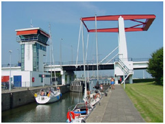 Route network land and sea
All versions of WinGPS 5 include an extensive waterway network of Western Europe, with all the bridges and locks with service times and dimensions. Sailors can plan a standing mast route but also their journey to the Baltic Sea. Offshore the network contains fairways of the Wadden Sea. During 2015, the waterway network will be updated automatically if you are connected to the internet.
The waterway network coverage of the Baltic Sea is new in this new release. These are covered by the combi packs of NV-Verlag and the digital chart sets of Delius Klasing. The waterway network is modified with the messages indicated by our users, and the government. This are changes like dimensions and operating hours of bridges, locks and waterways.
The network is also extended in France for the new upcoming chart "Vaarkaart North France 2015".
 OSM surface chart
OpenStreetMap will be included in WinGPS 5 2015 as a detailed surface map. Just like in our Android apps (WinGPS Marine); This is not a marine chart, but it covers the whole world (only when connected to the internet). This map is ideal for weather forecast with Grib files and an alternative for areas where you can't get marine charts for.
Obstructions
New in Pro & Voyager is the ability to download information about obstructions from the FIS database (the European Fairway Information System). These obstrustions can be plotted on a route. It's up to the user to decide about the use of another route if the waiting time is too long.
Wind and depth in Xtrack format.
The new format (*.xtrk) is a track format with wind, depth, log and heading included. These values are stored along a trajectory. This allows the software to color the route to indicate the depth measured on the map and a wind vector to be drawn. WinGPS 5 Voyager's handy wind flag can be displayed at any time along this track (deduced from the measured wind on board).
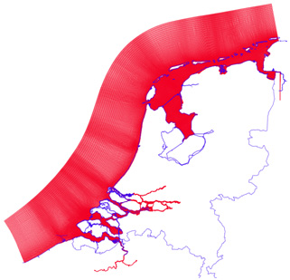 Kustfijn model Wadden Sea
The sailors on the Wadden Sea with WinGPS Pro or Voyager will find the KustFijn model of the RWS a big improvement. The Kustfijn model gives a detailed 2-layer prediction of the currents and tidal heights on the Wadden Sea (and other Dutch coastal waters). This model also takes the effects of the wind speed and direction in account. This technology has been on the wish list for a long time, and now comes available for all water sports enthusiasts on the Dutch coastal waters.
The long term prediction of NLTides with the 48 hours prediction of the Kustfijn model forms a unique combination.
The Kustfijn model covers the IJsselmeer, Lauwersmeer, Maasmond, Biesbosch and the Zeeland waters with Westerschelde. In Belgium a part of the Schelde to Gent and Rupel. The image shows a red grid of 134,000 grid cells where tidal hights and current speeds are registered for four times per day.
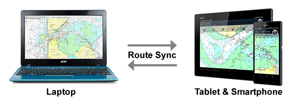
Route Sync with WinGPS Marine apps
Sailing with a tablet in the cockpit is very convenient. You don't need to go inside your cabin to check the laptop, and now you can discuss the upcoming key maneuvers while sailing.
Stentec developed WinGPS Marine for Android tablets & smartphones. These apps are available in Google Play™ and can be used to navigate on the same charts you use in WinGPS 5 on your laptop. The routes you created in WinGPS 5 can be transfered via WIFI to the WinGPS Marine app on your tablet. Now you can use this same route on your tablet for navigation, or modify it to transfer it back to your laptop and navigate the route there.