


- News
- E-mail list
- Signup for our newsletter
- Stentec news
- News
- Developers Blog
- WinGPS
- WinGPS series
- WinGPS versions
- WinGPS specifications
- For Windows
- WinGPS Lite
- WinGPS Navigator
- WinGPS Pro
- WinGPS Voyager
- For Android
- WinGPS Marine
- WinGPS Marine Plus
- For iOS
- Apps for iOS
- WinGPS Marine
- WinGPS Marine Plus
- DKW 1800 series
- Vaarkaart Friese Meren
- Service and upgrades
- Service Subscriptions
- WinGPS Service Card
- WinGPS Yacht Navigator
- Charts
- Chart overview
- DKW Inland waters
- DKW The Netherlands
- DKW Friese meren
- DKW Amsterdam
- DKW Biesbosch
- DKW Belgium
- DKW Northern France
- DKW Southern France
- DKW Northeast Germany
- DKW Northwest Germany
- DKW Southwest Germany
- DKW Rhine and Moselle
- DKW Danube 1-West
- DKW Danube 2-Central
- DKW Danube 3-East
- DKW Coastal waters
- DKW 1800 series
- DKW 1600+
- DKW UK1 English & Scottish Eastcoast
- DKW German Bight
- DKW German Baltic coast
- DKW Imray series
- DKW Delius Klasing series
- NV-Verlag series
- Exclusive for Android
- Subscription - DKW the Netherlands
- Chart apps
- Other
- ADAC Marina Guide
- Hardware
- Simulators
- Shop
- Downloads
- Support
- Downloads
- Help pages
- Documentation
- System Requirements
- Availability GRIB files
- Frequently asked questions - FAQ
- WinGPS 5
- WinGPS Marine (Android)
- WinGPS Marine (iOS)
- Installation help
- WinGPS 5 (Windows)
- WinGPS Marine (Android)
- Tips
- Offline installation DKW charts (Windows)
- Installation ENC charts (Windows)
- Connecting SD card (Android)
- NV Verlag charts
- Offline NOAA Charts
- Download TeamViewer
- Contact
- Contactform - Helpdesk
- Callback Service
- Commercial Shipping
|
|
Digital charts Delius Klasing
Congratulations on purchasing your Delius Klasing chart. By purchasing this chart you will receive free access to the digital version of the chart and the navigation program WinGPS Yacht Navigator for one year.
To take advantage of this offer, you must link the license number to your Stentec account. Below you will find more information about how you can achieve this.
Klicken Sie hier für Deutsch. Klik hier voor Nederlands.How do I install the chart and WinGPS Yacht Navigator?
When you purchase a paper chart from Delius Klasing you will receive a license code. This license code is located on the paper chart and entitles you to one year of free access to the digital version of the chart .
You will also receive one year of free access to the navigation program WinGPS Yacht Navigator (worth €29.90). This program has been specially developed for the Delius Klasing charts and is available for Windows, Android and iOS.
Follow the steps below to install the chart and WinGPS Yacht Navigator:
1. Link your obtained license number to your Stentec account.
Please note: paper charts marked 'edition 2023/2024' may contain an old license code. You cannot enter this code here. You can recognize this by the mention of 'Yacht Navigator' instead of 'WinGPS Yacht Navigator' on the form. Contact Delius Klasing for a new code.
If you do not have an account yet, you can create one directly here.
2. Download WinGPS Yacht Navigator by clicking on the download button of the relevant platform.


3. Open WinGPS Yacht Navigator and log in with your Stentec account.
5. Download the chart in WinGPS Yacht Navigator:
- WinGPS Yacht Navigator for Windows:
after you have opened WinGPS, you will be presented with the News Center. Here you will see a notice that a recently purchased chart has not yet been installed. Click 'Update All' and you will see a screen with all your charts available for download/update, including the chart you just linked. Check the box of this chart and click 'Continue'. - WinGPS Yacht Navigator for Android:
go to 'Chart manager' in the menu. Now swipe right so you go one screen to the left. Here are all your downloadable charts, including the chart you just linked. Click on the chart you would like to download, and press 'Download' in the upper right corner. - WinGPS Yacht Navigator for iOS:
go to 'Download Manager' in the menu. Here you will see all your charts available for download, including the chart you just linked. Click on the download button to the right of the chart in Download Manager.
Partnership Stentec and Delius Klasing
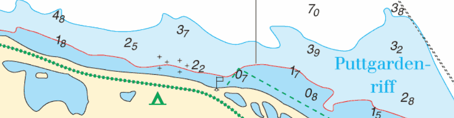
Since 2014, Stentec Software has been publishing the well-known Delius Klasing charts digitally. These are based on the paper charts of Delius Klasing and have a clear and orderly chart image.
Now, 10 years later in 2024, our collaboration has been strengthened and the digital versions of Delius Klasing's paper charts can be downloaded exclusively via Stentec..
These digital charts, also called DKW charts, are compatible with all versions of WinGPS. In honor of this wonderful collaboration, we have developed a special WinGPS version for the Delius Klasing charts: WinGPS Yacht Navigator.
The map image of the digital charts from Delius Klasing continues to retain the familiar clear appearance. For more information about the digital charts, click more information below.
System requirements:
- Valid version of WinGPS
- Between 40MB and 300MB disk space (varies per chart set)
- Windows laptop or PC: Windows Vista, 7, 8, 10 or 11 with DirectX 9 graphics card (or higher)
- Android tablet or smartphone: Android operating system, at least 2 GB of RAM (RAM)
- iPad or iPhone: iOS 12 (or higher), click here for more information.
Delius Klasing charts
Below you will see an overview of all charts from Delius Klasing that come with a license code for a digital chart.
|
|
Order your paper charts from Delius Klasing now and receive 1 year of free access to the digital version of the chart and a one-time 1 year of free access to the WinGPS Yacht Navigator navigation program.
These digital charts are also available separately as an annual subscription, without paper charts.
Want to expand your digital chart package?
Did you know that Stentec also supplies digital charts of other areas, such as the popular DKW Vaarkaart Nederland or DKW 1800 series? These charts are very detailed and are updated regularly. Ideal for the busy and changeable Dutch waters.
Cancel your subscription?
You can easily cancel your subscription by filling out the form below:

Harinxmastrjitte 29
8621 BJ HEEG
The Netherlands
T +31 (0) 515 443515


Copyright © Stentec Software. All rights reserved.
By using this website you acknowledge that you agree with our user agreement.