Quarterly update UK1 English and Scottish Eastcoast

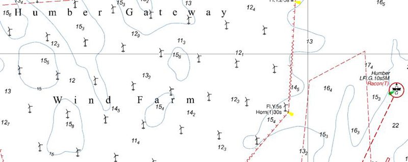
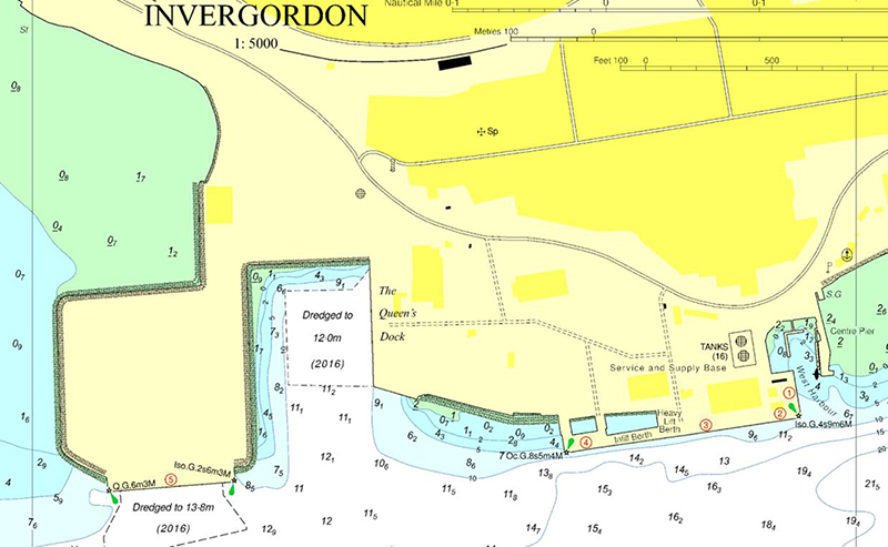
Last week we published an update for DKW UK01 English and Scottisch Eastcoast. In this set 11 detailed charts and 12 marina charts have been updated. The update can be downloaded from the news center (via 'help - open news center') or from the DKW Manager.

Updates
There were a lot of updates for these charts, including:

  • The windmill park 'Humber Gateway' has been added to the charts. (Illustration 1)
  • The 'Amethyst' gas field has been remeasured. The new measurements have been processed.
  • The yet to be constructed windmill park 'Race Back' has been added.
  • A marine chart has been added for the Greenport Dock at Hull.
  • Charts 1889 and 1890 (Cromarty Firth) have been adjusted with a new scale. (Illustration 2)

The updates are contained within the following charts:

  • BA104 - Approaches to the Humber (TS scheme)
  • BA107 - Approaches to the Humber (river)
  • BA108 - Approaches to the Wash
  • BA1188 - River Humber Spurn Head to Immingham
  • BA1889 - Cromarty Firth - Cromarty Bank to Invergordon
  • BA1890 - Cromarty Firth - Invergordon to Dingwall
  • BA1934 - River Tyne - Willongton Quay / Duntson
  • BA2693 - Approaches to Felixtowe, Harwich
  • BA3271 - Lerwick Harbour and Apporaches
  • BA3496 - River Humber, Immingham and Hull
  • BA3497 - River Humber Immingham to Humber Bridge
Click on an image for a larger view.