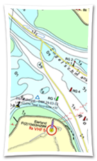
| Watercharts |
|
Stentec offers up-to-date and detailed nautical charts of the Netherlands, Belgium, Germany and the Danube. We also produce charts for Europes' coastal waters, the Caribbean islands and New-Zeeland. We collaborate with a.o. the Dutch Hydrographic Office, Rijkswaterstaat, Imray, Delius Klasing and NV-Verlag. |


 Temporary €30 discount on Premium and up to €50 discount on your DKW charts. Sail into the season up-to-date. With the summer approaching, now is the perfect...
 Navigation data always at your fingertips, without having to pick up your phone. The new WinGPS Marine app for Wear OS displays live data from your navigation system...
 WinGPS is here to help you over the wonderful Pentecost weekend. The weather forecast is looking excellent and many water sports enthusiasts are getting ready for...