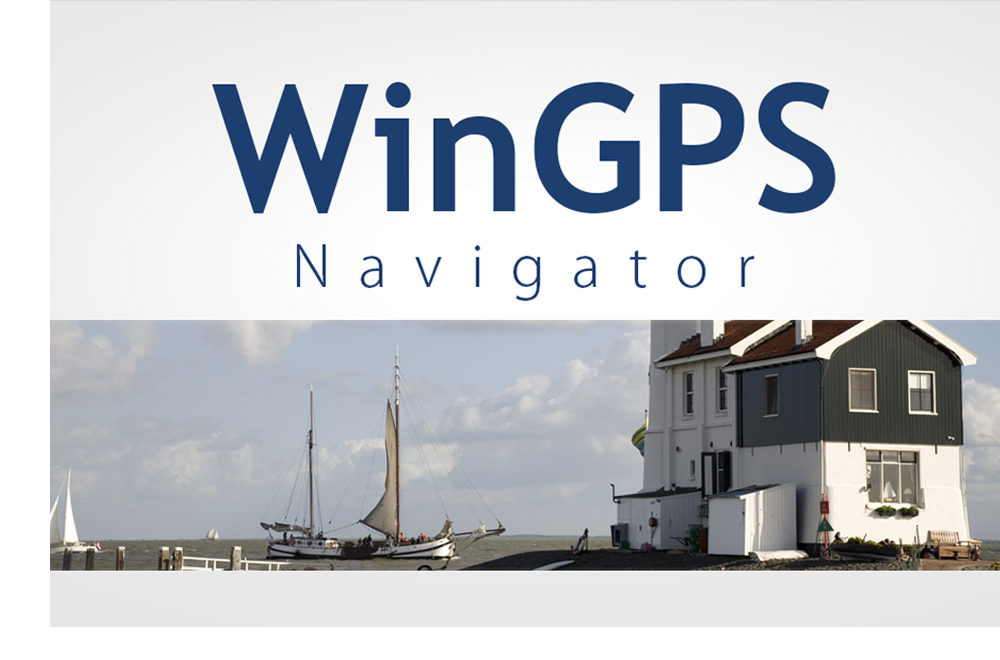
Charts for WinGPS
Besides your navigation program you will also need digital charts. The WinGPS series support world wide coverage which can easily be installed with DKW Manager.Most charts come with an online update service. Our goal is to deliver the most actual charts to sailors. Safety must come first. Besides the charts we publish, you may also create your own charts with DKW Builder.
Below an overview with charts suitable for WinGPS
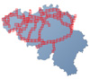
DKW Inland charts
Ammount of updates: n/a
Coverage:
- DKW Inland ENC Nord Deutschland More information Online Shop
- DKW Inland ENC Rhein More information Online Shop
- DKW Vaarkaart Fryslan More information Online Shop
- DKW Vaarkaart Nederland Online Shop
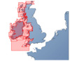
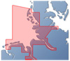
DKW 1800 The Netherlands
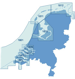
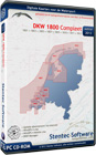
Stentec Software publishes the digital version of the Hydrographic charts of The Netherlands since since 1999. Thanks to the weekly online update service you will always have the most recent charts. The charts can be ordered seperately or as a whole.
Supplier: Stentec SoftwareAmmount of updates: Weekly
Coverage:
- DKW 1801 Noordzeekust
- DKW 1803 Westerschelde
- DKW 1805 Oosterschelde
- DKW 1807 Zoommeer
- DKW 1809 Nieuwe Waterweg
- DKW 1810 IJsselmeer
- DKW 1811 Waddenzee West
- DKW 1812 Waddenzee Oost
DKW Imray
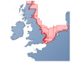
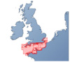
Stentec Software publishes the renown Imray charts digitally since 2009. These are based on paper charts and also have the famous Imray colors. The great advantage of these charts is that they cover a large area in 1 set.
Supplier: Stentec Software
Ammount of updates: 4 times/year
Coverage:
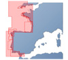
- DKW-ID10 Engelse en Schotse Oostkust
- DKW-ID20 English Channel
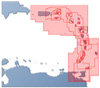
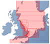
- DKW-ID30 Britse Westkust en Ierland
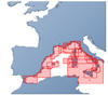
- DKW-ID40 Atlantische kust Frankrijk, Portugal tot Gibraltar
- DKW-ID50 Middellandse Zee West (European Coast)
- DKW-ID60 Middellandse Zee Midden
- DKW-ID70 Oostelijke Middellandse Zee
- DKW-ID100 Eastern Caribbean
DKW Internationaal
For the most popular areas we also publish our own chart sets. This way you can easily download your charts from our websites. Because we make the charts ourselves, it is easier to update them regularly, keeping them recent and safe.
Supplier: Stentec Software
Ammount of updates: n/a
Coverage:
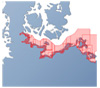
- DKW Duitse Oostzeekust
- DKW Duitse Bocht
- DKW Engelse Oostkust
NV-Verlag
 NV-Verlag is a publisher of charts which cover the entire world. They also publish the Baltc Sea charts, which are combipacks, paper and digital charts.
Supplier: NV-Verlag, Navicarte, Soltek
Ammount of updates: n/a.
Coverage:
- Africa
- Atlantic
- Internal Waters Europe
- Caribbean and South America
- Florida, Bahamas & Gulf Coast
- Indian Ocean
- Mediterranean
- North Sea
- East Coast U.S.
- Baltic Sea
- Pacific Ocean
- World


 Temporary €30 discount on Premium and up to €50 discount on your DKW charts. Sail into the season up-to-date. With the summer approaching, now is the perfect...
 Navigation data always at your fingertips, without having to pick up your phone. The new WinGPS Marine app for Wear OS displays live data from your navigation system...
 WinGPS is here to help you over the wonderful Pentecost weekend. The weather forecast is looking excellent and many water sports enthusiasts are getting ready for...