The warm weather made for a wonderful season to be out on the water. At the same time, this poses major challenges on Dutch and European waterways.
Water levels in rivers, lakes, and inland waterways are currently extremely low. Shallow areas are forming more quickly than usual, and familiar routes can suddenly become hazardous.
It is precisely under these conditions that an up-to-date and reliable route planner is essential on board.
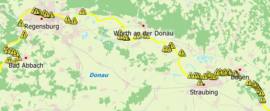
n the 2026 editions of WinGPS 6, you can easily view waterway obstructions, and if you have an internet connection, they are automatically updated as soon as a change occurs.
The yellow triangles indicate closures across the entire waterway network in Europe. You can click on them for more information. The waterway network is also highlighted in yellow in the areas where a closure is in effect. This allows you to immediately see which sections you may not be able to navigate and to check whether the closure applies to you.
Our route planner even takes obstructions into account and routes around them.
We’ve created an instructional video for you on this topic:

Tip: The video is in Dutch, but you can change the subtitles to your own language.
Don't let the drought spoil your boating fun. Update your WinGPS license and DKW charts today so you always have the most up-to-date information on your laptop, tablet, or smartphone.

Don't have WinGPS 6 yet?
Then get started now and discover what WinGPS 6 can do for you. The shipping notices with information about waterway obstructions are included in WinGPS 6 Pro, Voyager, and Inland.
See here which WinGPS versions suit your needs, or order now.