


Navigate on your iPad and iPhone
Since 2019, the navigation program WinGPS is also available in the Appstore. In addition to WinGPS on the laptop and WinGPS Marine on an Android device, you can also navigate on an iOS device!
On this page we would like to tell you more about our various navigation apps for your iPad and iPhone. At the bottom of the page we will keep you informed of the latest developments. At the bottom of the page, we will keep you updated on the latest developments in this area.
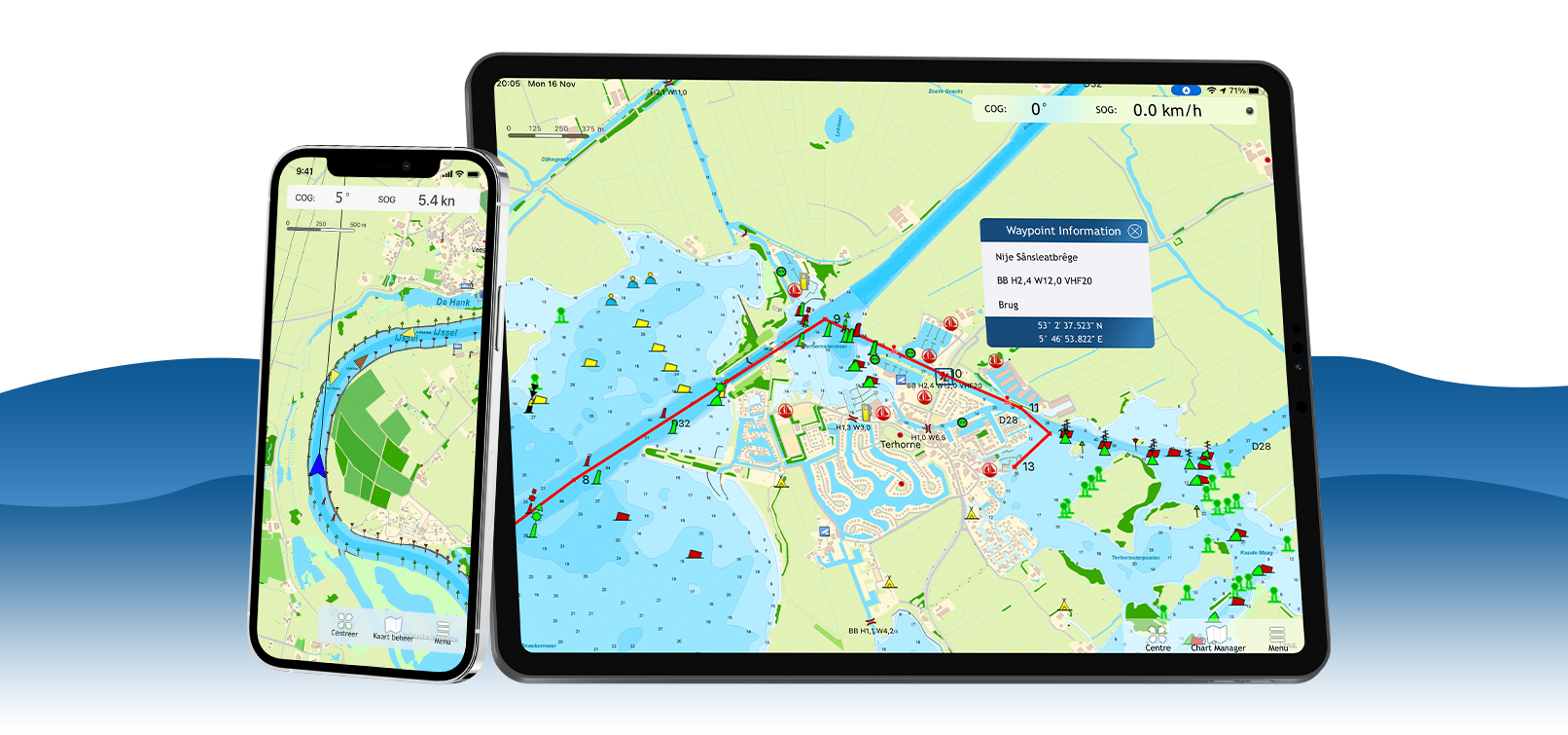
WinGPS Marine for iOS
Get to know the navigation app WinGPS Marine for free and view your navigation charts, position and speed, among other things. Plot a navigation waypoint so that you immediately see the course-to-steer and distance-to-go. Ideal for smaller trips or as a backup.
If you choose the more extensive WinGPS Marine Plus app, you can plan routes, download GRIB-files, plot tidal data and connect your AIS. This way you can create a complete back-up navigation system on board.


Charts in WinGPS Marine
The charts you can use in these apps are Stentec's own DKW charts. For example, the well-known DKW 1800 series including weekly update service or the free DKW Vaarkaart Frisian Lakes.
In WinGPS Marine you can also use Apple's free online charts for orientation. You can download the DKW charts directly in the app and use them for navigation, after you have logged in with your Stentec account.
| Note: Only 2018 and newer charts can be used in this app. Do you have older charts? Upgrade your charts in our online shop. Click here to upgrade your charts. |



Latest developments
|
Photo's of bridges and locks in WinGPS Marine Plus
Posted on August 5, 2026 New
WinGPS Marine Plus
You can now see photo's of the bridges and locks in WinGPS Marine Plus, if you click on the bridges and locks icons. 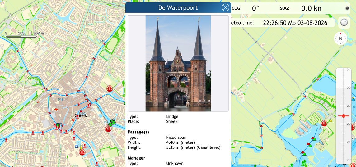
|
|
GRIB-files in WinGPS Marine Plus Posted on August 5, 2026 New
WinGPS Marine Plus
You can now download GRIB-files from other soucres in WinGPS Marine Plus, such as KNMI Hirlam, NOAA-waves, RWS, Stentec-tidal and BSH. 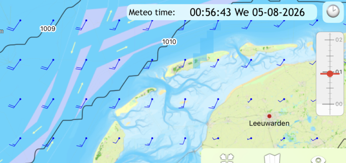
|
Posted on August 5, 2026 New
WinGPS Marine Plus
In WinGPS Marine Plus, you can now view the Dutch tides for the entire calendar year, that is, the currents and tide stations along the Dutch coast. 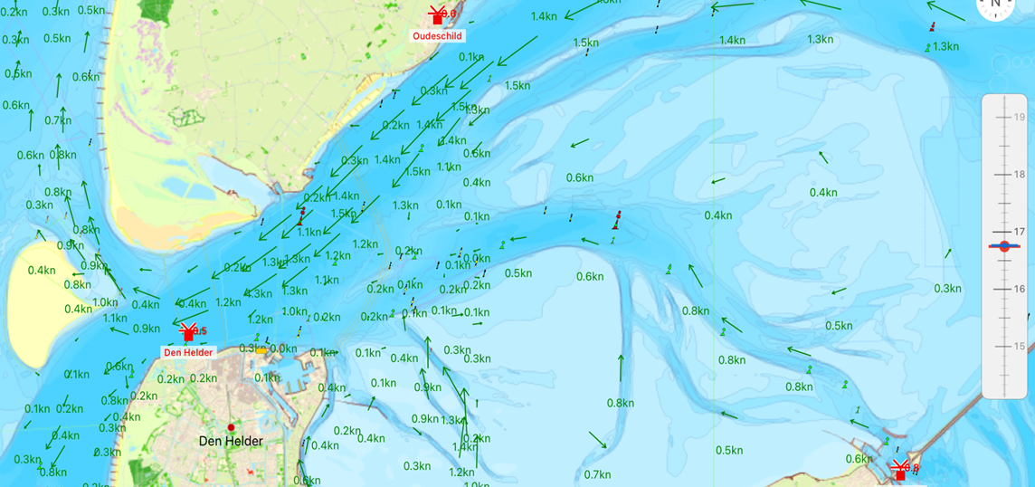
|
GRIB-files from NOAA in WinGPS Marine Plus Posted on August 3, 2023
WinGPS Marine Plus
In WinGPS Marine, you can now download GRIB files from NOAA for the entire world. These files contain forecasts for wind, precipitation, and air pressure. 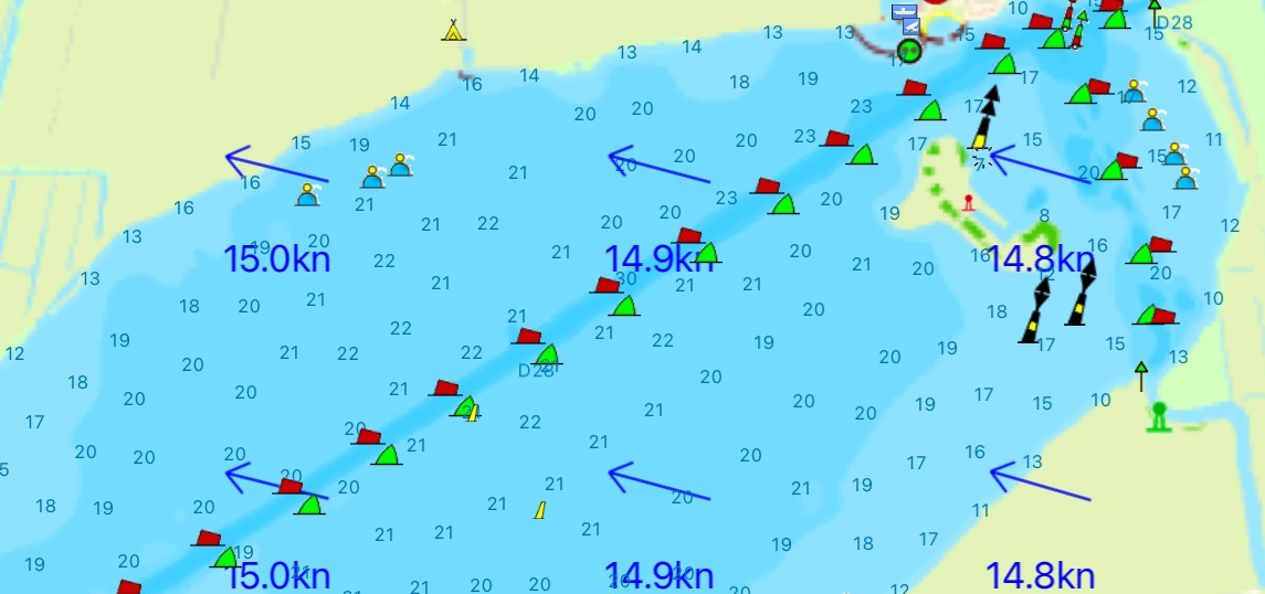
|
Routes over the waterway network in Marine Plus Posted on June 27, 2022
WinGPS Marine Plus
In WinGPS Marine Plus you can now plan a route over the waterway network, taking into account the dimensions of your ship, the waterways and the bridges & locks. 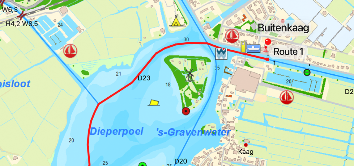
|
|
Navigation waypoint on waterway network in WinGPS Marine Posted on June 27, 2022
WinGPS Marine
In WinGPS Marine you can now place a navigation waypoint on the waterway network, after which a route is automatically drawn over the intermediate waterways. 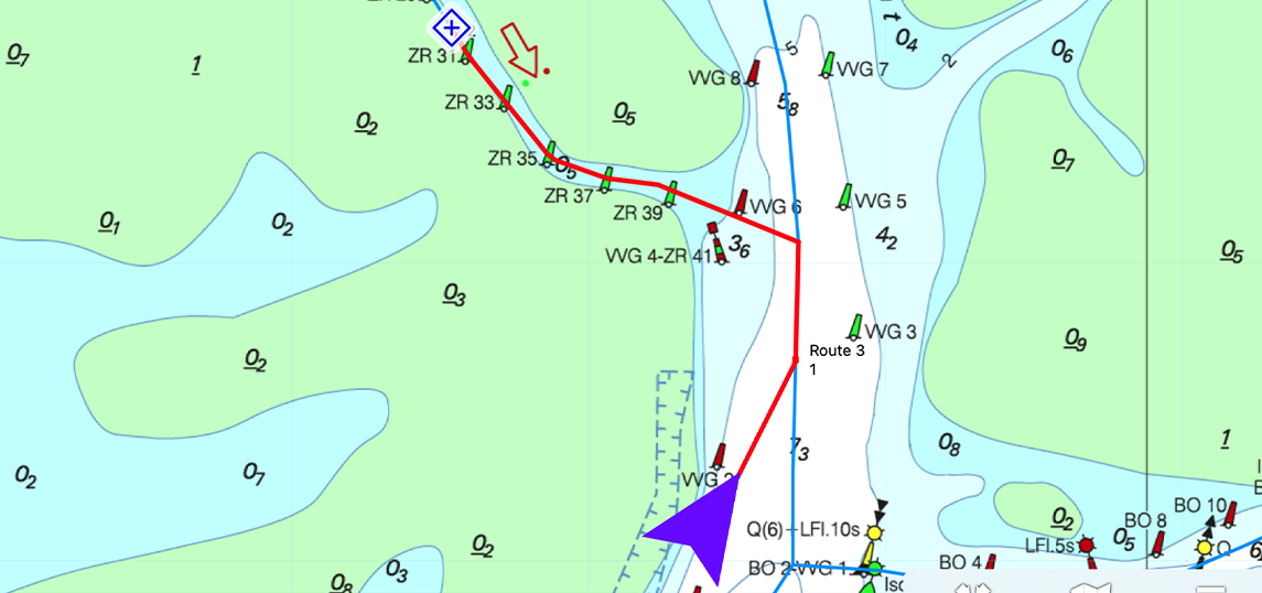
|
Waterway network in WinGPS Marine and Marine Plus Posted on august 9, 2021
WinGPS Marine and Marine Plus
The WinGPS Marine and WinGPS Marine Plus apps now also include the waterway network with information about waterways, bridges and locks. 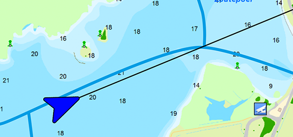
|
Posted on December 17, 2020
WinGPS Marine Plus
Download the more extensive navigation app WinGPS Marine Plus in the Appstore from now on! You can already plot routes, connect your AIS to it and switch on the Course-up mode. Over time, more functions are added, such as GRIB files and linking other on-board instruments. 
|
Update WinGPS Marine Posted on Ocotober 25, 2019
WinGPS Marine
From now on you can also view your sailed routes, turn on distance circles and place a navigation waypoint in WinGPS Marine. 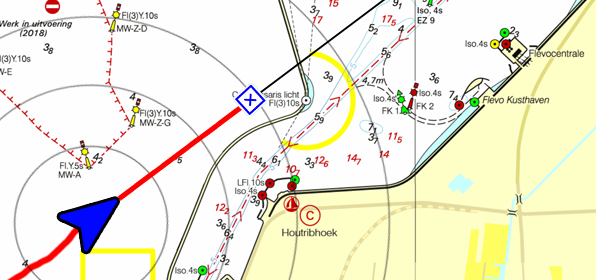
|
| | |
|
Release WinGPS Marine Posted on June 11, 2019
WinGPS Marine
Download the free navigation app WinGPS Marine now in the Appstore! Now you can load all your DKW charts and view your position, course and speed. More features will be added in upcoming updates. 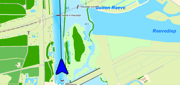
|
Bèta WinGPS Marine Posted on March 15, 2019
WinGPS Marine
The beta version is online and is being tested by WinGPS users. The feedback from this is used to be able to release a solid version of WinGPS Marine in the short term. 
|
Harinxmastrjitte 29
8621 BJ HEEG
The Netherlands
T +31 (0) 515 443515


Copyright © Stentec Software. All rights reserved.
By using this website you acknowledge that you agree with our user agreement.