DKW Coastal waters
In the navigation program WinGPS you can use our own DKW charts for navigation. The DKW charts of the coastal waters are released annually.
On this page you will find an overview of all these coastal water charts. Go directly to:
- DKW 1600+
- DKW 1800-series
- DKW UK1 English & Scottish Eastcoast
- DKW DB German Bight
- DKW DOK German Baltic coast
- DKW Imray series
- DKW Delius Klasing-series
- NV-Verlag-series
|
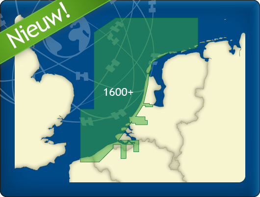
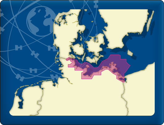
DKW 1600+ North Sea Coast Netherlands With our new DKW 1600+, you can navigate the Dutch and Belgian coasts with a clear, up-to-date digital chart, including the trusted weekly BaZ updates automatically installed in WinGPS. The chart is based on the Hydrographic Chart 1600 and supplemented with additional chart sheets. This gives you a single, clear overview of the most important sailing areas along the coast and in the North Sea. The DKW 1600+ covers:
|
|
|
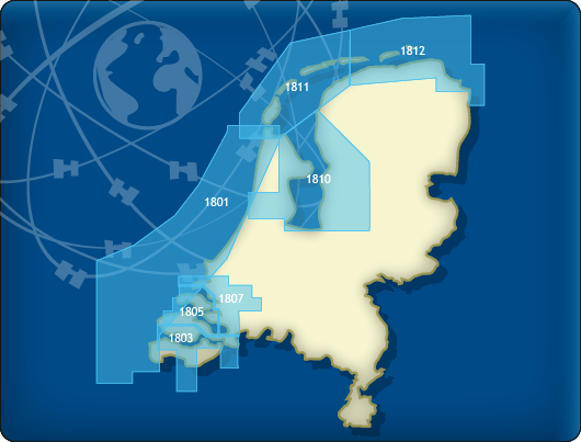
DKW 1800-series Since 1999 Stentec Software produces the digital versions of the Dutch hydroraphical charts. Thanks to the weekly BaZ Update Service you will always have the latest, most up-to-date charts. The Waddensea charts DKW 1811 and DKW 1812 are supplied with monthly updated depth marks from Rijkswaterstaat. Great when sailing on the tidal waters of the Wadden Sea. The following DKW1800 series are included in this set:
|
|
|
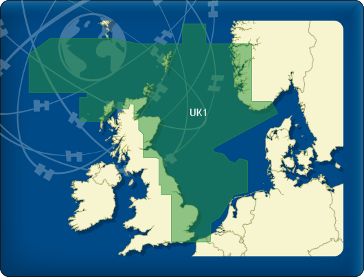
DKW UK1 English & Scottish Eastcoast The DKW UK1 English & Scottish Eastcoast is developed for sailors, motorboaters and commercial shipping. The chart gives a clear view of the entire English and Scottish Eastcoast and is ideal in combination with the paid versions of WinGPS. You can easily and quickly plan routes on the North Sea and the British coast. The detailed charts in this chart set cover the English coast from Dover to Northern Scotland. The Thames is covered past London up until Teddington. Including passage charts for the North sea, the English Channel, Orkney and the Shetland Islands. This chart set has more detail than the DKW Imray ID10. |
|
|
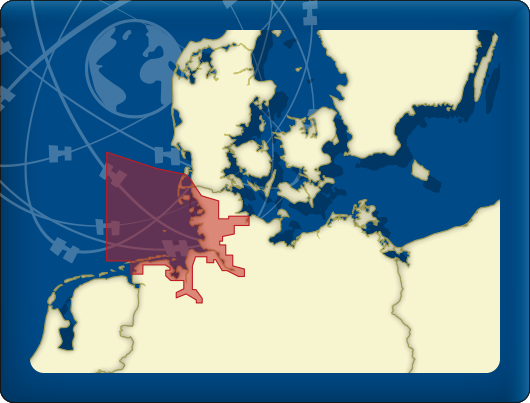
DKW DB German Bight The DKW German Bight is developed for sailors, motorboaters and commercial shipping. The chart set is ideal in combination with the paid versions of WinGPS. You can easily and quickly plan routes along the German Bight and to the Baltic Sea. The detailed charts in this chart set cover the German coast from Just to Kiel, Hamburg, Helgoland to the Danish border. |
|
|
DKW DOK German Baltic coast The DKW German Bight is developed for sailors, motorboaters and commercial shipping. The chart set is ideal in combination with the paid versions of WinGPS. You can easily and quickly plan routes to the Baltic sea along the German coast. The detailed charts in this chart set cover the German Baltic coast from Flensburg to Useom, with a.o. Kiel, Rostock and Kloster. From the Eastern Danish border up until the Polish border. |
|
|
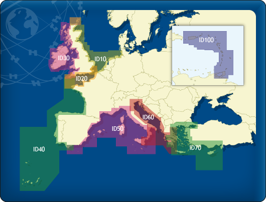
DKW Imray series Since 2009 Stentec Software publishes the famous Imray charts digitally. These are based on the paper charts and feature the same well known Imray colors. The following DKW Imray charts are available:
|
|
|
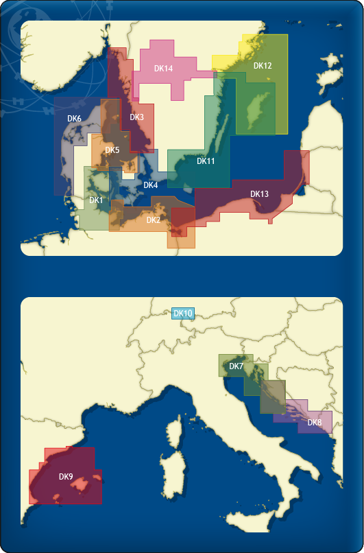
DKW Delius Klasing series Since 2014 Stentec Software publishes the well known Delius Klasing series digitally. These are based on Delius Klasings paper charts and have the same colors. The following sets are available in the DKW Delius Klasing series:
|
|
|
NV Verlag series NV-Verlag is a publisher of paper navigational charts which include digital versions of the same chart set. These digital charts can be used in WinGPS 5 and connect seemlessly with Stentecs DKW charts. The most popular NV-Verlag chart sets are those of the Baltic Sea. These are complete sets with paper charts, digital charts and harbour pilots. The clear chart image is perfect for planning routes and viewing your current location. The different NV-Verlag chart sets cover the following areas:
|
|