DKW charts inland waterways
In the WinGPS navigation program you can use our own DKW charts for navigation, among other things. The DKW charts of the inland waterways are released annually.
A special Inland Update Service is available for commercial shipping on European inland waterways. With this update service you can download all the charts below and update them during the year. Click here for more information.
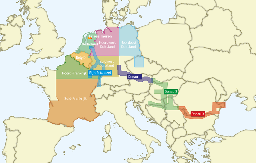
On this page you will find an overview with information about all these inland waterways charts. Click on the image below to go directly to the relevant chart:
|
DKW The Netherlands The DKW The Netherlands is developed for sailors, motorboaters and commercial use. The DKW The Netherlands is the most up-to-date inland water chart, thanks to all available updates throughout the year. All Dutch inland waters are incorporated: the salty waters of Zeeland, the stirring rivers of Limburg and the small canoe fosses in Friesland. The DKW the Netherlands is great in combination with a paid version of WinGPS. Use the route network for a quick and easy way to plan routes along the Dutch inland waters. |
|

|
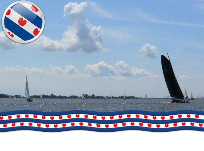
DKW Friese Meren - FREE This is the perfect chart when you want to sail on the Friese Meren. The DKW Friese Meren is free to give you an experience with Stentecs navigation software and digital charts. This chart covers the Friese Meren area from Stavoren and Lemmer up until Grou and Makkum. Including all lakes and waterways in between:
|
|
|
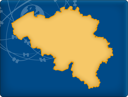
DKW Belgium The DKW Belgium is developed for sailors, motorboaters and commercial shipping. The chart gives a clear view of all Belgian water ways and is ideal in combination with the paid versions of WinGPS. Using the route network you can easily and quickly plan routes on the inland waterways of Belgium. In this chart set all large Belgian waterways are covered. Including the Maas, IJzer, Bovenschelde, Charleroi-Brussel Channel, Dender and the Gent-Brugge Channel. |
|
|
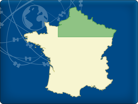
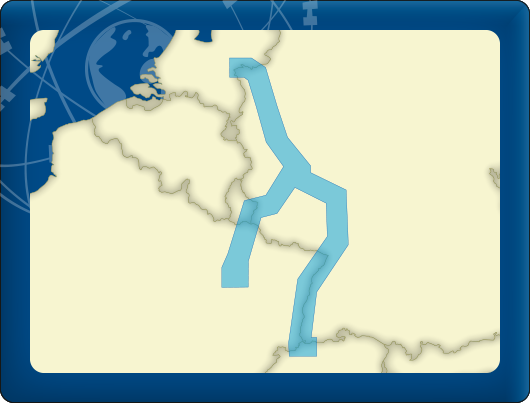
DKW Northern France The DKW Northern France is developed for sailors, motorboaters and commercial shipping. The chart gives a clear view of all Northern French water ways and is ideal in combination with the paid versions of WinGPS. Using the route network you can easily and quickly plan routes on the inland waterways of Northern France. In this chart set all large Northern French waterways are covered. The covering area is from the Belgian/French border up intil Paris, Including the Somme, the Rhine, the Sambre, the Meuse and the Seine. |
|
|
DKW Southern France The DKW Southern France is developed for sailors, motorboaters and commercial shipping. The chart gives a clear view of all Southern French water ways and is ideal in combination with the paid versions of WinGPS. Using the route network you can easily and quickly plan routes on the inland waterways of Southern France. In this chart set all large Southern French waterways are covered. The covering area is from below Paris up until the Mediterranean and Atlantic coast, including a.o.:
|
|

|
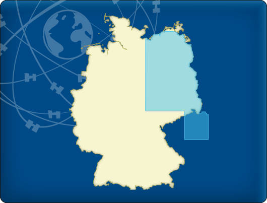
DKW Northeast Germany The DKW Northeast Germany is developed for sailors, motorboaters and commercial shipping. The chart gives a clear view of all Northeastern German water ways and is ideal in combination with the paid versions of WinGPS. Using the route network you can easily and quickly plan routes on the inland waterways of Northeast Germany. In this chart set all large Northeastern German waterways are covered, Berlin included. The covering area is from the Baltic coast up until Prague, including a.o.:
|
|
|
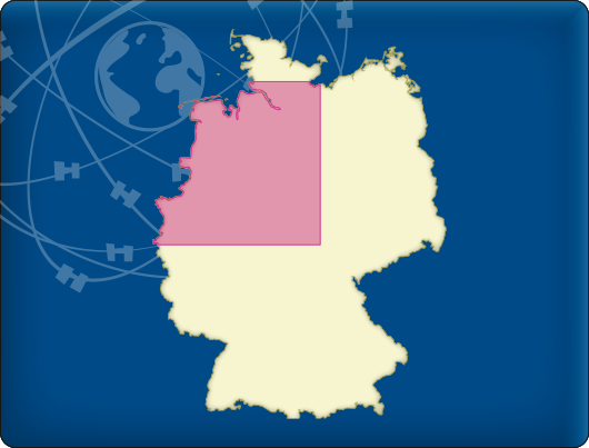
DKW Northwest Germany The DKW Northwest Germany is developed for sailors, motorboaters and commercial shipping. The chart gives a clear view of all Northwestern German water ways and is ideal in combination with the paid versions of WinGPS. Using the route network you can easily and quickly plan routes on the inland waterways of Northwest Germany. In this chart set all large Northwestern German waterways are covered. The covering area is from the Dollard up until the Baltic coast at Lubeck and Duisburg, including a.o.
|
|
|
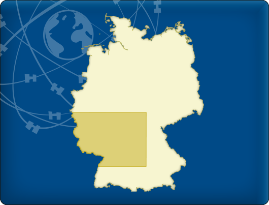
DKW Southwest Germany The DKW Southwest Germany is developed for sailors, motorboaters and commercial shipping. The chart gives a clear view of all Southwestern German water ways and is ideal in combination with the paid versions of WinGPS. Using the route network you can easily and quickly plan routes on the inland waterways of Southwest Germany. In this chart set all large Southwestern German waterways are covered. The covering area is from Bonn up until the French and Belgian border and Bamberg, including a.o.:
|
|
|
DKW Rhine and Moselle The DKW Rhine and Moselle is developed for sailors, motorboaters and commercial shipping. The chart gives a clear view of the German and French water ways and is ideal in combination with the paid versions of WinGPS. Using the route network you can easily and quickly plan routes on the inland waterways. The DKW Rhine and Moselle contains the Rhine from Lobith up until Basel and the Moselle from Koblenz up until Toul and Nancy in France. |
|
|
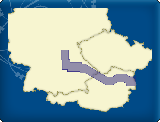
DKW Danube 1-West The DKW Danube 1-West is developed for sailors, motorboaters and commercial shipping. The chart gives a clear view of all the Western Danube and is ideal in combination with the paid versions of WinGPS. Using the route network you can easily and quickly plan routes on the Western Danube. In this chart set the western Danube is covered from Bamberg, passing Nürnberg, Regensburg, Passau, Linz up until Vienna to just before Bratislava, including a.o.
|
|
|
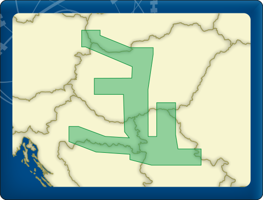
DKW Danube 2-Central The DKW Danube 2-Central is developed for sailors, motorboaters and commercial shipping. The chart gives a clear view of all the Central Danube and is ideal in combination with the paid versions of WinGPS. Using the route network you can easily and quickly plan routes on the Central Danube. In this chart set the central Danube is covered from Bratislava past Budapest and Lake Balaton up until Szeged, Sisak and Belgrade including a.o.:
|
|
|
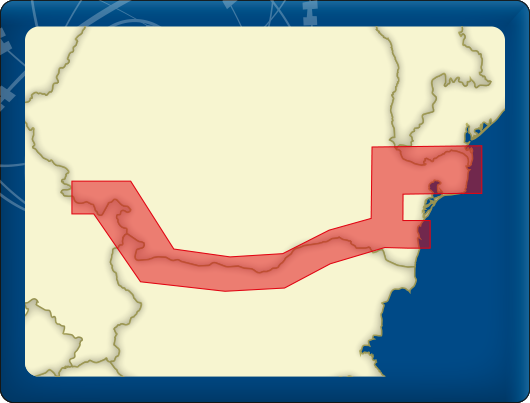
DKW Danube 3-East The DKW Danube 3-East is developed for sailors, motorboaters and commercial shipping. The chart gives a clear view of all the eastern Danube and is ideal in combination with the paid versions of WinGPS. Using the route network you can easily and quickly plan routes on the eastern Danube. In this chart set the eastern Danube is covered from Belgrade up until the Black Sea, including a.o.:
|
|