


ENC charts in WinGPS
Since late 2018 it is also possible to use ENC charts in WinGPS. This allows you to comply with the new German law, which makes it mandatory to use iENC on German highways (defined by the WSV).
|
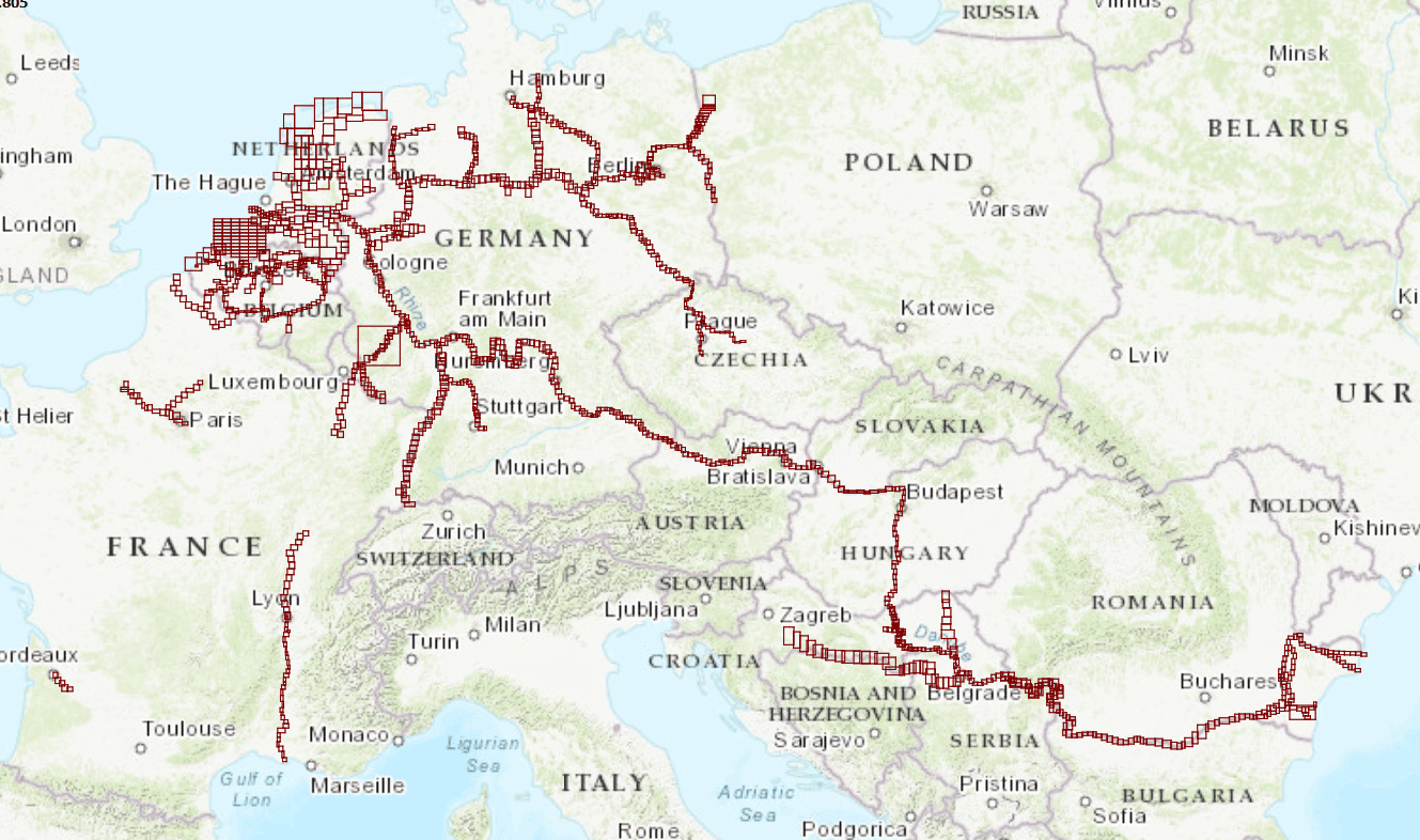
Download and install ENC charts The S57 charts can be downloaded free of charge from the website of the government authorities of the country concerned. For the European inland waterways you can look at www.vaarweginformatie.nl for an overview of all available Dutch ENC charts, with all links to the other available European ENC chart sets. For ENC chart sets of American and other international waters, look at the links below: |
Click on the image for an overview of the available ENC charts in Europe. |
You can find tips for installing ENC charts in WinGPS here.
Look into our status report for the latest update on the status of IENC map coverage and quality from participating European governments.
|
Automatic loading iENC When purchasing the professional navigation program WinGPS Inland you can subscribe to the Inland Update Service. This gives you access to our own iENC server with which you only have to tick the countries where you will be sailing in WinGPS Inland, after which the relevant iENC will be automatically downloaded and updated.
|
|


What are S57 charts and ENC charts?
Commercial navigation makes extensive use of Electronic Navigational Charts, also known as 'ENC'. An ENC shows all data that are important for navigation. The data can be viewed separately and in different layers.
The format in which ENC are supplied is: S57. This is the officially established exchange format for digital hydrographic data. ENC are officially equivalent to the paper nautical chart and you can use official ENC as the main navigation tool in an ECDIS type-approved system. There has to be a back-up as well.
Sometimes iENC are metioned. These are Inland Electronic Navigational Charts and are therefore focused on inland waterways. These charts are free to download and are made available by the government authorities of the country concerned.
(Source: www.defensie.nl)
Combine ENC charts with DKW charts
Create a chart image according to your wishes, using the S57 settings in WinGPS Inland. For example, you can combine DKW charts with the iENC for a more beautiful and clear chart view (see images below).
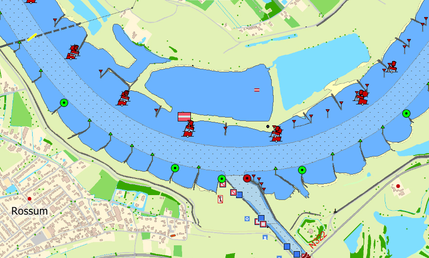
Image 1: DKW chart (underlay) with details of ENC charts projected over it.
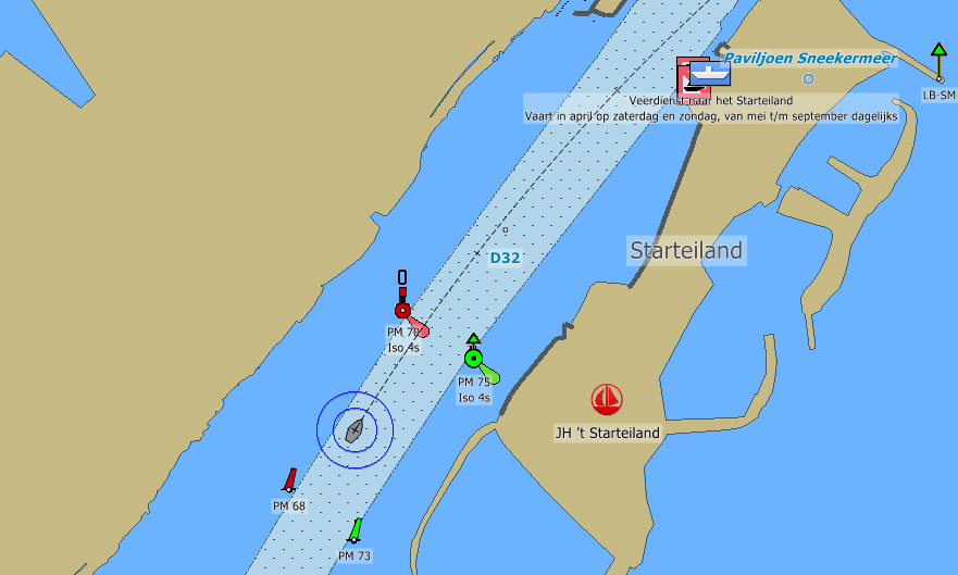
Image 2: ENC chart with waypoints from the DKW chart projected over it.


