


- Nieuws
- E-mail lijst
- Inschrijven voor onze nieuwsbrief
- Stentec nieuws
- Nieuws
- BaZ-Updates
- Ontwikkelaarsblog
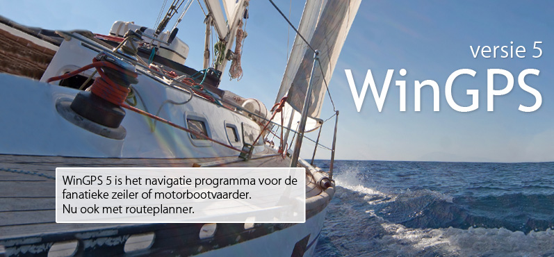
- WinGPS
- WinGPS-serie
- WinGPS-versies
- WinGPS specificaties
- Voor Windows
- WinGPS Lite
- WinGPS Navigator
- WinGPS Pro
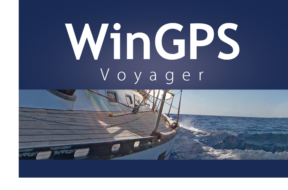
- WinGPS Voyager
- WinGPS Inland
- Voor Android
- WinGPS Marine
- WinGPS Marine Plus
- Voor iOS
- Apps voor iOS
- WinGPS Marine
- WinGPS Marine Plus
- DKW 1800-serie
- Vaarkaart Friese Meren
- Service en upgrades
- Service Abonnementen
- WinGPS Service Card
- WinGPS Yacht Navigator
- Kaarten
- Algemeen
- Kaartoverzicht
- DKW Binnenwater
- DKW Vaarkaart Nederland
- DKW Vaarkaart Friese meren
- DKW Vaarkaart Amsterdam
- DKW Vaarkaart Biesbosch
- DKW Vaarkaart België
- DKW Vaarkaart Noord-Frankrijk
- DKW Vaarkaart Zuid-Frankrijk
- DKW Vaarkaart Noordoost-Duitsland
- DKW Vaarkaart Noordwest-Duitsland
- DKW Vaarkaart Zuidwest-Duitsland
- DKW Vaarkaart Rijn en Moezel
- DKW Vaarkaart Donau 1-West
- DKW Vaarkaart Donau 2-Midden
- DKW Vaarkaart Donau 3-Oost
- DKW Kustwateren
- DKW 1800-serie
- DKW 1600+
- DKW UK1 Engelse & Schotse Oostkust
- DKW Duitse Bocht
- DKW Duitse Oostzeekust
- DKW Imray-serie
- DKW Delius Klasing-serie
- NV-Verlag-serie
- Speciaal voor Android
- Abonnement - DKW Vaarkaart Nederland
- Kaarten-apps
- Overig
- ADAC Marina Gids
- Hardware
- Randapparatuur
- Hardware-overzicht
- AIS advies
- Navigatie oplossingen
- Complete oplossingen (Windows)
- Simulators
- Shop
- Downloads
- Ondersteuning
- Beroepsvaart

Koppel uw boord-GPS Gebruik een Bluetooth- of wifi-verbinding om uw tablet of smartphone te koppelen aan uw boord-GPS. Door uw boord-GPS te gebruiken gebruikt u minder batterij en heeft u een meer accurate positiebepaling. Als u geen draadloze boord-GPS heeft, kunt u ook prima de interne GPS van uw tablet of smartphone gebruiken. |
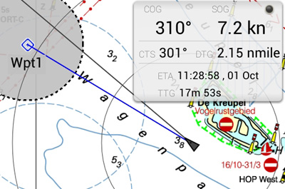
Waypoint navigatie Met een druk op de kaart plaatst u eenvoudig een waypoint en krijgt u direct een CTS (course to Steer) en DTG (distance to go). Deze zelf gemaakte waypoints kunt u bewerken en verwijderen, maar u kunt ook de waypoints uit de meegeleverde waypointdatabase gebruiken voor navigatie. |
Digitale kaarten
Alle DKW-kaarten van 2014 of nieuwer kunnen worden gebruikt in WinGPS Marine. Deze kaarten kunnen worden geïnstalleerd op meerdere systemen met 1 licentiecode, gebruik makende van uw Stentec-account. Bijvoorbeeld op uw laptop, tablet en smartphone. De app controleert tijdens het opstarten automatisch of er nog updates beschikbaar zijn voor uw geïnstalleerde kaarten.
WinGPS Marine gebruikt ESRI-kaarten als er geen DKW-kaarten zijn geïnstalleerd op het apparaat. Dit is een gratis kaartenoverlay die alleen kan worden gebruikt indien er een werkende internetverbinding is. ESRI-kaarten zijn niet geschikt voor navigatie, maar kan wel worden gebruikt voor een eerste routeplanning.
Het is ook mogelijk om de gratis digitale kaarten van de NOAA in WinGPS Marine Lite te gebruiken. Deze kaarten zijn van de Amerikaanse overheid en worden gratis ter beschikking gesteld op de website van de NOAA. Klik hier voor installatiehulp.
|
Systeemeisen: |
|
|
WinGPS Service Card
De WinGPS Service Card is een kaart die Stentec elk jaar uitbracht en was exclusief beschikbaar voor WinGPS 5-licentiehouders. Door deze kaart aan te schaffen had u recht op alle updates van WinGPS 5 van het jaar van de Service Card. Denk hierbij aan toevoegingen & verbeteringen aan het routenetwerk, bruggen & sluizen en nieuwe functies in WinGPS 5. Daarbij kon u gebruik maken van mooie kortingen en voordelen.
Wilt u ook in 2024 de nieuwe versie (incl. bijbehorende updates) van uw WinGPS 5/6 ontvangen? Dan kunt u kiezen voor het nieuwe Premium Abonnement.

De WinGPS Service Card 2022 was beschikbaar tot en met 20 maart 2022.
Heeft u de Service Card 2022? Dan heeft u in december 2022 gratis de upgrade naar WinGPS 6 - 2022 ontvangen. Om uw WinGPS 6 ook in 2024 up-to-date te houden en gebruik te maken van de nieuwste functionaliteiten, raden wij u het Premium Abonnement aan.

|
|
WinGPS Lite
WinGPS Lite is de gratis versie van de WinGPS serie voor uw Windows PC.
U kunt WinGPS Lite gebruiken om kennis te maken met digitale navigatiesofware voor op het water. In combinatie met bijvoorbeeld de DKW1800 serie waterkaarten of de DKW Vaarkaart Nederland kunt u ervaren hoe betrouwbaar en veilig WinGPS werkt.
Sluit een GPS ontvanger aan op uw laptop en u kunt:
- uw positie bepalen
- uw koers zien
- uw snelheid zien
- uw traject bijhouden
Voor Windows en Android De gratis versies van Stentec's navigatiesoftware WinGPS Lite is ontwikkeld voor uw Windows Laptop. Ook is er van de Android versie een gratis lite versie beschikbaar, deze heet WinGPS Marine Lite en is te downloaden via Google Play. |
Wilt u meer functionaliteit? Dan is de WinGPS-Serie iets voor u. Hiermee kunt u bijvoorbeeld routes uitzetten, GRIB-files downloaden voor weersverwachting, boordinstrumenten zoals AIS aansluiten en nog veel meer! |
Digitale waterkaarten
Alle DKW Waterkaarten van Stentec kunt u installeren in deze gratis versie van WinGPS.
|
|
|
Systeemeisen: |
| Functions in WinGPS 5 | Lite | Navigator | Pro | Voyager | |
| Chart Handeling | |||||
| Chart support for DKW1 & 2, ANWB & NV Digital | |||||
| Chart Viewers | 1 | 2 | 3 | 3 | |
| Chart Manager | |||||
| Make your own chart collection | |||||
| Input & Output | |||||
| Input : GPS | |||||
| Input : Compass, Wind, Depth, Log, AIS | |||||
| Output : Auto Pilot, GPS/Compass repeater | |||||
| Tracking & Cursor | |||||
| ChartUp, NorthUp, CourseUp, LegUp, HeadUp, Polar | Only ChartUp & NorthUp |
Only ChartUp & NorthUp |
|||
| Cursor position main screen | Central | Manual | Automatic or Manual |
Automatic or Manual |
|
| Cursor position detail screen | Automatic | Automatic or Manual |
Automatic or Manual |
||
| Shipcursor, Own ship on scale | |||||
| AIS targets on scale, Drift angle, Range rings | |||||
| GPS Information | |||||
| COG, SOG, Track,Pos (WGS-84) | |||||
| Adjustable GPS-filter | |||||
| Speed Vectors | |||||
| Ground speed, True & Relative wind speed | |||||
| Stream vector, Wind over water, AIS boats | |||||
| Navigation Options | |||||
| Track manager, HR screen print | |||||
| Route/WP managers, WP group/types | |||||
| XTE-bar, CTS, DTG | |||||
| Route list, Night screen, Track info | |||||
| Anchor watch, Export HTML logbook | |||||
| Distance measurement, Bearing line | |||||
| Time slider | |||||
| Interactive weather and tidal routing | |||||
| AIS and (M)ARPA | |||||
| AIS, colour per type | |||||
| AIS-XT (Extrapolated AIS) | |||||
| AIS Text messages | |||||
| AIS targets on scale | |||||
| AIS Forward track prediction | |||||
| Weather & Tides | |||||
| Manual wind vector | |||||
| Grib files GribUS (wind, isobars, rain) | |||||
| NOAA and BSH Grib files | |||||
| NHO (11*13km) Grib files | |||||
| Grib coupled wind vector | |||||
| Grib coupled stream vector | |||||
| Race and advanced touring options | |||||
| Lay lines (manual control) | |||||
| Wind depending cruisingspeed and full consumption | |||||
| Interactive route optimization with stream | |||||
| Polar diagram plus edit mode | |||||
| Lay lines (controlled by polar diagram) | |||||
| Interactive route optimization | |||||
| Passage time calculation (ETA) | |||||
| Track plotting | |||||
| Multiple tracks | |||||
| GPS Filter | |||||
| Adjustable GPS Filter | |||||
| Time points and labels, Multi ship track replay | |||||
| Coloured tracks for replay boats | |||||
| Predicted track Own Ship & AIS targets | |||||
| Alarms | |||||
| Lost GPS Signal | |||||
| WP (WayPoints), XTE, Anchor watch | |||||
| CPA (AIS), Depth | |||||
| Up/download to GPS | |||||
| Download tracks from most Garmin's incl. USB | |||||
| Up/download Routes, WP, tracks to Garmin & Furuno, Magellan, MLR, NMEA and Valsat | |||||
| Database options | |||||
| Notifications, ANWB wateralmanac support, GPX routes | |||||
| WayPoint/Route database | |||||
| Import/Export Binary | |||||
| Text lists,Backup/Restore | |||||
| Route Planner (the Netherlands) | |||||
| Fastest or shortest route | |||||
| Fixed cruising speed (low, middle, high). | |||||
| Variable cruising speed | |||||
| Sailing areas: inland, open sea, Wadden, Ijsselmeer | |||||
| Fixed height of ship | |||||
| Stepped and unstepped mast | |||||
| Lower mast at bridge (lowering & raising time) | |||||
| Choise current speed for waterways (low, middle, high) | |||||
| Routes | |||||
| Rhumb line route (constant course) | |||||
| Great circle route | |||||
| Automatic route optimalisation open water | |||||
| Sailing modes | |||||
| Sailing on motor | |||||
| Sailing on sails | |||||
| Engine on at low VMG (velocity made good) | |||||
| Don't tack in waterways | |||||
| Prices | |||||
| Prices Download | Free | € 129,- | € 279,- | € 379,- | |
| Prices CD version | Free | € 149,- | € 299,- | € 399,- |
|
| Functies in WinGPS 5 | Lite | Navigator | Pro | Voyager | |
| GPS Volgen | |||||
| Kaartvensters | 1 | 2 | 3 | 3 | |
| Routeplanner | |||||
| Vooruit in de tijd kijken | |||||
| Weer (Grib) | |||||
| Stroming & Getij (NL Tides, Rijkswaterstaat) | |||||
| NMEA Instrumenten zoals : AIS, Dieptemeter,Autopilot, etc. | |||||
| Interactief routes plannen met Polair | |||||
| WinGPS | |||||
| Functies gespecialiseerd voor motorboten | |||||
| Functies gespecialiseerd voor zeilboten | |||||
| Prijzen | |||||
| Prijs Download | Gratis | € 129,- | € 279,- | € 379,- | |

Stentec's nieuwe WinGPS 4 Mobile Navigator is speciaal ontwikkeld voor GPS-navigatie met uw PocketPC of mobiele telefoon met Mobile 5 of 6. Door de grote knoppen is WinGPS 4 Mobile Navigator aan boord ook met een vinger te bedienen.
- WinGPS 4 Mobile Start-Up sheet
- WinGPS 4 Mobile Nederlandse handleiding
| Koop dit Product Naar de shop |  |
Specificaties WinGPS 4 Mobile Navigator

- Geschikt voor alle kaarten voor WinGPS 4, zoals DKW1800, ANWB, Navkom en van DKW1 naar DKW2 omzgezette kaarten. Tevens met DWK Builder gemaakte kaartensets. Ook de meest gangbare BSB4 kaarten worden vanaf versie 4.1 ondersteund.
- Alle kaarten sluiten naadloos op elkaar aan als één grote kaart. Ideaal bij routes uitzetten op meerdere kaarten. U hoeft geen kaartnamen meer te onthouden, maar slechts te zoomen en schuiven. Meerdere kaartensets tegelijkertijd gebruiken.
- Positie en gevaren traject plotten, wanneer een NMEA-0183 compatible GPS is aangesloten Positie pijl met koerslijn.
- Grondkoers (COG), grondsnelheid (SOG) en WGS84 coördinaten Kaartrotatie: Chart Up, North Up, Leg Up (langs routelijn) en Course Up Automatische centrering, voor zoveel mogelijk kaart voor u.
- Uitzetten van een route met waypoints en langsvaren met XTE indicator Optioneel: schaal indicator en Noordpijl Installatie, verwijderen en bijwerken (alleen DKW1800) van kaarten met DKW Manager.
|
WinGPS Voyager Stentecs top navigatieprogramma helpt u bij het plannen van de optimale route en biedt hiermee extra veiligheid bij lange reizen en voordeel bij wedstrijden. Voyager toont de snelste, kortste, zuinigste of voordeligste route, zowel op de motor als onder zeil.
|
|
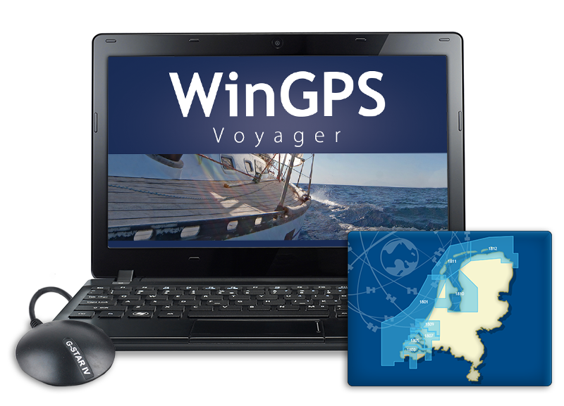
GPS-navigatie op uw laptop WinGPS Voyager is een interactieve routeplanner die u op uw Windows-laptop kunt installeren. Door uw boordinstrumenten te koppelen, verandert uw laptop in een volledig navigatiesysteem. Koppel een tweede monitor (bijvoorbeeld een waterdicht touchscreen) aan uw laptop of installeer de kaarten op een Android-tablet, zodat u ook buiten uw route kunt bekijken en indien nodig aanpassen als de situatie is gewijzigd. |
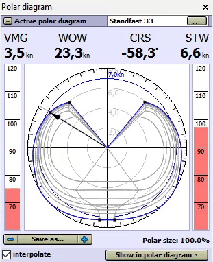
Polair diagram De grootste meerwaarde van WinGPS Voyager t.o.v. Pro is de routeoptimalisatie dankzij het gebruik van een polair diagram tijdens het routeplannen. In een polair diagram is de snelheid van een zeilschip bij verschillende windsnelheden en koersen vastgelegd en is dus voor elk schip uniek. Naast de afmetingen van uw schip kunt u in WinGPS Voyager het polair diagram van het zeilschip selecteren uit de ruim 3000 meegeleverde polair diagrammen. Staat uw schip er niet tussen? Dan kunt u zelf een polair diagram opnemen met Voyager en aangesloten windmeter, of een reeds bestaand polair diagram aanpassen naar de gewenste data. Tijdens het varen kunt u zien of u de optimale koers vaart en de maximale snelheid uit uw schip haalt. WinGPS Voyager bevat polaire diagrammen van ruim 3000 verschillende boottypen waaronder: Baltic, Bavaria, Beneteau, Breehorn, Contest, Dehler, Dufour, Elan, Etap, F&F, Feeling, First, Friendship, Gib’Sea, Grand Soleil, Halberg Rassy, Hanse, Hunter, J22-92, Jeanneau, Kolibri, Koopmans, Maxi, Nicholson, Oceanis, Optima, Solana, Sigma, Spirit, Standfort, Sunfast, Sun Odyssey, Swan, Sweden, Trintella, v.d. Stadt, Victoire, Waarschip, Winner en X-yacht. Klik hier voor een volledige lijst met beschikbare polair diagrammen. |
|
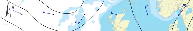
GRIB-files Download GRIB-files voor de weersvoorspelling van uw vaargebied voor de komende 16 dagen als goede voorbereiding voor uw reis of wedstrijd. Voyager kan u helpen de optimale route te plannen, rekeninghoudend met de wind. Kijk met de tijdschijf vooruit in de tijd om te zien hoe het weer zich zal ontwikkelen.
|
|
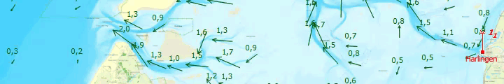
Stroming, getijden, waterstanden en golven In sommige vaargebieden, zoals de Waddenzee, is het water behoorlijk veranderlijk. Met de jaarlijkse stromings- en getijdengegevens van de NLTides, uitgegeven door de Dienst der Hydrografie, kan er voor de Nederlandse kustwateren vooruit worden gekeken in het kalenderjaar om te bepalen wanneer een overtocht het beste kan worden gepland. Download enkele dagen voorafgaand aan de reis de zeer gedetailleerde stromingsinformatie, waterstanden en diepte-informatie van het Kustfijn-model. Dit model is gebaseerd op data van Rijkswaterstaat, waarin actuele invloeden worden meegenomen, zoals de windopstuwing. Gaat de reis naar de Duitse Bocht, Oostzee, Noordzee of het Kanaal, dan is het mogelijk om GRIB-files te downloaden voor actuele stromingsdata. Deze data is afkomstig van de BSH, de Duitse Dienst der Hydrografie, en geven informatie voor de komende 2 à 3 dagen. Soms kan een combinatie van wind en stroming vervelende hoge golven geven. Deze ontwijkt u waarschijnlijk liever, dan dat u er door verrast wordt. Door de GRIB-files met golfvoorspelling van de NOAA te downloaden in Voyager, en in te stellen wat uw maximale golfhoogte is, ziet u meteen wanneer u beter een gebied kunt vermijden. Volg deze link voor een voorbeeld. Alle hierboven genoemde data kan automatisch worden meegenomen tijdens het routeplannen, samen met de wind en het polaire diagram. Voor de binnenwateren zijn er NAP-meetstations toegevoegd aan WinGPS. Deze geven de actuele waterstanden van de Nederlandse binnenwateren, afkomstig van Rijkswaterstaat. Zodra de scheepvaartberichten worden bijgewerkt, worden ook de NAP-waterstanden bijgewerkt.
|
|
Routeoptimalisatie Nadat u het polair diagram heeft ingesteld en de laatste GRIB-files voor weersvoorspelling heeft gedownload, kunt u beginnen met het plannen van de meest optimale route. U hoeft alleen de routepunten in te geven en WinGPS Voyager geeft u advies, rekeninghoudend met de wind en de eigenschappen van uw schip. De aankomsttijd en passagetijden langs routepunten worden direct getoond waardoor u direct kunt zien of uw route veilig bevaarbaar is. Door de tijdsbalk te verslepen ziet u direct over de kaart wat er gaat gebeuren. Ideaal voor bijvoorbeeld de Wadden of de oversteek naar Engeland.
|
Staandemastroute Staat er een te harde wind om buitenom te varen? Dan zet u eenvoudig en snel een route uit over de staandemastroute en kunt u meteen zien hoe lang uw reis duurt met alle bruggen- en sluizeninformatie. |
Veilig navigeren met AIS Als u een AIS-apparaat heeft kunt u dit aansluiten op WinGPS Voyager. Hierdoor ziet u de AIS-objecten op de kaart, incl. naam, MMSI-nummer, callsign, afmetingen, bestemming, vracht en uiteraard de positie, snelheid en koers van het schip. Geef aan wat uw CPA is en Voyager geeft u een alarm wanneer een schip op ramkoers ligt. Omdat u dit AIS-object ziet oplichten kunt u direct met het callsign het schip oproepen en afstemmen wat de koersplannen zijn. Zowel voor eigen schip als voor AIS-schepen kan het vooruit voorspelde traject op de kaart worden weergegeven. AIS-XT, oftewel AIS-extrapolatietechnologie, zorgt voor een vloeiende beweging van AIS-schepen op uw scherm. Handig voor het beoordelen van een verkeerssituatie en bij het maken van een bocht. Met de tijdschuif kan de baan alvast worden langs gevaren en worden gekeken welke AIS-schepen worden gekruist. Bij inzoomen worden de AIS-schepen op schaal getoond evenals uw eigen schip. Ideaal voor als u op de rivieren vaart en u niet om een hoekje kunt kijken. Zo ziet u direct of dat AIS-object een klein pleziervaartuig is of een groot binnenvaartschip. |
|
Uw betrouwbare partner thuis en aan boord Een groot voordeel van WinGPS Voyager is de mogelijkheid het programma op twee systemen te installeren, waardoor u thuis op een groot scherm rustig uw route alvast kunt uitzetten en uw reis kunt voorbereiden. Met name bij langere of meer gecompliceerde routes, zoals over de Waddenzee, is dit ideaal. Kijk vooruit in de tijd met de tijdschuif en bepaal wanneer voor u het beste tijdstip is om te vertrekken, gebaseerd op stroming, getijden en wind. Het downloaden van de actuele waterstanden voor de Waddenzee of IJsselmeer, oftewel het Kustfijn-model, maakt het plannen van een overtocht nog gemakkelijker. Tijdens het varen houdt WinGPS Voyager een logboek bij met data van gekoppelde boordapparatuur, uw route en eventuele eigen ingaven. Uw gevaren traject kunt u later gedetailleerd analyseren. Bij thuiskomst kunt u uw gevaren trajecten en logboeken afdrukken, e-mailen of op uw website plaatsen. Leuk voor het thuisfront of voor de bemanning. In combinatie met WinGPS kunt u de digitale vaarkaarten van Stentec gebruiken, ook wel DKW-kaarten genoemd. Zorg dat deze up-to-date zijn als u begint met het routeplannen en print de routetabel en eventueel de bijgewerkte kaarten van belangrijke punten op de route uit. Zo bent u goed voorbereid voor uw reis! Ter info: WinGPS Voyager is voorbereid op afwijkingen in uw GPS door zonnevlammen. Door verhoogde zonneactiviteit zullen er steeds vaker zonnevlammen plaatsvinden die enorme storingen in GPS kunnen veroorzaken. WinGPS Voyager is hier op afgesteld en zal uw positie veilig doorgeven.
Als u er zeker van wilt zijn dat WinGPS draait op uw systeem, kunt u eerst onze gratis WinGPS Lite installeren. Werkt deze versie probleemloos op uw systeem, dan werken WinGPS Navigator, Pro en Voyager ook. U kunt WinGPS Lite downloaden via deze link. |
|
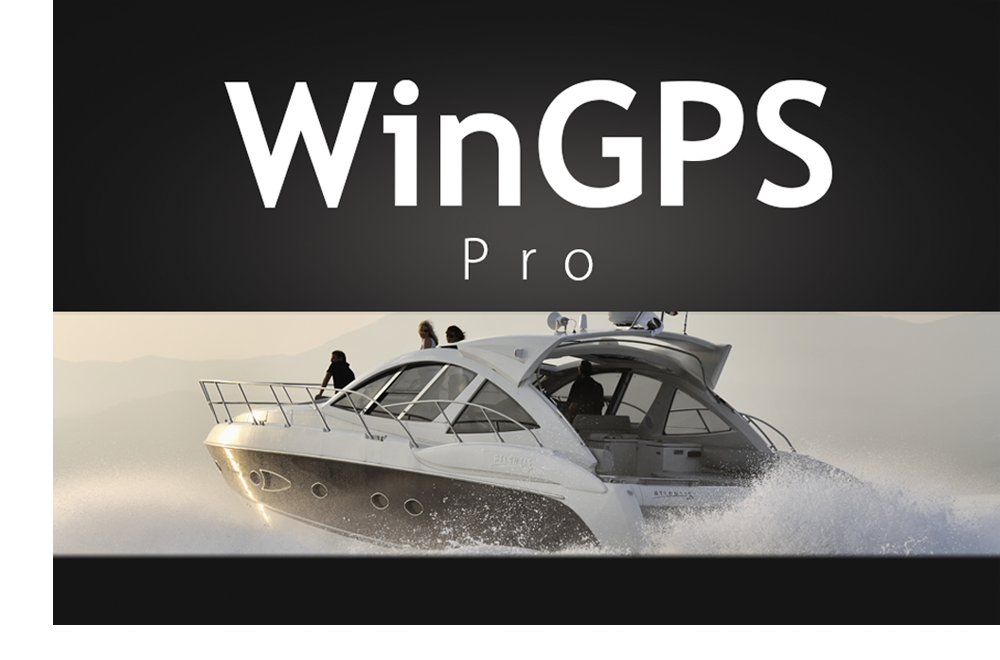
WinGPS Pro Wilt u naast navigeren en routeplannen ook uw boordinstrumenten aansluiten en/of op getijdenwater varen? Dan is WinGPS Pro voor u het professionele navigatieprogramma voor open water en binnenwateren.
|
|

GPS-navigatie op uw laptop WinGPS Pro is een interactieve routeplanner die u op uw Windows-laptop kunt installeren. Door uw boordinstrumenten te koppelen, verandert uw laptop in een volledig navigatiesysteem. Koppel een tweede monitor (bijvoorbeeld een waterdicht touchscreen) aan uw laptop of installeer de kaarten op een Android-tablet, zodat u ook buiten uw route kunt bekijken en indien nodig aanpassen als de situatie is gewijzigd. |
Meerdaagse route met scheepvaartberichten Routes op de binnenwateren kunnen in WinGPS Pro ook voor meerdere dagen eenvoudig worden gepland; u ziet direct waar u op de gewenste ‘rusttijden’ bent, waardoor u van te voren een geschikte haven kunt vinden en inplannen. Download de actuele scheepvaartberichten om vervelende stremmingen tijdens uw tocht te voorkomen. |
Kaartvensters en roterende kaart Tijdens het varen van de route kunt u meerdere kaartvensters openen. Dit kan bijvoorbeeld een kaartvenster zijn waarop u uw schip head-up ziet varen en de kaart met u meeloopt en -draait, met daarnaast een tweede kaartvenster waarin u de aanloop van de haven alvast kunt bekijken. |
|
Veilig navigeren met AIS Als u een AIS-apparaat heeft, dan kunt u deze aansluiten op WinGPS Pro. Hierdoor ziet u de AIS-objecten op de kaart, incl. naam, MMSI-nummer, callsign, afmetingen, bestemming, vracht en uiteraard de positie, snelheid en koers van het schip. Geef aan wat uw CPA is en WinGPS Pro geeft u een alarm wanneer een schip op ramkoers ligt. Omdat u dit AIS-object ziet oplichten kunt u direct met het callsign het schip oproepen en afstemmen wat de koersplannen zijn. Zowel voor eigen schip als voor AIS-schepen kan het vooruit voorspelde traject op de kaart worden weergegeven. AIS-XT, oftewel AIS-extrapolatietechnologie, zorgt voor een vloeiende beweging van AIS-schepen op uw scherm. Handig voor het beoordelen van een verkeerssituatie en bij het maken van een bocht. Met de tijdbalk kan de baan alvast worden langs gevaren en worden gekeken welke AIS-schepen worden gekruist. Bij inzoomen worden de AIS-schepen op schaal getoond evenals uw eigen schip. Ideaal voor als u op de rivieren vaart en u niet om een hoekje kunt kijken. Zo ziet u direct of dat AIS-object een klein pleziervaartuig is of een groot binnenvaartschip. |
GRIB-files
Download GRIB-files voor de weersvoorspelling van uw vaargebied voor de komende 7 dagen als goede voorbereiding voor uw reis of wedstrijd. Kijk met de tijdbalk vooruit in de tijd om te zien hoe het weer zich zal ontwikkelen.
Stroming, getijden en waterstanden
In sommige vaargebieden, zoals de Waddenzee, is het water behoorlijk veranderlijk. Met de jaarlijkse stromings- en getijdengegevens van de NLTides, uitgegeven door de Dienst der Hydrografie, kan er voor de Nederlandse kustwateren vooruit worden gekeken in het kalenderjaar om te bepalen wanneer een overtocht het beste kan worden gepland.
Download enkele dagen voorafgaand aan de reis de zeer gedetailleerde stromingsinformatie, waterstanden en diepte-informatie van het Kustfijn-model. Dit model is gebaseerd op data van Rijkswaterstaat, waarin actuele invloeden worden meegenomen, zoals de windopstuwing.
Gaat de reis naar de Duitse Bocht, Oostzee, Noordzee of het Kanaal, dan is het mogelijk om GRIB-files te downloaden voor actuele stromingsdata. Deze data is afkomstig van de BSH, de Duitse Dienst der Hydrografie, en geven informatie voor de komende 2 à 3 dagen.
Alle hierboven genoemde data kan automatisch worden meegenomen tijdens het routeplannen. Voer de diepgang van uw schip in, download de laatste waterstanden en zet de route uit; WinGPS Pro geeft direct aan waar u genoeg water onder de kiel heeft en waar u kunt droogvallen.
Voor de binnenwateren zijn er NAP-meetstations toegevoegd aan WinGPS. Deze geven de actuele waterstanden van de Nederlandse binnenwateren, afkomstig van Rijkswaterstaat. Zodra de scheepvaartberichten worden bijgewerkt, worden ook de NAP-waterstanden bijgewerkt.
|
Uw betrouwbare partner thuis en aan boord Een groot voordeel van WinGPS Pro is de mogelijkheid het programma op twee systemen te installeren, waardoor u thuis op een groot scherm rustig uw route alvast kunt uitzetten en uw reis kunt voorbereiden. Met name bij langere of meer gecompliceerde routes, zoals over de Waddenzee, is dit ideaal. Kijk vooruit in de tijd met de tijdbalk en bepaal wanneer voor u het beste tijdstip is om te vertrekken, gebaseerd op stroming, getijden en wind. Het downloaden van de actuele waterstanden voor de Waddenzee of IJsselmeer, oftewel het Kustfijn-model, maakt het plannen van een overtocht nog gemakkelijker. Tijdens het varen houdt WinGPS Pro een logboek bij met data van gekoppelde boordapparatuur, uw route en eventuele eigen ingaven. Uw gevaren traject kunt u later gedetailleerd analyseren. Bij thuiskomst kunt u uw gevaren trajecten en logboeken afdrukken, e-mailen of op uw website plaatsen. Leuk voor het thuisfront of voor de bemanning. In combinatie met WinGPS kunt u de digitale vaarkaarten van Stentec gebruiken, ook wel DKW-kaarten genoemd. Zorg dat deze up-to-date zijn als u begint met het routeplannen en print de routetabel en eventueel de bijgewerkte kaarten van belangrijke punten op de route uit. Zo bent u goed voorbereid voor uw reis! Ter info: WinGPS Pro is voorbereid op afwijkingen in uw GPS door zonnevlammen. Door verhoogde zonneactiviteit zullen er steeds vaker zonnevlammen plaatsvinden die enorme storingen in GPS kunnen veroorzaken. WinGPS Pro is hier op afgesteld en zal uw positie veilig doorgeven.
Als u er zeker van wilt zijn dat WinGPS draait op uw systeem, kunt u eerst onze gratis WinGPS Lite installeren. Werkt deze versie probleemloos op uw systeem, dan werken WinGPS Navigator, Pro en Voyager ook. U kunt WinGPS Lite downloaden via deze link. |
|
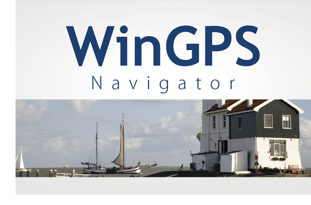
WinGPS Navigator WinGPS Navigator is een volledig en betaalbaar basis-navigatieprogramma voor zeilers en schippers op de binnenwateren.
|
|
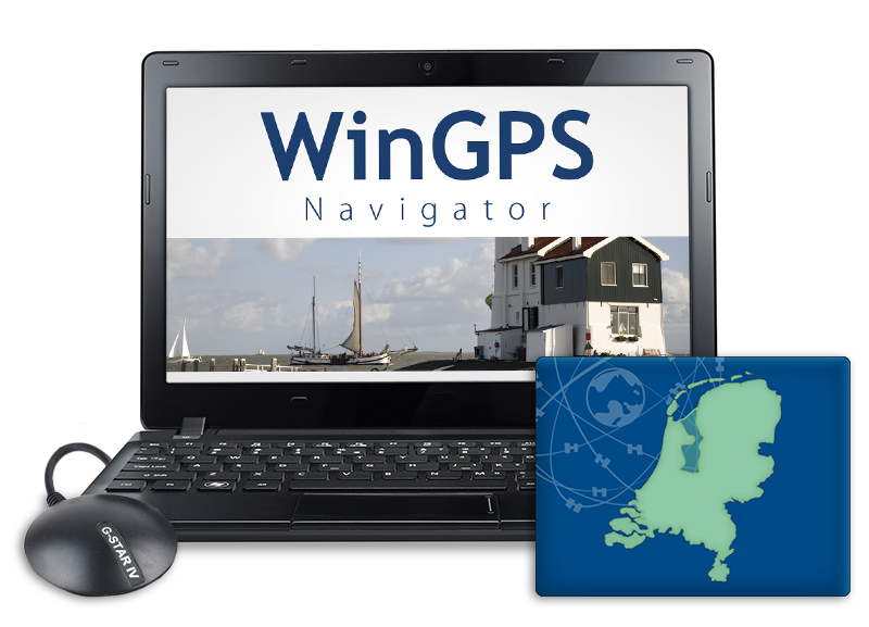
GPS-navigatie op uw laptop WinGPS Navigator is een interactieve routeplanner die u op uw Windows-laptop kunt installeren. Door uw GPS-ontvanger te koppelen, verandert uw laptop in een volledig navigatiesysteem. Koppel een tweede monitor (bijvoorbeeld een waterdicht touchscreen) aan uw laptop of installeer de kaarten op een Android-tablet, zodat u ook buiten uw route kunt bekijken en indien nodig aanpassen als de situatie is gewijzigd. |
|
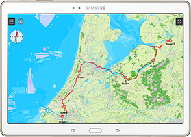
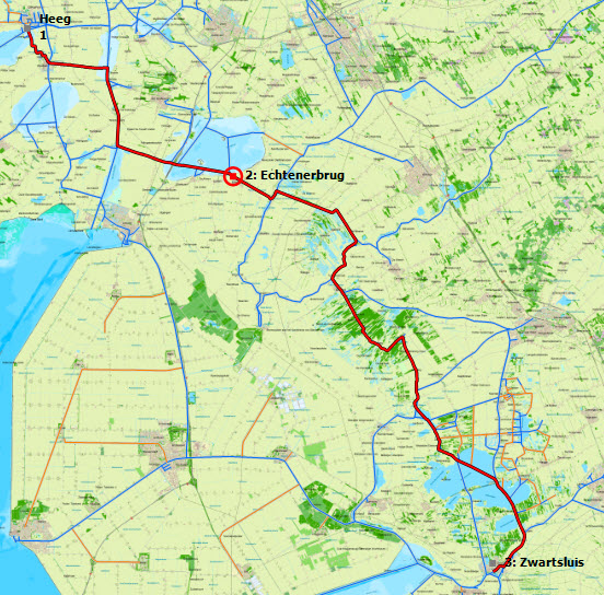
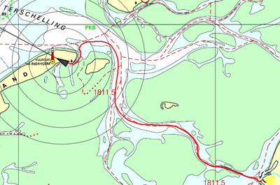
Routeplannen Plan gemakkelijk routes over het uitgebreide routenetwerk van Nederland, België, Duitsland, Frankrijk, de Oostzee en de Donau tot de Zwarte Zee. Voer éénmalig de afmetingen en snelheden van uw schip in en u bent klaar om routes uit te zetten. U geeft het beginpunt en de eindbestemming van uw reis op en de route zal automatisch voor u worden uitgezet. Hierbij wordt gekeken naar de vaarwegen en doorvaartopeningen & bedieningstijden van bruggen en sluizen. |
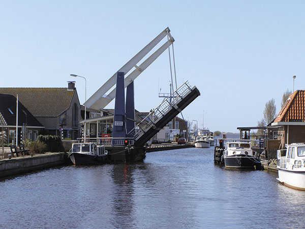
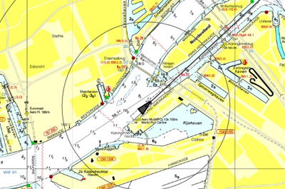
Routenetwerk, bruggen en sluizen Het routenetwerk in WinGPS Navigator wordt de maximale toegestane diepte, breedte, lengte en snelheid getoond en kunt u zien of het vaarwater bedoeld is voor beroepsvaart of pleziervaart. Op dit routenetwerk staan alle kunstwerken genoemd, oftewel alle bruggen, sluizen, hoogspanningsleidingen en aquaducten. Bij elk kunstwerk wordt aangegeven wat de doorvaartafmetingen zijn. Bij de bruggen en sluizen worden ook foto’s getoond plus alle andere nodige informatie. Zoals o.a. de kolklengte, drempeldieptes, en uiteraard het bijbehorende VHF-kanaal. |
Logboek en traject Tijdens het varen houdt WinGPS Navigator uw gevaren traject bij. Dit is een dunne rode lijn op de kaart, met de datum en eventueel ook tussenliggende tijden. Wanneer u zelf een logboek start, wordt ook deze automatisch bijgehouden tijdens het varen. In dit logboek kunt u zelf ook informatie toevoegen, zoals een foto van een walvis die u heeft zien zwemmen of een link naar dat ene lekkere restaurantje. Bij thuiskomst kunt u uw logboek, trajecten en routes gedetailleerd analyseren of afdrukken/e-mailen. Leuk voor het thuisfront of voor de bemanning. |
GRIB-files
Download GRIB-files voor de weersvoorspelling van uw vaargebied voor de komende 7 dagen als goede voorbereiding voor uw reis of wedstrijd. Kijk met de tijdbalk vooruit in de tijd om te zien hoe het weer zich zal ontwikkelen.
Uw betrouwbare partner thuis en aan boord
Een groot voordeel van WinGPS Navigator is de mogelijkheid het programma op twee systemen te installeren, waardoor u thuis op een groot scherm rustig uw route alvast kunt uitzetten en uw reis kunt voorbereiden. Het afdrukken van het routeoverzicht maakt het varen van een tocht nog gemakkelijker.
Tijdens het varen houdt WinGPS Navigator een logboek bij van uw route en eventuele eigen ingaven. Uw gevaren traject kunt u later gedetailleerd analyseren. Bij thuiskomst kunt u uw gevaren trajecten en logboeken afdrukken, e-mailen of op uw website plaatsen. Leuk voor het thuisfront of voor de bemanning.
In combinatie met WinGPS kunt u de digitale vaarkaarten van Stentec gebruiken, ook wel DKW-kaarten genoemd. Zorg dat deze up-to-date zijn als u begint met het routeplannen en print de routetabel en eventueel de bijgewerkte kaarten van belangrijke punten op de route uit. Zo bent u goed voorbereid voor uw reis!
Ter info: WinGPS Navigator is voorbereid op afwijkingen in uw GPS door zonnevlammen. Door verhoogde zonneactiviteit zullen er steeds vaker zonnevlammen plaatsvinden die enorme storingen in GPS kunnen veroorzaken. WinGPS Navigator is hier op afgesteld en zal uw positie veilig doorgeven.
|
Digitale waterkaarten
|
|
Systeemeisen: |
Programma wijzigingen: |
Als u er zeker van wilt zijn dat WinGPS draait op uw systeem, kunt u eerst onze gratis WinGPS Lite installeren. Werkt deze versie probleemloos op uw systeem, dan werken WinGPS Navigator, Pro en Voyager ook. U kunt WinGPS Lite downloaden via deze link.
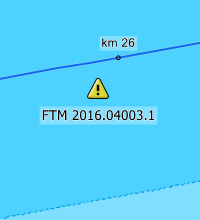
 De BaZ-update van deze week is beschikbaar voor gebruikers van WinGPS. Deze keer zijn er voor 11 kaarten updates beschikbaar van de DKW...
More inBaZ Update

Harinxmastrjitte 29
8621 BJ HEEG
T +31 (0) 515 443515


Copyright © Stentec Software. Alle rechten voorbehouden.
Door deze website te gebruiken, geeft u aan dat u akkoord gaat met onze gebruikersovereenkomst.
Lees hier onze privacyverklaring.