


 Now in addition to the award-winning navigation software "WinGPS 5" for Windows laptops, Stentec Navigation also developed a navigation solution for Android™ smartphones and tablets. This navigation solution for Android is named "WinGPS™ Marine".
The Android and Windows versions work great together, side by side. The license of the digital nautical charts that you already own also work on this Android system (2014 edition charts). The on-board equipment you have connected in WinGPS 5 can also be used in WinGPS Marine.
WinGPS Marine has different versions to choose from.
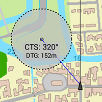
![]() WinGPS™ Marine Lite is our first navigation app for Android. In this app you can use digital nautical charts for navigation. Stentec's hybrid charts which include depth states, buoys, campsites, etc. can also be used in this app. In this app you can create a waypoint, and with CTS (course to steer) and DTG (distance to go) you can use this app to navigate to a waypoint.
WinGPS™ Marine Lite is our first navigation app for Android. In this app you can use digital nautical charts for navigation. Stentec's hybrid charts which include depth states, buoys, campsites, etc. can also be used in this app. In this app you can create a waypoint, and with CTS (course to steer) and DTG (distance to go) you can use this app to navigate to a waypoint.
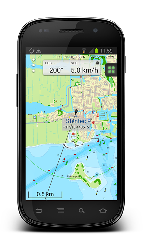
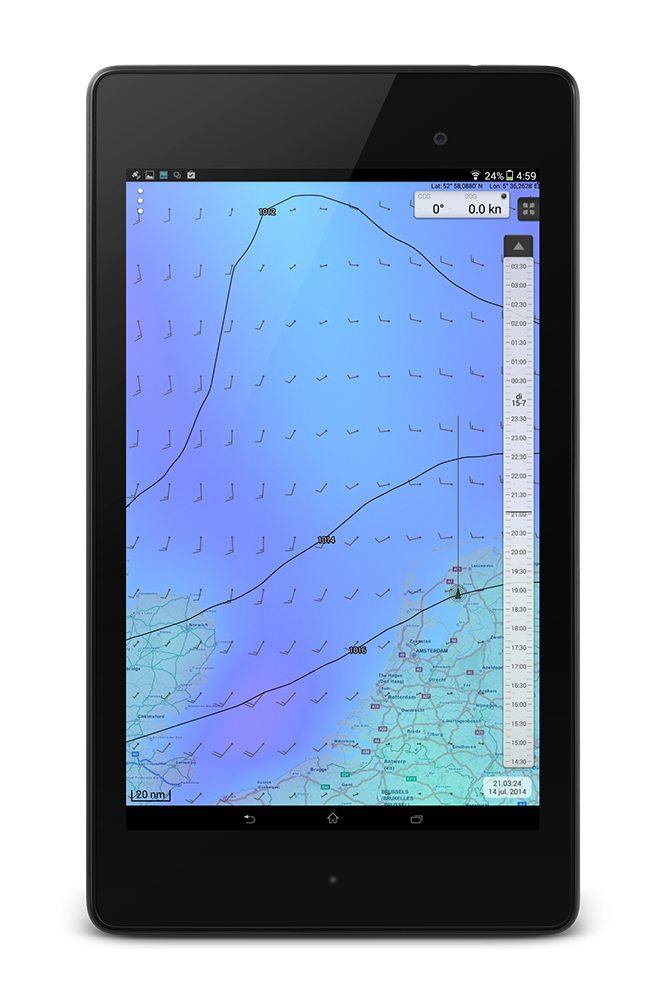
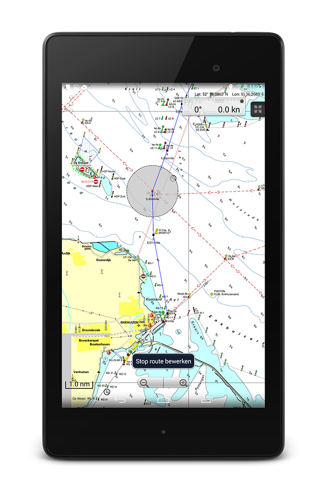
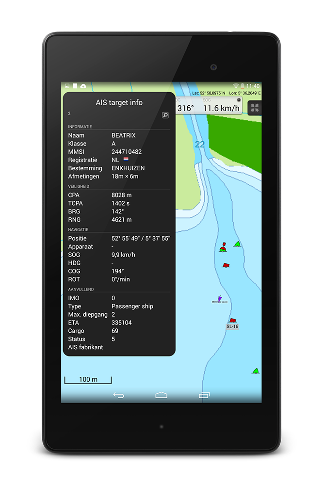
![]() WinGPS™ Marine is the navigation app that allows true marine navigation on your Android device. With this app you can create routes and edit them while on the move. The sailed tracks can be recorded and saved to review later. Your AIS receiver can communicate with this app using a wireless connection. With this you see all surrounding ships plotted on the chart, you can bring up the target list and see all AIS data of your targets. The built-in AIS collision alarm helps you in making important decisions. The wind, temperature and rainfall can be plotted on the chart view by downloading GRIB information in the app. By using the time bar you can see the prediction on your track.
WinGPS™ Marine is the navigation app that allows true marine navigation on your Android device. With this app you can create routes and edit them while on the move. The sailed tracks can be recorded and saved to review later. Your AIS receiver can communicate with this app using a wireless connection. With this you see all surrounding ships plotted on the chart, you can bring up the target list and see all AIS data of your targets. The built-in AIS collision alarm helps you in making important decisions. The wind, temperature and rainfall can be plotted on the chart view by downloading GRIB information in the app. By using the time bar you can see the prediction on your track.
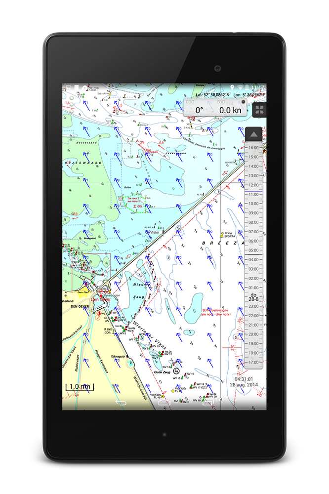
![]() WinGPS™ Marine Plus is the flagship app of this series. This advanced navigation app helps you to plan your route and is an excellent monitor for on board. Connect your board system using a wireless connection and read out your wind meter, compass, log and echosounder. Review all entered and incoming data in the data plotter and instrument monitor to optimize your route. In addition to meteo data you can also download tidal data to use for planning and adjusting your route in this app. Just like in WinGPS Marine you can use the timebar to see the future developments of the wind, rain, temperature, and also current plotted on the chart view.
WinGPS™ Marine Plus is the flagship app of this series. This advanced navigation app helps you to plan your route and is an excellent monitor for on board. Connect your board system using a wireless connection and read out your wind meter, compass, log and echosounder. Review all entered and incoming data in the data plotter and instrument monitor to optimize your route. In addition to meteo data you can also download tidal data to use for planning and adjusting your route in this app. Just like in WinGPS Marine you can use the timebar to see the future developments of the wind, rain, temperature, and also current plotted on the chart view.

www.wingpsmarine.com
Stentec Chart-apps are individual apps that can be used as paper chart replacement per area. This actually is the app "WinGPS Marine Lite", but with pre-integrated digital charts. You can use these apps on the go, because you don't have to install the digital nautical charts in these apps. The Chart-apps can be purchased in Google Play™ and after this you can also use these digital water charts in WinGPS Marine, and even in WinGPS 5 on your Windows computer.
Do you want to see which DKW charts are available for WinGPS Marine? Check out our online shop. The charts you purchase in our online shop can directly be downloaded and installed on your tablet or smartphone using the chart management in WinGPS Marine.


