


There is an update available for the chart set DKW1812. This update is based on the new 1812 2014 which was released this month. Users of DKW1800 series complete, north and the set DKW1812 can update this chart automatically using WinGPS 5 (Windows) or WinGPS Marine (Android).
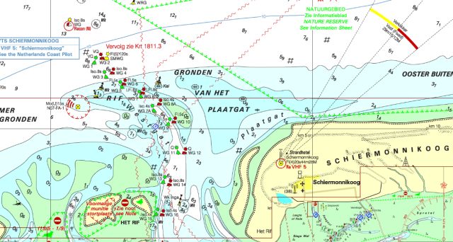
With this update the overview chart 1812.01 has a clearer overview because of the reduced detail on the chart. Also the protected nature (laid down by law last year) are now visible on the charts. In these zones there are restrictions regarding anchoring and fishing. The shipping channels have a up to date depth image and is now in sync with the bouyage at the ports "Nes" and the "Kromme Balg".
The update of the depth image has new measurements of these waterways: De Boontjes, Het Boschgat, Het Schuitegat, de Vaargeul langs de Pollendam, de Glinder en de Groote Siege.


