


| Release: DKW Danube 1-West & Northeast Germany |
Great news for motorboat- and inland sailors. Two new chartsets are released this week: DKW Danube 1-West & DKW Northeast Germany.
DKW Vaarkaart Danube 1-West
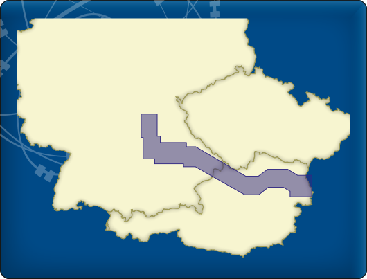
With the new DKW Vaarkaart Danube 1-West you will have a full coverage from Bamberg up until Hainburg an der Donau with this new clear and detailed waterchart.
The following waterways are included:
- Main-Danube canal
- Danube, with all navigatable side arms from Kelheim until just past Vienna (km 1873-2414)
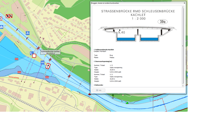
Included are 4.500 waypoints as chart information such as buoys, marinas, moorings, VHF channels, place names, ferries, shipping marks and petrol stations.
The new DKW Danube 1-West is developed for sailors and commercial shipping in western Europe. The chart connects to DKW Northeast Germany & DKW Southwest Germany. The rest of the Danube is scheduled in the course of 2016.
DKW Vaarkaart Northeast Germany
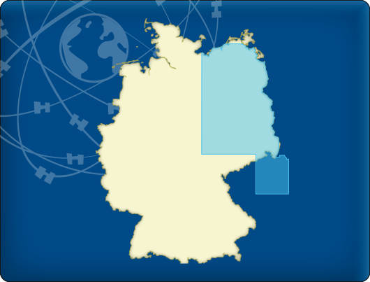
After Northwest and Southwest Germany, Northeast Germany is added to our collection. This chart has a big coverage area and contains a lot of clear and detailed charts stretching as far as a part of the Czech Republic.
The following waterways are included:
- The Elbe from Chvaletice in Czech Republic past Dömitz (km 550)
- The Moldau
- The Havel and adjacent waters
- The Oder and the Westoder from Eisenhüttenstadt (km 540) to the mouth of the Baltic sea
- The Müritz and adjacent waters
- The Spree and adjacent waters
- The Saale
- The Peene
Included are 13.428 waypoints as chart information such as buoys, marinas, moorings, VHF channels, place names, ferries, shipping marks and petrol stations.
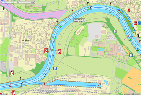
The base map is based on, where available, the official Inland ENC charts of the WSA (Wasser- und Schifffahrtsämter), and LAVDIS (Czech Republic) on a special, with ArcMap created, OpenStreetMap sublayer for an optimal chartview.
The new DKW Vaarkaart Northeast Germany is developed for sailors and commercial shipping in western Europe. The chart connects to DKW Northwest Germany, DKW Baltic coas & DKW Danube 1-West.
Stentec's DKW Vaarkaart charts have a hybrid format. This means the water charts consist of a detailed gridmap, with overlaying (vector) chart information in the form of waypoints. Updates are hereby quickly downloaded and installed easily. This way you will always have the latest charts available!


