


The DKW Vaarkaart Southern France is now available for WinGPS. This new chart may be ordered in our online shop on DVD-rom or as advantageous download.
DKW Vaarkaart Southern France may be used in both WinGPS 5 for your navigation laptop as well as WinGPS™ Marine on your Android™ tablet and/or smartphone.
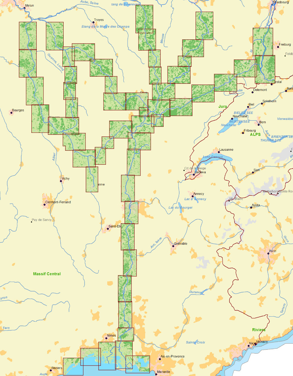
DKW Vaarkaart Southern France covers the inland waters in the Southern part of France and connects seamlessly to our DKW Vaarkaart Northern France.
The route network in WinGPS 5 will receive an extra update in July (this update is now available for download at the news center). This update will improve and expand the network in the area towards Sète.The scale of the detail charts is 2m per pixel (or 1:7,500 on the screen). This is enough to see buildings along the waterway and show the AIS ships plotted on scale on the chartview. An overview of all the charts in the set can be found here.
Vaarkaart Southern France is available in our online shop. The download version of 1.1 GB costs € 99,90, on DVD it costs € 119,90.
WinGPS 5 Pro is recommended for a visit to France with your motorboat or barge. The rotating chartview and AIS functionality provide you easy navigation and a safe trip. WinGPS 5 also contains the dimensions and operating times of all locks and bridges in the area. Route planning with WinGPS 5 Pro is easy and fast. Read more..


