|
Just before the start of the holiday season there have been several updates for the popular chart series DKW German Bight and DKW German Baltic coast. When you are planning on sailing to these waters you can purchase these charts right away and are able to use the most recent data for these charts.
When you have a 2015 edition for these sets you can purchase a upgrade for the 2016 editions for a reduced price via: Upgrade DKW German Bight 2016 and Upgrade DKW German Baltic coast 2016.
Update
If you already have a 2016 version of these sets installed you can easily update them via the News center. Opening the News center in WinGPS is possible via 'Help - Open news center'. You can also install the updates via the DKW Manager by choosing 'Install/Update'.
|
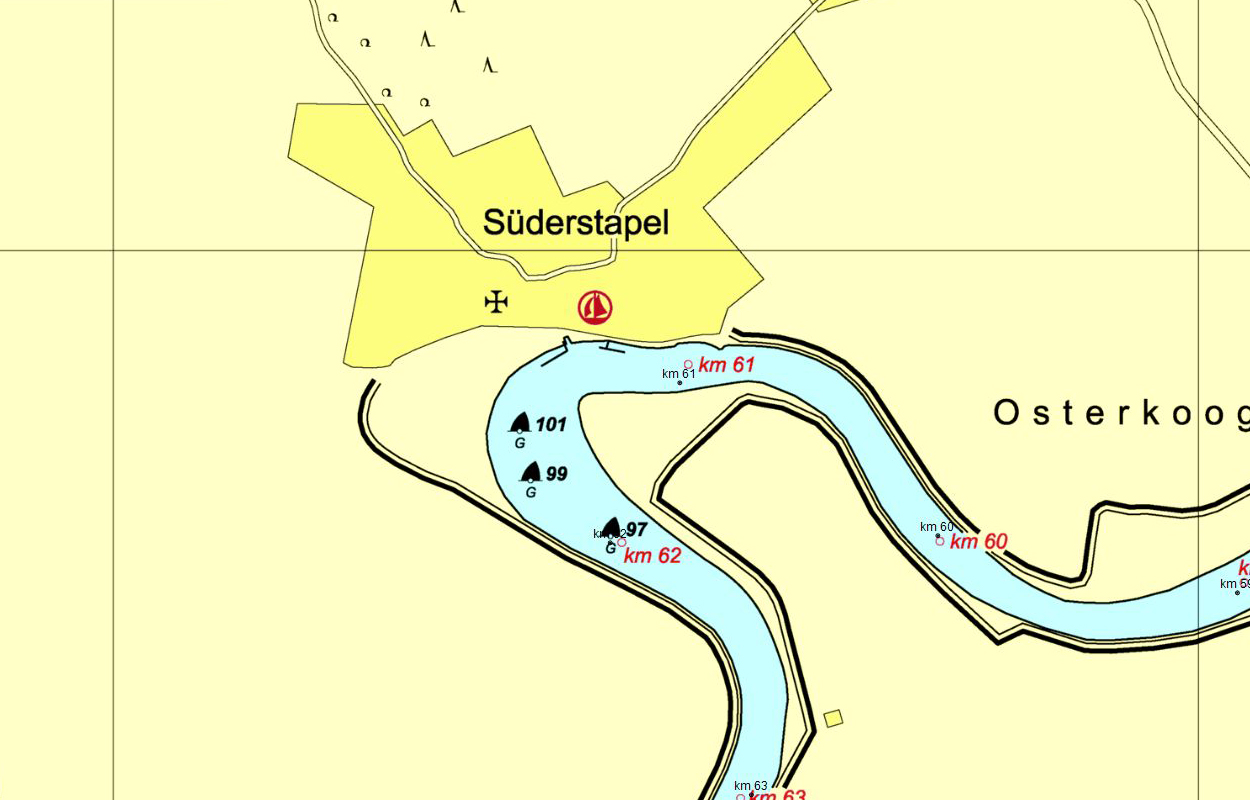
DKW German Bight
There were a lot of updates for these charts, including:
- The Eider in Northwest Germany has been divided into two charts. This allows for extra zooming and a better chart image.
- Depths and buoying have been actualized on several parts of the charts.
Click on an illustration for a larger view
|
|
|
DKW German Baltic coast
There were a lot of updates for these charts, including:
- The chart grouping has been changed, allowing for a smaller amount of charts covering the same area.
- A few bothersome objects have been mapped at the Kieler Förde.
- Depth numbers and buoying have been actualized on several parts of the charts.
|
|
|