|
To make the best and safest start as possible this summer, we released an update for WinGPS 5 for Windows. In this summer update for WinGPS 2017 the waterway network and bridges & locks database have been revised with the latest data. Also, several functions have been either optimized or added.
When you have a WinGPS Service Card 2017 or a license for WinGPS 5 2017, you will receive the update immediately, and can download and install the update from the news center. When the news center does not open automatically when WinGPS is started, click on 'help - open news center'.
WinGPS 5 Navigator
For WinGPS 5 Navigator the following is updated:
- For the item 'Updated' in the chart manager and the chart status the dates will be shown for all different chart sets (See the image below). Formerly this was only visible for the DKW 1800 series.
- Because of a software bug sometimes the standard route settings wouldn't be saved correctly after changes were made, this has been solved.

WinGPS 5 Pro
For WinGPS 5 Pro the following is updated, in combination with the above list:
- The Smart labeling function has been expanded further with the addition of the labels for routes and shipping notifications. This results in an even clearer chart image (See the image below).
- When multiple shipping notifications were stacked upon one another, only the top message would be shown when clicked upon. When one of these messages will now be clicked on, all messages from all underlying notifications will be shown.
- The data for the GRIB source 'Weerdata KNMI stations per 10 minuten' had been changed by the KNMI, which made it impossible to load the data within WinGPS. This has been solved.
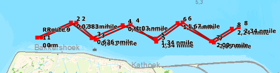
Example with Smart Labeling disabled.
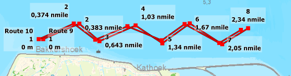
Example with Smart Labeling enabled.
WinGPS 5 Voyager
For WinGPS 5 Voyager the following is updated, in combination with the above list:
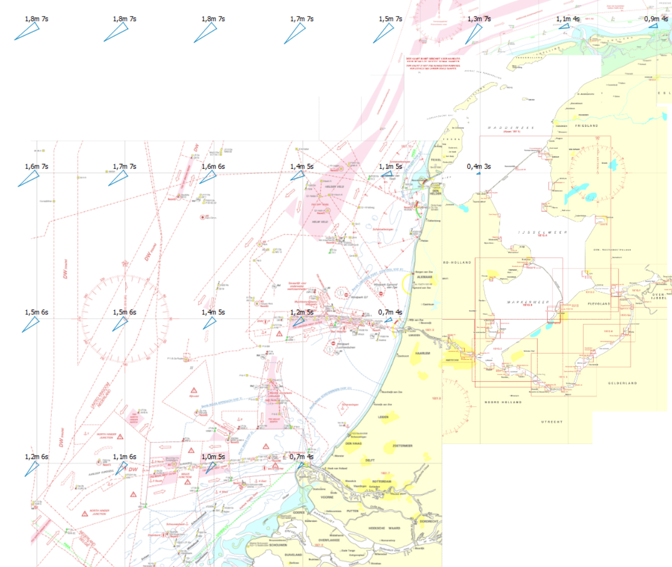
- Within the GRIB sources you will find a new addition for the wave predictions. Plan a comfortable route with this new mode in which high waves and sharp-to-hauled courses are avoided. View the GRIB data for the Northsea, Waddensea, IJsselmeer, Markermeer and Randmeren.
Click on the image for a larger view.
|