|
Great news for all sailors who venture outside of the Dutch open waters. Most of the NV-Verlag charts are available in the 2018 editions. Some new chart sets were added to the assortment and the charts for crossing the Atlantic Ocean have returned! Follow this link for a full overview of all NV-Verlag charts.
Trip around the Baltic
The popular Baltic chart sets are delivered as combination package: a paper chart set, a harbour plan book and a download with which the charts can be installed in WinGPS 5.
For voyages to the Baltic sea we recommend the use of our DKW 1800 series and our DKW German Bight. Both chart sets are updated weekly, connect seemlessly and will connect to the NV-Verlag Series 1 chart set.
|


|
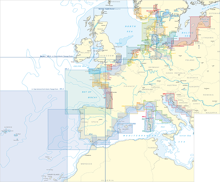
Click on the image for morea information about the NV-Verlag chart sets.
Crossing the Atlantic Ocean
A welcome addition are the chart sets for crossing the Atlantic Ocean. These are 3 new chart sets which cover the Atlantic Ocean from France, Portugal and Spain up until Canada, America and the Caribbean, including detailed charts of the Canary Isles, Azores, Madeira, Cape Verde and the coast of Northern Spain and Portugal. The charts connect flawlessly with the Imray charts or the NOAA charts.
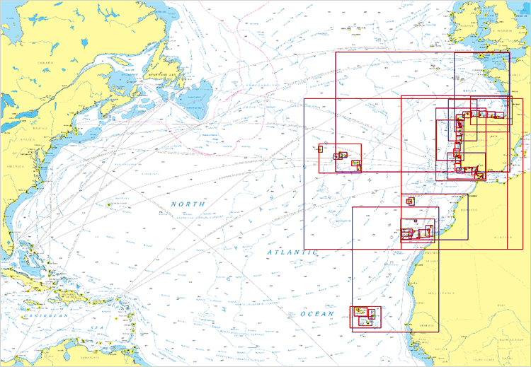
Click on the image to visit our online shop.
|


