


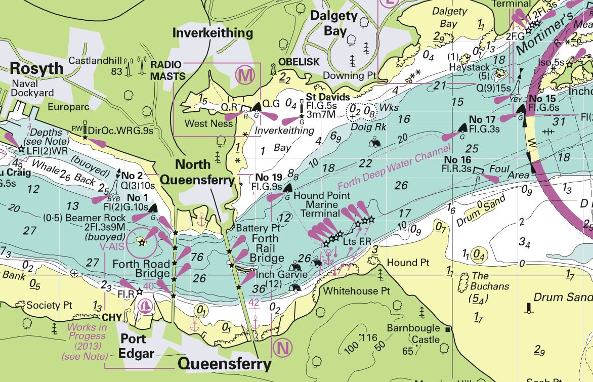
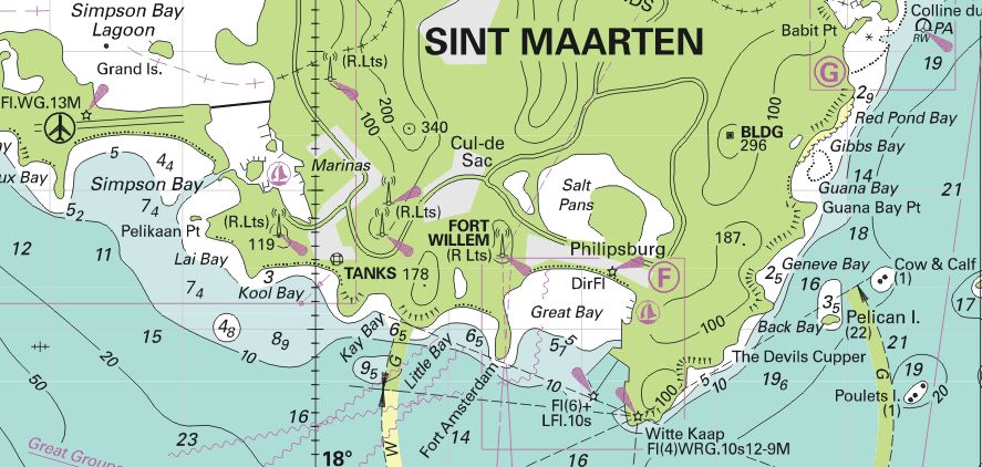
 De nieuwe editie betekent dat zo’n 100 kaarten zijn herzien. Meestal betreft het kleine wijzigingen of de verwerking van NtM-berichten. Op de ID10 is kaart C27 volledig hertekend. Hierbij zijn een aantal detailkaartjes toegevoegd van populaire havens, zoals “North Queensferry and Port Edgar”. Voor watersporters op de Antillen is vermeldenswaardig dat de kaarten van Sint Maarten op de ID100 zijn vervangen.
 De 2014 editie van de DKW Imray kaarten zijn verkrijgbaar in onze online shop. Er zijn van deze kaarten uiteraard ook voordelige upgrade-versies beschikbaar.
Nieuwe kaarten in de 2014 editie (t.o.v. de 2013 editie van januari).
ID10
C28 Harwich to Wells-next-the-Sea
C30 Harwich to Hoek van Holland and Dover Strait
C68 Cape Wrath to Wick and the Orkney Islands
C1 Thames Estuary
C23 Fife Ness to Moray Firth
*C25 Harwich to River Humber and Holland
*C26 IJmuiden to Die Elbe
*C30 Harwich to Hoek van Holland and Dover Strait
Y18 The River Medway & Approaches
C27 Firth of Forth
*Includes detail of the new TSS and routeing measures off the coast of the Netherlands
ID20
C1 Thames Estuary
C4 Needles Channel to Bill of Portland
C15 The Solent
2200.4 Chichester & Langstone Harbours
2200.5 Portsmouth Harbour & Approaches
C32 Baie de Seine
Plus chart 2400.3 Isles of Scilly has been added to improve coverage around the Isles of Scilly
C9 Beachy Head to the Isle of Wight
C35 Baie de Morlaix to L’Aber-Ildut
ID30
C54 Galway Bay to Donegal Bay
C58 Trevose Head to Bull Point
C63 Firth of Clyde
C68 Cape Wrath to Wick and the Orkney Islands
2800.2 Loch Crinan to Garbh Eileach
2800.3 Cuan Sound to Loch Spelve and Kerrera Sound
2800.4 Oban to Loch Aline and Port Appin
2800.5 Loch Aline to Tobermory and Loch Sunart
2800.6 Loch Linnhe South and Loch Creran
2800.7 Loch Linnhe and Loch Levan
Also, four new charts are offered to improve large-scale coverage of Mull and adjacent coasts:
2800.8 Iona to Carsaig
2800.9 Treshnish Isles and Ulva
2800.10 Tobermory to Loch Eatharna
2800.11 Tiree to Loch Eatharna
C69 Loch Ryan to Belfast Lough and Strangford Lough
2900.2 Loch Fyne
2900.3 Lower Loch Fyne and Inchmarnock Water
2900.4 Upper Clyde
2900.5 Loch Long and Gareloch
Also, includes a new chart in the Firth Of Clyde:
2900.6 Kyles of Bute and Burnt Islands
C65 Crinan to Mallaig and Barra
C67 North Minch and Isle of Lewis
Plus chart 2400.3 Isles of Scilly has been added to improve coverage around the Isles of Scilly
ID40
C39 Lorient to Le Croisic
two new charts are offered to provide detailed coverage of Madeira and the Azores:
E1 Arquipélago dos Açores
E3 Arquipelago da Madeira
C19 Cabo Finisterre to Gibraltar
C48 A Coruña to Porto
Chart 2400.3 Isles of Scilly has been added to improve coverage around the Isles of Scilly
C35 Baie de Morlaix to L’Aber-Ildut
C42 La Rochelle to Santander
ID50
M11 Gibraltar to Cabo de Gata & Morocco
M13 Dénia to Barcelona and Ibiza
M14 Barcelona to Bouches du Rhône
ID60
G1 Mainland Greece and the Peloponnisos
M30 Southern Adriatic and Ionian Seas
ID70
G2 Aegean Sea (North)
G28 Nísos Khíos & the Coast of Turkey
ID100
A23 Virgin Islands and St Croix
A30 Martinique
A28 Guadeloupe
B1 St Lucia
A231 St Thomas to Virgin Gorda
A232 Tortola to Anegada
A24 Anguilla, St Martin and St Barthélémy
 De BaZ-update is verschenen en beschikbaar voor gebruikers van WinGPS. Deze week zijn er voor 9 kaarten bijgewerkt uit de 1800 serie en voor 5...


