|
The 2017 edition of the DKW Vaarkaart Nederland is available now. The new version has a large number of changes. Below you may find an overview with the most important updates. If you already purchased the chart as a pre-order, the updates are available already for you.
The chart set may be used in WinGPS 5 for Windows and WinGPS Marine for Android. When you purchase this set, you are entitled to all updates that will be processed this year.
DKW Vaarkaart Nederland has been developed for pleasure and commercial crafts in Western Europe. This chart is produced yearly by Stentec based on the topografic charts of The Netherlands along with comments from our users.
|

|
Specifications of the chart set
This hybrid chart contains:
- 2 Overview charts (scale 1:250.000, 30m/pixel).
- 5 Detailed charts for orientation and route planning (scale 1:25.000, 3m/pixel).
- Waypoint-database with 39.019 waypoints which contain a.o.bouyage, marinas,docking places, diesel spots, campings and VHF channels. Also signs and docking places for commercial crafts. In WinGPS all these groups are enabled/disabled seperately.
Smartlabeling
With the new Smartlabeling option of WinGPS 5 2017, the charts of DKW Vaarkaart Nederland 2017 look more beautiful and organised than ever. The names of bridges/locks do not overlap anymore which keeps the waterway a lot more clear. That is why we recommend upgrading to or purchasing WinGPS 5 2017 when using DKW Vaarkaart Nederland 2017.
New in 2017
- Actual chart information based on TOP10NL November 2016 (aerial pictures 2015)
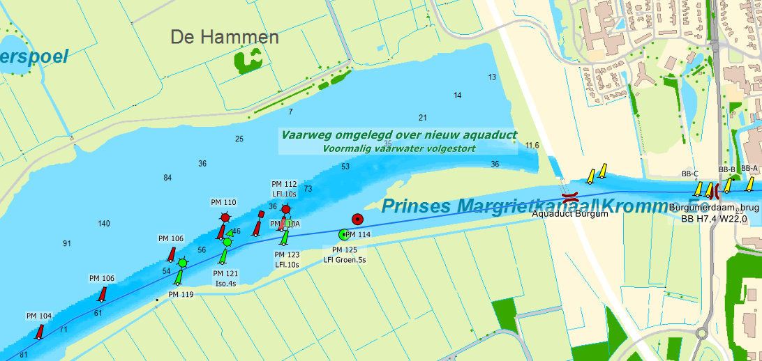
- The newly moved 'Kromme Ee' near Bergum is now positioned correctly (image 1).
- bouyage has been updated and will be updated regularly in 2017.
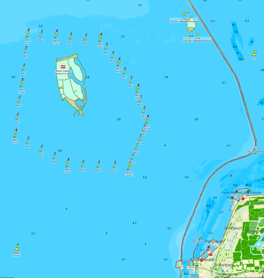
- The 'Marker Wadden' and the widened Breeddiep have been added based on recent satalite pictures (image 2).
- Bouyage of Friesland, Groningen and Overijssel has been changed to the newest information.
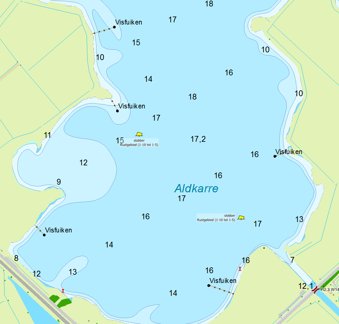
- The Friese Meren chart now also holds the fish traps (image 3).
- Docking places 'hospitable Randmeren' with depth, phone number and links to more information have been added.
- Outdated IENC data from Rijkswaterstaat has been removed to keep the chart as clear as possible, mainly in North Netherland.
- Recent depth information of Zeeland, including dangerous wrecks with NAP depth.
- The rest of The Netherlands will receive a brand new IENC file from Rijkswaterstaat which will be processed in DKW Vaarkaart Nederland 2017.
- The marinas have been expanded and updated, thanks to comments of our users.
- More water way names on the chart.
- On the extra detailed chart Friese Meren the names are now in Frisian on the overview chart and in Dutch on the navigation chart. (For example Snitser Mar / Sneekermeer).
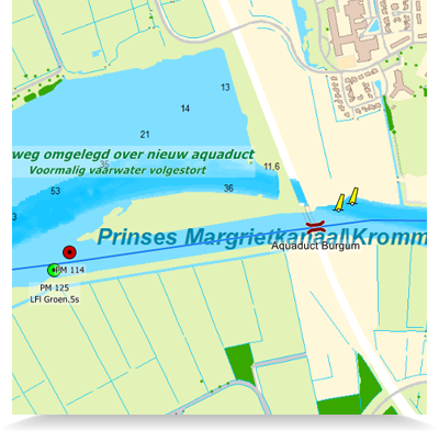
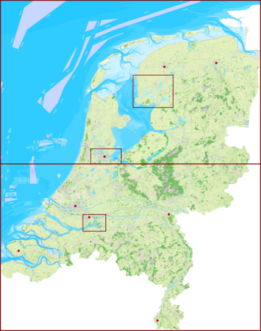
Image 1
|
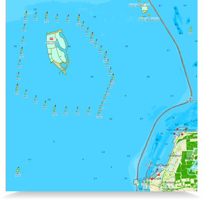
Image 2
|
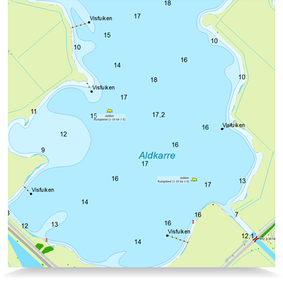
Image 3
| |
Click on an image for a larger view.
|
Upgrade from 2016
If you have the DKW Vaarkaart Nederland 2016, you may purchase an advantageous upgrade.
|
Service Card discount
Service Card 2017 license holders will receive no less than € 20,- discount on the DKW Vaarkaart Nederland 2017. This disount will automatically be added to your order.
|
|
|