


The new edition of the chart set DKW UK1 - English & Scottish east coast is now available in our online shop, at our dealers and in our store in Heeg.
The charts can be used in WinGPS™ Marine for Android™ next week. If you are logged into this app with your Stentec account, the DKW UK1 2015 will appear as an available chart.
Nieuw in de 2015 editie
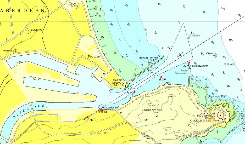
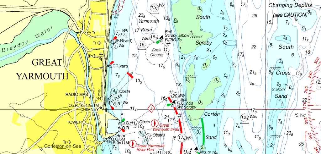
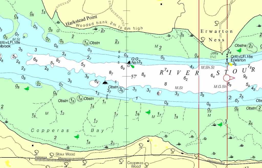
In the new 2015 edition of the UKHO, there are 55 of the 239 charts renewed (including port plans and detail charts). The most important changes include altered depth images in river estuaries, changes in the obstructions and the processing of the NTM, the British Notices to Mariners.
See screenshots:
The list below shows the altered cards (excluding port plans and detailed maps):
- BA104 Approaches to the Humber (TS scheme)
- BA108 Approaches to the Wash
- BA210 Newburgh to Montrose
- BA728 Rosyth (River Forth)
- BA736 Firth of Forth, Granton and Burntisland to Rosyth
- BA737 River Forth, Rosyth to Kincardine
- BA741 Scotland East Coast, Plans in the Firth of Forth
- BA1188 River Humber Spurn Head to Immingham
- BA1190 Flamborough Head to Balkeney Point
- BA1446 Approaches to Aberdeen
- BA1534 Great Yarmouth and Approaches
- BA1535 Lowestoft and Apporaches
- BA1543 Winterton Ness to Orford Ness
- BA1698 Dover
- BA1975 Thames Estaury NP
- BA2052 Orford Ness to the Naze
- BA2249 Orkney Islands Western Sheet
- BA2502 Eddrachilllis Bay
- BA2503 Kinlochbervie and approaches
- BA2504 Lochinver and approaches
- BA2566 Tees Bay
- BA2693 Approaches to Felixtowe, Harwich
- BA3272 Moul of Eswick to Heli Ness
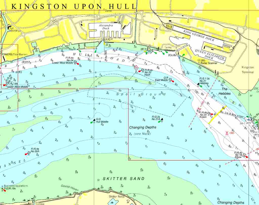
- BA3496 River Humber, Immingham and Hull
- BA3497 River Humber Immingham to Humber Bridge
In this 2015 edition, many changes have been made and therefore we advise you to purchase an upgrade if you have the 2014 edition of this chart set.


