


| 2017 Editions for NV Verlag charts now available for WinGPS 5 |

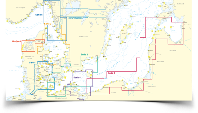
Great news for our Baltic Sea sailors! Most of the NV Verlag charts are available in their 2017 editions. The popular Baltic Sea charts are sold as a combined package: the paper chart set, a harbor pilot book and a CD-rom or download with which the digital charts can be installed in WinGPS 5. For voyages to the Baltic Sea (starting from the Netherlands) we recommend the use of the DKW 1800 series and the DKW German Bight. Both sets are updated weekly, fit together perfectly and merge into NV Verlag series 1. 
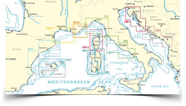
 Mediterranean Sea
 |


