 Development of the WinGPS Marine Plus is behind schedule. Developing a complete navigation program for Android has been harder than we thought. We add and test new options and versions frequently. Test version 0.6.4 of Friday 11 July looks pretty good and complete, even if we still have planned several impovements. A nice moment for a ‘sneak preview’.
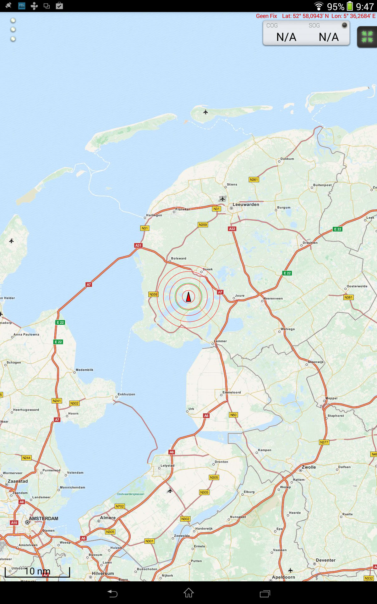
After logging in with my account the programs starts with an OSM chart which can be moved fluently. Because I am cannot get a GPS fix inside, the GPS light is blinking.
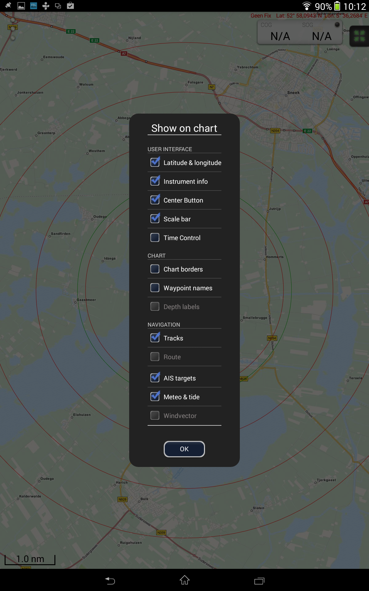
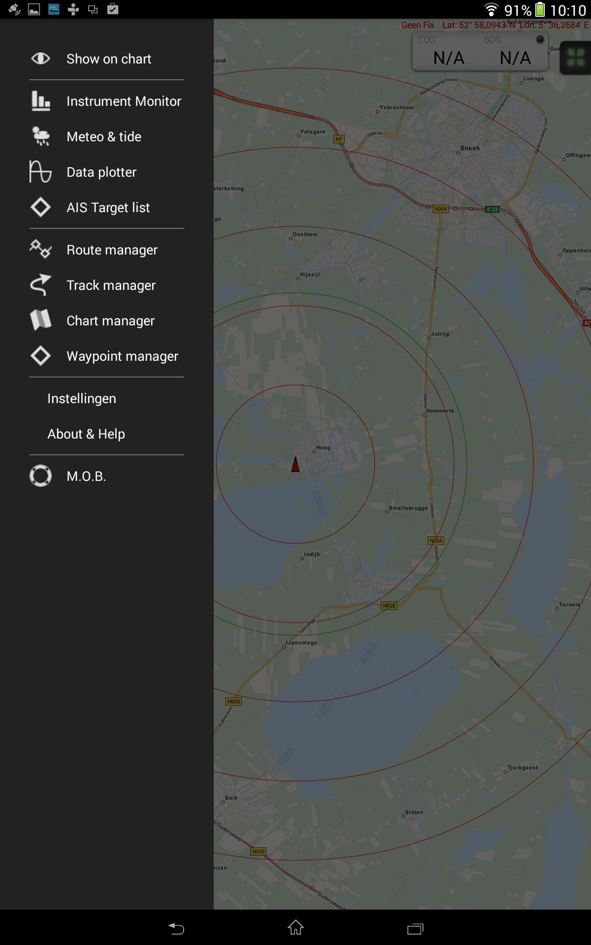
The 3 butons at the left top allow me to activate the menu. The top option 'Show on chart' allows you to choose which information is shown on the chart.
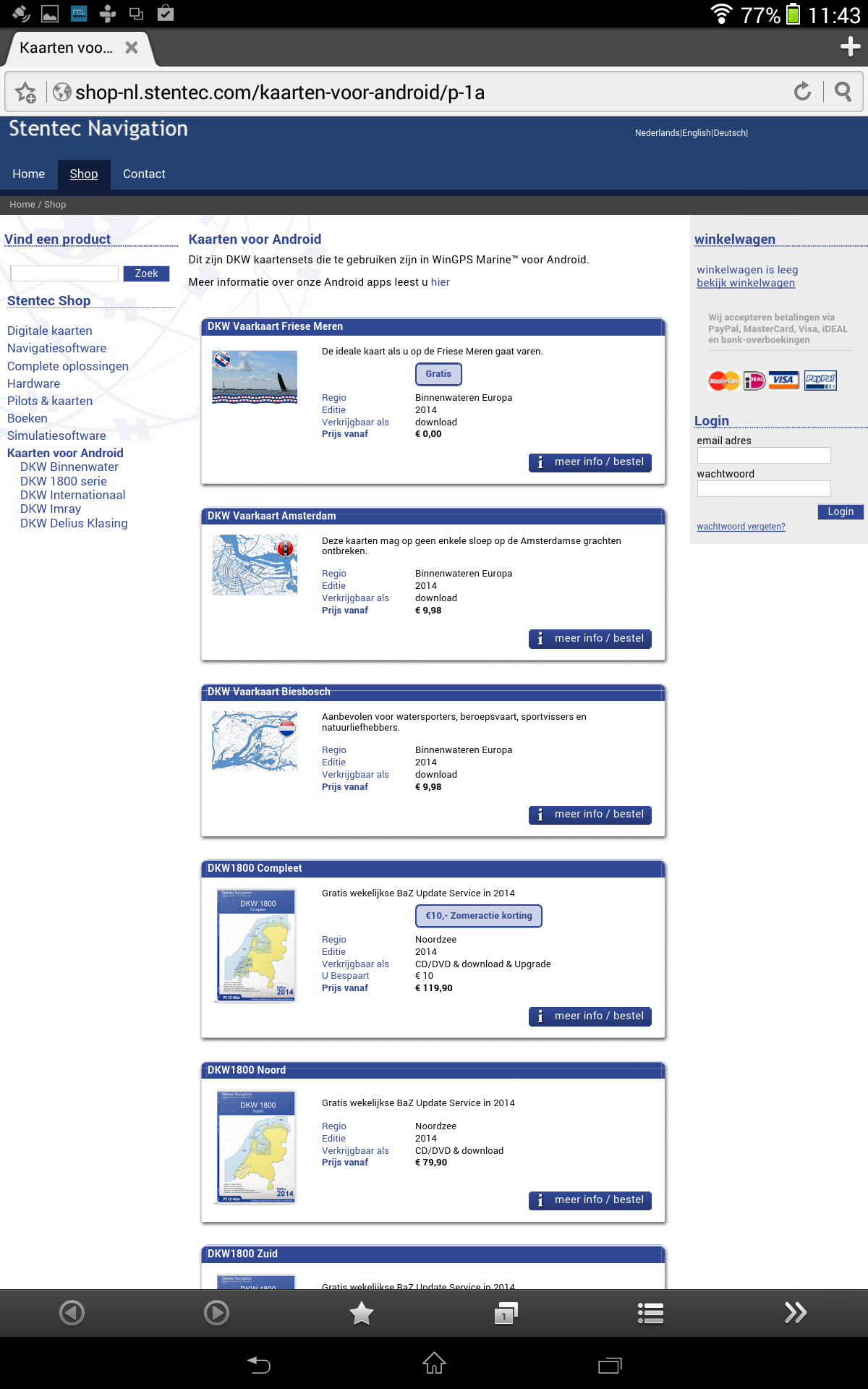
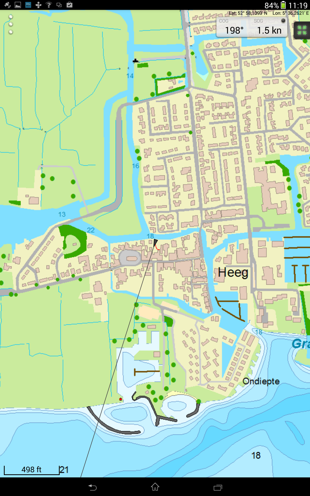
I decided to turn off the OSM chart and selecting a different chart. When connected to the internet the most left screen at Chart Manager shows a list of all charts which may be installed. Because I want to test near Heeg, I selected the Vaarkaart Friese Meren en pressed the download button. The download is very fast, since it is already on my SD card. By clicking the focus GPS at the right top, the chart will find and focus on the GPS position.
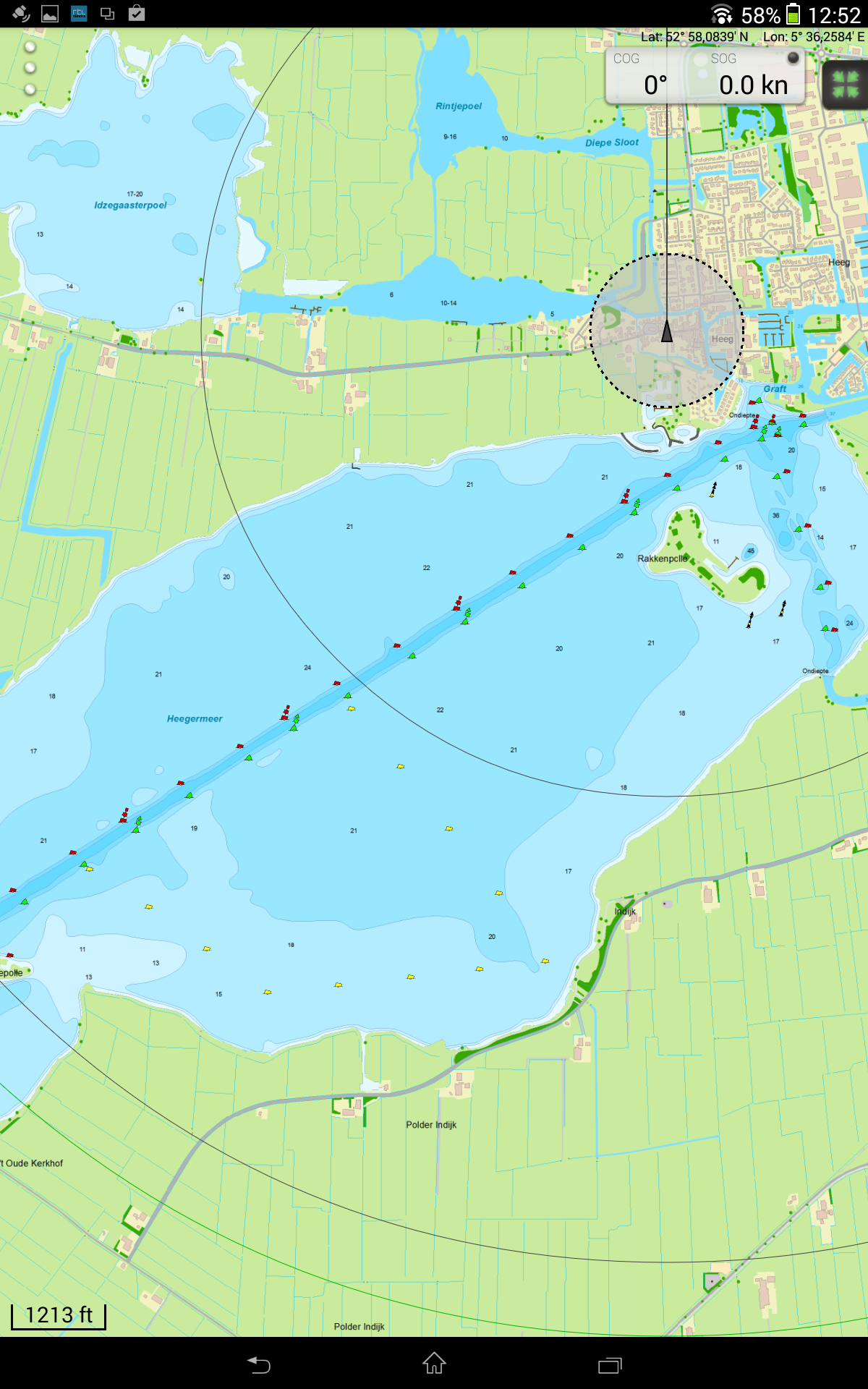 The GPS position can easily be moved to any position with a long press.
Walking in the garden shows the SOG and COG. The internal GPS of the XperiaZ tablet only shows accuracy to about 0,5 kn. The average tablets and smart phones allow for 0,1 kn. This may be improved in future updates. GPS filter is activated but does not respond to the internal GPS.
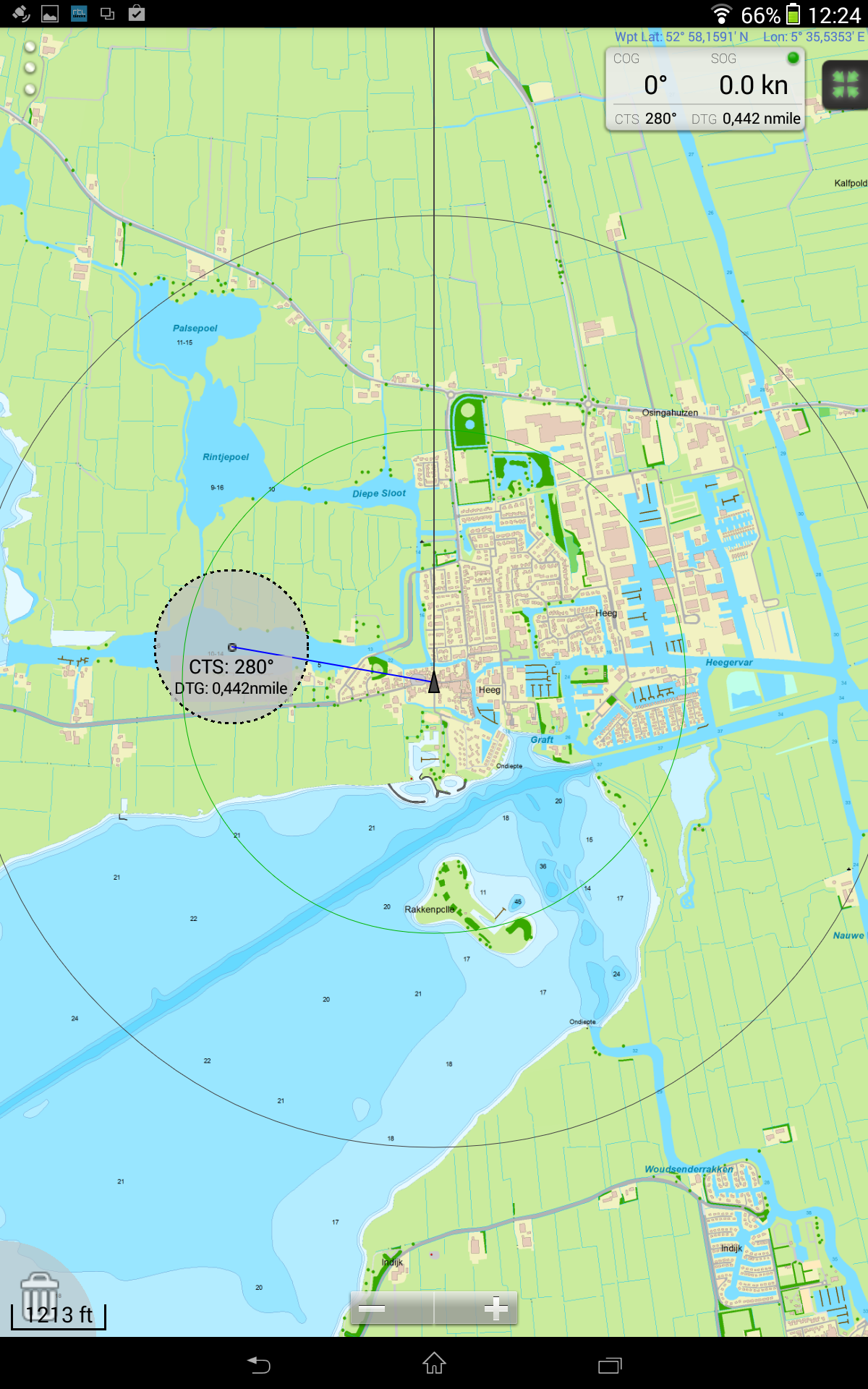
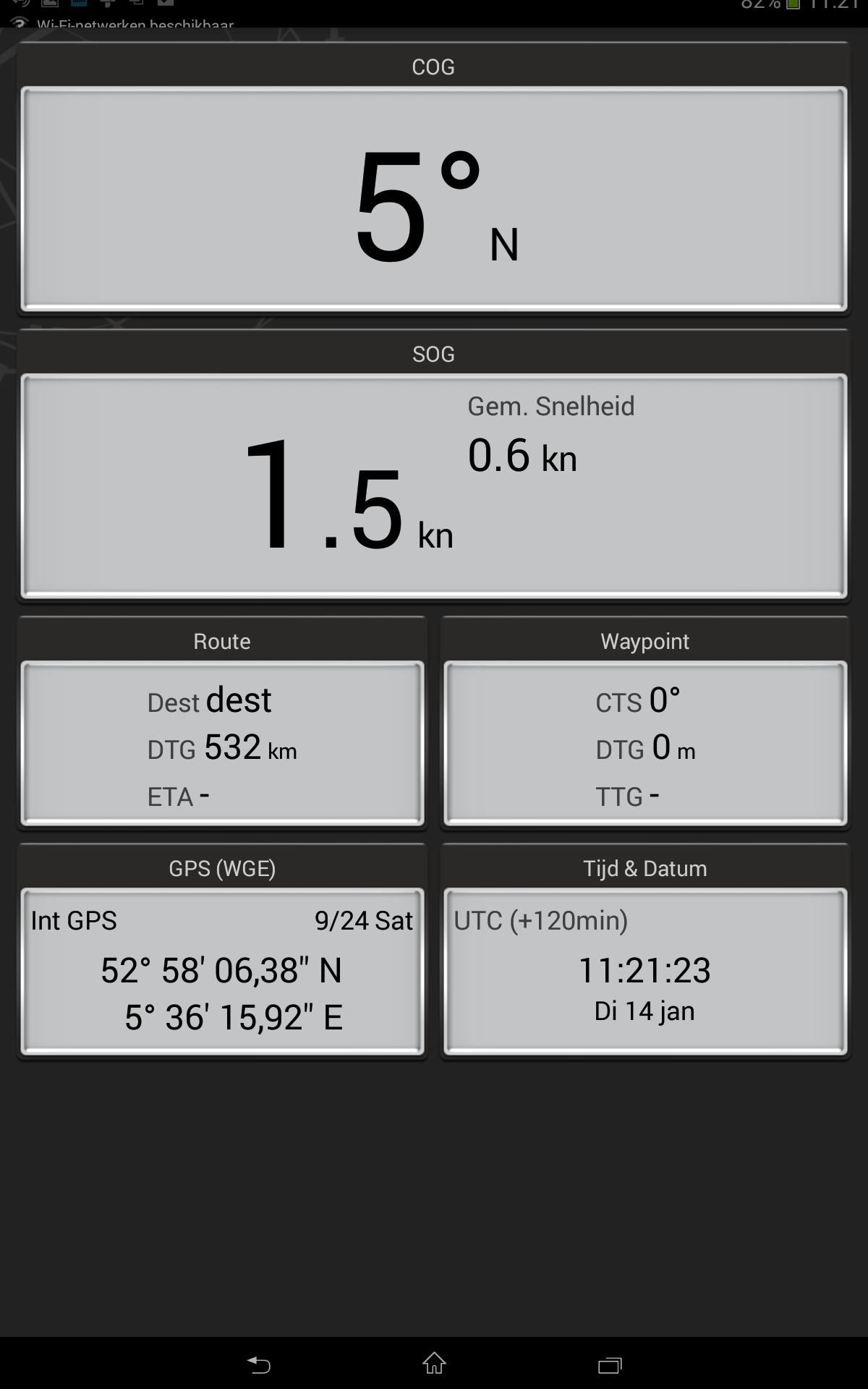
A waypoint can be easily placed by sliding the transparant disc with your finger. The instrument monitor shows the SOC/COG beautifully as well as the CTS/DTG to a waypoint.
 The track manager shows the tracks which are created when the app is started and closed. Selected tracks can be renamed, searched and deleted.
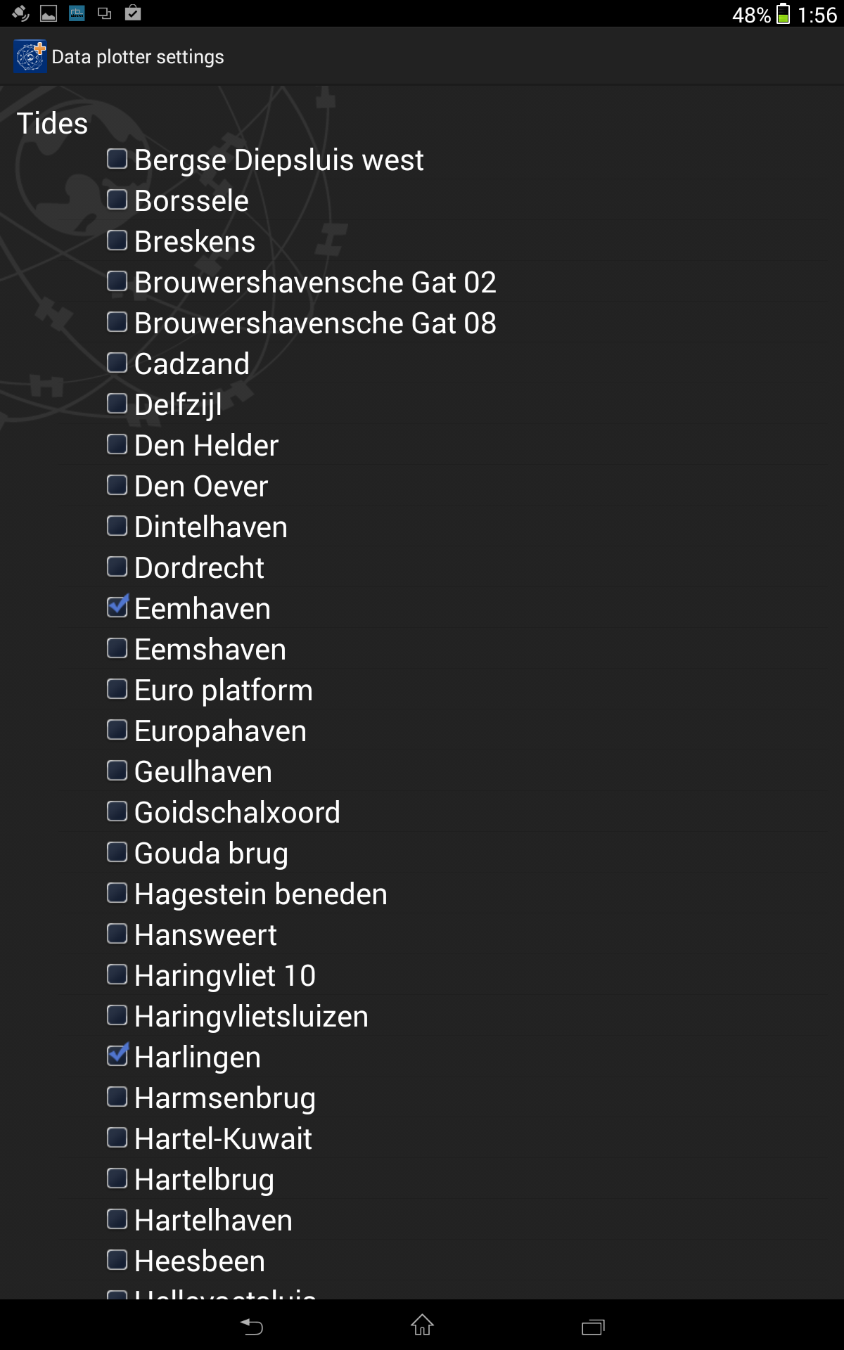
The data plotter allows several tide stations and GRIB files to be selected. At the bottom of the screen, a horizontal time line can be seen. Zooming and sliding alllows the data plotter to be set up.
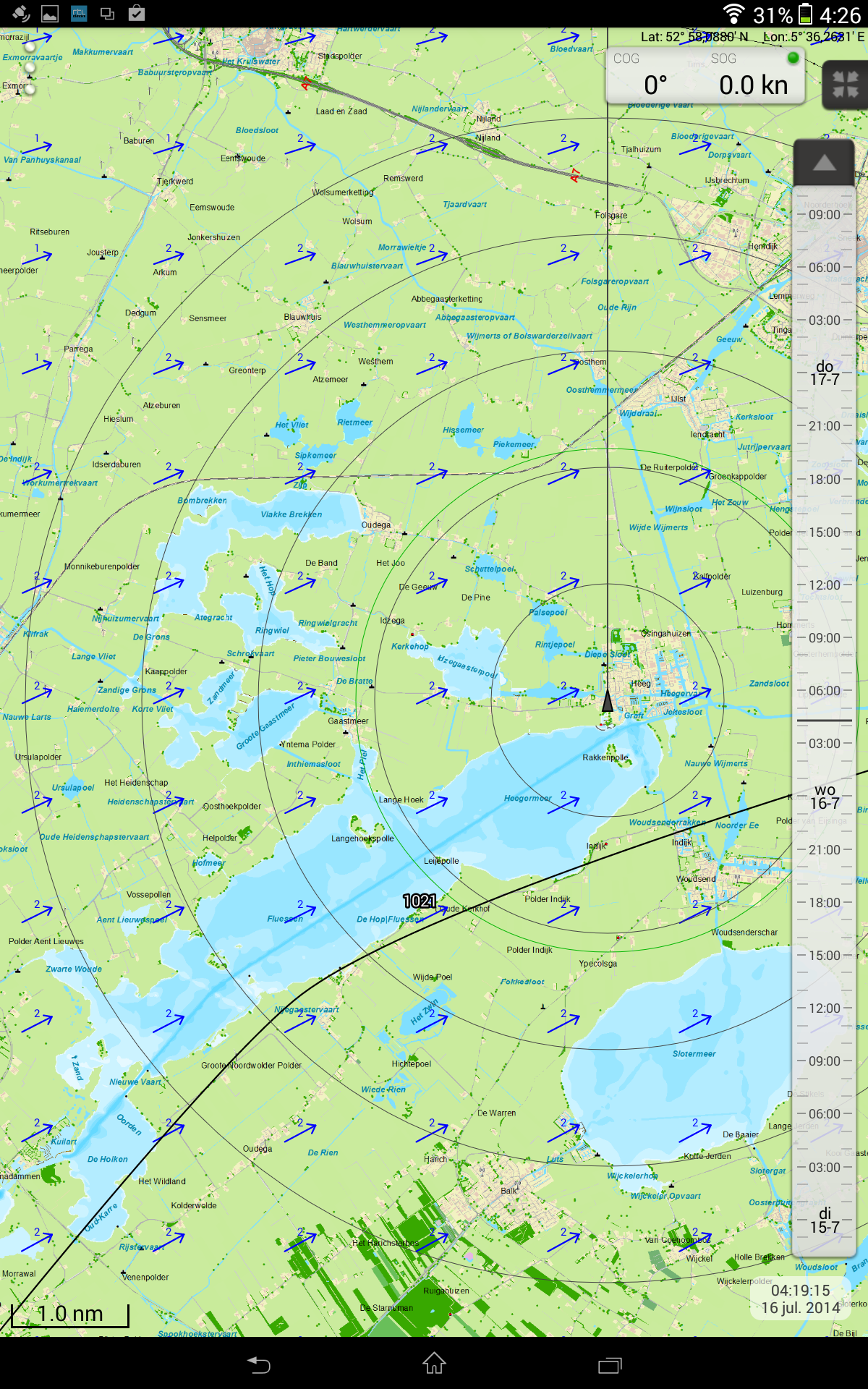
Show on chart activates a time slide on the right side of the screen which allows you to forward and rewind. This shows the wind and current in time.
The horizontal black line in the center of the time slide shows date and time of for example the GRIB files on the screen. The time beneath the time slide should show the same. Clicking on the time, you can edit the time. Enabling real-time mode, the time slides will follow your system time. Adjusting it by hand, disables real-time mode.
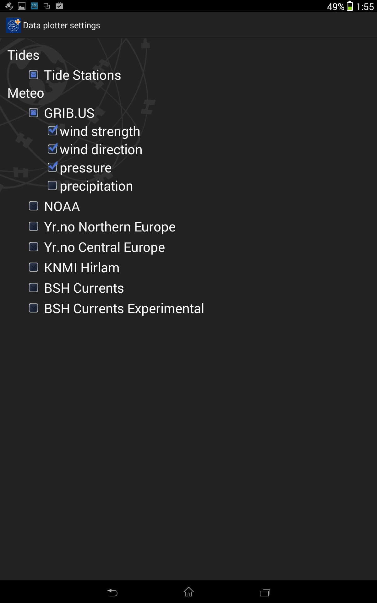
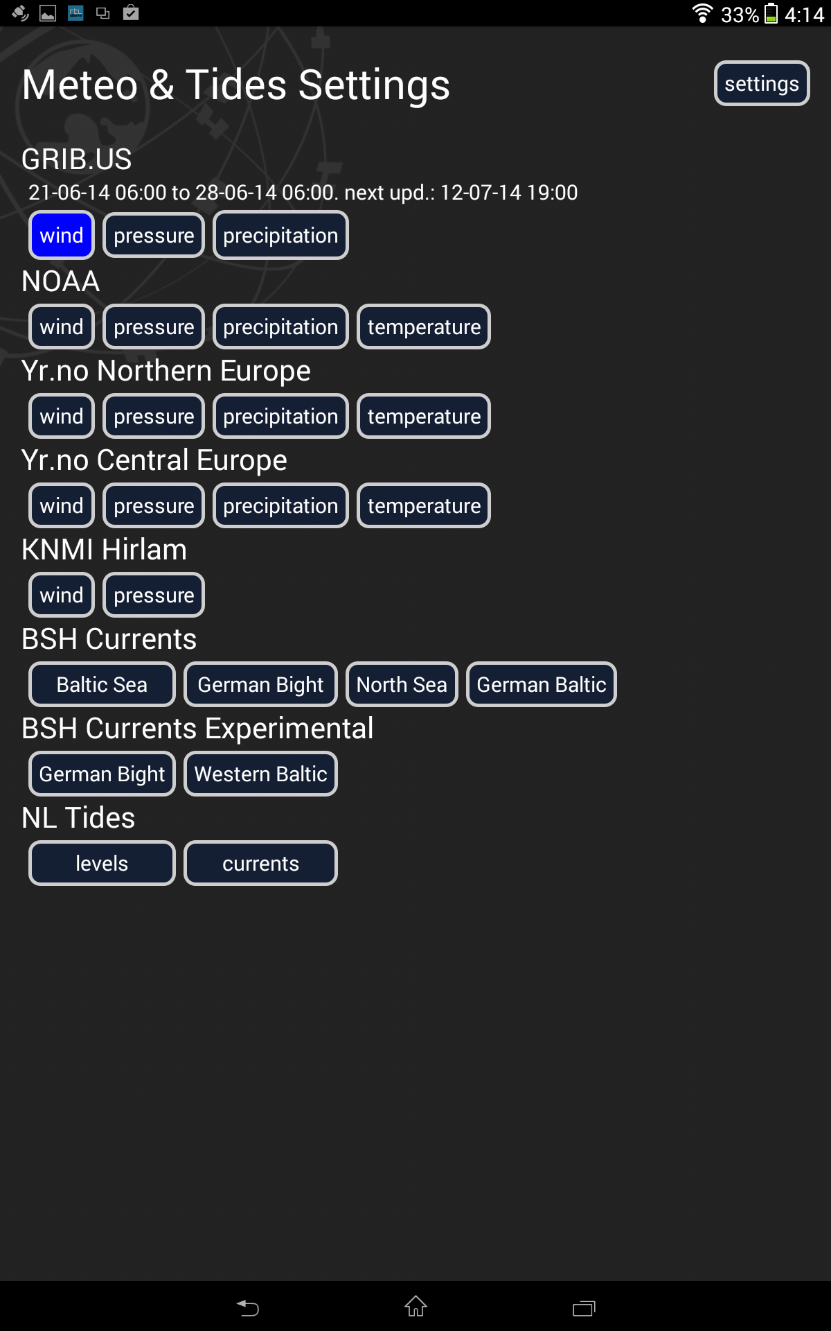
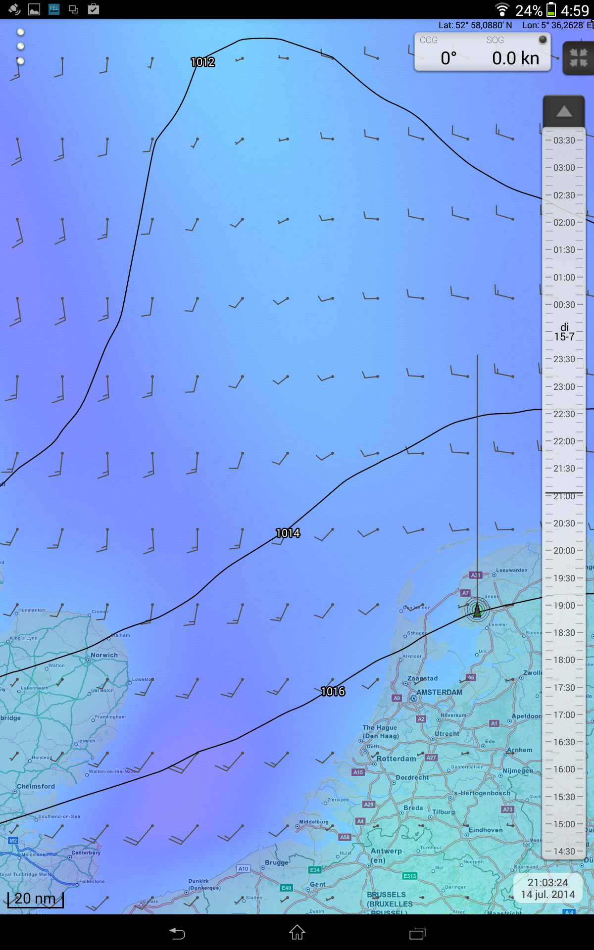 In Meteo & Tides I selected GribUS. The color shows which data is enabled.
The GRIB files were activatedon the Friese Meren chart. To do this, the Update now button had to be pressed. The color of the arrows can also be edited and it is also visible when the next GRIB is expected. If the rain is turned off, it is recommended to show the intensity of the wind above the North Sea.
Settings of Meteo & Tides allows for the length of the tide and the wind and current arrow to be selected. You may, for example, enable the current to be shown 10 times as large as the wind.
By lcicking the arrow above the time slide, the time will fast forward, showing you an animation of the wind in time. It will keep speeding up as you press more often.
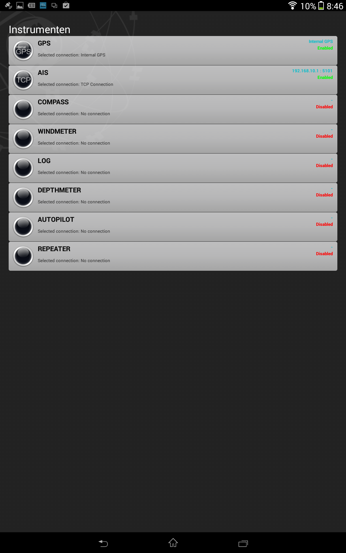
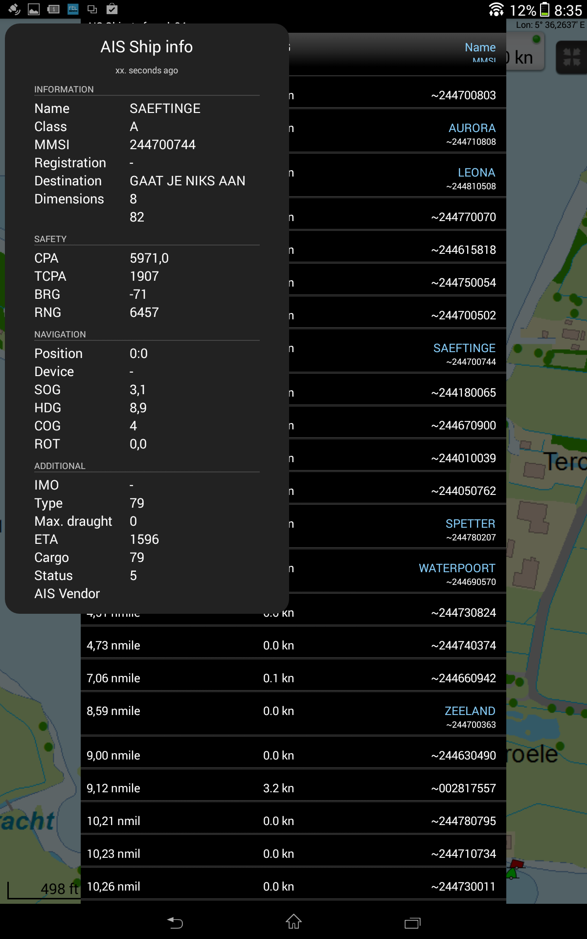
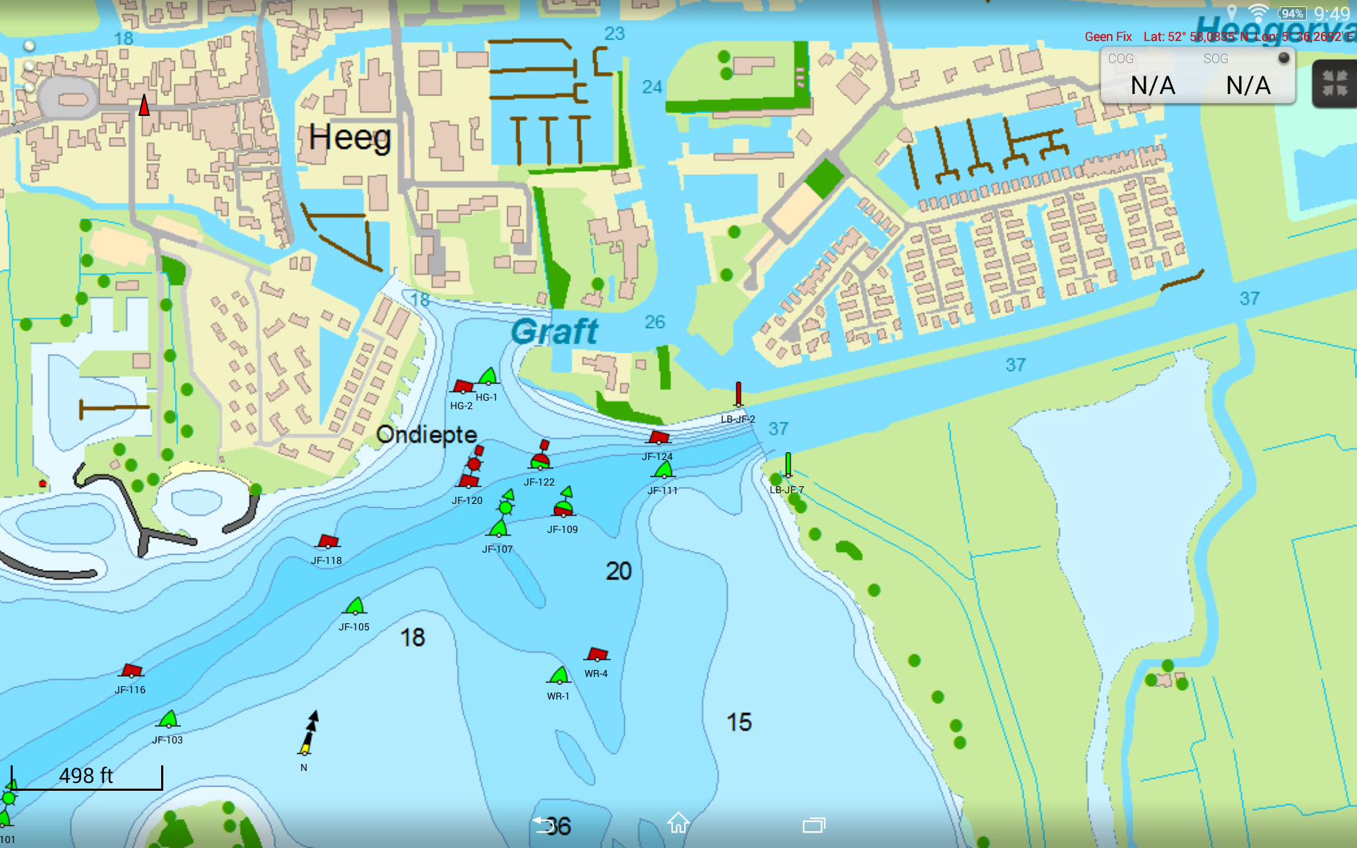
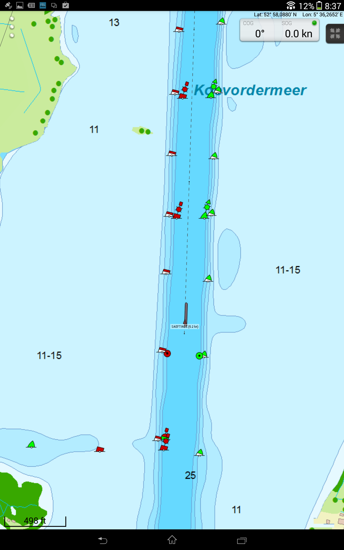 To receive AIS from the EasyTRX Wifi a TCP-connectie must be made with Add TCP and afterwards this TCP connection must be chosen and enabled. The AIS targets will be shown as triangles on the screen and the AIS target list will fill with about 30 ships. Most of these are moored. AIS ships are shown on scale with speed and name beneath.
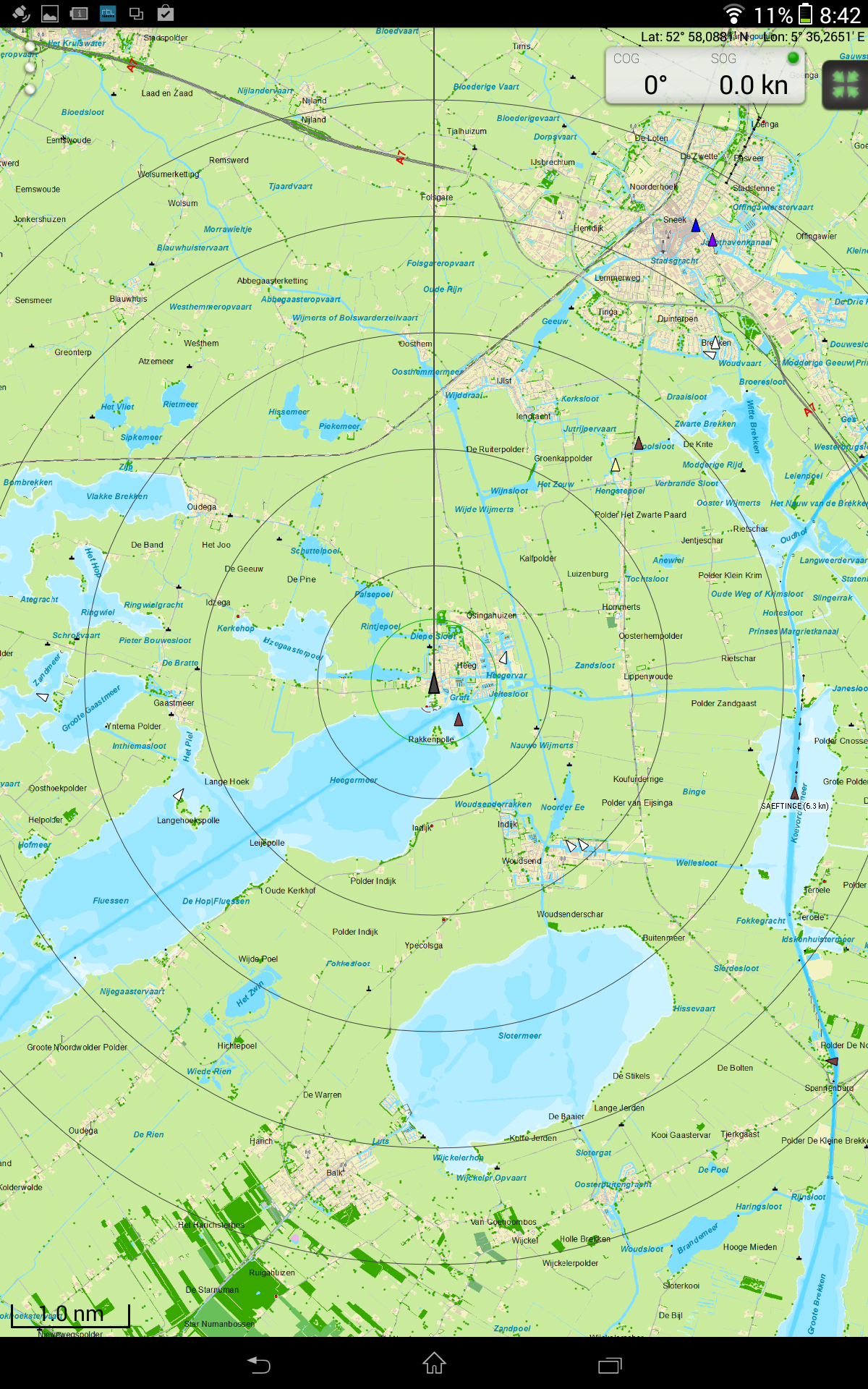
The target list only shows a radius, SOG and name. By clicking on a target, the AIS ship info screen will be opened.
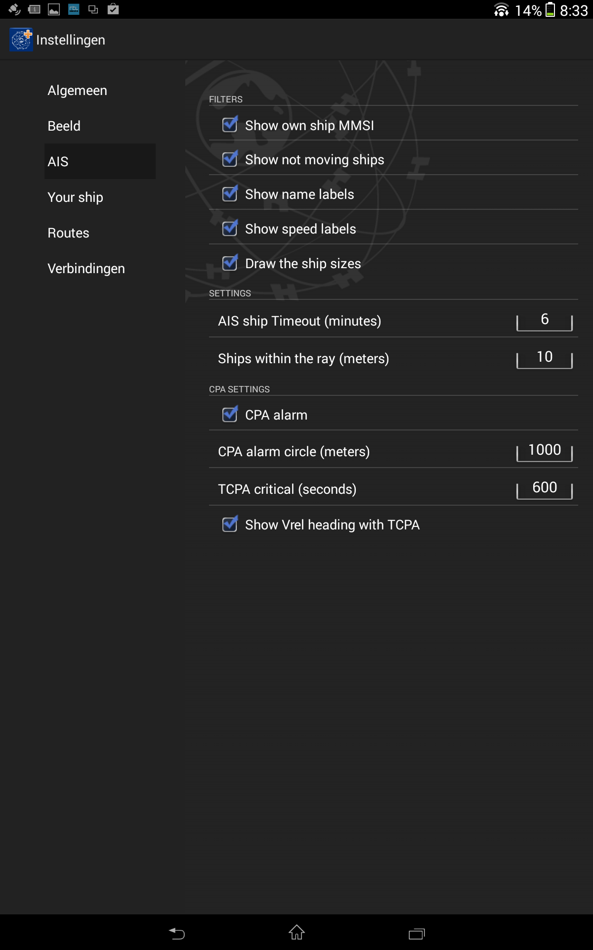
Preferences allows you to select the optimal settings for AIS, including an CPA and TCPA alarm. The screen shows a green CPA circle. AIS targets within the TCPA of this circle show a collision vector, which shows if these ships pass on the front or back or may collide.
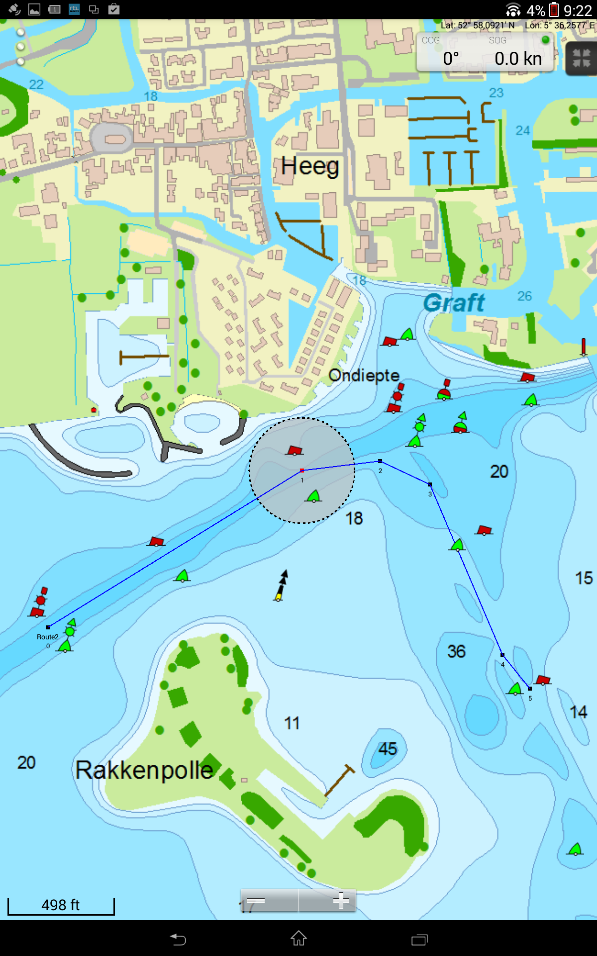 Route manager has the 'create' function which allows you to easily make a new route. The transparant disc lets you move a route point quickly and accurately. Points may also be added and removed. In this version, starting and switching to a next route point is not possible.
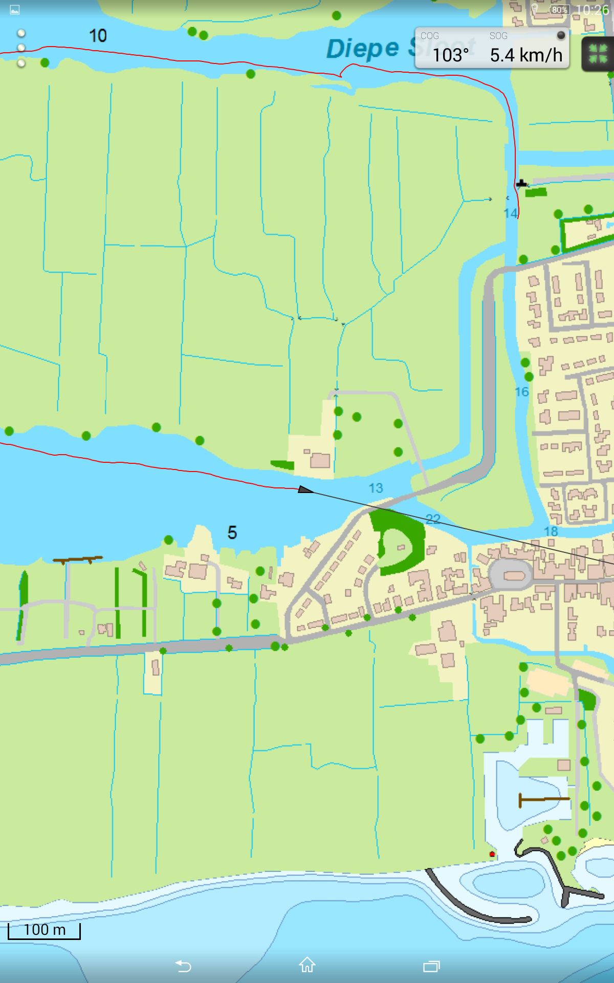
After installing the Android KitKat update voor the XperiaZ, the WinGPS MarinePlus app was shown fullscreen with the Android buttons projected over it. A test in Heeg showed that the new chart view works great. The navigation info screen with SOG and COG was logical and clear. To keep the screen calm, I disabled the LAT/LONG.
Screenshots made during this test: